world.wikisort.org - India
Hingoli district (Marathi pronunciation: [ɦiŋɡoliː]) is an administrative district in the state of Maharashtra in India. The district is headquartered at Hingoli. The district occupies an area of 4,526 km2 and has a population of 11,77,345 of which 15.60% were urban (as of 2011[update]).[2] Hingoli was actually known as the Nizams military base as it was bordered with Vidharbha. In that era military troops, hospitals, veterinary hospital were in operation from Hingoli. Being a military base the city was one of the important and famous places of the Hyderabad state. One of the twelve Jyotirlinga shrines, the Aundha Nagnath is located in Hingoli district about 25 km south-west from district headquarter.
Hingoli district | |
|---|---|
District of Maharashtra | |
 Aundha Nagnath Temple | |
 Hingoli district Location in Maharashtra | |
| Country | |
| State | Maharashtra |
| Division | Aurangabad |
| Headquarters | Hingoli |
| Tehsils | Hingoli, Kalamnuri, Sengaon, Aundha Nagnath, Basmath |
| Government | |
| • Body | Hingoli Zilla Parishad |
| • Guardian Minister | Abdul Sattar Abdul Nabi (Cabinet Minister Mha) |
| • President Zilla Parishad |
|
| • District Collector |
|
| • CEO Zilla Parishad |
|
| • MPs |
|
| Area | |
| • Total | 4,526 km2 (1,747 sq mi) |
| Population (2011) | |
| • Total | 1,177,345[1] |
| • Urban | 15.60 |
| Time zone | UTC+05:30 (IST) |
| Website | hingoli |
As of 2011[update] it is the third least populous district of Maharashtra (out of 36), after Sindhudurg and Gadchiroli.[1]
Officer
Members of Parliament
- Hemant Patil (SHS)
(Hingoli)
Guardian Minister
| Guardian Minister Hingoli | |
|---|---|
| पालकमंत्री हिंगोली | |
 Emblem of India | |
Incumbent Abdul Sattar Abdul Nabi since 27 September 2022 | |
| Style | The Honourable |
| Appointer | Chief Minister of Maharashtra |
| Term length | 5 years / No time limit |
| Website | hingoli |
list of Guardian Minister
| Name | Term of office |
|---|---|
| Dilip Kamble | 31 October 2014 - 8 November 2019 |
| Varsha Gaikwad | 9 January 2020 - 29 June 2022 |
| Abdul Sattar Abdul Nabi | 27 September 2022 - Incumbent |
District Magistrate/Collector
| District Magistrate / Collector Hingoli | |
|---|---|
| जिल्हाधिकारी तथा जिल्हदंडाधिकरी हिंगोली | |
Emblem of India | |
Incumbent Shri. Jitendra Papalkar (IAS) since 2018 | |
| Residence | At Hingoli district |
| Appointer | Government of Maharashtra |
| Term length | No time limit |
| Website | hingoli |
list of District Magistrate / Collector
| Name | Term of office |
|---|---|
| Shri. Jitendra Papalkar (IAS) | 2018 - Incumbent |
History

The territory of the present district became part of Bombay state in 1956 and Maharashtra state in 1960 as part of Parbhani district. This district was carved out from Parbhani district on 1 May 1999 with five own tehsils: Hingoli, Kalamanuri, Sengaon, Aundha Naganath, and Basamat.
Geography
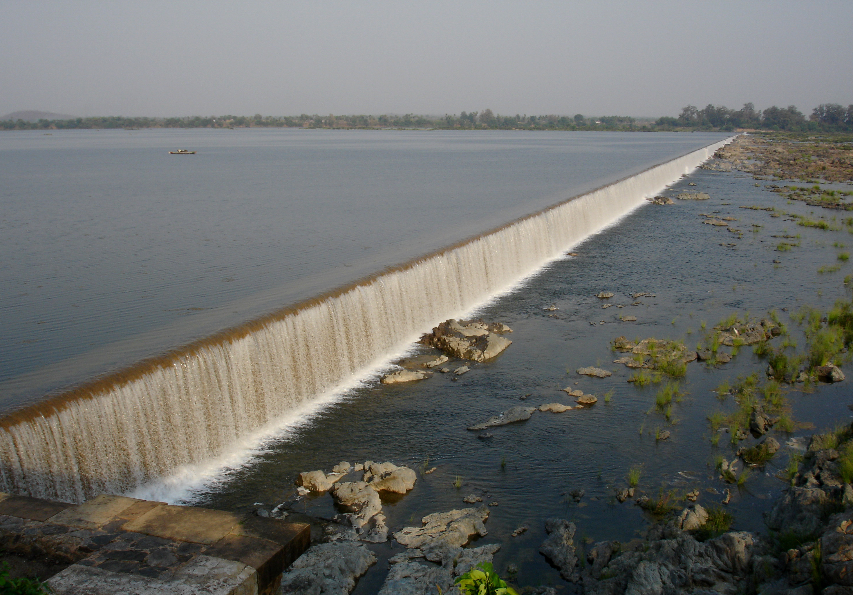
Hingoli is situated at the northern part of Marathwada in Maharashtra. Borders of Hingoli are surrounded by districts Washim and Yavatmal in northern side, Parbhani in western side, and Nanded at south-eastern side. There are two medium-sized dams present on both East and West sides of the district namely Isapur dam and Yeldari dam, Isapur dam provides water to irrigation purpose whereas Yeldari dam caters to irrigation as well as production of hydroelectricity. One minor dam named Siddheshwar also used for irrigation purpose in district.
Demographics
As of the 2011 Census of India, Hingoli district has a population of 1,177,345,[1] roughly equal to the nation of Timor-Leste[3] or the US state of Rhode Island.[4] This gives it a ranking of 401st in India (out of a total of 640).[1] The district has a population density of 244 inhabitants per square kilometre (630/sq mi) .[1] Its population growth rate over the decade 2001-2011 was 19.43%.[1] Hingoli has a sex ratio of 942 females for every 1000 males,[1] and a literacy rate of 78.17%. Scheduled Castes and Scheduled Tribes make up 15.51% and 9.51% of the population respectively.[1]
At the time of the 2011 Census of India, 83.53% of the population in the district spoke Marathi, 6.86% Urdu, 4.81% Hindi and 3.23% Lambadi as their first language.[6]
Governance
This district is divided into two sub-divisions, which are further divided into five talukas. Hingoli sub-division is divided into three talukas: Hingoli, Kalamnuri and Sengaon. Basmath sub-division is divided into two talukas: Aundha and Basmath.
There are three Vidhan Sabha constituencies in this district: Basmath, Kalamnuri and Hingoli. All three are part of Hingoli Lok Sabha constituency.[7]
Economy
| Year | Pop. | ±% p.a. |
|---|---|---|
| 1901 | 226,384 | — |
| 1911 | 272,785 | +1.88% |
| 1921 | 267,991 | −0.18% |
| 1931 | 298,807 | +1.09% |
| 1941 | 319,200 | +0.66% |
| 1951 | 352,856 | +1.01% |
| 1961 | 430,986 | +2.02% |
| 1971 | 533,595 | +2.16% |
| 1981 | 655,199 | +2.07% |
| 1991 | 823,931 | +2.32% |
| 2001 | 987,160 | +1.82% |
| 2011 | 1,177,345 | +1.78% |
| source:[8] | ||
In 2006 the Ministry of Panchayati Raj named Hingoli one of the country's 250 most backward districts (out of a total of 640).[9] It is one of the twelve districts in Maharashtra currently receiving funds from the Backward Regions Grant Fund Programme (BRGF).[9]
Places of interest
Hindu temples and shrines
Some of the notable Hindu temples are as follows:[10][11]
- Mallinath Digambar Jain Temple, Shirad Shahpur
- Aundha Nagnath is one of the twelve jyotirlingas from Hindu mythology. It is situated in the town of same name, Aundha, in Hingoli district.
- Tulja Devi Sansthan, Ghota
- Sant Namdev Sansthan Narsi, Narsi
- Tulja Bhavani Devi Temple, or Tulaja Devi Sansthan, Kalamnuri
- Jaleshwar Mahadev Temple (built in the lake), Hingoli
- Shri Datta Mandir, Mangalwara, Hingoli
- Dakshinmukhi Hanuman Temple, Khatkali
- Barashiv Hanuman Mandir, Barashiv
- Kanifnath Temple, Khairi Ghumat, Sengaon
- Jagdamba Devi Temple, Sengaon
- Chintamani Ganapati Temple, Hingoli
See also
- Make in Maharashtra
- Tourism in Marathwada
Notes
- "District Census 2011 - Hingoli" (PDF). Office of the Registrar General, India. 2011.
- "Census GIS India". Archived from the original on 11 January 2010. Retrieved 27 August 2009.
- US Directorate of Intelligence. "Country Comparison:Population". Archived from the original on 27 September 2011. Retrieved 1 October 2011.
Timor-Leste 1,177,345 July 2011 est.
- "2010 Resident Population Data". U. S. Census Bureau. Archived from the original on 1 January 2011. Retrieved 30 September 2011.
Rhode Island 1,052,567
- "C-16 Population By Religion - Maharashtra". census.gov.in.
- 2011 Census of India, Population By Mother Tongue
- "Districtwise List of Assembly and Parliamentary Constituencies". Chief Electoral Officer, Maharashtra website. Archived from the original on 18 March 2010. Retrieved 24 March 2009.
- Decadal Variation In Population Since 1901
- Ministry of Panchayati Raj (8 September 2009). "A Note on the Backward Regions Grant Fund Programme" (PDF). National Institute of Rural Development. Archived from the original (PDF) on 5 April 2012. Retrieved 27 September 2011.
- "Hingoli District official page". Archived from the original on 18 April 2018. Retrieved 18 July 2016.
- "Archived copy" (PDF). Archived from the original (PDF) on 21 August 2021. Retrieved 18 July 2016.
{{cite web}}: CS1 maint: archived copy as title (link)
External links
Places adjacent to Hingoli district | ||||||||||||||||
|---|---|---|---|---|---|---|---|---|---|---|---|---|---|---|---|---|
| ||||||||||||||||
| Topics |
| ||||||||||||
|---|---|---|---|---|---|---|---|---|---|---|---|---|---|
| Regions |
| ||||||||||||
| Divisions and Districts |
| ||||||||||||
| Million-plus cities in Maharashtra |
| ||||||||||||
| Other cities with municipal corporations | |||||||||||||
Portal:India | |||||||||||||
Godavari basin | |||||||||||||||
|---|---|---|---|---|---|---|---|---|---|---|---|---|---|---|---|
| Rivers |
|     | |||||||||||||
| Dams, barrages |
| ||||||||||||||
| Geographical features / regions | |||||||||||||||
| Riparian districts |
| ||||||||||||||
| Cities | |||||||||||||||
| Languages / people | |||||||||||||||
| Coalfields |
| ||||||||||||||
| Oil / gas fields |
| ||||||||||||||
| Industries |
| ||||||||||||||
| Transport |
| ||||||||||||||
| Pollution concerns, River basin's sustainable productivity & ecology |
| ||||||||||||||
| Related topics |
| ||||||||||||||
| Other basins | |||||||||||||||
Authority control | |
|---|---|
| General |
|
| National libraries | |
На других языках
[de] Hingoli (Distrikt)
Der Distrikt Hingoli (Marathi: .mw-parser-output .Deva{font-size:120%}@media all and (min-width:800px){.mw-parser-output .Deva{font-size:calc(120% - ((100vw - 800px)/80))}}@media all and (min-width:1000px){.mw-parser-output .Deva{font-size:100%}}हिंगोली जिल्हा) ist einer von 35 Distrikten des Staates Maharashtra in Indien. Er hat etwa 1,2 Millionen Einwohner. Die Stadt Hingoli ist Verwaltungssitz des Distrikts.- [en] Hingoli district
[ru] Хинголи (округ)
Хинголи (маратх. हिंगोली जिल्हा; англ. Hingoli) — округ в индийском штате Махараштра. Образован 1 мая 1999 года из части территории округа Парбхани. Административный центр — город Хинголи. Площадь округа — 4524 км². По данным всеиндийской переписи 2001 года население округа составляло 987 160 человек. Уровень грамотности взрослого населения составлял 66,3 %, что выше среднеиндийского уровня (59,5 %). Доля городского населения составляла 15,6 %.Другой контент может иметь иную лицензию. Перед использованием материалов сайта WikiSort.org внимательно изучите правила лицензирования конкретных элементов наполнения сайта.
WikiSort.org - проект по пересортировке и дополнению контента Википедии