world.wikisort.org - India
Nanded district (Marathi pronunciation: [naːn̪d̪eɖ]) is a district of Maharashtra state in central India. The city of Nanded is the district headquarters.
Nanded District | |
|---|---|
District of Maharashtra | |
 Kandhar Fort | |
| Nickname: "District of Sanskrit Poets" | |
 Nanded district Location in Maharashtra | |
| Country | |
| State | Maharashtra |
| Division | Aurangabad |
| Headquarters | Nanded |
| Tehsils | |
| Government | |
| • Body | Nanded Zilla Parishad |
| • Guardian Minister | Girish Mahajan (Cabinet Minister Mha) |
| • President Zilla Parishad | Ms. Megha Rani Ambulgekar |
| • District Collector |
|
| • CEO Zilla Parishad |
|
| • MPs |
|
| Area | |
| • Total | 10,528 km2 (4,065 sq mi) |
| Population (2011) | |
| • Total | 3,361,292 |
| • Density | 320/km2 (830/sq mi) |
| • Urban | 27.19 % |
| Demographics | |
| • Literacy | 75.45% |
| • Sex ratio | 943 |
| Time zone | UTC+05:30 (IST) |
| PIN | 431601[1] |
| Vehicle registration | MH-26 |
| Major highways | NH-222, National Highway 204, National Highway 361, National Highway 61 |
| Average annual precipitation | 954 mm |
| Per capita income(Nanded district) | INR 1,22,767 (2019-20)[2] |
| Nominal gross domestic product(Nanded district) | INR 50,020crores (2019-20)[3] |
| Website | nanded |
Officer
Members of Parliament
- Prataprao Govindrao Chikhalikar (BJP)
(Nanded) - Sudhakar Tukaram Shrangare (BJP)
(Latur) - Hemant Patil (BSS)
(Hingoli)
Guardian Minister
| Guardian Minister Nanded | |
|---|---|
| पालकमंत्री नांदेड | |
 Emblem of India | |
 Girish Mahajan since 24 September 2022 | |
| Style | The Honourable |
| Appointer | Chief Minister of Maharashtra |
| Term length | 5 years / No time limit |
| Website | nanded |
list of Guardian Minister
| Name | Term of office |
|---|---|
| Diwakar Raote | 31 October 2014 - 8 November 2019 |
| Ashok Chavan | 9 January 2020 - 29 June 2022 |
| Girish Mahajan | 24 September 2022 - Incumbent |
District Magistrate/Collector
| District Magistrate / Collector Nanded | |
|---|---|
| जिल्हाधिकारी तथा जिल्हदंडाधिकरी नांदेड | |
Emblem of India | |
Incumbent Abhijit Rajendra Raut (IAS) since 2019 | |
| Residence | At Nanded district |
| Appointer | Government of Maharashtra |
| Term length | No time limit |
| Website | nanded |
list of District Magistrate / Collector
| Name | Term of office |
|---|---|
| Abhijit Rajendra Raut (IAS) | 2019 - Incumbent |
History
Nanded is mentioned in historical accounts since 1st century. Upon reorganization of states in 1956, the district of Nanded came to comprise six talukas namely Kandhar, Hadgaon, Biloli, Degloor, Mudhol whereas Mukhed and Bhokar were called Mahals (revenue headquarters). As a result of reorganization of states, Bichkunda, Jukkal villages of Degloor taluka as well as the whole of Mudhol taluka (excluding Dharmabad) were merged with Nizamabad District of Telangana. In lieu of them, Kinwat and Islapur villages were separated from Adilabad District and made part of Nanded District again. Islapur village was combined with Kinwat taluka and Dharmabad came to be merged with Biloli taluka.
Geography
This section does not cite any sources. (October 2021) |
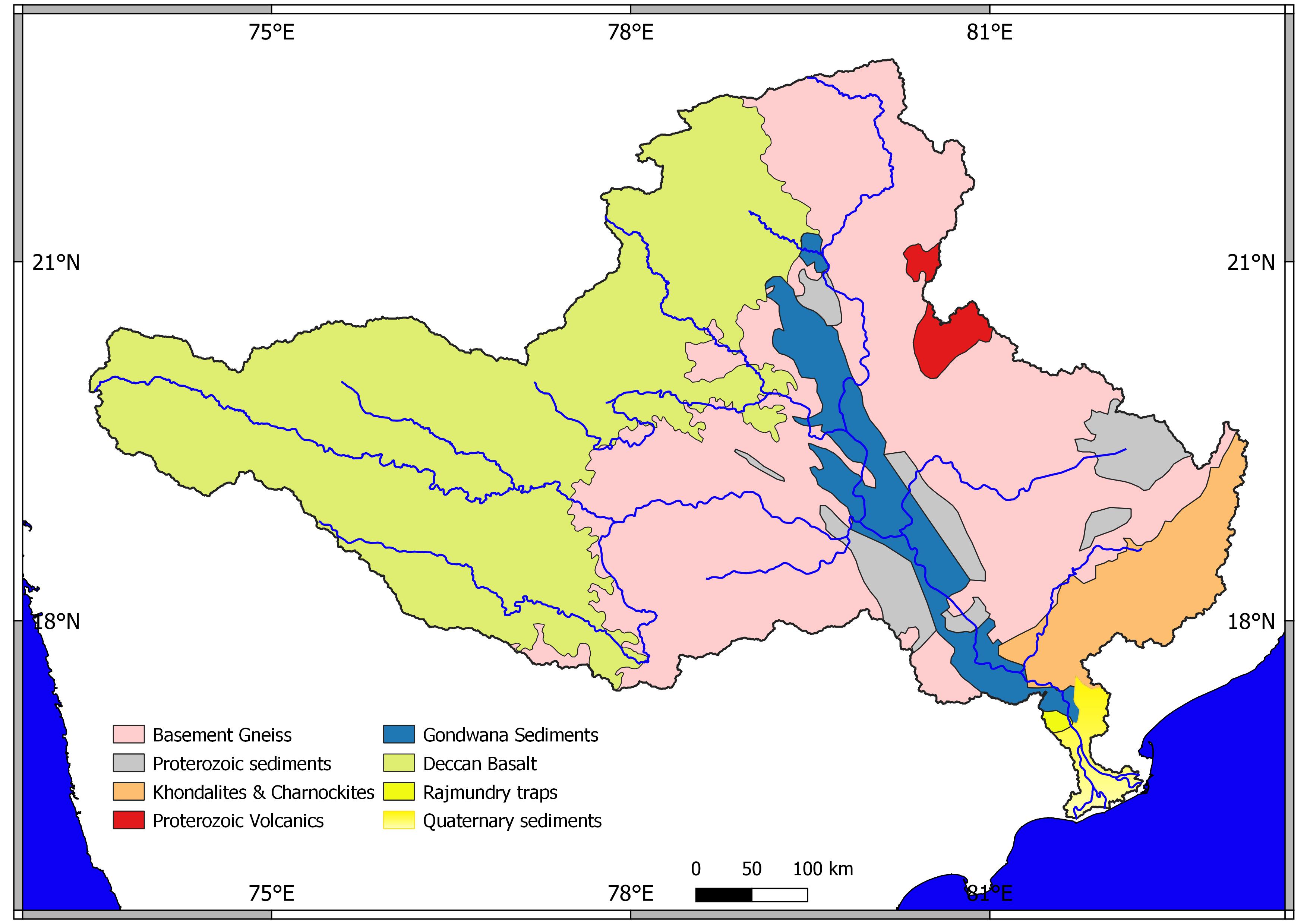
The district of Nanded lies between 180 15' to 190 55' North latitudes and 770 to 78025' East longitudes. It covers an area of 10,332 sq km. Nanded District lies in the eastern part of Maharashtra state as well as the eastern portion of Marathwada region, which corresponds to Aurangabad Division.
Nanded is bounded on the north by Yavatmal district of the Vidarbha region, with Latur on south-west, Parbhani and Hingoli districts on the west. On the eastern side lies Adilabad, Nirmal, Nizamabad and Kamareddy districts of Telangana state, and on the south lies Bidar of Karnataka state. The area presents undulating topography with uneven hills, plateau, gentle slopes and valley planes.
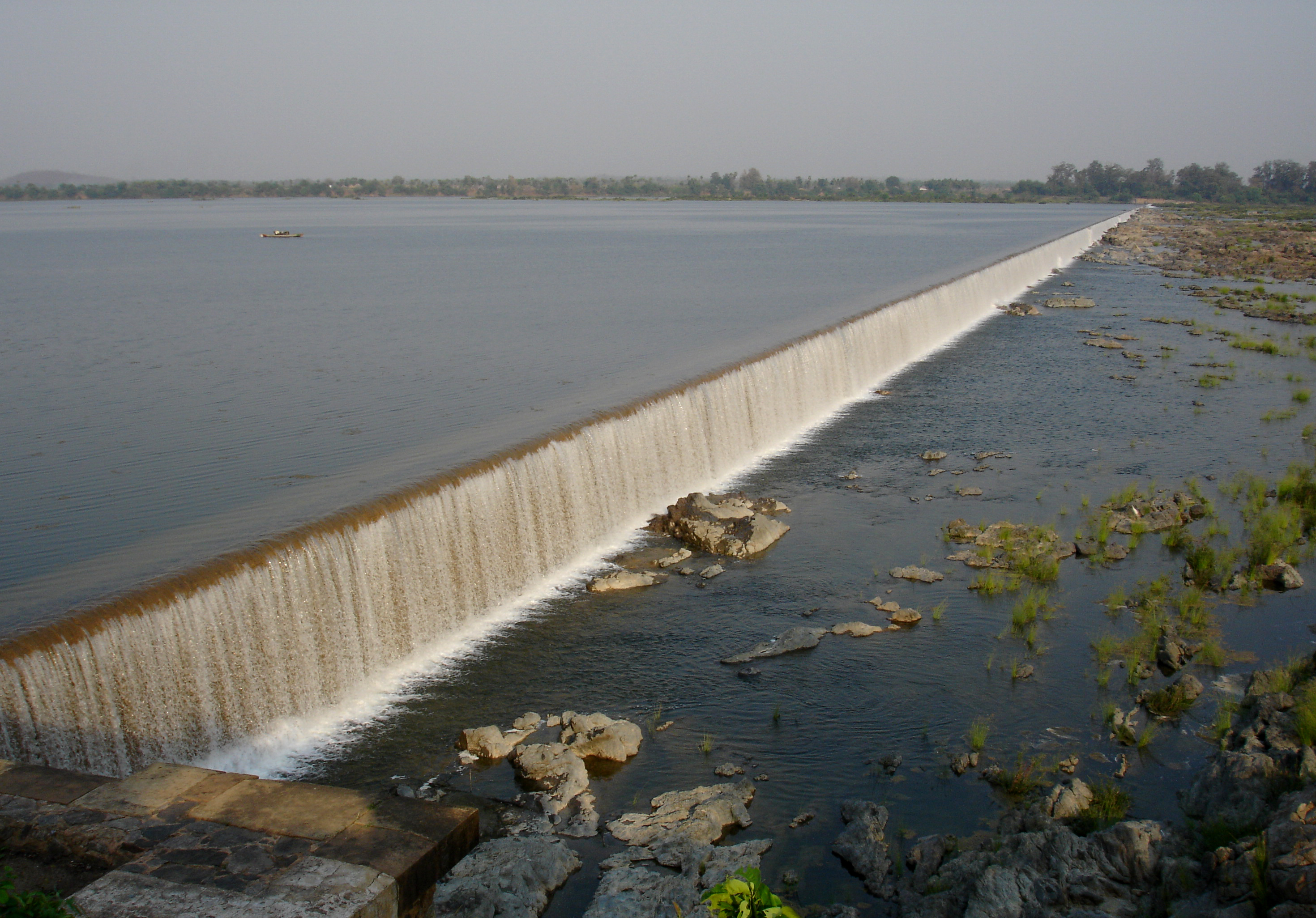
The Godavari River flows through the district. Physio-graphically, the district can be divided into 2 major parts, the hilly region on the North and North East and low-lying area on the banks of the rivers Godavari, Manjra, Manyad, Penganga.
Demographics
| Year | Pop. | ±% p.a. |
|---|---|---|
| 1901 | 550,261 | — |
| 1911 | 671,066 | +2.00% |
| 1921 | 649,825 | −0.32% |
| 1931 | 706,773 | +0.84% |
| 1941 | 784,289 | +1.05% |
| 1951 | 883,531 | +1.20% |
| 1961 | 1,079,674 | +2.03% |
| 1971 | 1,397,762 | +2.62% |
| 1981 | 1,749,334 | +2.27% |
| 1991 | 2,330,374 | +2.91% |
| 2001 | 2,876,259 | +2.13% |
| 2011 | 3,361,292 | +1.57% |
| source:[4] | ||
According to the 2011 census, the district has an area of 10,502 km2 and its population is 3,361,292 of which 27.19% were urban.[5] roughly equal to the nation of Uruguay[6] or the US state of Connecticut.[7] This gives it a ranking of 99th in India (out of a total of 640).[5] The district has a population density of 319 inhabitants per square kilometre (830/sq mi) .[5] Its population growth rate over the decade 2001-2011 was 16.7%.[5] Nanded has a sex ratio of 937 females for every 1000 males,[5] and a literacy rate of 76.94%. Scheduled Castes and Scheduled Tribes make up 19.05% and 8.38% of the population respectively.[5]
Languages
At the time of the 2011 Census of India, 75.46% of the population in the district spoke Marathi, 9.63% Urdu, 5.36% Hindi, 5.23% Lambadi, 2.10% Telugu and 0.83% Gondi as their first language. Urdu is mainly concentrated in Nanded city, while Gondi is mainly in Mahur and Kinwat taluks.[9]
Economy
In 2006 the Ministry of Panchayati Raj named Nanded one of the country's 250 most backward districts (out of a total of 640).[10] It is one of the twelve districts in Maharashtra currently receiving funds from the Backward Regions Grant Fund Programme (BRGF).[10]
Industrial Estates are located in Nanded, Dharmabad, Loha, Degloor, Kinwat, Krushnoor (SEZ).
Culture
Nanded is mentioned in the Ramayana, as the place where Bharat's mother came from. Mahur fort was a major fort in ancient times.[11] In Mahur, the Goddess Renuka temple is the major attraction for pilgrims. It is part of the Saade Teen Shaktipeeth (three and a half seats of power of the deity). There are many temples in Mahur viz Datta & Lord Parashuram temples. Kedarguda Temple in Hadgaon district is dedicated to Lord Kedarnath, known for Devrai (the forest dedicated to God). Another ancient Temple at Gaitond (mouth of cow) in Hadgaon taluka of Nanded district dedicated to Lord Shiva is a pilgrimage site.
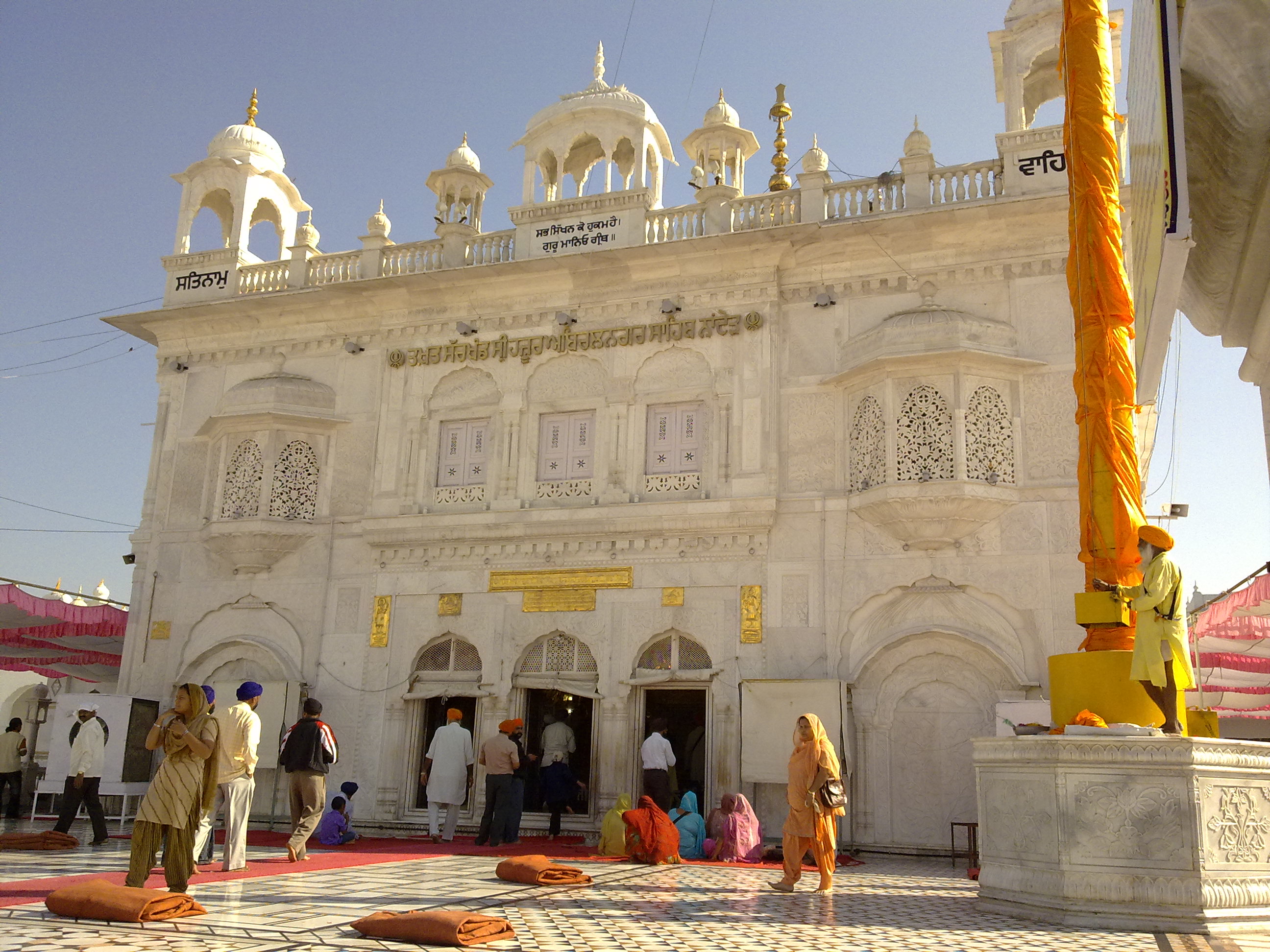
The Sahasrakund Waterfall located at Islapur village, Kinwat is a favourite destination for tourists during the monsoon. Hot water springs with containing sulphur and phosphate are believed to have medicinal properties. Unkeshwar village in Kinwat taluka has a Shiva temple. Malegaon Yatra dedicated to Lord Khandoba in Malegaon taluka is considered one of biggest in India. The 10th and last living guru of Sikhs, Guru Gobind Singh spent his last days and here he transferred the title of Guru to "Aad Granth" as "Guru Granth Sahib". A gurdwara was built on the site of Guru Gobind Singh's cremation. The gurdwara is part of the Hazur Sahib.
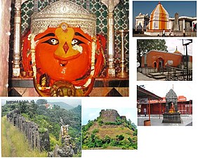 Temples and forts in Mahur, Nanded district
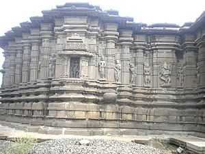 Sidhheshwar Temple near Hottal, Nanded district
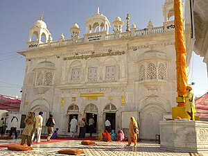 Hazur Sahib, a Sikh shrine located in the Nanded city


Education
- Swami Ramanand Teerth Marathwada University (SRTMU), located in Nanded, was established in 1994 as a state public university of Maharashtra state.
- Dr. Shankarrao Chavan Government Medical College
- Shri Guru Gobind Singhji Institute of Engineering and Technology
Notable people
- Vaman Pandit, a Marathi scholar and a poet.
- Guru Gobind Singh, the last Sikh Guru who died in Nanded.
- Banda Singh Bahadur, the Sikh military commander.
- Shankarrao Chavan, the former Chief minister and former Home minister of Maharashtra state.
- Ashok Chavan, former Chief Minister of Maharashtra state and former Member of Parliament of the Nanded Loksabha constituency.
- Prataprao Govindrao Chikhalikar, current Member of Parliament and former MLA
- Kamalkishor Kadam, a former minister of education.
- Chandreshekhar Sonwane, Indian American Rocket Scientist who is supporting NASA's Artemis and Lunar Gateway human habitat.
- Nagnath Lalujirao Kottapalle, former Vice-chancellor of BAMU, an educationalist and an author.
- Datta Bhagat, an Ambedkarite author.
- Narhar Ambadas Kurundkar, a scholar, critic and author.
- Vivek Ram Chaudhari, Indian Airforce chief marshal.[12]
See also
- Make in Maharashtra
- Marathwada
References
- "Nanded Pin code". pin-code.net. Retrieved 9 February 2021.
- Records, Official. "District Per capita income of Maharashtra 2020-21". Planning Department, Government of Maharashtra, India. Maharashtra Vidhanmandal.
- Records, Official. "District Nominal gross Domestic Product of Maharashtra 2020-21". Planning Department, Government of Maharashtra, India. Maharashtra Vidhanmandal.
- Decadal Variation In Population Since 1901
- "District Census 2011 - Nanded" (PDF). Office of the Registrar General, India. 2011.
- US Directorate of Intelligence. "Country Comparison:Population". Archived from the original on 13 June 2007. Retrieved 1 October 2011.
Uruguay 3,308,535 July 2011 est.
- "2010 Resident Population Data". U. S. Census Bureau. Retrieved 30 September 2011.
Connecticut 3,574,097
- "C-16 Population By Religion - Maharashtra". census.gov.in.
- 2011 Census of India, Population By Mother Tongue
- Ministry of Panchayati Raj (8 September 2009). "A Note on the Backward Regions Grant Fund Programme" (PDF). National Institute of Rural Development. Archived from the original (PDF) on 5 April 2012. Retrieved 27 September 2011.
- Mahurghat Archived 11 September 2014 at the Wayback Machine Government of India.
- "IAF chief Vivek Ram Chaudhari: Ready for any eventuality, focus on being atmanirbhar".
External links
Places adjacent to Nanded district | |
|---|---|
| Topics |
| ||||||||||||
|---|---|---|---|---|---|---|---|---|---|---|---|---|---|
| Regions |
| ||||||||||||
| Divisions and Districts |
| ||||||||||||
| Million-plus cities in Maharashtra |
| ||||||||||||
| Other cities with municipal corporations | |||||||||||||
Portal:India | |||||||||||||
Godavari basin | |||||||||||||||
|---|---|---|---|---|---|---|---|---|---|---|---|---|---|---|---|
| Rivers |
|     | |||||||||||||
| Dams, barrages |
| ||||||||||||||
| Geographical features / regions | |||||||||||||||
| Riparian districts |
| ||||||||||||||
| Cities | |||||||||||||||
| Languages / people | |||||||||||||||
| Coalfields |
| ||||||||||||||
| Oil / gas fields |
| ||||||||||||||
| Industries |
| ||||||||||||||
| Transport |
| ||||||||||||||
| Pollution concerns, River basin's sustainable productivity & ecology |
| ||||||||||||||
| Related topics |
| ||||||||||||||
| Other basins | |||||||||||||||
Authority control | |
|---|---|
| General |
|
| National libraries | |
На других языках
[de] Nanded (Distrikt)
Der Distrikt Nanded (Marathi: .mw-parser-output .Deva{font-size:120%}@media all and (min-width:800px){.mw-parser-output .Deva{font-size:calc(120% - ((100vw - 800px)/80))}}@media all and (min-width:1000px){.mw-parser-output .Deva{font-size:100%}}नांदेड जिल्हा; früher auch Nander) ist einer von 35 Distrikten des Staates Maharashtra in Indien.- [en] Nanded district
[ru] Нандер (округ)
Нандер (маратх. नांदेड जिल्हा; англ. Nanded) — округ в индийском штате Махараштра. Образован 1 мая 1960 года. Административный центр — город Нандер. Площадь округа — 10 528 км². По данным всеиндийской переписи 2001 года население округа составляло 2 876 259 человек. Уровень грамотности взрослого населения составлял 67,8 %, что выше среднеиндийского уровня (59,5 %). Доля городского населения составляла 24 %.Другой контент может иметь иную лицензию. Перед использованием материалов сайта WikiSort.org внимательно изучите правила лицензирования конкретных элементов наполнения сайта.
WikiSort.org - проект по пересортировке и дополнению контента Википедии