world.wikisort.org - India
Gadchiroli district (Marathi pronunciation: [ɡəɖt͡ʃiɾoliː]) is an administrative district in Maharashtra, India. The city of Gadchiroli is the administrative headquarters of the district.
Gadchiroli district | |
|---|---|
District of Maharashtra | |
| Gadchiroli | |
 Kotri river near Bhamragad | |
 Location in Maharashtra | |
| Coordinates (Gadchiroli): 20°11′10″N 80°00′19″E | |
| Country | |
| State | Maharashtra |
| Division | Nagpur Division |
| Headquarters | Gadchiroli |
| Tehsils | |
| Government | |
| • Body | Gadchiroli Zilla Parishad |
| • Guardian Minister | Devendra Fadnavis Deputy Chief Minister |
| • President Zilla Parishad |
|
| • District Collector |
|
| • CEO Zilla Parishad |
|
| • MPs |
|
| Area | |
| • Total | 14,412 km2 (5,565 sq mi) |
| Population (2011) | |
| • Total | 1,072,942 |
| • Density | 74/km2 (190/sq mi) |
| • Urban | 6.93% |
| Demographics | |
| • Literacy | 60.1% |
| • Sex ratio | 976 |
| Vehicle registration | MH-33 |
| Major highways | NH 63, NH 353C, NH 353D, NH 542 & NH 930 |
| Average annual precipitation | 1704 mm |
| Website | Official website |
Officer
Members of Parliament
- Ashok Nete (BJP)
(Gadchiroli–Chimur)
Guardian Minister
| Guardian Minister Gadchiroli | |
|---|---|
| पालकमंत्री गडचिरोली | |
 Emblem of India | |
 Devendra Fadnavis Deputy Chief Minister since 27 September 2022 | |
| Style | The Honourable |
| Residence | Mumbai Sagar Bangla |
| Appointer | Chief Minister of Maharashtra |
| Term length | 5 years / No time limit |
| Website | gadchiroli |
list of Guardian Minister
| Name | Term of office |
|---|---|
| Raje Ambrishrao Raje Satyawan Rao Atram | 31 October 2014 – 24 October 2019 |
| Eknath Shinde | 9 January 2020 - 27 June 2022 |
| Vijay Wadettiwar Additional charge |
27 June 2022 - 29 June 2022 |
| Devendra Fadnavis Deputy Chief Minister |
27 September 2022 - Incumbent |
District Magistrate/Collector
| District Magistrate / Collector Gadchiroli | |
|---|---|
| जिल्हाधिकारी तथा जिल्हदंडाधिकरी गडचिरोली | |
Emblem of India | |
Incumbent Shri. Sanjay Meena (IAS) since 2018 | |
| Residence | At Gadchiroli district |
| Appointer | Government of Maharashtra |
| Term length | No time limit |
| Website | gadchiroli |
list of District Magistrate / Collector
| Name | Term of office |
|---|---|
| Shri. Sanjay Meena (IAS) | 2018 - Incumbent |
Extent and history
Maharashtra tapers in the east, where this district forms the south-east corner. The district is bordered by Gondia district to the north, Rajnandgaon, Kanker, Narayanpur and Bijapur districts of Chhattisgarh to the east, Jayashankar Bhupalpally district of Telangana to the south, and Mancherial and Komaram Bheem districts of Telangana and Chandrapur district to the west.
It was created on 26 August 1982 by the separation of Gadchiroli and Sironcha taluks from Chandrapur district.
Strategic planning
The district is currently a part of the Red Corridor.[1]
Divisions
The district is divided into six revenue sub-divisions:Gadchiroli, Aheri,Chamorshi,Etapalli,Wadsa(Desaiganj),Kurkheda. These are each further divided into 2 taluka. Gadchiroli sub-division consists of Gadchiroli and Dhanora, Chamorshi sub-division consist of chamorshi and Mulchera talukas; Aheri sub-division consists of Aheri and Sironcha.Etapalli sub-division cover Etapalli and Bhamragad talukas; and Desaiganj (Wadsa) sub-division consists of Wadsa and Armori.Kurkheda sub-division consist of Kurkheda and Korchi talukas. There are 557 gram panchayats (village councils) and 1,688 Revenue Villages. The district has 12 panchayat samitis (local development-block governments). Only three municipalities, Gadchiroli, Wadsa (Desaiganj), and Armori exist in the district.
Following the delimitation of the constituencies in 2008, the district had three Vidhan Sabha (legislative assembly) constituencies: Gadchiroli, Armori and Aheri. All of these are part of the newly carved Gadchiroli-Chimur Lok Sabha constituency.[2]
Natural geography
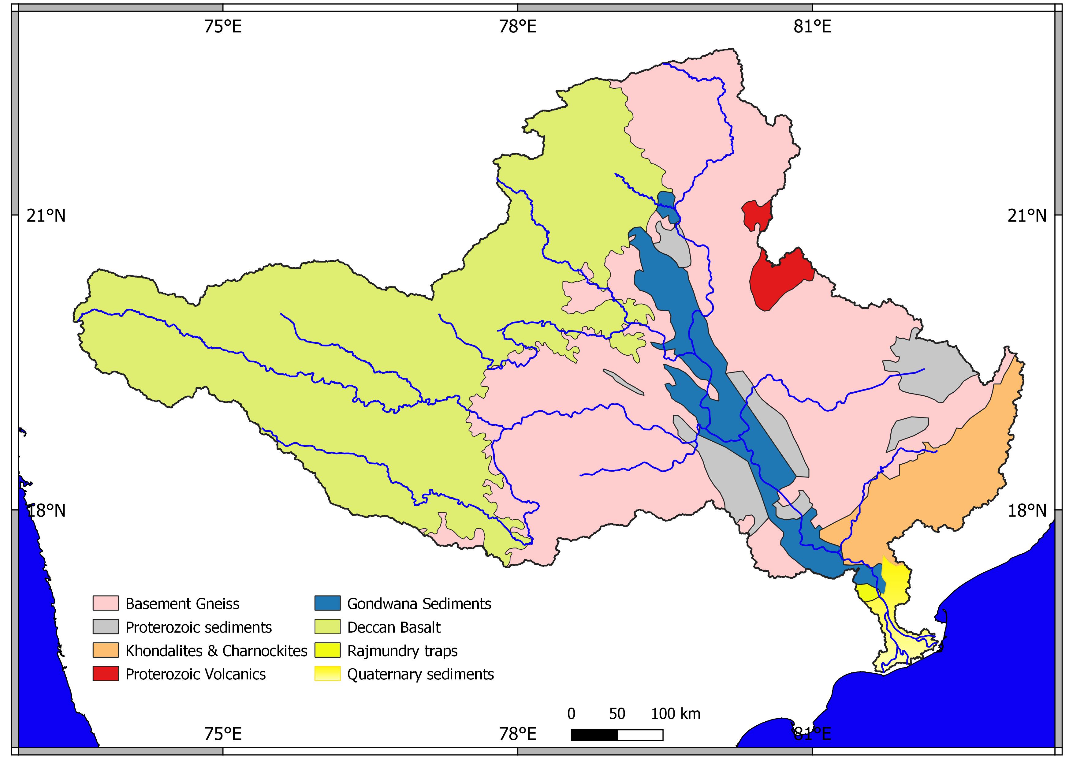
Established on 26 August 1982 The main river basin of the district is the Godavari, which flows west-to-east and forms the southern boundary of the district. The major tributaries of the Godavari are the Indravati and the Pranhita, the latter of which is formed by the confluence of the Wainganga and the Wardha near Chaprala village of Chamorshi taluka.
Dhanora, Etapalli, Aheri and Sironcha talukas in the eastern part of the district are covered by forest. Hills are found in Bhamragad, Tipagad, Palasgad and Surjagad area. The eastern part of Gadchiroli, bordering Chhattisgarh state, is mainly hilly and is tribal-dominated, similar to neighbouring Bastar region in Chhattisgarh.
Demographics
| Year | Pop. | ±% p.a. |
|---|---|---|
| 1901 | 177,244 | — |
| 1911 | 225,086 | +2.42% |
| 1921 | 220,771 | −0.19% |
| 1931 | 254,088 | +1.42% |
| 1941 | 290,730 | +1.36% |
| 1951 | 324,962 | +1.12% |
| 1961 | 386,392 | +1.75% |
| 1971 | 522,229 | +3.06% |
| 1981 | 637,336 | +2.01% |
| 1991 | 787,010 | +2.13% |
| 2001 | 970,294 | +2.12% |
| 2011 | 1,072,942 | +1.01% |
| source:[3] | ||
According to the 2011 census Gadchiroli district has a population of 1,072,942,[4] roughly equal to the nation of Cyprus[5] or the US state of Rhode Island.[6] This gives it a ranking of 424th in India (out of a total of 640).[4] The district has a population density of 74 inhabitants per square kilometre (190/sq mi).[4] Its population growth rate during 2001–2011 was 10.46%.[4] Gadchiroli has a sex ratio of 975 females for every 1000 males,[4] and a literacy rate of 70.55%.[4]
Scheduled caste and Scheduled Tribe population in the district is 120,745 (11.25%) and 415,306 (38.71%) of the population respectively. Almost 85% of the tribals are Gonds, in particular the Madia Gonds.[7]
Languages
At the time of the 2011 Census of India, 56.38% of the population in the district spoke Marathi, 23.68% Gondi, 8.87% Telugu, 5.12% Bengali, 2.15% Hindi and 1.69% Chhattisgarhi as their first language. Marathi is the main language in the west of the district, while Gondi is the dominant language in the eastern parts. Telugu speakers are majority in Sironcha tehsil in the far south.[9]
As of 2011[update] it is the second-least-populous district of Maharashtra (out of 39), after Sindhudurg.[4]
Economy
The district is categorised as tribal and undeveloped, with farming as the main occupation. Forests cover more than 79.36% of the hilly geographical of the district. The district produces bamboo and Tendu leaves, and paddy is the main agricultural product. Other agriculture includes sorghum, linseed, pigeon pea (tur), and wheat.
The only large-scale industry in the district is a paper mill at Ashti in Chamorshi taluka and the paper pulp factory at Desaiganj. There are many rice mills in the district. The Tussar silk worm centre is in Armori taluka. 18.5 kilometres (11.5 mi) of railway lines pass through the district.
The district is known for activity of Naxalites – the People's Liberation Guerrilla Army – who have taken shelter in the dense forests and hills.
In 2006 the Ministry of Panchayati Raj named Gadchiroli among the country's 250 most-backward districts (out of a total of 640).[10] It is one of the twelve districts in Maharashtra currently receiving funds from the Backward Regions Grant Fund Programme (BRGF).[10]
Health
The Lok Biradari Prakalpa (LBP) situated at Hemalkasa in the Bhamragad taluka is one of the major institutions offering healthcare and education services to the local Madia Gond tribals. LBP was envisioned by the late Gandhian, Dr. Murlidhar Devidas Amte, fondly called Baba Amte. His family consisting of Dr. Prakash Amte, Dr. Mandakini Amte and their children currently work at the LBP.[11][better source needed]
Education
The government recently established Gondwana University on dated 27 September 2011 in Gadhchiroli district.[12]
High schools
• Global media Kerala model E/M school,allapalli.
- government English medium school gadchiroli
- Gondwana Sainiki Vidyalaya, Gadchiroli
- Platinum Jubilee School and Junior College (Science), Gadchiroli
- Shriniwas High School Ankisa
- Dharmarao High School Sironcha
- Republic English Medium School, Aheri
- School Of Scholars, Gadchiroli
- Rampuri Primary School
- Shri. Shivaji High School, Gadchiroli
- Z.P. High School, Gadchiroli
- Carmel High School, Gadchiroli
- Vasant Vidyalaya High School
- Rani Durgavati High School & Junior College Allapalli
- Netaji Subhash Chandra Jr. College, Sundernagar
- Indira Gandhi Memoriyal High School & Junior College, Subhashgram
- Mahatma Gandhi vidyalaya, Armori
- Dr. Ambedkar vidyalaya, Armori
- Hitakarani high school, Armori
- Swami Vivekanda Vidyalaya, Armori
- Adarsh English High school, Desaiganj (wadsa)
- Mahatma Gandhi Vidyalaya, Desaiganj (Wadsa)
- Dr. Babasaheb Ambedkar Vidyalaya, Desaiganj (Wadsa)
- Pushpa Priya Devi High School & Junior science College Jimalgatta
- Vianney Vidya Niketan (ICSE), Navegaon, Gadchiroli
Model school Aheri
- Platinum Jubilee School & Jr. College (science)
- School Of Scholars, Gadchiroli
- Shriniwas Junior College, Ankisa
- Z. P. Junior College of Science Sironcha
- Shivaji Junior Science College
- Govt ITI Complex, Gadchiroli
- Mahatma Gandhi junior college, Armori
- N.S.C Jr. College Sundarnagar
- Adarsh English High School & Junior College, Desaiganj (Wadsa)
- Mahatma Gandhi Vidyalaya & Junior College, Desaiganj (Wadsa)
Senior (degree) colleges
- Bhagvantrao Arts College Sironcha
- Shivaji Science College Gadchiroli
- Mahila Mahavidyalaya, Gadchiroli
- Government Science College, Gadchiroli
- Government Polytechnic, Gadchiroli
- College of Agriculture, Sonapur complex Gadchiroli
- Model College ,Gadchiroli
- Fule-Ambedkar College of Social Work, Gadchiroli
- Mahatma Gandhi college, Armori
- Chanakya Academy, Aheri & Alapalli (Competitive Exam Coaching Center)
- Chanakya Academy, Police Physical Ground, Aheri
- Adarsh Mahavidyalaya Art & Com. Desaiganj (Wadsa)
Sainath Adhayapak vidyalaya, Murkhala Prof.Jogendra kawade college Vairagad Shri govindrao Munghate Art and Science college kurkheda
Important places

- Wadadham Fossil Park, tah, Sironcha
- Chaprala Wildlife Sanctuary
- Bhamragarh Wildlife Sanctuary
- Lok Biradari Prakalp, Hemalkasa
- Binagunda waterfall, Bhamragad
- Tipagad, tah. Korchi
- Khobramendha, tag dhanora
- Bhandareshwar temple, tag Armori
- Search hospital, Chatgaon
- Desaiganj Wadsa, market place
- Markanda dev, Tah Chamorshi
- Somnur sangam tah, Sironcha
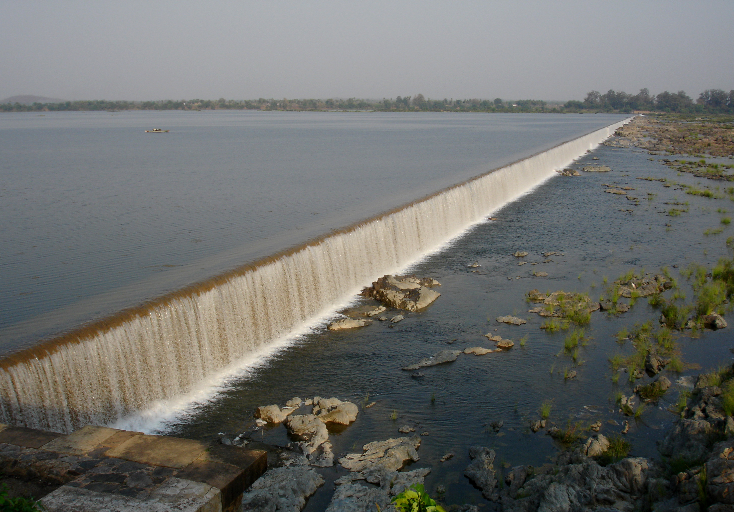
- Pranhita Sangam tah, Sironcha
- Triveni sangam bhamragad
See also
- Make In India
- Chandrapur
- Gondia
- Nagpur
References
- "83 districts under the Security Related Expenditure Scheme". IntelliBriefs. 11 April 2019. Retrieved 17 April 2019.
- "District wise List of Assembly and Parliamentary Constituencies". Chief Electoral Officer, Maharashtra website. Archived from the original on 18 March 2010.
- Decadal Variation In Population Since 1901
- "District Census 2011 - Gadchiroli" (PDF). Office of the Registrar General, India. 2011.
- US Directorate of Intelligence. "Country Comparison:Population". Archived from the original on 27 September 2011. Retrieved 1 October 2011.
Cyprus 1,120,489 July 2011 est.
- "2010 Resident Population Data". U. S. Census Bureau. Archived from the original on 1 January 2011. Retrieved 30 September 2011.
Rhode Island 1,052,567
- "Census GIS India". Archived from the original on 3 July 2007. Retrieved 27 August 2009.
- "C-16 Population By Religion - Maharashtra". census.gov.in.
- 2011 Census of India, Population By Mother Tongue
- Ministry of Panchayati Raj (8 September 2009). "A Note on the Backward Regions Grant Fund Programme" (PDF). National Institute of Rural Development. Archived from the original (PDF) on 5 April 2012. Retrieved 27 September 2011.
- People's Brotherhood Project. Lok Biradari Prakalp. Retrieved on 2016-07-31.
- "Gondwana University". Retrieved 10 April 2017.
External links
Places adjacent to Gadchiroli district | ||||||||||||||||
|---|---|---|---|---|---|---|---|---|---|---|---|---|---|---|---|---|
| ||||||||||||||||
| Districts of Vidarbha | |
|---|---|
| Cities with municipal corporations | |
Portal:India | |
| Topics |
| ||||||||||||
|---|---|---|---|---|---|---|---|---|---|---|---|---|---|
| Regions |
| ||||||||||||
| Divisions and Districts |
| ||||||||||||
| Million-plus cities in Maharashtra |
| ||||||||||||
| Other cities with municipal corporations | |||||||||||||
Portal:India | |||||||||||||
Godavari basin | |||||||||||||||
|---|---|---|---|---|---|---|---|---|---|---|---|---|---|---|---|
| Rivers |
|     | |||||||||||||
| Dams, barrages |
| ||||||||||||||
| Geographical features / regions | |||||||||||||||
| Riparian districts |
| ||||||||||||||
| Cities | |||||||||||||||
| Languages / people | |||||||||||||||
| Coalfields |
| ||||||||||||||
| Oil / gas fields |
| ||||||||||||||
| Industries |
| ||||||||||||||
| Transport |
| ||||||||||||||
| Pollution concerns, River basin's sustainable productivity & ecology |
| ||||||||||||||
| Related topics |
| ||||||||||||||
| Other basins | |||||||||||||||
Authority control | |
|---|---|
| General |
|
| National libraries | |
На других языках
[de] Gadchiroli (Distrikt)
Der Distrikt Gadchiroli (Marathi: .mw-parser-output .Deva{font-size:120%}@media all and (min-width:800px){.mw-parser-output .Deva{font-size:calc(120% - ((100vw - 800px)/80))}}@media all and (min-width:1000px){.mw-parser-output .Deva{font-size:100%}}गडचिरोली जिल्हा) ist einer von 35 Distrikten des Staates Maharashtra in Indien.- [en] Gadchiroli district
[ru] Гадчироли (округ)
Гадчироли (маратх. गडचिरोली जिल्हा; англ. Gadchiroli) — округ в индийском штате Махараштра. Образован 26 августа 1982 года из части территории округа Чандрапур. Административный центр — город Гадчироли. Площадь округа — 14 412 км². По данным всеиндийской переписи 2001 года население округа составляло 970 294 человека. Уровень грамотности взрослого населения составлял 60,1 %, что немного выше среднеиндийского уровня (59,5 %). Доля городского населения составляла 6,9 %.Другой контент может иметь иную лицензию. Перед использованием материалов сайта WikiSort.org внимательно изучите правила лицензирования конкретных элементов наполнения сайта.
WikiSort.org - проект по пересортировке и дополнению контента Википедии