world.wikisort.org - India
Osmanabad District (pronunciation: [usmaːnabaːd̪]) (Transliteration: Usmanabad Jil'hā) is an administrative district in the Marathwada region in the Indian state of Maharashtra. The district headquarter is located at Osmanabad. The District of Osmanabad derives its name from the last ruler of Hyderabad, the 7th Nizam, Mir Osman Ali Khan, of which the region was a part till 1947. This region was earlier part of The Hyderabad State until Independence.This primarily rural district occupies an area of 7,569 km2 (2,922 sq mi) of which 241.4 km2 (93.2 sq mi) is urban and has a population of 1,657,576 of which 16.96% were urban (as of 2011).[1]
Osmanabad District | |
|---|---|
District of Maharashtra | |
 View from Naldurg Fort | |
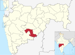 Location in Maharashtra | |
 Osmanabad district | |
| Coordinates (Osmanabad): -18.40°N 76.40°E | |
| Country | |
| State | Maharashtra |
| Division | Aurangabad |
| Headquarters | Osmanabad |
| Tehsils | 1. Osmanabad Tahsil, 2. Tuljapur, 3. Omerga, 4. Lohara, 5. Kalamb, 6. Bhoom, 7. Paranda, 8. Washi |
| Government | |
| • Body | Osmanabad Zilla Parishad |
| • Guardian Minister | Tanaji Sawant (Cabinet Minister MH) |
| • President Z. P. Osmanabad | NA |
| • District Collector | Mr. Kaustubh Diwegaonkar IAS |
| • CEO Z. P. Osmanabad | Rahul Gupta |
| • MPs | Omraje Nimbalkar (Osmanabad) |
| Area | |
| • Total | 7,569 km2 (2,922 sq mi) |
| Population (2011) | |
| • Total | 1,657,576 |
| • Density | 220/km2 (570/sq mi) |
| Demographics | |
| • Literacy | 76.33% |
| • Sex ratio | 920 |
| Time zone | UTC+05:30 (IST) |
| Major highways | National Highway 52, National Highway 65, National Highway 361 |
| Average annual precipitation | 760.40 mm |
| Website | osmanabad |
Officer
Members of Parliament
Omraje Nimbalkar (SHS (UBT))
(Osmanabad)
Guardian Minister
| Guardian Minister Osmanabad | |
|---|---|
| पालकमंत्री उस्मानाबाद | |
 Emblem of India | |
Incumbent Tanaji Sawant since 24 September 2022 | |
| Style | The Honourable |
| Appointer | Chief Minister of Maharashtra |
| Term length | 5 years / No time limit |
| Website | osmanabad |
list of Guardian Minister
| Name | Term of office |
|---|---|
| Deepak Sawant | 31 October 2014 - 7 January 2019 |
| Subhash Desai Additional Charge | 7 January 2019 - 16 June 2019 |
| Jaydutt Kshirsagar | 16 June 2019 - 8 November 2019 |
| Shankarrao Gadakh | 9 January 2020 - 29 June 2022 |
| Tanaji Sawant | 24 September 2022 - Incumbent |
District Magistrate/Collector
| District Magistrate / Collector Osmanabad | |
|---|---|
| जिल्हाधिकारी तथा जिल्हदंडाधिकरी उस्मानाबाद | |
Emblem of India | |
Incumbent Mr. Kaustubh Diwegaonkar (IAS) since 2019 | |
| Residence | At Osmanabad district |
| Appointer | Government of Maharashtra |
| Term length | No time limit |
| Website | osmanabad |
list of District Magistrate / Collector
| Name | Term of office |
|---|---|
| Mr. Kaustubh Diwegaonkar (IAS) | 2019 - Incumbent |
Location
Osmanabad district lies in the southern part of state. It lies on the Deccan plateau, about 600 m above sea level. Parts of the sina, Manjira and Terna River flow through the district. The district is located on the south side of the Marathwada region between latitude 17.35 to 18.40 degrees north, and latitude 75.16 to 76.40 degrees east.
Osmanabad District is bordered by the Beed District to the north, Latur District to the east, Solapur District to the west, Ahmednagar district to the north-west and the Bidar and Kalaburagi districts of state of Karnataka to the south. Most of the district lies in the hilly areas of the Balaghat Range.
Climate
The rainy season starts from mid-June and continues till the end of September. The climate is humid in October and November and dry and cool from mid-November to January. From February to June the climate is dry and becomes increasingly hot. During summer the temperature of Osmanabad district is low compared to other districts of Marathwada region. The average annual rainfall in the district is 760.40 mm. Temperature Max.: 42.1 °C; Min.: 8 °C
Tahsils
There are eight talukas (tahsils) in Osmanabad district.[2]
Paranda is a historical place known for the Paranda Fort.
Tuljapur is a major taluka town, about 45 km from Solapur, 25 km from Osmanabad town and 40 km from Hyderabad national Highway at Naldurga.
Tuljapur is best known for its Tulja Bhavani Mandir. It is said that Tulja Bhavani mata had offered sword to Chattrapati Shivaji Maharaj (not verifiable) and his son Chattrapati Sambhaji Maharaj re-built the temple. Omerga is a densely populated taluka in Osmanabad. The Tata Institute of Social Sciences, Mumbai also has a School of Rural Development (the "Rural Campus") at Tuljapur.
Kalamb is a major taluka, 55 km from district headquarter Osmanabad. Kalamb city is old city with river Manjara flowing nearby. Major APMC market is main attraction. The taluka is blessed by Yedeshwari Devi, whose temple located at Yermala, 25 km from kalamb.
Demographics
| Year | Pop. | ±% p.a. |
|---|---|---|
| 1901 | 387,122 | — |
| 1911 | 460,516 | +1.75% |
| 1921 | 442,156 | −0.41% |
| 1931 | 492,845 | +1.09% |
| 1941 | 547,945 | +1.07% |
| 1951 | 603,273 | +0.97% |
| 1961 | 726,036 | +1.87% |
| 1971 | 928,227 | +2.49% |
| 1981 | 1,029,702 | +1.04% |
| 1991 | 1,276,327 | +2.17% |
| 2001 | 1,486,586 | +1.54% |
| 2011 | 1,657,576 | +1.09% |
| source:[3] | ||
In the 2011 census Osmanabad district had a population of 1,657,576,[1] roughly equal to the nation of Guinea-Bissau[4] or the US state of Idaho.[5] This gave it a ranking of 298th among district of India (out of a total of 640). Scheduled Castes and Scheduled Tribes make up 16.00% and 2.17% of the population respectively.[1]
The district had a population density of 219 inhabitants per square kilometre (570/sq mi).[1] Its population growth rate over the decade 2001-2011 was 11.69%.[1] Osmanabad had a sex ratio of 920 females for every 1000 males,[1] and a literacy rate of 76.33%.[1]
At the time of the 2011 Census of India, 85.42% of the population in the district spoke Marathi, 5.89% Hindi, 4.25% Urdu and 2.04% Lambadi as their first language.[7]
Politics
The Shivsena (SHS), Congress (IND), NCP, BJP and BSP are the major political parties in Osmanabad district.[8][9]
Osmanabad's representation in the Indian Parliament (Lok Sabha) is via the Osmanabad constituency which also includes a piece of northern Solapur district (Barshi) and a piece of southern Latur district (Ausa). Current Member of parliament from Osmananbad loksabha constituency is Omprakash Raje Nimbalkar[10] Osmanabad constituency is formed by six Assembly constituencies i.e. Osmanabad, Omerga, Tuljapur, Paranda Boom, these four from Osmanabad district, Barshi from Solapur District, and Ausa from Latur District.
There are four constituencies for the Maharashtra Legislative Assembly (Vidhan Sabha): the Paranda constituency, Osmanabad constituency, Tuljapur constituency, and Umarga constituency.[11][12]
Transport
Railway
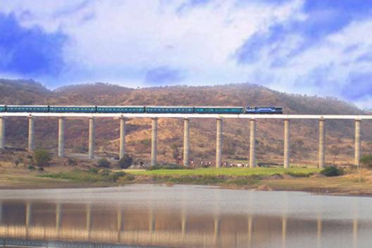
A small portion of the Barshi light railway connecting Latur-Barshi-Kurduvadi passed through northern fringe of Osmanabad district until 2007. The rail track was converted to broad gauge and the track alignment was changed southwards to pass near Osmanabad town. The modified track from Latur to Osmanabad opened for traffic in September 2007. The modified rail track from Osmanabad to Kurduvadi junction became operational in October 2008 and connects Osmanabad to Pune and Mumbai by a shorter rail route than via Latur. North India also connected by this new track. Railway service is available for Nagpur to Kolhapur, Miraj to Parli, Pandharpur to Nizamabad, Pune to Hyderabad, Pune to Amarawati, Pune To Nizmabad via Osmanabad station. Tourism and Transport are developed. Osmanabad is well connected with Mumbai, Pune, Latur, Parbhani, Nanded, Amravati, Nagpur, Kolhapur, Miraj, Parli. Osmanabad station comes under Central Railway (CR) zone.
National Highways
Below National Highways passes through the Osmanabad District.[13]
1. NH-52: Sangrur(Punjab)-Hisar(Haryana)-Kota(Rajasthan)-Indore(Madhya Pradesh)-Dhule-Aurangabad-Beed-Osmanabad-Tuljapur-Solapur-Vijayapura-Hubballi-Ankola(Karnataka)
(Villages from Osmanabad district on this NH are- Pargaon-Kunthalgiri Phata-Terkheda-Yermala-Yedshi-Osmanabad-Tuljapur-Tamalwadi)
2. NH-63: Barshi-Yedshi-Dhoki-Murud-Latur-Udgir-Deglur-Nizamabad(Telangana)-Sironcha(Maharashtra)-Jagdalpur(Chhattisgarh)-Kotpad(Odisha)-Borigumma
3. NH-65: Pune-Indapur-Solapur-Omerga-Hyderabad-Vijayawada-Machilipatnam(Andhra Pradesh)
(Villages from Osmanabad district on this NH are- Itkal-Anadur-Naldurg-Jalkot-Yenegur-Dalimb-Omerga-Turori)
4. NH-361: Tuljapur-Latur-Ahmedpur-Nanded-Yavatmal-Wardha-Butibori(Near Nagpur)
5. NH-548B: Mantha-Selu-Pathari-Sonpeth-Parali-Ambajogai-Latur-Ausa-Omerga-Yenegur-Murum-Alur-Akkalkot-Nagansur-Vijayapura-Athani-Chikhodi-Sankeshwar-Gotur(Karnataka)
6. NH-548C: Satara-Koregaon-Mhaswad-Malshiras-Akluj-Tembhurni-Barshi-Yermala-Kalamb-Kej-Majalgaon-Partur-Mantha-Lonar-Mehkar-Khamgaon-Shegaon-Akot-Anjangaon-Betul (Madhya Pradesh)
7. NH-652: Tuljapur-Naldurg-Hannur-Akkalkot
Airport
Osmanabad Airport located 10 Kilometres north of Osmanabad, does not have any commercial air traffic. Reliance Airport Developers, who won a bid in 2009 to run the airport on a 95-year lease,[14][15] plan to use this airport for aviation training.[16] The nearest operational airports are Aurangabad Airport and Nanded Airport.
Cultural places
Dargah
A dargah (Sufi shrine is in the Osmanabad city built over the grave of a revered religious figure) of Khwaja Shamsuddin Gazi. The interior decoration of the dargah consisting of many colourful glass pieces and it is so mesmerizing. The Urs of Khwaja Shamshoddin Gazi festival celebrates in the city in the month of the Rajab of the Islamic calendar.
Tuljapur
The most famous tourist destination in Osmanabad District is in Tuljapur, which is famous for the Tuljabhavani Temple, (Marathi: श्री क्षेत्र तुळजा भवानी देवस्थान) a Hindu temple dedicated to the goddess Bhavani(Durga Or Parvati). It is considered one of the 51 Shakti Pithas. It is situated 32 km from Osmanabad and was built in c. 12th century CE.
Kanheri
Kanheri is situated in Vashi taluka. Here is a Datta Temple and a Maruti Temple.
Historical Places
Naldurg
Naldurg is another historical place in Osmanabad with a historic Naldurg Fort. The fort contains two man-made waterfalls known as Nar-Madi Dhabdhaba or Waterfalls.
Kunthalgiri
Kunthalgiri tirth consists of 11 Jain temples : Kunthagiri is the great holy place of the Digambar, Jains and famous for Digambarpanthi Jain temple in Bhoom tahsil. The main temple of Kunthalgiri is Shri Kul Bhushan – Desh Bhushan Mandir known as Bara Mandir here. Shri Kul Bhushan – Desh Bhushan went to Moksha in the period of Lord Munisuvratnath. Idols of Lord Shantinath, Munisuvratnath & Adinath are present here. The main idol of the temple is of Munisuvranatha. Adinatha idol is carved in Ardh Padmasana posture and Parsvanath idol is white-colored and has 11 hoods of a cobra.
Shantinath temple built in year 1875 is also present here. Moolnayak of this temple is a 2 feet 3 inch black colder idol of Lord Shantinatha in padmasan posture. Idols of other Tirthankars and Goddess Padmavati & Sarasvati are also here. A 53 feet tall Manstambha was erected in 1944, having 4 idols of Lord Munisuvratnath installed on the top.
Bahubali Temple, Adinath Temple, Ajitnath Temple, Chaitya & Nandishwer Jinalaya, Neminath Temple, Mahaveer Temple, Kanch Mandir and Ratnatraya Temple are also present in Kunthagiri.[17]
Ter
- Temple of Lord Mahaveer is situated in this town. It is said that Samavsharan of Lord Mahaveer came here. This temple is about 800 or more years old.
- An ancient temple of Lord Parsvanath is also here, during reconstruction 20, ancient idols of Teerthankars were found. Idols of Lord Mahaveer, and Lord Parsvanath are very well sculptured.
- The temple of Saint Goroba is also located in Ter. This temple is one of the attractions for the tourists and pilgrims visiting Osmanabad. The temple was built in the 13th century after the death of Saint Goroba in 1317. This temple is square-shaped and constructed completely with stone. There is also a Sabha Mandap here to perform religious and cultural activities.
Yedshi Ramling Ghat Wildlife Sanctuary
Yedshi Ramling Ghat Wildlife Sanctuary is situated in the villages of Yedshi, Wadgaon and Bhanasgaon in Osmanabad Tehsil.
Paranda Fort
Paranda city of Osmanabad district contains the medieval Paranda Fort which has large canon and shell stored in the fort or artillery.
Saint Goroba Kaka Temple
Ter town near Osmanabad city having Saint Goroba Kaka Temple. Ter is also an ancient city known as Tagar. 'Lamature Museum' in the town contains many Archaeological artifacts which give proof of ancientness of Ter Town.
Mosque
Kati village in Tuljapur Division has two mosques said to be more than 500 years old. The larger is called Jamia Masjid. The smaller Masjid is older and very small with a mysterious typical architecture.
Shelagoan
Shelagoan (jagir) is a place where there is a Maruti Temple.
Mankeshwar
Mankeshwar is a place where there is a Hemadpanthi Shiv Temple and goddess Satwai Devi temple.
Yedeshwari Temple Yermala
Famous Yedeshwari Devi is on the hilltop of Yermala nearly 25 km from kalamb and 40 km from Osmanabad.
Other
Railway Circuit house in Yedshi was built in the 1870s by the British Government for top railway officers of that era. It is an architectural gem and provides a good view of the forest. The Circuit House is currently under control and administration of Indian Railway and reserved for Railway Class 1 Officers.
The district also offers some worth visiting sites to name a few are: Yedshi Ramling (Temple of Lord Shiva), Wadgaon Siddheshwar (Temple of Lord Shiva), Jain temple, Trivikram Mandir, Chaity Museum are some worth sites. New excavation is in progress & more than five hundreds things discovered at those sites.
See also
- Marathwada
References
- "District Census 2011 - Osmanabad" (PDF). Office of the Registrar General, India. 2011.
- "Blocks of Osmanabad, Maharashtra". Registrar General & Census Commissioner, India. Archived from the original on 13 November 2011.
- Decadal Variation In Population Since 1901
- US Directorate of Intelligence. "Country Comparison:Population". Archived from the original on 13 June 2007. Retrieved 1 October 2011.
Guinea-Bissau 1,596,677 July 2011 est.
- "2010 Resident Population Data". U. S. Census Bureau. Retrieved 30 September 2011.
Idaho 1,567,582
- "C-16 Population By Religion - Maharashtra". census.gov.in.
- "Table C-16 Population by Mother Tongue: Maharashtra". censusindia.gov.in. Registrar General and Census Commissioner of India.
- "Election Information in Osmanabad Parliament . Dr. Padamsingh bajirao Patil is member of parliament from 2009. Constituency". Party Analyst (IT GRIDS, India). Archived from the original on 4 October 2013. Retrieved 5 May 2013.
- "State Assembly Elections 2009: Maharashtra: Osmanabad". Indian Election Affairs.
- "Map: Parliamentray Constituencies Maharashtra" (PDF). Election Commission of India. Archived from the original (PDF) on 6 March 2009.
- "Delimitation of Parliamentary and Assembly Constituencies Order, 2008" (PDF). Election Commission of India. p. 271. Archived (PDF) from the original on 5 October 2010.
- "Assembly Constituencies-Post delimitation: Maharashtra: Osmanabad District" (PDF). Election Commission of India. 2008. Archived from the original (PDF) on 5 May 2013.
- Details of National Highways (NHs) as on 31.03.2019
- "Reliance Airport gets five projects on lease". The Times of India. 6 August 2009. Archived from the original on 27 September 2012. Retrieved 19 September 2011.
- "MIDC-run airports set for makeover". Indian Express. 1 July 2008. Retrieved 19 September 2011.
- "Aviation Academy proposed at Osmanabad Airport". National Web Network India. 8 January 2011. Retrieved 20 September 2011.[permanent dead link]
- http://jain.org.in/tirth-Kunthalgiri, Maharashtra.html
External links
- Osmanabad Business Directory
- Osmanabad Visiting Places
- Osmanabad Police
- Osmanabad official website
- Information of Tuljabhavani temple
- Osmanabad Online Archive
Places adjacent to Osmanabad district | ||||||||||||||||
|---|---|---|---|---|---|---|---|---|---|---|---|---|---|---|---|---|
| ||||||||||||||||
| Topics |
| ||||||||||||
|---|---|---|---|---|---|---|---|---|---|---|---|---|---|
| Regions |
| ||||||||||||
| Divisions and Districts |
| ||||||||||||
| Million-plus cities in Maharashtra |
| ||||||||||||
| Other cities with municipal corporations | |||||||||||||
Portal:India | |||||||||||||
Authority control | |
|---|---|
| General |
|
| National libraries | |
На других языках
[de] Osmanabad (Distrikt)
Der Distrikt Osmanabad (Marathi: .mw-parser-output .Deva{font-size:120%}@media all and (min-width:800px){.mw-parser-output .Deva{font-size:calc(120% - ((100vw - 800px)/80))}}@media all and (min-width:1000px){.mw-parser-output .Deva{font-size:100%}}उस्मानाबाद जिल्हा) ist einer von 35 Distrikten des Staates Maharashtra in Indien.- [en] Osmanabad district
[ru] Османабад (округ)
Османабад (маратх. उस्मानाबाद जिल्हा; англ. Osmanabad) — округ в индийском штате Махараштра. Образован 1 мая 1960 года. Административный центр — город Османабад. Площадь округа — 7569 км². По данным всеиндийской переписи 2001 года население округа составляло 1 486 586 человек. Уровень грамотности взрослого населения составлял 69 %, что выше среднеиндийского уровня (59,5 %). Доля городского населения составляла 15,7 %.Другой контент может иметь иную лицензию. Перед использованием материалов сайта WikiSort.org внимательно изучите правила лицензирования конкретных элементов наполнения сайта.
WikiSort.org - проект по пересортировке и дополнению контента Википедии