world.wikisort.org - India
Solapur District (Marathi pronunciation: [solaːpuːɾ]) is a district in Maharashtra state of India. The city of Solapur is the district headquarters. It is located on the south east edge of the state and lies entirely in the Bhima and Seena basins.[2] The entire district is drained by the Bhima River.[3]
This article has multiple issues. Please help improve it or discuss these issues on the talk page. (Learn how and when to remove these template messages)
|
Solapur district | |
|---|---|
District of Maharashtra | |
 Grasslands at Nannaj Bustard Sanctuary | |
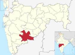 Location in Maharashtra | |
| Coordinates (Solapur): 17°50′N 75°30′E | |
| Country | |
| State | Maharashtra |
| Division | Pune Division[1] |
| Headquarters | Solapur |
| Tehsils | 1. Akkalkot, 2. Barshi, 3. Karmala, 4. Madha, 5. Malshiras, 6. Mangalwedha, 7. Mohol, 8. Pandharpur, 9. Sangola, 10. North Solapur and 11. South Solapur |
| Government | |
| • Body | Solapur Zilla Parishad |
| • Guardian Minister | Dattatray Vithoba Bharne (Minister of State Mha) |
| • President Z. P. Solapur | NA |
| • District Collector | Mr. Milind Shambharkar IAS |
| • CEO Z. P. Solapur | NA |
| • MPs | Jaisidhesvar Swami (Solapur) Ranjit Naik-Nimbalkar (Osmanabad) |
| Area | |
| • Total | 14,895 km2 (5,751 sq mi) |
| Population (2011) | |
| • Total | 4,317,756 |
| • Density | 290/km2 (750/sq mi) |
| • Urban | 31.83% |
| Demographics | |
| • Literacy | 71.2% |
| • Sex ratio | 935 |
| Time zone | UTC+05:30 (IST) |
| Website | http://solapur.gov.in/ |
Solapur district leads Maharashtra in production of Indian cigarettes known as beedi.[4]
Demographics
| Year | Pop. | ±% p.a. |
|---|---|---|
| 1901 | 875,368 | — |
| 1911 | 946,761 | +0.79% |
| 1921 | 900,267 | −0.50% |
| 1931 | 1,058,959 | +1.64% |
| 1941 | 1,215,953 | +1.39% |
| 1951 | 1,490,446 | +2.06% |
| 1961 | 1,843,102 | +2.15% |
| 1971 | 2,233,369 | +1.94% |
| 1981 | 2,588,139 | +1.49% |
| 1991 | 3,231,057 | +2.24% |
| 2001 | 3,849,543 | +1.77% |
| 2011 | 4,317,756 | +1.15% |
| source:[5] | ||
According to the 2011 census Solapur District has a population of 4,317,756, the 43rd largest district in India by population (out of 640). The district has a population density of 290 inhabitants per square kilometre (750/sq mi). Its population growth rate over the decade 2001-2011 was 12.1%. Solapur has a sex ratio of 932 females for every 1000 males, and a literacy rate of 77.72%. Scheduled Castes and Scheduled Tribes make up 15.05% and 1.80% of the population respectively.[6]
At the time of the 2011 Census of India, 73.13% of the population in the district spoke Marathi, 9.28% Kannada, 6.47% Hindi, 4.49% Telugu and 3.94% Urdu as their first language.[8][9]

Talukas
Solapur district is subdivided for administrative purposes into eleven talukas, which in turn comprise smaller divisions. The talukas are North Solapur, South Solapur, Akkalkot, Barshi, Mangalwedha, Pandharpur, Sangola, Malshiras, Mohol, Madha and Karmala.[10]
Notable people
- M. F. Husain - painter
- Shashikala - Hindi film actress
- Sarala Yeolekar - Marathi film actress
- Lalchand Hirachand (Industrialist)
- Yusufkhan Mohamadkhan Pathan (Scholar)
- Jabbar Patel - Marathi film director
- Atul Kulkarni - Marathi and Hindi film actor
- Nagraj Manjule - Marathi film director
- Rinku Rajguru - Marathi film actress
- Akash Thosar - Marathi film actor
- Ranjitsinh Disale[11] - Teacher, Winner of Global Teacher Prize 2020
See also
- Nandnee
References
- Sushant Kulkarni (3 July 2015). "Anti-Corruption Bureau: Pune Unit records highest number of bribery traps in state". The Indian Express. Pune. Retrieved 28 July 2015.
- Shri Mahadev Dada Tonpe, Mahavir Shah. "सोलापूर जिल्हा" [Solapur Jilha]. Solapur Pune Pravasi Sanghatna (in Marathi). Solapur. Retrieved 28 July 2015.
- "Solapur District Geographical Information". Archived from the original on 23 February 2007. Retrieved 11 December 2006.
- Meena Menon (21 June 2006). "A dream come true for beedi workers of Solapur". The Hindu. Mumbai. Retrieved 28 July 2015.
- Decadal Variation In Population Since 1901
- "District Census 2011 - Solapur" (PDF). Office of the Registrar General, India. 2011. Retrieved 30 September 2011.
{{cite web}}: CS1 maint: url-status (link) - "C-16 Population By Religion - Maharashtra". census.gov.in.
- 2011 Census of India, Population By Mother Tongue
- "Solapur census records". The Gezzeters department Solapur.
- "Geographical information" (PDF). Solapur district. Retrieved 24 January 2018.
- "Top teacher wins $1m and gives half away". BBC News. Retrieved 15 January 2021.
External links
Places adjacent to Solapur district | ||||||||||||||||
|---|---|---|---|---|---|---|---|---|---|---|---|---|---|---|---|---|
| ||||||||||||||||
Solapur district topics | ||
|---|---|---|
| History |
|  |
| Rivers | ||
| Dams | ||
| Tehsils | ||
| Cities and towns | ||
| Places to see | ||
| Education |
| |
| Transport | ||
| Lok Sabha constituencies |
| |
| Vidhan Sabha constituencies |
| |
| Culture |
| |
| Sports | ||
| Topics |
| ||||||||||||
|---|---|---|---|---|---|---|---|---|---|---|---|---|---|
| Regions |
| ||||||||||||
| Divisions and Districts |
| ||||||||||||
| Million-plus cities in Maharashtra |
| ||||||||||||
| Other cities with municipal corporations | |||||||||||||
Portal:India | |||||||||||||
Authority control | |
|---|---|
| General |
|
| National libraries | |
На других языках
[de] Solapur (Distrikt)
Der Distrikt Solapur (Marathi: .mw-parser-output .Deva{font-size:120%}@media all and (min-width:800px){.mw-parser-output .Deva{font-size:calc(120% - ((100vw - 800px)/80))}}@media all and (min-width:1000px){.mw-parser-output .Deva{font-size:100%}}सोलापूर जिल्हा) ist einer von 35 Distrikten des Staates Maharashtra in Indien.- [en] Solapur district
[ru] Солапур (округ)
Солапу́р (маратх. सोलापूर जिल्हा; англ. Solapur) — округ в индийском штате Махараштра. Образован 1 мая 1960 года. Административный центр — город Солапур. Площадь округа — 14 895 км². По данным всеиндийской переписи 2001 года население округа составляло 3 849 543 человека. Уровень грамотности взрослого населения составлял 71,2 %, что выше среднеиндийского уровня (59,5 %). Доля городского населения составляла 31,8 %.Другой контент может иметь иную лицензию. Перед использованием материалов сайта WikiSort.org внимательно изучите правила лицензирования конкретных элементов наполнения сайта.
WikiSort.org - проект по пересортировке и дополнению контента Википедии