world.wikisort.org - India
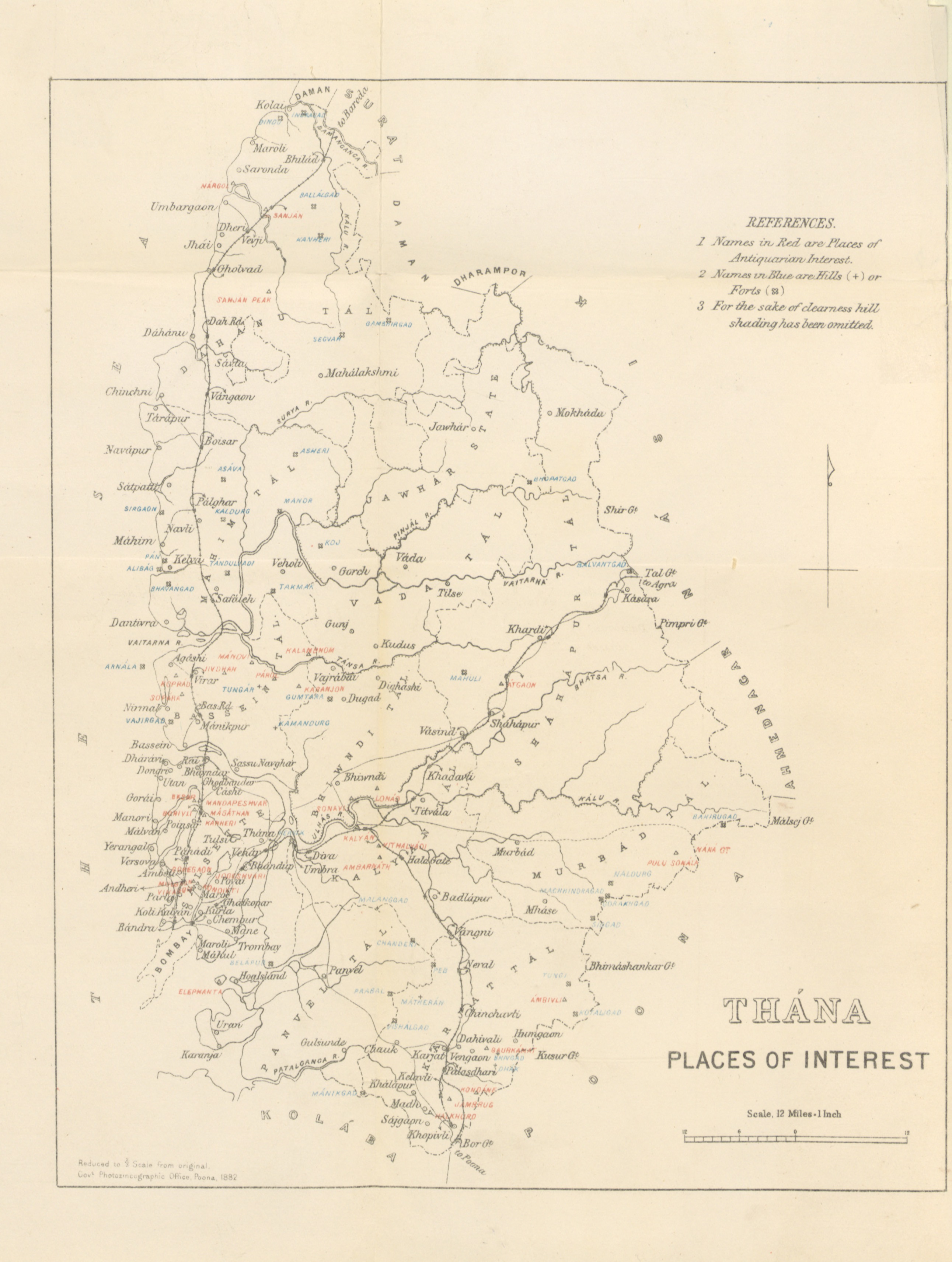
Thane (Marathi: [ˈʈʰaːɳeː]; also known as Thana, the official name until 1996) is a metropolitan city in Maharashtra, India. It is situated in the north-eastern portion of the Salsette Island. Thane city is entirely within Thane taluka, one of the seven talukas of Thane district; also, it is the headquarters of the namesake district. With a population of 1,841,488 distributed over a land area of about 147 square kilometres (57 sq mi), Thane city is the 15th most populated city in India with a population of 1,890,000 according to the 2011 census.[1]
This article possibly contains original research. (November 2021) |
Thane
Thana | |
|---|---|
City | |
From top, left to right: Eastern express highway, Dadoji Kondadev Stadium, Upvan Lake, Hiranandani Estate, Talao Pali | |
 Thane Location in Maharashtra, India  Thane Thane (India)  Thane Thane (Asia) | |
| Coordinates: 19°11′50″N 72°58′20″E | |
| Country | |
| State | Maharashtra |
| District | Thane |
| Government | |
| • Type | Municipal Corporation |
| • Body |
|
| • Mayor | Vacant |
| • Deputy Mayor | Vacant |
| • Municipal Commissioner | Mr. Abhijit Bangar |
| Area | |
| • Total | 147 km2 (57 sq mi) |
| • Rank | 15 |
| Population (2011) | |
| • Total | 1,886,941 |
| • Rank | 15 |
| • Density | 13,000/km2 (33,000/sq mi) |
| Demonym | Thanekar |
| Language | |
| • Official | Marathi |
| Time zone | UTC+5:30 (IST) |
| PIN | 400601—15 |
| Telephone code | 022 |
| Vehicle registration | MH-04 (Thane City) MH-05 (Kalyan) |
| Lok Sabha constituencies | Thane Kalyan |
| Vidhan Sabha constituencies | Thane Kopri-Pachpakhadi Ovala-Majiwada Mumbra-Kalwa |
| Literacy (2017-18) | 91.36% |
| Website | thanecity |


Located on the northwestern side of the state of Maharashtra, the city is an immediate neighbour of Mumbai city and a part of the Mumbai Metropolitan Region.
Etymology and other names
The word 'Thane' is derived from local Marathi word "ठाणे" meaning "Police Check Post". Thane was the next Major British Police Check Post after Mumbai (formerly Bombay).
The name Thane has been variously Romanised as Tana,[2] Thana,[3] Thâṇâ,[4] and Thame.[5] Ibn Battuta and Abulfeda knew it as Kukin Tana; Duarte Barbosa as Tana Mayambu.[6] Before 1996, the city was called 'Thana', the British spelling of the city, until it was replaced with the more-local name.
History
A copper plate dating to AD 1078 was discovered near the foundations of Thane Fort in 1787. A land grant from Arikesara Devaraja, lord of Tagara, wherein he addresses the inhabitants of a city called "Sri Sthanaka".[7] for a long time it was military training and recruitment center of Maratha empire
British occupied Salsette Island, Thana Fort, Fort Versova and the island fort of Karanja in start of First Anglo-Maratha War but after short time it were recaptured by forces of Haripant Phadke and Tukoji Holkar it remained under control of Maratha empire until Second Anglo-Maratha War[8]
Transport
Railways
Thana was the terminus for the first ever passenger train in Asia. On 16 April 1853, the passenger train service was inaugurated between Bori Bunder (Bombay) and Thane.[9] Covering a distance of 34 km (21 mi), it was hauled by three locomotives: Sahib, Sindh and Sultan.
Thane is connected with neighbouring suburbs through Central and Trans-Harbour Line Suburban railway network. Thane is a railway junction for the Thane-Vashi & Panvel Harbour Line and Central Line. It is one of the busiest stations in India and handles 654,000 passengers daily.[10][11]
Metro
As of 2019, Wadala and Thane are being connected through a Metro line.[12]
On 26 August 2015, the MMRDA sanctioned ₹354 billion for 118 km Mumbai metro network. This includes a 40-km Wadala-Ghatkopar-Thane-Kasarvadavali Metro-4 corridor via Wadala GPO and R.A.Kidwai Marg costing ₹120 billion.[13]
As of January 2021, the MMRDA, the nodal agency for building 300 km of vast Metro network, has proposed a plan to build an elevated depot for three Metro lines : 4 (Wadala-Thane-Kasarvadavali), 4A (Kasarvadavali-Gaimukh), 10 (Gaimukh-Shivaji Nagar) and 11 (Wadala-General Post Office, CSMT) at one stop. This depot is proposed at Mogharpada, Thane. The total project cost is estimated to be ₹ 596.60 crore.[14]
Thane Municipal Transport (TMT)
Thane Municipal Corporation started its own transport service on 9 February 1989, known as Thane Municipal Transport (TMT). TMT provides services the city interior and Mumbai suburbs like Mulund, Andheri, Mira road, Nala Sopara, Bhiwandi, Vasai, Virar, Borivali, Vashi, Airoli, Ghatkopar, Dadar, Bandra, BKC, Bhayandar, Kalyan, and Panvel, among others.[15]
| Number of … | Details |
|---|---|
| Buses | 299 |
| Routes | 45 |
| Depots | 3: Kalwa Depot Wagale Estate Depot Kolshet Depot (proposed) Anand Nagar(ghodbunder road) |
| Bus stands | 8 |
| Bus stops | 874[15] |
| km travelled per day | 63,135 |
| Daily bus trips | 7,114 |
| Daily passengers | 280,017 |
| Daily income | ₹1,388,547/- |
| km travelled per day per bus | 211 |
| Employees | 2,558[15] |
Navi Mumbai Municipal Transport (NMMT)

Navi Mumbai Municipal Transport (NMMT) ply in direction towards Vashi and Navi Mumbai. It goes through Airoli, Turbe etc. Most of NMMT buses ply in Thane from the Kalwa area. NMMT connects city of Thane to various parts of Navi Mumbai. NMMT operates buses to Airoli, Rabale, Mahape, Panvel, Vashi, Ghansoli, Nerul, CBD Belapur etc.
Mira Bhayandar Municipal Transport (MBMT)

Mira-Bhayandar Municipal Transport (MBMT) started from 2006. The buses ply from Dahisar Check naka towards Versova [Thane] Check naka. So till now majority of MBMT buses can be taken up at the Check naka only. MBMT has started new services to Thane City from January 2010.
| Route | Route No | Starting | Destination (Thane) | Route Description |
|---|---|---|---|---|
| Ordinary | 7 | Bhayander Railway Station (West) | Ghodbunder Village | Kashimira[16] |
| Limited | 10 LTD | Bhayander Railway Station (West) | Thane Railway Station (East) | Ghodbunder Road |
| Ordinary | 29 | Mira Road Railway Station | Marathon Chowk (Teen Haath Naka) | Ghodbunder Road |
Vasai-Virar Municipal Transport (VVMT)
VVMT is the newest public transport, operational from October 2013. The area of Thane City was connected to the Vasai & Virar by the VVMT.
| Route | Route No | Starting | Destination (Thane) | Route Description |
|---|---|---|---|---|
| Ordinary | 111 | Vasai Court/Tahasildar Office | Mulund East | Via Ahemdabad Highway, Godbunder Road, Eastern Express Highway, LBS Marg, Mulund West |
| Ordinary | 112 | Vasai Court/Tahasildar Office | Thane Rly Station East | Via Ahemdabad Highway, Godbunder Road, Eastern Express Highway, Kopari[17] |
Future of transport in Thane
A light rail network covering 42 km has been proposed in three phases. In the first phase, consultants have suggested connectivity between Balkum and Kolshet via Naupada. It will be 16.05 km long with 14.65 km elevated, and only 1.4 km on the surface, and 11 stations in all.[18]
Geography
Climate
Thane has a tropical monsoon climate that borders on a tropical wet and dry climate. The overall climate is equable with high rainfall days and very few days of extreme temperatures.
In Thane, temperature varies from 22 °C to 36 °C. Winter temperatures can fall to 12 °C at night while summer temperatures can rise to over 40 °C at noon. The lowest daytime temperatures are witnessed during the peak of the summer monsoon in July and August when temperatures can drop to about 25 °C. Out of total rainfall, 80% rainfall is experienced during June to October. Average annual rainfall is 2000–2500 mm and humidity is 61–86%, making it a humid zone.
| Climate data for Thane | |||||||||||||
|---|---|---|---|---|---|---|---|---|---|---|---|---|---|
| Month | Jan | Feb | Mar | Apr | May | Jun | Jul | Aug | Sep | Oct | Nov | Dec | Year |
| Average high °C (°F) | 29.5 (85.1) |
31.3 (88.3) |
32.7 (90.9) |
33.1 (91.6) |
33.3 (91.9) |
31.9 (89.4) |
29.8 (85.6) |
29.3 (84.7) |
30.1 (86.2) |
32.9 (91.2) |
33.4 (92.1) |
31.0 (87.8) |
31.7 (89.1) |
| Average low °C (°F) | 15.4 (59.7) |
17.3 (63.1) |
20.6 (69.1) |
23.7 (74.7) |
26.1 (79.0) |
25.8 (78.4) |
24.8 (76.6) |
24.5 (76.1) |
24.0 (75.2) |
23.1 (73.6) |
20.5 (68.9) |
18.2 (64.8) |
22.1 (71.8) |
| Average precipitation mm (inches) | 3.1 (0.12) |
1.0 (0.04) |
1.5 (0.06) |
2.3 (0.09) |
25.1 (0.99) |
541.3 (21.31) |
922.0 (36.30) |
539.7 (21.25) |
326.9 (12.87) |
93.2 (3.67) |
19.1 (0.75) |
2.3 (0.09) |
2,477.5 (97.54) |
| Source: Government of Maharashtra | |||||||||||||
Demographics

The population of Thane according to the 2011 census is 1,886,941.[19] The average literacy rate of Thane city is 91.36 percent for where male and female literacy was 94.19 and 88.14 percent respectively. The sex ratio of Thane city is 882 females per 1000 males. Child sex ratio is 900 girls per 1000 boys. Total children (0–6) in Thane city are 186,259 as per Census India report on 2011. There were 98,017 boys while 88,242 are girls. Children form 10.24% of total population of Thane City.[20]
The dominant language spoken in Thane is Marathi. Around 70% of population speaks Marathi. Some of the East Indian families in the Khatri ward of Thane still speak Portuguese.[21] About 1,800 of India's approximately 5,000 Jews live in Thane.[22]
Lakes
| No. | Lake Name | Location | Area (in hectares) |
|---|---|---|---|
| 1 | Ambe Ghosale Lake | At Meenatai Thakare Chowk, Castle Mill Naka (Opposite Desai Bunglow) in Uthalsar Ward committee | 2.77 |
| 2 | Brahamala Lake | Near Babubhai Petrol Pump in Uthalsar Ward Committee | 0.5173 |
| 3 | Burbank Lake | Inside Hiranandani Estate, between Park Avenue and Wood Street. To the west of it is Lake Enclave. | 0.5857 |
| 4 | Datiwali Lake | East side of Diva station situated in the marshland of Ulhas river in Mumbra Ward Committee Area | 0.77 |
| 5 | Dawala Lake | At Ovala in Majiwada-Manpada Prabhag Samiti | 1.136 |
| 6 | Desai Lake | On westside of Ulhas river, in Desai village in Mumbra Ward Committee | 1.75 |
| 7 | Devasar Lake | At the end of Bhayanderpada at foothills of Sanjay Gandhi National Park in Majiwada-Manpada Ward Committee | 0.516 |
| 8 | Diaghar Lake | At the outskirts of Diaghar village in Mumbra Ward Committee | 0.363 |
| 9 | Diva Lake | Situated just outside Diva station in Mumbra Ward Committee | 0.405 |
| 10 | Gokul Nagar Lake | It is a small lake situated in the heart of the city in the midst of Gokulnagar slums in Uthalsar Ward Committee | 0.325 |
| 11 | Hariyali Lake | Near Thane Railway Station in Kopari Ward Committee | 0.7939 |
| 12 | Jail Lake | Opp. Post Office beside Jail Water Tank in Uthalsar Ward committee | 1.43 |
| 13 | Jogila Lake | Near Uthalsar Ward office | approx 0.1 |
| 14 | Kacharali Lake | Opp. TMC Head Office in Naupada Ward Committee | 2 |
| 15 | Kalwa Lake | Kalwa Ward office. Located close to railway station | 2 |
| 16 | Kasar-Wadavali Lake | Majivada, Manpada Ward office | 4.5173 |
| 17 | Kausa Lake | Mumbra Ward office, Kausa | 1.5173 |
| 18 | Kavesar Lake | Situated at Waghbill road | 2.1746 |
| 19 | Khardi Lake | The lake is situated in premises of khardipada, Shil | approx. 1.15 |
| 20 | Kharegaon Lake | Kalwa Ward office | 0.7377 |
| 21 | Khidkali Lake | Mumbra Ward office Khidkali Lake is situated on the eastern side of the Thane creek near the Shil phata | 1.7 |
| 22 | Kolbad Lake | Uthalsar Ward office | 1 |
| 23 | Kolshet Lake | Manpada Ward office | 1 |
| 24 | Makhamali Talav (Lake) | Uthalsar Ward office | 1 |
| 25 | Masunda Lake (Talao Pali) | Masunda Lake ( also known as Talao Pali) is located on West of Thane, in the heart of Thane city. The lake is surrounded by important historic places like Gadkari Rangayatan, St. John church, Kopineshwar temple and Jambli market. There is a Mahadev Dhyan Mandir at the centre of the lake and also a statue of Shivaji Maharaj near the lake. | 7.2 |
| 26 | Naar Lake | Naar Lake is situated on outskirts of Thane along the Ghodbunder road | 0.7550 |
| 27 | Phadakepada Lake | Mumbra Ward office | 1.71 |
| 28 | Railadevi Lake | Railadevi Ward office | 8 |
| 29 | Rewale Lake | Majivada-manpada Ward office | 0.5173 |
| 30 | Shill Lake | Mumbra Ward office | 6 |
| 31 | Shivaji Nagar, Balkumb Lake | The lake is situated along old agra road next to water supply line in Balkum area | 0.2247 |
| 32 | Siddheshwar Lake | Uthalsar Ward office | 3 |
| 33 | Upvan Lake | Vartak Nagar Ward office is located at the foothills of Yeoor. It is also the Venue for Sanskruti Arts Festival held every half year. A statue of Lord Shiva is situated in the middle of the lake. A Ganesh Temple is situated at near lake. | 6 |
| Reference:[23] | |||
Education
Schools
- D.A.V. Public School
- Hiranandani Foundation School
- Holy Cross Convent High School
- Little Flower High School, Thane
- New Horizon Scholars School, Thane
- Podar International School[24]
- S.E.S. High School and Junior College
- Smt. Sulochanadevi Singhania School
- Sri Ma Vidyalaya, Patlipada, Thane
- St. John the Baptist High School, Thane
- Vasant Vihar High School
Colleges and Institutes
- A. P. Shah Institute of Technology
- Dr. V. N. Bedekar Institute of Management Studies And Law
- Institute of Management and Computer Studies
- KC College of Engineering
- Rajiv Gandhi Medical College
- Rustomjee Academy for Global Careers[25]
- Vidya Prasarak Mandal's Polytechnic
Notable people
- Malaika Arora – Bollywood actress and dancer
- Amrita Arora – Bollywood actress
- Jitendra Awhad – Indian politician
- Hruta Durgule – Indian television actress
- Anand Dighe – "Dharmaveer' Unit Chief of Shiv Sena in Thane district
- Poorva Gokhale – Indian television actress
- Suhas Joshi – Indian film and television actress
- Umesh Kamat – Indian film and television actor
- Kavita Lad – Indian television and film actress
- Sanjay Kelkar – Indian politician
- Prajakta Koli – Indian Youtuber
- Pramod Mahajan – Indian politician
- Priya Marathe – Indian television actress
- Sanjeev Naik – Indian politician
- Anand Paranjpe – Indian politician
- Prakash Paranjape – Indian politician
- Ravindra Phatak – Indian politician
- Diana Pinto – Miss India America 2009
- Satish Pradhan – Indian politician
- Prithvi Shaw – Indian cricketer
- Eknath Shinde – Indian politician & current chief minister of Maharashtra
- Shrikant Shinde – Indian politician
- Pratap Sarnaik – Indian politician
- Anant Tare – Indian politician
- Laxmi Narayan Tripathi – Indian LGBT Activist
- Rajan Vichare – Indian politician
See also
- 2013 Thane building collapse in Shil Phata
- Thane Railway Station
- Transportation in Thane
- Trans Thane Creek
- List of schools in Thane
- Chandanwadi
- Line 4 (Mumbai Metro)
- List of towns and villages in Thane district
- Thane Creek
References
- "District Profile | Thane District, Govt. of Maharashtra | India". Retrieved 22 January 2021.
- Butler, Alban; Peter Doyle, eds. (c. 1756), "Bd Thomas of Tolentino", Lives of the Fathers, Martyrs, and Other Principal Saints, p. 68, ISBN 9780860122531.
- Habig, Marion Alphonse (1979), The Franciscan Book of Saints, Franciscan Herald Press, cited in "Thomas of Tolentino and Companions", Roman Catholic Saints, retrieved 9 November 2016.
- Cunha, J. Gerson da (1876), Notes on the History and Antiquities of Chaul and Bassein, Bombay, p. 174, ISBN 9788120608450.
- "Bl. Thomas of Tolentino", Catholic Online.
- Cunha (1876), p. 16.
- Journal of the Royal Asiatic Society of Great Britain and Ireland, p. 112.
- Naravane, M.S. (2014). Battles of the Honourable East India Company. A.P.H. Publishing Corporation. pp. 53–54. ISBN 9788131300343.
- Colonialism: An International, Social, Cultural and Political encyclopedia By Melvin Eugene Page, Penny M. Sonnenburg, page 135 Archived 7 July 2014 at the Wayback Machine
- Thane is busiest railway station in Mumbai – Times Of India Archived 11 June 2013 at the Wayback Machine. Articles.timesofindia.indiatimes.com (19 May 2013). Retrieved 16 July 2013.
- "Kalyan, Kurla and Thane among the 10 dirtiest stations in the country". Archived from the original on 30 December 2018.
- Soon, take a metro from south Mumbai to Thane Archived 30 April 2013 at the Wayback Machine. Hindustan Times (23 April 2013). Retrieved 16 July 2013.
- Reporter, B. S. "MMRDA sanctions Rs 35,400 cr for 118 km Mumbai metro network". Archived from the original on 28 August 2015. Retrieved 27 August 2015.
- "Elevated Metro depot in Thane for 3 lines to cost Rs 596.60 crore". Free Press Journal. Retrieved 5 April 2021.
- Archived 13 November 2008 at the Wayback Machine
- Know your Town Better Archived 9 March 2010 at the Wayback Machine. Mira-Road.com.
- . Vasai.com.
- Times of India report. timesofindia.indiatimes.com. (26 December 2005).
- Census of India: Sub-District Details Archived 21 July 2011 at the Wayback Machine. Censusindia.gov.in. Retrieved 16 July 2013.
- Thane City Population Census 2011 | Maharashtra Archived 18 February 2013 at the Wayback Machine. Census2011.co.in. Retrieved 16 July 2013.
- Thane Gazetteer: Population: Christians – Speech Archived 10 November 2010 at the Wayback Machine. Maharashtra.gov.in. Retrieved 21 January 2012.
- "Jew in Thane". The Times of India. Archived from the original on 23 December 2017. Retrieved 25 October 2017.
- "Thane Municipal Corporation | Lakes in Thane City". Archived from the original on 19 January 2017. Retrieved 18 January 2017.
- "Podar International School". podareducation.org. Archived from the original on 13 April 2019. Retrieved 13 April 2019.
- "Best Vocational Education & Training Courses Institute in India | RAGC". Rustomjee Academy For Global Careers. Archived from the original on 12 April 2019. Retrieved 13 April 2019.
External links
- Thaneweb.com—The city portal
- Official Website of Thane Forest Circle Archived 23 May 2018 at the Wayback Machine
- ThaneMahapailika.com Archived 14 May 2019 at the Wayback Machine—Thane Municipal Corporation (Local Body)
- Official website of Thane City
- Thane District
| Topics |
| ||||||||||||
|---|---|---|---|---|---|---|---|---|---|---|---|---|---|
| Regions |
| ||||||||||||
| Divisions and Districts |
| ||||||||||||
| Million-plus cities in Maharashtra |
| ||||||||||||
| Other cities with municipal corporations | |||||||||||||
Portal:India | |||||||||||||
Authority control | |
|---|---|
| General |
|
| National libraries | |
На других языках
[de] Thane
Thane (Marathi: .mw-parser-output .Deva{font-size:120%}@media all and (min-width:800px){.mw-parser-output .Deva{font-size:calc(120% - ((100vw - 800px)/80))}}@media all and (min-width:1000px){.mw-parser-output .Deva{font-size:100%}}ठाणे, Ṭhāṇe; früher Thana) ist eine Stadt im indischen Bundesstaat Maharashtra.- [en] Thane
[ru] Тхана
Тхана[1] (Тхане; маратх. ठाणे, ʈʰaːɳeˑ) — город в западной Индии, в штате Махараштра. Расположен в начале протоки Тхана-Крик, части эстуария реки Улхас. Административный центр одноимённого округа. Название города произошло в результате англизации названия храма Ганеши — Шри Стханака. Известен как «город озёр». Площадь — 147 км². Является частью агломерации Мумбаи.Другой контент может иметь иную лицензию. Перед использованием материалов сайта WikiSort.org внимательно изучите правила лицензирования конкретных элементов наполнения сайта.
WikiSort.org - проект по пересортировке и дополнению контента Википедии