world.wikisort.org - India
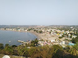
Uttan is a coastal town just north of Mumbai in Thane district of Maharashtra. A coastal town, it comes under the jurisdiction of the Mira-Bhayandar Municipal Corporation. Part Jurisdiction is also handed over to the Mumbai Meteropolitan Region Development Authority (MMRDA). Uttan is located 8 km away from Bhayandar.
This article needs additional citations for verification. (December 2019) |
Uttan | |
|---|---|
town | |
 Uttan Beach in Uttan | |
 Uttan Location in Mumbai, Maharashtra ,India  Uttan Location in Maharashtra, India | |
| Coordinates: 19.280°N 72.785°E | |
| Country | |
| State | Maharashtra |
| District | Thane |
| City | Mira-Bhayandar |
| Government | |
| • Type | Municipal Corporation |
| • Body | Mira-Bhayandar Municipal Corporation |
| Elevation | 6 m (20 ft) |
| Languages | |
| • Official | Marathi |
| Time zone | UTC+5:30 (IST) |
| PIN | 401106 |
| Telephone code | 022 |
| Vehicle registration | MH-04 |
Some of the recreational places closest to Uttan are:[1]
- Dharavi mata mandir, Tarodi village, Uttan [2]
- Essel World and Water Kingdom
- Gorai
- Keshav Srushti
- Global Vipassana Pagoda
References
- "Uttan Beach – Mumbai Suburb Beach at Bhayander". Mumbai 77.
- "भाईंदरच्या तारोडी गावातील धारावी देवी". Lokmat (in Marathi). 8 October 2019. Retrieved 9 June 2022.
Текст в блоке "Читать" взят с сайта "Википедия" и доступен по лицензии Creative Commons Attribution-ShareAlike; в отдельных случаях могут действовать дополнительные условия.
Другой контент может иметь иную лицензию. Перед использованием материалов сайта WikiSort.org внимательно изучите правила лицензирования конкретных элементов наполнения сайта.
Другой контент может иметь иную лицензию. Перед использованием материалов сайта WikiSort.org внимательно изучите правила лицензирования конкретных элементов наполнения сайта.
2019-2025
WikiSort.org - проект по пересортировке и дополнению контента Википедии
WikiSort.org - проект по пересортировке и дополнению контента Википедии