world.wikisort.org - India
Trombay is an eastern suburb in Bombay (Mumbai), India.
This article needs additional citations for verification. (September 2010) |
This article possibly contains original research. (August 2017) |
Trombay | |
|---|---|
Suburb | |
 Trombay Location in Mumbai, India | |
| Coordinates: 19.0°N 72.9°E | |
| Country | |
| State | Maharashtra |
| District | Mumbai Suburban |
| City | Mumbai |
| Government | |
| • Type | Municipal Corporation |
| • Body | Brihanmumbai Municipal Corporation (MCGM) |
| Languages | |
| • Official | Marathi |
| Time zone | UTC+5:30 (IST) |
History

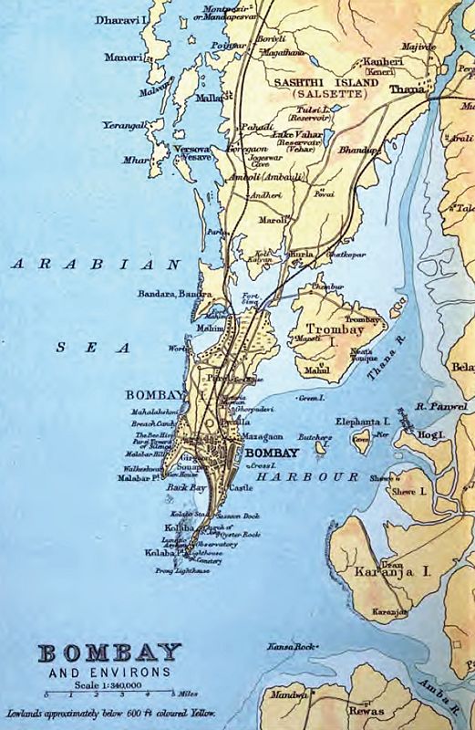
Trombay was called Neat's Tongue because of its shape. Once, it was an island nearly 5 km East of Mumbai and was about 8 km in length and 8 km in width. The island contains several ruins of Portuguese churches from the 1620s and 1630s.[1]
In 1928, the Great Indian Peninsular Railway opened the Trombay-Andheri line called the Salsette Trombay Railway or Central Salsette Tramway.[2]
See also
References
- Gazetteers of the Bombay Presidency - Thana - http://www.maharashtra.gov.in/pdf/gazeetter_reprint/Thane-III/places_Trombay.html - Retrieved on 3 December 2010.
- Times of India - Chembur-Ghatkopar Plus - "Untitled Document". Archived from the original on 15 May 2011. Retrieved 3 December 2010. - Retrieved on 3 December 2010
Текст в блоке "Читать" взят с сайта "Википедия" и доступен по лицензии Creative Commons Attribution-ShareAlike; в отдельных случаях могут действовать дополнительные условия.
Другой контент может иметь иную лицензию. Перед использованием материалов сайта WikiSort.org внимательно изучите правила лицензирования конкретных элементов наполнения сайта.
Другой контент может иметь иную лицензию. Перед использованием материалов сайта WikiSort.org внимательно изучите правила лицензирования конкретных элементов наполнения сайта.
2019-2026
WikiSort.org - проект по пересортировке и дополнению контента Википедии
WikiSort.org - проект по пересортировке и дополнению контента Википедии