world.wikisort.org - India
Khopoli (also known as Campoolie) is an industrial city in the Khalapur taluka of Raigad district, in the Indian state of Maharashtra, at the base of the Sahyadri mountains. Patalganga River, which is the tailrace channel of the Tata Hydroelectric Power Station, flows through Khopoli.[1][2]
Khopoli
Campoolie | |
|---|---|
| Nickname: City Of Waterfalls | |
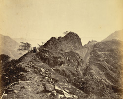
 Khopoli Location in Maharashtra, India | |
| Coordinates: 18.789°N 73.343°E | |
| Country | India |
| State | Maharashtra |
| District | Raigad |
| Elevation | 61 m (200 ft) |
| Population (2011) | |
| • Total | 108,648 |
| Demonym | Khopolikar |
| Language | |
| • Official | Marathi |
| Time zone | UTC+5:30 (IST) |
| PIN | 410203 410204 410216 |
| Vehicle registration | MH-46 |
It is a municipal council and is a part of the Mumbai Metropolitan Region. Khopoli Municipal Council covers an area of 30 km2 (12 sq mi).[3]
Khopoli is served by a railway station connected to the Mumbai suburban railway by a single line from Karjat. The distance between CSMT to Khopoli is 114.24 km (70.99 mi) along the Central Railway Suburban Line, which is a broad gauge line carrying electric locomotives.[4][5]
Initially, Khopoli railway station had only one platform for both the up and down movement of local trains. In 2019, it was revamped with an additional platform.
It is also located on NH 4,[6][7] about 80 km (50 mi) south of Mumbai and 80 km (50 mi) from Pune. Industries are well developed due to the strategic importance of the region as the Mumbai - Pune national highway passes through the city. The city is called a city of waterfalls due to a number of waterfalls in the rainy season. Due to the presence of industries, the city has attracted migrants from across India. The tourism industry has seen an uptick from a few years.
Khopoli is home to various Marathi, English, Hindi and even International schools. It has seen rapid growth in industry.
Geography and history
Khopoli was called Campoolie during the British Raj. Khopoli is located at 18°45' N, 73°20'.[1] It is situated at about 61 m above mean sea level.[8] It falls under three Pincodes - Khopoli 410203, Khopoli Power House 410204 and Jagdish Nagar 410216.[9] STD code for Khopoli is (0)2192.[10]
A colonial source describes Khopoli as follows:
The Bhor ghat is formed of a succession of lofty eminences, towering above each other, the last of which attains a height of 2000 feet (610 m) above the level of the sea. Its outline at a distance is bold and imposing; it presents a plane or table summit, with ranges of stupendous hills beyond, with the sublimity of which Europe possesses little that is analogous; at its foot stands the small and romantic village of Campolee, which has a noble tank and a Hindu temple, both built by Nana Furanvese (the Peishwa's prime minister) at his individual expense.[11]
There was an annachatra or a free feeding house, in the vicinity of the Mahadev temple, but by 1882 all that remained of it were huge grinding stones.[12] The GIPR line was extended to Khopoli in 1856.[5][13]
Khopoli is the site of the first privately owned hydroelectric power station in India built by the Tatas.[14]
Climate
Khopoli has a tropical monsoon climate (Am) with little to no rainfall from November to May and extremely heavy rainfall from June to September with moderately heavy showers in October.
| Climate data for Khopoli | |||||||||||||
|---|---|---|---|---|---|---|---|---|---|---|---|---|---|
| Month | Jan | Feb | Mar | Apr | May | Jun | Jul | Aug | Sep | Oct | Nov | Dec | Year |
| Average high °C (°F) | 29.7 (85.5) |
30.8 (87.4) |
33.0 (91.4) |
34.6 (94.3) |
35.0 (95.0) |
32.6 (90.7) |
29.8 (85.6) |
29.6 (85.3) |
30.2 (86.4) |
32.4 (90.3) |
32.0 (89.6) |
30.7 (87.3) |
31.7 (89.1) |
| Daily mean °C (°F) | 23.2 (73.8) |
24.2 (75.6) |
26.9 (80.4) |
29.2 (84.6) |
30.5 (86.9) |
29.2 (84.6) |
27.2 (81.0) |
26.9 (80.4) |
27.0 (80.6) |
27.7 (81.9) |
25.9 (78.6) |
24.0 (75.2) |
26.8 (80.3) |
| Average low °C (°F) | 16.8 (62.2) |
17.6 (63.7) |
20.8 (69.4) |
23.8 (74.8) |
26.0 (78.8) |
25.8 (78.4) |
24.7 (76.5) |
24.2 (75.6) |
23.8 (74.8) |
23.0 (73.4) |
19.9 (67.8) |
17.4 (63.3) |
22.0 (71.6) |
| Average precipitation mm (inches) | 0 (0) |
0 (0) |
0 (0) |
4 (0.2) |
25 (1.0) |
618 (24.3) |
1,695 (66.7) |
1,182 (46.5) |
522 (20.6) |
125 (4.9) |
13 (0.5) |
3 (0.1) |
4,187 (164.8) |
| Source: [15] | |||||||||||||
Demographics
In the 2011 India census, Khopoli had a population of 108,648. Males constitute 53% of the population and females 47%. Khopoli has an average literacy rate of 74%, higher than the national average of 59.5%. Male literacy is 80%, and female literacy is 68%. Thirteen per cent of the population is under 6 years of age.[16]
Industries
The factories in Khopoli municipal limits are:
- Alta Laboratories Limited, a bulk chemical manufacturer and a pioneer and still India's largest producer of salicylic acid and its various derivatives.[17]
- Bohler-Uddeholm India Limited[18]
- Bombay Oxygen Limited
- Government Milk Scheme, Khopoli.[19]
- India Steel Works Limited, Bright Bar Division[20]
- Innovassynth Technologies Limited (Formerly Indian Organic Chemicals)[21]
- Isibars Limited, Special Steels Division[22]
- Mahindra Sanyo Pvt Ltd
- Mohan Rockey Spring Water Breweries Limited[23]
- Paper & Pulp Conversions Ltd (PAPCO), a pioneering paper & paperboard mill started by industrialist Baburaoji Parkhe. The first industry in Khopoli which brought electricity to the town. Started operations in Khopoli in 1949 and closed down in 1990.
- SANPlast PVT LTD Limited[24]
- Tata Hydro Electric Power Supply Company Limited[25]
- Tata steel BSL
- Wärtsilä India Limited,[26] Wärtsilä Corp, its parent company, is a Finland-based equipment provider; it plans to convert this unit into a global manufacturing and sourcing unit.[27]
- Wheelabrator Alloy Castings Limited[28]
- Zenith Steel Pipes Limited[29]
Educational institutions
Various institutions run schools, colleges and a polytechnic.
Khalapur Taluka Shikshan Prasarak Mandal
Khalapur Taluka Shikshan Prasarak Mandal runs the following institutions in Khopoli:[30]
- Yak Public School (English Medium School CBSE affiliated)
- Maharashtra IAS/ MPSC Academy
- Jagdish Chandra Mahindra Memorial School
- Shishu Mandir Khopoli (English Medium School)
- Janata Vidyalaya Junior College
- Janata Vidyalaya (Marathi Medium School)
- Khopoli Hindi Vidyalaya (Hindi Medium School)
- K. M. C. College (affiliated to Mumbai University)[31][32]
- Khopoli Polytechnic[33][34]
- Sahyadri Vidyalaya
- Zenith High School (English medium School)
- Gagangiri English International School, Khopoli
- Anand Shala, Khopoli
Culture, religion and tourism
Khopoli has a "fine oval shaped reservoir" and a temple of God Mahadev as Vireshwar built by Nana Phadnavis. The reservoir is built of solid and strong black rock and is oval shaped. The circumference of the reservoir is about 1207 m and it covers an area of about 75000 sq m. The reservoir holds excellent water throughout the year. The reservoir has surrounding walls also built in stone and are of a width of about 1.5 m to 1.8 m. The reservoir has stone steps leading to the water. The temple is of a height of about 22.9 m m from the base to the top and the foundation measures 12.2 m x 6.1 m. Inside is the image of God Shiva. The Sabha mandap measures about 6.1 m x 3.1 m. At the entrance of the temple is a samadhi. A fair is held in honor of the temple deity on Mahashivaratri day - Maagha Vadya 13.[1][12]
The PAPCO Mill complex has a Parashurama temple and Fire temple or Agni Mandir which was built in 1971.[35][36] The Gagangiri Maharaj Ashram is located in Khopoli, it is there that Gagangiri Maharaj died on 4 February 2008.[37]
The Akhil Bharatha Ayyappa Seva Sangham, includes the Ayyappa Temple, in its list of Ayyappa temples in India and abroad.[38]
The major tourist attractions in the city include Adlabs Imagica, which is India's largest theme park. Mahad Ganpati temple, Zenith waterfalls, and Gangangiri Maharaj Ashram Lonavala is just 8 km away from the city.
Notable people
- Raghunath Vaman Dighe (1896-1980), Marathi writer
References
- Pagadi, Setu Madhavrao (July 1964). "Kolaba District Gazetteer: Places - Khopoli". Government of Maharashtra. Gazetteers Department, Maharashtra. Retrieved 4 December 2009.
- Sule, Surekha (December 2004). "Will Area Water Partnerships give people back their rivers?". Infochange India. Archived from the original on 25 July 2008. Retrieved 4 December 2009.
{{cite web}}: CS1 maint: unfit URL (link) - "Basic Statistics - Statistics on Corporations and Councils". Mumbai Metropolitan Regional Development Authority. Archived from the original (PDF) on 25 December 2010. Retrieved 10 December 2009.
- "Background of Mumabi Suburban Rail system" (PDF). Indian Railway. Retrieved 10 December 2009. [dead link]
- "Kolaba district gazzeteer - communication - railways". The gazzeteer's department, Maharashtra. Retrieved 10 December 2009.
- "Land Development" (PDF). Retrieved 10 December 2009.
- "Regional Plan - MMRDA - Part 2/ Chapter 11. Transportation: A strategic perspective" (PDF). Archived from the original (PDF) on 1 April 2010. Retrieved 10 December 2009.
- Chapman, John (1851). The cotton and commerce of India - Considered in relation to interests of Great Britain with remarks on railway communication in the Bombay Presidency. London: Whittaker & Co. p. 378.
- "Pin code search". India Post. Archived from the original on 20 May 2012. Retrieved 4 December 2009.
- "STD Code Search". BSNL. Archived from the original on 30 November 2009. Retrieved 4 December 2009.
- Montgomery Martin, Robert (1837). The British Colonial Library, Vol VIII, History of the Possessions of the Honorable East India Company; Vol I. Ave Maria Lane, London.: Whittaker & Co. p. 133.
- Campbell, James M. (November 1882). "Places of interest: Khopvili" (.html). Thane District Gazetteer. Gazetteers department, Bombay Presidency. Retrieved 8 April 2007.
- "IR History: Early Days - I, The first trains in India". The Indian Railways Fan Club. Retrieved 10 December 2007.
- Dubey, S. D. "Hydro Development in India - An overview and challenges" (PDF). An ASSOCHAM study. The Associated Chambers of Commerce and Industry of India. Archived from the original (PDF) on 28 September 2007. Retrieved 8 March 2007.
- "Khopoli climate: Average Temperature, weather by month, Khopoli weather averages - Climate-Data.org". en.climate-data.org. Retrieved 25 December 2021.
- "Census of India 2001: Data from the 2001 Census, including cities, villages and towns (Provisional)". Census Commission of India. Archived from the original on 16 June 2004. Retrieved 1 November 2008.
- "Alta Laboratories Limited". Retrieved 28 July 2010.
- "Bohler-Uddeholm India Limited". Retrieved 13 October 2009.
- Walke, Tanmay (September 2006). "Government Milk Scheme, Khopoli". Maharashtra State Dairy Development Department. Retrieved 4 December 2009.
- "India Steel Works Limited". Retrieved 13 October 2009.
- "Innovassynth Technologies Limited". Retrieved 13 October 2009.
- "Isibars Limited". Archived from the original on 9 May 2010. Retrieved 13 October 2009.
- "India Breweries". 6 September 2007. Archived from the original on 19 June 2009. Retrieved 13 October 2009.
- "SANPlast Pvt LTD". Retrieved 17 August 2016.
- "Indian Network". Retrieved 13 October 2009.
- "Wärtsilä in India". Retrieved 13 October 2009.
- Mukherjee, Promit (19 August 2008), "Wartsila sees Khopoli unit as global hub", DNA, retrieved 4 December 2009
- Runwal, S. S. (28 August 2003). "43rd Annual report 2002-2003" (PDF). Wheelabrator Alloy Castings Limited. Retrieved 4 December 2009. [permanent dead link]
- "Zenith Steel Pipes Limited". Archived from the original on 11 September 2009. Retrieved 13 October 2009.
- Maharashtra State Board of Secondary and Higher Secondary Education (February 2009). "Result summary". Maharashtra State Board of Secondary and Higher Secondary Education. Archived from the original on 28 May 2010. Retrieved 4 December 2009.
- Pankajam, G.; Sreedharan, T. D.; Bhalla, B.M. (27 February 2004). "Report of the Peer Team On the Institutional Accreditation of the K. T. S. P. Mandal's K. M. C. College, Khopoli, Khalapur, 410203, Dist. Raigad, Maharashtra". Retrieved 13 October 2009. [permanent dead link]
- "Affiliation - University Affiliated Colleges - Arts - Colleges". University of Mumbai. Archived from the original on 3 August 2009. Retrieved 10 December 2009.
- "Diploma Engineering Institutes offering Diploma Programmes in two shifts". 10 September 2008. Archived from the original (PDF) on 2 August 2010. Retrieved 10 December 2009.
- "Programmes in School of Science and Technology : Prospectus" (PDF). Dr. Rajendra Vadnere, Acting Registrar, Yeshwantrao Chavan Maharashtra Open University, Nashik. June 2009. Archived from the original (PDF) on 31 May 2011. Retrieved 10 December 2009.
- Parashurama
- "List of Social Initiatives". Retrieved 7 December 2013.
- "Mahayogi Sri Sri Gagangiri Maharaj mahasamadhi". Retrieved 4 December 2009.
- Akhila Bharatha Ayyappa Seva Sangham (8 November 2009). "List of Ayyappa temples in India and abroad". Akhila Bharatha Ayyappa Seva Sangham. Archived from the original on 17 January 2005. Retrieved 4 December 2009.
| Talukas |  | ||||
|---|---|---|---|---|---|
| Electoral constituencies |
| ||||
| Cities and towns |
| ||||
| Villages |
| ||||
Authority control | |
|---|---|
| General |
|
| National libraries | |
| Other |
|
На других языках
[de] Khopoli
Khopoli ist eine Stadt im indischen Bundesstaat Maharashtra. Die Stadt ist Teil der Metropolregion Mumbai.- [en] Khopoli
Другой контент может иметь иную лицензию. Перед использованием материалов сайта WikiSort.org внимательно изучите правила лицензирования конкретных элементов наполнения сайта.
WikiSort.org - проект по пересортировке и дополнению контента Википедии