world.wikisort.org - India
Kolhapur district (Marathi pronunciation: [kolʱaːpuɾ]) is a district in the Maharashtra state of India. The city of Kolhapur is its district headquarter. It is situated near Panchaganga river.[1]
This article needs additional citations for verification. (April 2015) |
Kolhapur district | |
|---|---|
District of Maharashtra | |
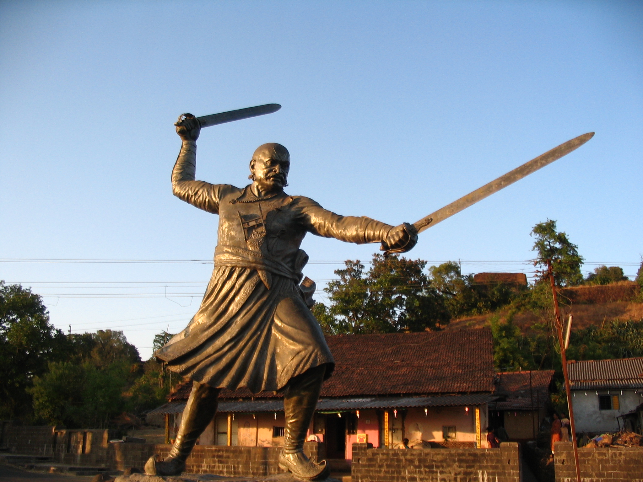     Clockwise from top-left: Statue of Baji Prabhu Deshpande in Panhala Fort, Pohale Caves, view from Vishalgad Fort, Radhanagari Wildlife Sanctuary, Mahalakshmi Temple in Kolhapur | |
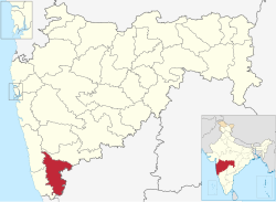 Location in Maharashtra | |
| Country | |
| State | Maharashtra |
| Division | Pune |
| Headquarters | Kolhapur |
| Tehsils | 1. Gadhinglaj, 2. Karveer, 3. Bhudargad, 4. Panhala, 5. Kagal, 6. Shirol, 7. Hatkanangale, 8. Ajara, 9. Chandgad, 10. Gaganbawada, 11. Radhanagari, 12. Shahuwadi |
| Government | |
| • Body | Kolhapur Zilla Parishad |
| • Guardian Minister | Deepak Kesarkar (Cabinet Minister MH) |
| • President Zilla Parishad |
|
| • District Collector |
|
| • CEO Zilla Parishad |
|
| • MPs |
|
| Area | |
| • Total | 7,692 km2 (2,970 sq mi) |
| Population (2011) | |
| • Total | 3,874,015[1] |
| • Urban | 32% |
| Demographics | |
| • Literacy | 82%[1] |
| Time zone | UTC+05:30 (IST) |
| Major highways | NH-4, NH-204 |
| Average annual precipitation | 1035 mm |
| Website | kolhapur |
It is bordered by the Sangli district to the North, by Ratnagiri district, Sindhudurg to the West and by Karnataka state to the East.[2]
Officer
Members of Parliament
- Sanjay Mandlik (BSS)
(Kolhapur) - Dhairyasheel Sambhajirao Mane (BSS)
(Hatkanangle)
Guardian Minister
| Guardian Minister Kolhapur | |
|---|---|
| पालकमंत्री कोल्हापुर | |
 Emblem of India | |
Incumbent Deepak Kesarkar since 24 September 2022 | |
| Style | The Honourable |
| Appointer | Chief Minister of Maharashtra |
| Term length | 5 years / No time limit |
| Website | kolhapur |
list of Guardian Minister
| Name | Term of office |
|---|---|
| Chandrakant Patil | 31 October 2014 - 8 November 2019 |
| Balasaheb Thorat | 9 January 2020 - 5 March 2020 |
| Satej Patil | 5 March 2020 - 29 June 2022 |
| Deepak Kesarkar | 24 September 2022 - Incumbent |
District Magistrate/Collector
| District Magistrate / Collector Kolhapur | |
|---|---|
| जिल्हाधिकारी तथा जिल्हदंडाधिकरी कोल्हापुर | |
Emblem of India | |
Incumbent Mr. Rahul Rekhawar (IAS) since 2018 | |
| Residence | At Kolhapur district |
| Appointer | Government of Maharashtra |
| Term length | No time limit |
| Website | kolhapur |
list of District Magistrate / Collector
| Name | Term of office |
|---|---|
| Mr. Rahul Rekhawar (IAS) | 2018 - Incumbent |
History
Kolhapur was a princely state during British rule of India. Shahu Maharaj ruled it from 1894 to 1922. He worked for the development of the state. It was a hub for Marathi film industry. It was known as 'Chitranagari'. It is now known as Bhalji Pendharkar Chitranagari.[1]
Geography
Kolhapur district have Bauxite mineral resources in Sahyadri mountains. Ghatprabha, Tamraparni, Dudhganga, Krushna, Bhogawati, Warna, Kasari, Panchaganga, Wedganga, Kumbhi rivers flow through this district. Groundnut, Soyabean, Tobacco, Rice, Jowar, Cotton and Sugarcane are prime crops of this district. Cashew is prime crop of Chandgad taluka. Kolapur is part of Pune division.[2] Radhanagari dam is present on the Bhogawati river. Kolhapur has Panhala hill station. Male to female ratio of the district is 1000:953[1]
Climate

Kolhapur's climate is a blend of coastal and inland elements common to Maharashtra. The temperature has a range between 10 to 35 °C (50 to 95 °F). Summer in Kolhapur is comparatively cooler, but much more humid, than neighbouring inland cities. Maximum temperatures rarely exceed 35 °C (95 °F) and typically range between 33 and 35 °C (91 and 95 °F). Lows during this season are around 24 to 26 °C (75 to 79 °F).
The city receives abundant rainfall from June to September due to its proximity to the Western Ghats. The heavy rains often lead to severe flooding during these months. 2005, 2006, 2019 and 2021 were years when floods occurred. Temperatures are low in the rainy season and range between 19 and 30 °C (66 and 86 °F).
Kolhapur experiences winter from November to February. The winter temperatures are warmer than other cities in Maharashtra such as Pune and Nashik. Lows range from 9 to 16 °C (48 to 61 °F) while highs are in the range of 24 to 32 °C (75 to 90 °F) due to its high elevation and being adjacent to the Western Ghats. Humidity is low in this season making the weather much more pleasant.
Demographics
| Year | Pop. | ±% p.a. |
|---|---|---|
| 1901 | 872,720 | — |
| 1911 | 792,681 | −0.96% |
| 1921 | 794,673 | +0.03% |
| 1931 | 908,317 | +1.35% |
| 1941 | 1,039,279 | +1.36% |
| 1951 | 1,267,609 | +2.01% |
| 1961 | 1,552,636 | +2.05% |
| 1971 | 2,001,973 | +2.57% |
| 1981 | 2,457,095 | +2.07% |
| 1991 | 2,989,507 | +1.98% |
| 2001 | 3,523,162 | +1.66% |
| 2011 | 3,876,001 | +0.96% |
| source:[3] | ||
According to the 2011 census, Kolhapur district has a population of 3,876,001. This gives it a ranking of 65th in India (out of a total of 640). The district has a population density of 504 inhabitants per square kilometre (1,310/sq mi). Its population growth over the decade 2001-2011 was 9.96%. Kolhapur has a sex ratio of 953 females for every 1000 males. Scheduled Castes and Scheduled Tribes make up 13.01% and 0.78% of the population respectively.[4] Kolhapur has one of the highest Human Development Index in India which stood at 0.770 in 2011.[5][6]
At the time of the 2011 Census of India, 89.16% of the population in the district spoke Marathi, 3.84% Hindi, 2.70% Urdu and 2.00% Kannada as their first language. Urdu and Kannada both had a decline in absolute numbers from 2001 to 2011.[8]
The district has three centres of tourism, the Mahlakshmi Temple and Karveer Peeth Jagadguru Shankaracharya Math in the city of Kolhapur and Jyotiba temple in Wadi Ratnagiri.[9]
Educational institutions
This section does not cite any sources. (September 2021) |
The Kolhapur district has a good number of educational institutions that provide a range of educational programs - from KG to PG and beyond. The district has Shivaji University located in the city of Kolhapur. The university provides various master and Ph.D. level programs. Shivaji University covers three districts - Kolhapur, Sangli and Satara under its jurisdiction. Apart from the university, Kolhapur district has a number of other renowned educational institutions like CSIBER-Chhatrapati Shahu Institute of Business Education and Research, Rajaram College Kolhapur, Swami Vivekanand College Kolhapur, D. Y. Patil College of Engineering and Technology, Chhatrapati Shahu Maharaj Government Medical College, Mouni Vidyapeeth, KIT College of Engineering Kolhapur, etc. Kolhapur District is enriched in terms of the availability of quality education of all kinds.
Economy


Manufacturing industry
Kolhapur has a Higher per capita domestic product than the states average. It has auto-ancillary, Foundry, and Casting industrial establishments which act as supporting industries for Pune and Bangalore industries.[10]
The city is the home of Kolhapuri chappal, a hand-crafted buffalo leather slipper that is locally tanned using vegetable dyes. Kolhapuri slippers are sold on Mahadwar road.[11][12][13] Other handicrafts include: hand block printing of textiles; silver, bead and paste jewellery crafting; pottery; wood carving and lacquerware; brass sheet work and oxidised silver artwork;and lace and embroidery making.[14]
Kolhapur is also an industrial city with approximately 300 foundries producing exports with a value of 15 billion rupees per year.[15] A manufacturing plant of Kirloskar Oil Engines [KOEL] is set up in 5 star MIDC at Kagal near Kolhapur, and the Raymond clothes plant is also located in the same industrial area. Kolhapur has two more industrial areas, Gokul-Shirgaon MIDC, Shiroli MIDC and Shivaji Udyamnagar is an industrial area in the city. Shivaji Udyamnagar has a rich entrepreneurial tradition of more than 100 years and a high skilled artisanship in the area of oil engines.
Kolhapuri jewelry includes a type of necklace called Kolhapuri saaj, patlya (two broad bangles), chinchpeti (choker), tanmani (short necklace), nath (nose ring), and bajuband (an amulet).[16]
Administration and divisions
| Name of Division (Headquarter) | Sr. No. | Districts | Administration | Sub-Division | Taluka | Source |
|---|---|---|---|---|---|---|
| Pune Division HQ=Pune Districts=5 SubDivisions=31 Talukas=64 |
1. | Kolhapur District | HQ-Kolhapur Sub-Divisions-6 Taluka-12 |
Panhala | District website | |
| Ichalkaranji | ||||||
| Karvir | ||||||
| Radhanagari |
| |||||
| Bhudargad |
| |||||
| Gadhinglaj | ||||||

Notable people
- Shahu of Kolhapur - Maharaja and a social reformer.
- Tarabai - Maratha Queen and warrior.
- Ramchandra Pant Amatya - One of the Ashta Pradhans for Shivaji Maharaj.
- Santaji Ghorpade - Maratha warrior and Sarsenapati.
- Baburao Painter - Indian film director.
- Vishnu Digambar Paluskar - Hindustani classical singer, founder of Gandharva Mahavidyalay.
- Sudhir Phadke - Singer and composer.
- Bhalji Pendharkar - Award Winning Director.
- Nanda - Film Actress.
- Suresh Wadkar - Playback Singer.
- Jayant Narlikar - Indian astrophysicist.
- V. Shantaram - Indian filmmaker, film producer and actor.
- Shivaji Sawant - Indian novelist.
- Ranjit Desai - Popular marathi writer.
- Master Vinayak - Indian actor and film director.
- Suniti Ashok Deshpande - Indian educator, writer, translator and interpreter.
- Leena Nair - Ceo of Chanel.
- D. Y. Patil - Indian politician, Educator.
- Arun Sarnaik - Actor and singer.
- Dhondutai Kulkarni - Indian classical singer from the Jaipur-Atrauli gharana.
- Govindrao Tembe - Music Composer.
- B. B. Nimbalkar - Indian cricketer, best known for his score of 443 not out[1] during the 1948–49 Ranji Trophy.
- Dhananjay Mahadik - Indian politician and former member of parliament.
- Chandrakant Patil - Indian politician Maharashtra BJP President.
- Ramesh Deo - Indian film and television actor.
- Vasantrao Ghatge - Indian entrepreneur, business magnate, industrialist and a professor.
- Jagdish Khebudkar - Marathi littérateur and lyricist of Marathi cinema.
- Ashutosh Gowariker - Indian film director, actor, screenwriter and producer.
- Madhavrao Bagal - Writer, artist, journalist, social reformer, political activist, orator and a freedom fighter.
- Anant Mane - Film director.
- Satej Patil - Politician and Home Minister of State for Maharashtra Government.
- Padmini Kolhapure - Film Actress.
- Shruti Sadolikar - Indian classical singer of the khyal style in the Jaipur-Atrauli gharana.
- Sadashivrao Dadoba Mandlik - Former Member of Parliament and NCP leader.
- Sanjay Mandlik - Incumbent Member of Parliament and Shiv Sena Leader.
- Bhanu Athaiya - Indian costume designer and painter.
- Sangram Chougule - Body builder, Mr Universe winner (2012), Mr India (6 time winner), Mr Maharashtra (5 time winner).
- Suhas Khamkar - Body builder.
- Balakrishnabuwa Ichalkaranjikar. Indian vocalist of Khayal-genre of Hindustani classical music
- Subhash Khot FRS, mathematician and theoretical computer scientist and winner of multiple awards.
See also
- Gandhinagar, Kolhapur
- Mhakave
- Ichalkaranji
References
- Swami, V.N. (2020). जिल्हा मध्यवर्ती सहकारी बँक भरती परीक्षा मार्गदर्शक [District Central Cooperative Bank Clerk Grade Examination] (in Marathi). Latur, India: Vidyabharti Publication. pp. 85–86.
- Patil, Eknath (2021). तात्यांचा ठोकळा [Uncle's Box] (in Marathi). Kolhapur, Maharashtra: Spardha Vishwa Publication. p. 265.
- Decadal Variation In Population Since 1901
- "District Census 2011 - Kolhapur" (PDF). Office of the Registrar General, India. 2011. Retrieved 2011-09-30.
{{cite web}}: CS1 maint: url-status (link) - "Research Gate". 20 August 2017.
- "RMaharashtra Human Development Report 2012" (PDF). 20 August 2012.
- "C-16 Population By Religion - Maharashtra". census.gov.in.
- "Table C-16 Population by Mother Tongue: Maharashtra". censusindia.gov.in. Registrar General and Census Commissioner of India.
- "AAI proposal to acquire 11ha land for airport soon: MP - Times of India". The Times of India. Retrieved 2017-09-19.
- "Kolhapur posts higher per capita domestic product than state's average". 19 March 2015. Retrieved 1 April 2022.
- "Kolhapuri chappal to set foot in new markets". Indian Express. 13 June 2000. Retrieved 12 September 2017.
- "Kolhapuri chappals come easy on the pocket now." IBN Live website 17 July 2007. Accessed 21 October 2013.
- "Government unveils new trade policy". Indian Express. 5 June 2012. Retrieved 12 September 2017.
- "Maharashtra development report." Government of India Planning Commission report. Academic Foundation, 2007 ISBN 9788171885404, Accessed 8 April 2014.
- "MIDC to acquire 1,000 acres for Kagal park." Business Standard, 20 December 2006.
- "Exploring the Kolhapuri saaj - Times of India". The Times of India. Retrieved 2021-12-21.
External links
Places adjacent to Kolhapur district | ||||||||||||||||
|---|---|---|---|---|---|---|---|---|---|---|---|---|---|---|---|---|
| ||||||||||||||||
| |||||||||||||
| Topics |
| ||||||||||||
| Regions |
| ||||||||||||
| Divisions and Districts |
| ||||||||||||
| Million-plus cities in Maharashtra |
| ||||||||||||
| Other cities with municipal corporations | |||||||||||||
Portal:India | |||||||||||||
Kolhapur district topics | |||||
|---|---|---|---|---|---|
| History |
|  | |||
| Geography |
| ||||
| Cities and towns | |||||
| Transport |
| ||||
| Visitor attractions |
| ||||
| Culture |
| ||||
| Education |
| ||||
| Lok Sabha constituencies |
| ||||
| Vidhan Sabha constituencies |
| ||||
| Taluka/Tehsil | |||||
| Stadiums | |||||
‡ This constituency also has portions in Sangli district
| |||||
Authority control | |
|---|---|
| General |
|
| National libraries | |
На других языках
[de] Kolhapur (Distrikt)
Der Distrikt Kolhapur (Marathi: .mw-parser-output .Deva{font-size:120%}@media all and (min-width:800px){.mw-parser-output .Deva{font-size:calc(120% - ((100vw - 800px)/80))}}@media all and (min-width:1000px){.mw-parser-output .Deva{font-size:100%}}कोल्हापूर जिल्हा) ist einer von 35 Distrikten des Staates Maharashtra in Indien.- [en] Kolhapur district
[ru] Колхапур (округ)
Колхапур (маратх. कोल्हापूर जिल्हा; англ. Kolhapur) — округ в индийском штате Махараштра. Образован 1 мая 1960 года. Административный центр — город Колхапур. Площадь округа — 7685 км². По данным всеиндийской переписи 2001 года население округа составляло 3 523 162 человека. Уровень грамотности взрослого населения составлял 76,9 %, что выше среднеиндийского уровня (59,5 %). Доля городского населения составляла 29,8 %.Другой контент может иметь иную лицензию. Перед использованием материалов сайта WikiSort.org внимательно изучите правила лицензирования конкретных элементов наполнения сайта.
WikiSort.org - проект по пересортировке и дополнению контента Википедии