world.wikisort.org - India
Belagavi district, formerly known as also Belgaum district,[2] is a district in the state of Karnataka, India. The district is known as Sugar Bowl of Karnataka with 1.5 lakh (150,000) hectares being used for commercial production[3] and it has displaced Mandya district in sugar cane production over the last decade.[4] The city of Belagavi is the district headquarters in North Karnataka. It houses the second legislative building, where the Karnataka Legislature will meet once a year. A popular sweet is kunda. According to the 2011 Census of India, it has a population of 4,779,661, of which 24.03% live in urban areas,[5] making it the second most populous district in Karnataka (out of 30), after Bangalore.[6] The district has an area of 13,415 km2 (5,180 sq mi) making it the largest district in Karnataka, and is bounded by Kolhapur District and Sangli district of Maharashtra state on the west and north, on the northeast by Bijapur district, on the east by Bagalkot district, on the southeast by Gadag district, on the south by Dharwad and Uttara Kannada districts, and on the southwest by the state of Goa.
This article has multiple issues. Please help improve it or discuss these issues on the talk page. (Learn how and when to remove these template messages)
|
Belagavi District
Belgaum District | |
|---|---|
District of Karnataka | |
    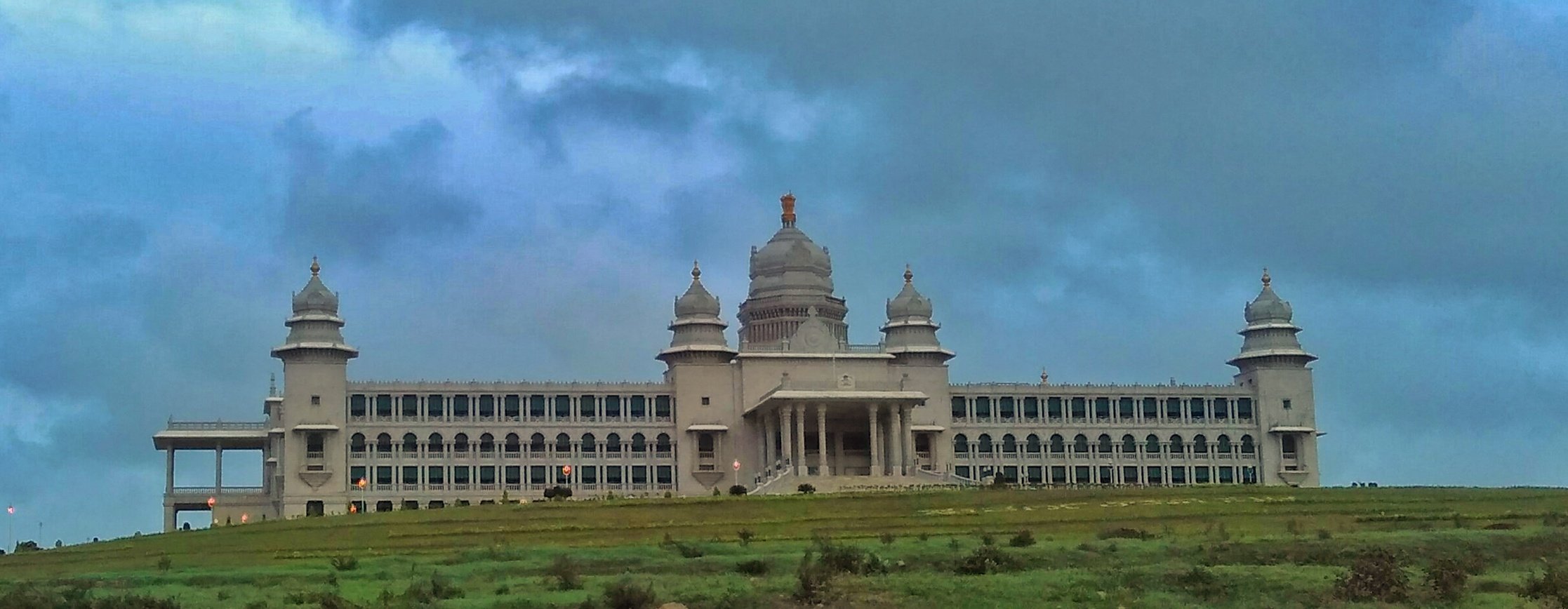 Clockwise from top-right:Gokak Falls, Navilatirtha, Suvarna Vidhana Soudha, Kamala Narayana Temple, Kamal Basadi in Belagavi Fort | |
 Location in Karnataka | |
 Belagavi district | |
| Coordinates: 15.85°N 74.55°E | |
| Country | |
| State | Karnataka |
| Division | Belagavi division |
| Headquarters | Belagavi |
| Government | |
| • Deputy Commissioner | Nitesh Patil |
| Area | |
| • Total | 13,415 km2 (5,180 sq mi) |
| Population (2011)[1] | |
| • Total | 4,779,661 |
| • Density | 360/km2 (920/sq mi) |
| Languages | |
| • Official | Kannada |
| Time zone | UTC+5:30 (IST) |
| ISO 3166 code | IN-KA |
| Vehicle registration |
|
| Sex ratio | 1.04 ♂/♀ |
| Literacy | 64.2% |
| Precipitation | 823 millimetres (32.4 in) |
| Website | belagavi |
History


Belagavi is the Divisional Headquarters of North Karnataka. The original name of the town of Belgaum was Venugrama, meaning Bamboo Village. It is also known as Malnad Pradesh. The most ancient place in the district is Halsi; and this, according to inscriptions on copper plates discovered in its neighborhood, was once the capital of a dynasty of nine Kadamba kings. It appears that from the middle of the 6th century to about 760 the area was held by the Chalukyas, who were succeeded by the Rashtrakutas. After the break-up of the Rashtrakuta dynasty a portion of it survived in the Rattas (875–1250), who from 1210 onward made Venugrama their capital. Inscriptions give evidence of a long struggle between the Rattas and the Kadambas of Goa, who succeeded in the latter years of the 12th century in acquiring and holding part of the district. By 1208, however, the Kadambas had been overthrown by the Rattas, who in their turn succumbed to the Yadavas of Devagiri in 1250. After the overthrow of the Yadavas by the Delhi Sultanate (1320), Belgaum was for a short time under the rule of the latter; but only a few years later the part south of the Ghataprabha River was subject to the Hindu rajas of Vijayanagara. In 1347 the northern part was conquered by the Bahmani Sultanate, which in 1473 took the town of Belgaum and conquered the southern part also. When Aurangzeb overthrew the Bijapura sultans in 1686, Belgaum passed to the Mughals. In 1776 the country was overrun by Hyder Ali of Mysore, but was taken by the Madhavrao Peshwa . In 1818 it was handed over to the British East India Company, and was made part of the district of Dharwar. In 1836 this was divided into two parts, the northern district becoming Belgaum.[7]
Yadur is situated beside the Krishna river, and there is a famous Veerbhadra temple there. Many devotees visit the area from Karnataka and Maharashtra. Hooli is one of the oldest villages in Belgaum district. There are many Chalukya temples in the village, including the famous Panchaligeswara temple.
Kittur in Belgaum district is a place of historical importance. Rani Chennamma of Kittur (1778–1829) is known for her resistance to British rule.
The British had a sizable infantry post here, having realised the military importance of its geographic location. It is one of the reasons for Belgaum's sobriquet The Cradle of Infantry. Development of a rail network for the movement of resources and later troops was one of the means employed by both the British East India Company and the British to exert control over India. Belgaum's railway station, the Mahatma Gandhi Railway Station was established by the British. A signboard declaring the sobriquet can be seen hung on Platform 1 at the station.
Border dispute
After India became independent in 1947, the Belagavi district (which was in the erstwhile Bombay Presidency) became a part of the Bombay State. In 1948, the Belgaum Municipality that was dominated by Marathi speaking politicians requested the Indian Dominion, Indian Constituent Assembly, and the Boundary Commission to include the Belgaum Municipal district in the proposed Samyukta Maharashtra state for the Marathi speakers.[8]
In accordance with the established policy of bifurcation on a linguistic majority basis, in 1956, the Belgaum district was incorporated into the newly formed Mysore state (now Karnataka) with the passage of the States Reorganization Act, adjoining areas that had a majority of Marathi speaking citizens were included in the newly formed Maharashtra state.[9][10]
Administrative divisions
The administration of Belgaum district has been divided into 14 taluks.
- Belgaum
- Bailhongal
- Chikkodi
- Gokak
- Hukkeri
- Raybag
- Ramdurg
- Athani
- Saundatti
- Khanapur
- Kittur
- Nippani
- Kagawad
- Mudalagi
Athani taluk is the largest with an area of 1,997.70 km2 and Raybag taluk is the smallest with an area of 958.8 km2. The district comprises three revenue sub-divisions headquartered at Belgaum, Bailhongal and Chikodi governed by an assistant commissioner and taluks headed by Tehsildar[11] and has six police sub-divisions. Apart from the Belgaum City Corporation, there are 17 municipalities, 20 towns, 485 gram panchayats, 1,138 inhabited villages and 26 non-inhabited villages. Belgaum is also the headquarters of the Belgaum Revenue
Water Bodies
List of Rivers flowing through Belgaum District
- Krishna,
- Malaprabha,
- Ghataprabha,
- Vedhganga,
- Doodhganga,
- Mahadayi,
- Pandari,
- Hiranyakeshi
Demographics
| Year | Pop. | ±% p.a. |
|---|---|---|
| 1901 | 1,131,186 | — |
| 1911 | 1,083,804 | −0.43% |
| 1921 | 1,088,763 | +0.05% |
| 1931 | 1,237,223 | +1.29% |
| 1941 | 1,410,054 | +1.32% |
| 1951 | 1,645,620 | +1.56% |
| 1961 | 1,983,498 | +1.88% |
| 1971 | 2,422,994 | +2.02% |
| 1981 | 2,978,913 | +2.09% |
| 1991 | 3,583,606 | +1.87% |
| 2001 | 4,214,505 | +1.63% |
| 2011 | 4,779,661 | +1.27% |
| source:[12] | ||
According to the 2011 census Belgaum district has a population of 4,779,661,[6] roughly equal to the nation of Singapore[13] or the US state of Alabama.[14] This gives it a ranking of 25th in India (out of a total of 640).[6] The district has a population density of 356 inhabitants per square kilometre (920/sq mi).[6] Its population growth rate over the decade 2001–2011 was 13.38%.[6] There were 969 females for every 1000 males,[6] and a literacy rate of 73.94%. Scheduled Castes and Scheduled Tribes make up 12.08% and 6.22% of the population respectively.[6]
Hindus are the biggest religion in the district with 84.49% of the population. Muslims are the second-largest with 11.06% and Jains are 3.73%.[15]
At the time of the 2011 census, 68.40% of the population spoke Kannada, 18.70% Marathi and 9.79% Urdu as their first language.[16]
Education
Belgaum district is a home to three universities: Visvesvaraya Technological University, Rani Channamma University, Belagavi and KLE University. Also, it has a nine engineering colleges, two medical colleges, two dental colleges, 15 polytechnics, 7 Indian system of medical colleges, and 180 degree colleges.[17]
Industry
The district has seven industrial areas, one special economic zone (SEZ) (India's first precision engineering SEZ with more than 200 acres) and 16 industrial estates.[3] The city's industrial growth begin when Babu Rao Pusalkar set up a small unit in city over a century ago and that transformed Belgaum city into foundry and hydraulics base.[18]
| Name of Industrial Area | Extent (acres) |
|---|---|
| Kanbargi Auto Complex | 267.00 |
| Kakati | 74.75 |
| Honaga | 209.5 |
| Kangrali | 58.59 |
| Gokak | 109.05 |
| Kittur | 433.19 |
| Kanagala | 848.00 |
| Name of Industrial Estate | Extent (acres) |
|---|---|
| Udyambag | 55.15 |
| Udyambag Tq. Karigarika Sangh | 0.32 |
| Angol- 1 | 21 |
| Angol- 2 | 4.6 |
| Kanbargi | 6 |
| Khanapur | 9.57 |
| Gokak | 9.62 |
| Chikkodi | 6 |
| Bailhongal | 3 |
| Ramdurg | 9.4 |
| Nippani | 3.5 |
| Kangrali | 2.5 |
| Desur | 41.34 |
| Athani | 28 |
| Borgaon | 75 |
| Kagwad | 20 |
List of industrial clusters in Belgaum district that are identified by Ministry of Micro, Small and Medium Enterprises[19]
| Cluster place | Cluster activity |
|---|---|
| Belgaum | Foundry, Powerloom and artisan activities like Dolls & Toys, Horn & Bone, Metalware, Artistic Chappals by hand |
| Angol | Wooden Furniture Cluster |
| Udyambag | Machine Tool and Engineering Cluster |
| Kudachi | Kudachi Jaggery Cluster |
| Madhabavi | Foot Diamond Leather Cluster |
| Ramdurg | Readymade Garments Cluster, Birds Power loom Cluster |
| Chikkodi | Jaggery processing Cluster |
| Khanapur | Bricks Processing Cluster, Pottery & Clay, Terracotta, Textiles Hand Embroidered |
| Athani | Athani Raisins processing cluster |
| Gokak | Dolls & Toys |
Notable people
- S. Ballesh - Shehnai artist
- Hemant Birje - actor
- Phadeppa Dareppa Chaugule - India's first Olympic marathon runner
- Kittur Rani Chennamma - Freedom fighter and queen of Kittur
- Gangadharrao Deshpande - activist
- Kumar Gandharva - classical singer
- Balappa Hukkeri- singer
- Shamba Joshi - writer
- Kaka Kalelkar (1885–1981) - independence activist
- Chandrashekhara Kambara - poet
- Basavaraj Kattimani - writer, novelist
- Laxmanrao Kirloskar - businessman
- Betageri Krishnasharma - writer
- Atul Kulkarni - actor
- Sudheendra Kulkarni - Indian politician, Columnist
- Shirasangi Lingaraj - provincial ruler
- Panth Maharaj - Hindu yogi
- Belawadi Mallamma - warrior queen
- Ronit More - cricketer
- Renukamma Murugodu - actress
- Pramod Muthalik - chief of Sri Ram Sena, politician
- Bandu Patil - hockey player
- D. C. Pavate - Indian Mathematician
- Charan Raj - Indian actor
- Sangolli Rayanna - freedom fighter
- Raja Lakhamagouda Sardesai - ruler of Vantmuri princely state
- Acharya Shantisagar - Jain Digambara monk
- Acharya Vidyasagar - Jain Digambara monk
Publications
- Belgaum district gazetteer (1905) by Reginald Edward Enthoven[20]
- Belgaum district gazetteer (1987) by Suryanath U. Kamath.[20]
- Belgaum by James Macnabb Campbell (2004)[21]
References
- "2001 Census". Official Website of Belgaum District. Archived from the original on 21 July 2011. Retrieved 4 January 2011.
- "Belgaum becomes Belagavi, as Centre clears name change plan". The Indian Express. 18 October 2014. Retrieved 30 August 2020.
- "Belagavi - foundry hub of North Karnataka" (PDF). karnataka.gov.in. Archived from the original (PDF) on 13 December 2019. Retrieved 14 March 2021.
- "Karnataka elections: Meet the five brothers from Belagavi who are contesting against each other". Hindustan Times. 4 May 2018. Retrieved 19 January 2020.
- "Census GIS India". Archived from the original on 11 January 2010. Retrieved 27 August 2009.
- "District Census 2011". Census2011.co.in. 2011. Retrieved 30 September 2011.
- One or more of the preceding sentences incorporates text from a publication now in the public domain: Chisholm, Hugh, ed. (1911). "Belgaum". Encyclopædia Britannica. Vol. 3 (11th ed.). Cambridge University Press. p. 668.
- Ravi Sharma (16 December 2005). "A dispute revived". Frontline. Archived from the original on 16 October 2006. Retrieved 24 October 2006.
- "DomainMarket.com, The world's best brand new brands". Archived from the original on 12 May 2012.
- Jaishankar Jayaramiah (21 November 2005). "Karnataka caught in 'language' web". The Financial express. Archived from the original on 10 March 2007. Retrieved 1 November 2006.
- "Sub Divisions and Talukas | District Belagavi, Government of Karnataka | India". Retrieved 18 January 2020.
- Decadal Variation In Population Since 1901
- US Directorate of Intelligence. "Country Comparison:Population". Archived from the original on 13 June 2007. Retrieved 1 October 2011.
Singapore 4,740,737 July 2011 est.
- "2010 Resident Population Data". U. S. Census Bureau. Archived from the original on 19 October 2013. Retrieved 30 September 2011.
Alabama 4,779,736
- "C-1 Population By Religious Community". Census of India. Retrieved 2 August 2021.
- "Table C-16 Population by Mother Tongue: Karnataka". Census of India. Registrar General and Census Commissioner of India. Retrieved 26 April 2022.
- "Belagavi District". www.investkarnataka.co.in. Archived from the original on 13 December 2019. Retrieved 13 December 2019.
- URS, ANIL. "Belagavi: A city on the frontlines reinvents itself". @businessline. Retrieved 14 December 2019.
- "KARNATAKA STATE INDUSTRIAL PROFILE 2015-2016" (PDF). dcmsme.gov.in. Retrieved 13 December 2019.
- "Gazetteer Department, Karnataka". gazetteer.kar.nic.in. Retrieved 22 November 2020.
- "Gazetteer Department, Karnataka". gazetteer.kar.nic.in. Retrieved 22 November 2020.
External links
Capital: Bengaluru | |||||||||
| State symbols |
| ||||||||
| Overviews |
| ||||||||
| History |
| ||||||||
| Districts and divisions |
| ||||||||
| Geography |
| ||||||||
| Culture |
| ||||||||
| Literature |
| ||||||||
| Noted poets |
| ||||||||
| People and society |
| ||||||||
| Tourism |
| ||||||||
| Awards |
| ||||||||
| Media |
| ||||||||
Authority control | |
|---|---|
| General |
|
| National libraries | |
На других языках
[de] Belagavi (Distrikt)
Der Distrikt Belagavi (Kannada: ಬೆಳಗಾವಿ ಜಿಲ್ಲೆ; auch Belgaum) ist ein Distrikt im indischen Bundesstaat Karnataka. Verwaltungssitz ist die namensgebende Stadt Belagavi.- [en] Belagavi district
[ru] Белгаум (округ)
Белга́ум (канн. ಬೆಳಗಾವಿ ಜಿಲ್ಲೆ; англ. Belgaum) — округ в индийском штате Карнатака. Образован в 1836 году. Административный центр — город Белгаум. Площадь округа — 13 415 км². По данным всеиндийской переписи 2001 года население округа составляло 4 214 505 человек. Уровень грамотности взрослого населения составлял 64,2 %, что выше среднеиндийского уровня (59,5 %). Доля городского населения составляла 24 %.Другой контент может иметь иную лицензию. Перед использованием материалов сайта WikiSort.org внимательно изучите правила лицензирования конкретных элементов наполнения сайта.
WikiSort.org - проект по пересортировке и дополнению контента Википедии