world.wikisort.org - India
Haveri is a district in the state of Karnataka, India.[2] As of 2011, it had a population of 1,597,668, out of which 20.78% were urban residents. The district headquarters is Haveri.
This article needs additional citations for verification. (May 2009) |
Haveri district | |
|---|---|
District of Karnataka | |
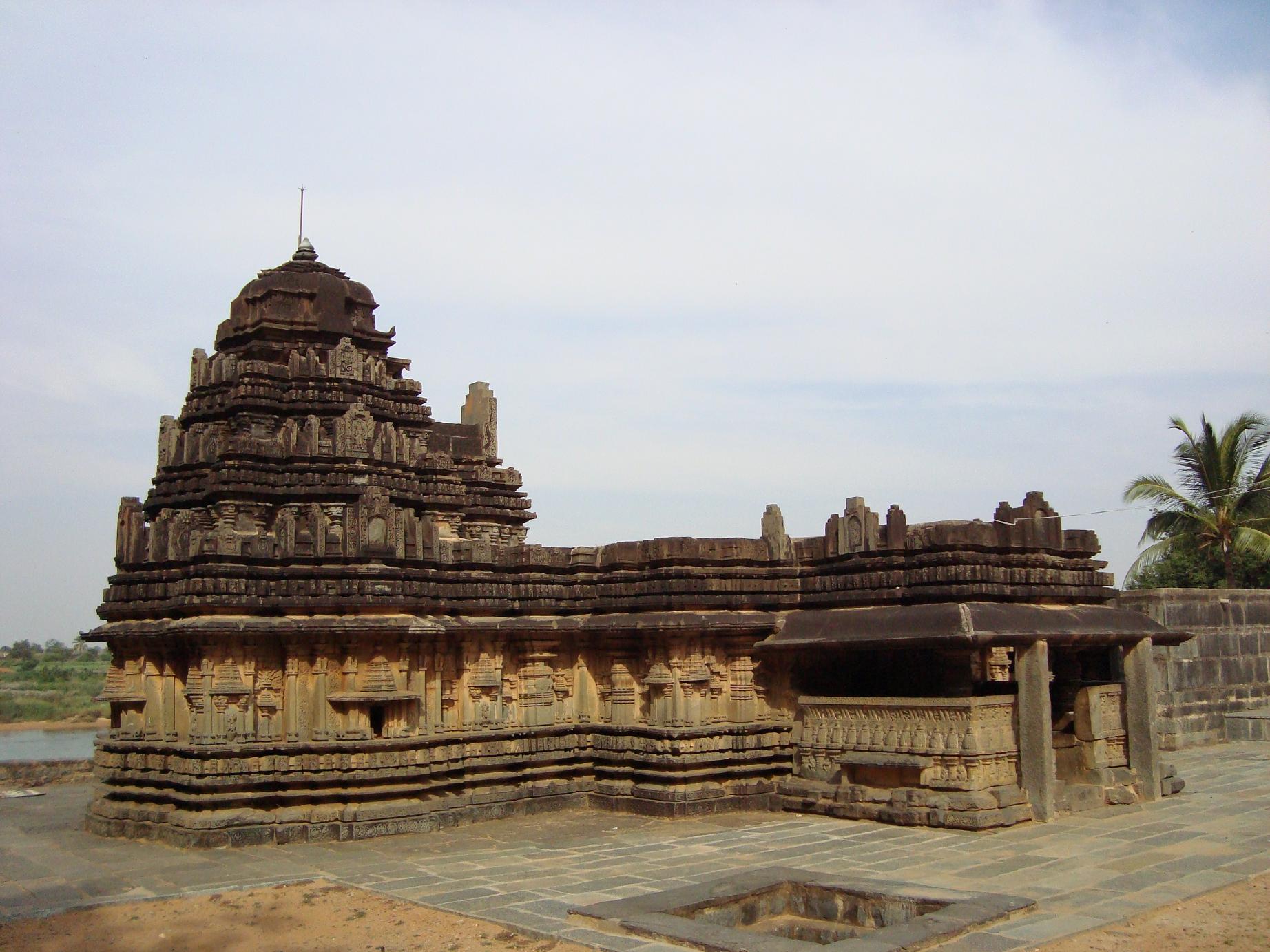     Clockwise from top-right: Galageshwara Temple at Galaganatha, Siddhesvara Temple in Haveri, Rajkumar circle in Utsav Rock Garden, Tarakeshwara Temple at Hangal, Chaudayyadanapura Mukteshwara temple in Ranebennur | |
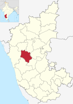 Location in Karnataka | |
 Haveri district | |
| Coordinates: 14.8°N 75.4°E | |
| Country | |
| Headquarters | Haveri |
| Largest city | Ranebennur |
| Taluks | Ranebennur Haveri Hangal Byadgi Hirekerur Shiggaon Savanur Rattihalli |
| Government | |
| • Deputy Commissioner | Sanjay Shettannanavar |
| Population (2011[1]) | |
| • Total | 1,597,668 |
| Languages | |
| • Official | Kannada |
| Time zone | UTC+5:30 (IST) |
| PIN | 581110 |
| Telephone code | + 91 (08375) |
| ISO 3166 code | IN-KA |
| Vehicle registration | KA- 27 Haveri KA 68 Ranebennuru |
| Website | haveri |
Name of the place Haveri is derived from two Kannada words "Havu" which means snake and "keri" which means lake together "Havukeri".
History
This section does not cite any sources. (February 2021) |
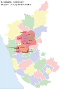

Core area of Western Chalukya monuments includes the places Badami, Sudi, Annigeri, Mahadeva Temple (Itagi), Gadag, Lakkundi, Lakshmeshwar, Dambal, Haveri, Bankapura, Rattahalli, Kuruvatti, Bagali, Balligavi, Chaudayyadanapura, Galaganatha, Hangal. It was possible because Soapstone is found in abundance in these areas. Haveri also comes under Core area of Western Chalukya architectural activity.
History of Haveri district dates to pre-historic period. About 1300 stone writings of different rulers like Chalukyas, Rastrakutas are found in the district. Bankapura Challaketaru, Guttavula Guttaru, Kadambas of Hangal and Nurumbad are some of the well known Samanta Rulers. Devendramunigalu the teacher of Kannada Adikavi Pampa and Ajitasenacharya the teacher of Ranna Chavundaraya lived in Bankapura. This was also the second capital of Hoysala Vishnuvardhana. Guttaru ruled during latter part of the 12th century and up to end of the 13th century from Guttavol (Guttal) village as Mandaliks of Chalukya, independently for some time and as Mandaliks of Seunas of Devagiri. Shasanas found in Chaudayyadanapura (Choudapur), a village near Guttal, reveal that Mallideva was Mandalika of 6th Vikramaditya of Chalukyas. Jatacholina, under the leadership of Mallideva built the Mukteshwara temple at Chaudayyadanapura (Choudapur).
Kadambas of Nurumbad during the period of Kalyani Chalukyas ruled about 100 villages with Rattihalli as their capital.
Tourism
Examples of tourist attractions in the district:

- Dargah of Irshad Ali Baba, Haveri
- Ranebennur Wildlife Sanctuary in Haveri District
- Siddhesvara Temple Haveri
- Galageshwara Temple at Galaganatha
- Temples at Kaginele (Kanakadasa)
- Hole-Anveri Temple
- Kadaramandalagi Anjaneyaswami Temple
- Mylara Lingeshwara Temple at Mylara near Guttala
- Utsav Rock Garden - Contemporary Sculptural Garden
- Heggeri Lake - Which is 900 acres

Churches at Haveri
- St Anne's Church at Hangal Road, Bharathi Nagar, Haveri
- St James Church at Guttal
- Church, Ranebennur
Temples at Kaginele
- Kaginele Mahasamsthana Kanaka Gurupeetha
- Handiganuor
- Ranebennur Wild Life Sanctuary in Haveri District
- Hombanna Bavi Akkialur Village.[3]
- Satenahalli Shatensha (Anjaneya) temple is located just 30 km from Haveri and 40 km from Ranibennur in Hirekerur Taluk.
Hotels Nearby
- Hotel Nimba International in Ranebennur which ranks as the best hotel in Haveri District.
- Hotel Ashoka in Haveri city where all the politicians of Karnataka state likes to stay when they visit Haveri.
Geography

Haveri District is exactly in the centre of Karnataka, being equidistant from Bidar in the far north and Kollegal in the far south. The district consists of Eight taluks, namely (Rattihalli), Hanagal, Shiggaon, Savanur, Haveri, Byadagi, Hirekerur, and Ranebennur. It is bounded by Dharwad district in the north, by Gadag district in the northeast, by Vijayanagara district in the east, by Davangere district in the south, by Shimoga district in the southwest and by Uttar Kannada in the west and northwest. Before it was made into its own district, it was part of Dharwad District. Haveri is 335 km from Bangalore.
Haveri is the administrative and political headquarters of the district, whereas Ranebennur in the south is a business hub.
Demographics
| Year | Pop. | ±% p.a. |
|---|---|---|
| 1901 | 473,218 | — |
| 1911 | 436,600 | −0.80% |
| 1921 | 414,028 | −0.53% |
| 1931 | 457,356 | +1.00% |
| 1941 | 491,410 | +0.72% |
| 1951 | 588,063 | +1.81% |
| 1961 | 734,775 | +2.25% |
| 1971 | 844,026 | +1.40% |
| 1981 | 1,052,989 | +2.24% |
| 1991 | 1,269,213 | +1.89% |
| 2001 | 1,439,116 | +1.26% |
| 2011 | 1,597,668 | +1.05% |
| source:[4] | ||
According to the 2011 census Haveri district has a population of 1,597,668,[5] roughly equal to the nation of Guinea-Bissau[6] or the US state of Idaho.[7] This gives it a ranking of 312th in India (out of a total of 640).[5] The district has a population density of 331 inhabitants per square kilometre (860/sq mi).[5] Its population growth rate over the decade 2001-2011 was 11.08%.[5] Haveri has a sex ratio of 951 females for every 1000 males,[5] and a literacy rate of 77.6%. Scheduled Castes and Scheduled Tribes make up 13.77% and 8.85% of the population respectively.[5]
At the time of the 2011 census, 77.29% of the population spoke Kannada, 17.70% Urdu and 2.84% Lambadi as their first language.[9]
Notable people
- Ranna - 10th century's poet, was born in Bankpur, near Haveri
- Kanakadasa - born in Bada village which is situated in the district.
- Panchakshara Gawai - noted Hindustani classical musician, born in Kada Shettihalli
- Sarvajna was born in Abalur in Hirekerur taluk
- Politics and war
- Mailara Mahadevappa - freedom fighter who resisted British rule, is from Motebennur. And his wife Siddhamma also contributed to the freedom struggle, praised as Siddhamati by Mahatma Gandhiji
- Siddappa Hosamani Karajgi - a freedom fighter, lawyer and politician
- Gudleppa Hallikeri - freedom fighter who is a native of Hosaritti.
- Ramaanand Mannangi - Noted freedom fighter and a Gandhian.
- Art and literature
- Shishunala Sharif - poet and philosopher of the 19th century, born in Shishuvinahala, Shiggaon taluk
- Subbanna Ekkundi - noted Kannada poet
- Puttaraj Gawai - Hindustani classical singer, founder of Veereswara Punyashrama in Gadag; born in Devagiri
- Galaganatha - Novelist in Kannada
- Vinayaka Krishna Gokak - noted Kannada poet and recipient of Jnanpith Award, was born in Savanoor
- Gudigeri Basavaraj - noted theatre personality, film actor
- Sudha Murthy, Chairperson, Infosys Foundation, was born in Shiggaon
- B. C. Patil - a Kannada film actor from Yeliwala
See also
- North Karnataka
- Tourism in North Karnataka
- Ranebennur
- Chaudayyadanapura
- Galaganatha
- Hangal
- Kundgol
- Balligavi
- Devagiri
References
- Haveri District : Census 2011 data
- "Hold investors' meet in Haveri". The Hindu. Chennai, India. 17 February 2007. Archived from the original on 24 February 2007. Retrieved 20 November 2008.
- "Colours of Haveri". DHNS. Retrieved 18 February 2017.
- Decadal Variation In Population Since 1901
- "District Census 2011". Census2011.co.in. 2011. Retrieved 30 September 2011.
- US Directorate of Intelligence. "Country Comparison:Population". Archived from the original on 27 September 2011. Retrieved 1 October 2011.
Guinea-Bissau 1,596,677 July 2011 est.
- "2010 Resident Population Data". U. S. Census Bureau. Archived from the original on 23 August 2011. Retrieved 30 September 2011.
Idaho 1,567,582
- "C-1 Population By Religious Community". Census of India. Retrieved 2 August 2021.
- "Table C-16 Population by Mother Tongue: Karnataka". Census of India. Registrar General and Census Commissioner of India.
External links
Capital: Bengaluru | |||||||||
| State symbols |
| ||||||||
| Overviews |
| ||||||||
| History |
| ||||||||
| Districts and divisions |
| ||||||||
| Geography |
| ||||||||
| Culture |
| ||||||||
| Literature |
| ||||||||
| Noted poets |
| ||||||||
| People and society |
| ||||||||
| Tourism |
| ||||||||
| Awards |
| ||||||||
| Media |
| ||||||||
Authority control | |
|---|---|
| General |
|
| National libraries | |
На других языках
- [en] Haveri district
[ru] Хавери (округ)
Хавери (канн. ಹಾವೇರಿ; англ. Haveri) — округ в индийском штате Карнатака. Образован 24 августа 1997 года из части территории округа Дхарвад. Административный центр — город Хавери. Площадь округа — 4 823 км². По данным всеиндийской переписи 2001 года население округа составляло 1 439 116 человек. Уровень грамотности взрослого населения составлял 67,8 %, что выше среднеиндийского уровня (59,5 %). Доля городского населения составляла 20,8 %.Другой контент может иметь иную лицензию. Перед использованием материалов сайта WikiSort.org внимательно изучите правила лицензирования конкретных элементов наполнения сайта.
WikiSort.org - проект по пересортировке и дополнению контента Википедии