world.wikisort.org - India
Betul is a municipality in southern Madhya Pradesh, India. It is the administrative center of Betul district and forms the southernmost part of the Bhopal Division in the Betul (Lok Sabha constituency). Bhimpur village, located 45 km (28 mi) west of Betul, is the site of proposed 2800 MW Nuclear Power plant.
Betul | |
|---|---|
City | |
 | |
 Betul | |
| Coordinates: 21.905°N 77.902°E | |
| Country | India |
| State | Madhya Pradesh |
| District | Betul |
| Government | |
| • Type | janapad panchayat |
| • Body | Municipal Corporation 2024 |
| Area | |
| • Total | 193 km2 (75 sq mi) |
| Elevation | 658 m (2,159 ft) |
| Population (2011) | |
| • Total | 153,330 |
| • Density | 790/km2 (2,100/sq mi) |
| Languages | |
| • Official | Hindi |
| Time zone | UTC+5:30 (IST) |
| ISO 3166 code | IN-MP |
| Vehicle registration | MP 48 |
| Website | www |
Name
During the early 20th century, Betul was known as Badnur.[1] It derives its present name from its surrounding district, which was named for its former headquarters at Betul Bazar, a small town about 5 km (3 mi) to its south. Betul—literally "without" (be) "cotton" (tool)—was named for its position outside the area's cottonfields.
History
Nearby Kherla was formerly the seat of an independent kingdom in the medieval and early modern period.[2] Under Company Rule, its fort was permitted to fall into ruin.[3] Badnur became the headquarters of Betul District in 1822. Surrounded by hills on all sides, it was used by the British for the exportation of coal.[4] It supported two bazaars; the larger, Kothi Bazar, held 2015 people in the 1870s.[2] At that time, the town had a circuit house, a dak bungalow, a caravanserai, jail, police station, pharmacy, and schools.[2] Its population c. 1901 was 3766.[1]
Following independence, Betul lay near the geographical center point of the new country, which is now marked by a stone at Barsali. Betul was connected to the Delhi–Chennai line of the Indian rail network in the early 1950s. It now serves as a junction point, providing the only access to the Chindwara District on broad-gauge rail.
Geography
Betul is located at 21.92°N 77.9°E,[5] near the geographical center point of modern India. It has an average elevation of 658 m (2,159 ft).
Climate
| Climate data for Betul, Madhya Pradesh (1981–2010, extremes 1948–2012) | |||||||||||||
|---|---|---|---|---|---|---|---|---|---|---|---|---|---|
| Month | Jan | Feb | Mar | Apr | May | Jun | Jul | Aug | Sep | Oct | Nov | Dec | Year |
| Record high °C (°F) | 34.9 (94.8) |
37.8 (100.0) |
42.3 (108.1) |
43.7 (110.7) |
48.0 (118.4) |
44.5 (112.1) |
38.6 (101.5) |
33.6 (92.5) |
35.5 (95.9) |
36.8 (98.2) |
35.0 (95.0) |
32.7 (90.9) |
48.0 (118.4) |
| Average high °C (°F) | 27.4 (81.3) |
30.1 (86.2) |
34.6 (94.3) |
38.7 (101.7) |
40.3 (104.5) |
35.7 (96.3) |
29.2 (84.6) |
27.6 (81.7) |
29.8 (85.6) |
31.1 (88.0) |
29.1 (84.4) |
27.8 (82.0) |
31.8 (89.2) |
| Average low °C (°F) | 10.5 (50.9) |
11.9 (53.4) |
16.1 (61.0) |
20.6 (69.1) |
24.7 (76.5) |
24.4 (75.9) |
22.5 (72.5) |
21.8 (71.2) |
21.1 (70.0) |
17.3 (63.1) |
13.4 (56.1) |
10.2 (50.4) |
17.9 (64.2) |
| Record low °C (°F) | −0.2 (31.6) |
1.1 (34.0) |
2.3 (36.1) |
10.6 (51.1) |
16.6 (61.9) |
14.9 (58.8) |
14.5 (58.1) |
13.1 (55.6) |
10.5 (50.9) |
5.0 (41.0) |
2.6 (36.7) |
1.3 (34.3) |
−0.2 (31.6) |
| Average rainfall mm (inches) | 13.8 (0.54) |
14.2 (0.56) |
19.7 (0.78) |
6.9 (0.27) |
13.3 (0.52) |
144.5 (5.69) |
330.1 (13.00) |
371.7 (14.63) |
189.8 (7.47) |
57.8 (2.28) |
20.6 (0.81) |
8.6 (0.34) |
1,191 (46.89) |
| Average rainy days | 1.1 | 1.5 | 1.4 | 0.7 | 0.9 | 8.0 | 15.2 | 15.5 | 8.8 | 3.2 | 1.7 | 0.8 | 58.7 |
| Average relative humidity (%) (at 17:30 IST) | 44 | 34 | 25 | 20 | 24 | 53 | 77 | 84 | 74 | 60 | 52 | 47 | 50 |
| Source: India Meteorological Department[6][7] | |||||||||||||
Demographics
During the 2011 Indian census, Betul had a population of 103,330. Males constitute 51.12% of the population, females 48.88%. Betul has an average literacy rate of 89.28%, higher than the national average of 74.04%. 10.82% of the population is under 6 years of age.[8]
Economy
Betul District's economy is predominantly an agrarian one. Its dense woods also permit forestry. Its road and rail connections and good telecom services have led some[who?] to predict that Betul will become an advanced industrial district.[citation needed]
Currently, Betul District supports 7160 cottage industries capitalized at 1235.65 Lakhs[clarification needed] and employing 17,682 people; 33 small-scale industries capitalized at 819.99 Lakhs[clarification needed] and employing 667 people; and 5 medium- or large-scale industries with a total capitalization 1681.37 Lakhs and a workforce of 999 people. Of the 33 SSI's, 8 are agricultural, 13 are mineral-based,[clarification needed] and 1 is forest-based. The five larger industrial plants are:
- M/s. Betul Oils & Flours Ltd., Kosmi Industrial Area (130.12 Lakhs),
- M/s. Madhyavarta Ex-oil Ltd., Kosmi Industrial Area (595.00 Lakhs),
- M/s. Adhishwar Oil & Fats Ltd. Chouthia, Multai (348.73 Lakhs),
- M/s. Betul Tyre & Tube Industry Pvt. Ltd., Sohagpur (302.25 Lakhs), and
- M/s. Wearwell Tyre & Tube Industries, Panka, Amla (305.27 Lakhs).
Transport
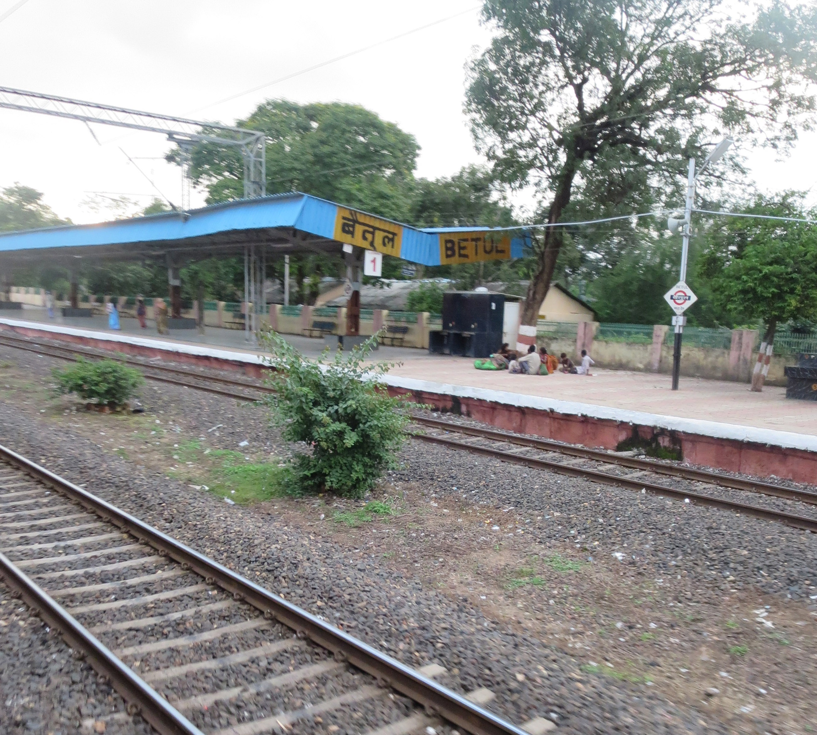
Betul is connected to the broad-gauge Delhi–Chennai (Grand Trunk) line of the Indian rail network, which also communicates with Bhopal and Nagpur. Two new railway lines are also proposed - Betul - Chandur Bazar [9] and Betul -Harda -Indore. Betul Railway station has 94 trains, to various parts of country like Delhi, Chennai, Hyderabad, Bangalore, Jaipur, Lucknow, Kanpur, Bhopal, Indore, Harda, Jabalpur, Nagpur etc.
Betul is serviced by National Highway 46 and National Highway 47, also connecting it with Bhopal and Nagpur. National Highway 47 connects it to Harda Indore as well. There are daily buses to Bhopal, Nagpur, Harda and Indore, as well as Jabalpur, Hoshangabad, and other cities. Betul's RTO code is MP48.
The nearest airports are at Nagpur and Bhopal, about 180 km (112 mi) away. The tyre industry also uses the area's waterways for export to the United States, the UK, the Middle East, and Africa.The nearest airport is Nagpur.
Education
In Betul, there are total 72 number of colleges. Some main colleges are as follows[10]
- Govt Jaywanti Haksar P G College Betul
- Government polytechnic college sonaghati Betul
- Bhimrao Ramrao Ambedkar College Of Education, Run By Shri Ram Shiksha Parishad, Chakkar Road Ambedk
- Late Shri Nandkishore Singh Patel Memorial College, Near Link Road, Sadar, Betul
- Netaji Subhas Chandra Bose College
- Shri Ram Pharmacy College Jamthi Betul
- Shri Balaji Institute of Technology & Management, Betul
In Betul, there are many schools for primary and secondary education. Some of the main schools are
- R D Public School, Kalapatha, Betul
- Satpuda Valley Public School, Sonaghati, Betul
- Kendriya Vidyalya Betul
- ELC English School
References
- EB (1911).
- EB (1878), p. 228.
- EB (1878), p. 229.
- "betul history". betul.nic.in. GOVERNMENT OF MADHAYA PRADESH. Retrieved 24 November 2019.
- Falling Rain Genomics, Inc - Betul
- "Station: Betul Climatological Table 1981–2010" (PDF). Climatological Normals 1981–2010. India Meteorological Department. January 2015. pp. 123–124. Archived from the original (PDF) on 5 February 2020. Retrieved 28 December 2020.
- "Extremes of Temperature & Rainfall for Indian Stations (Up to 2012)" (PDF). India Meteorological Department. December 2016. p. M115. Archived from the original (PDF) on 5 February 2020. Retrieved 28 December 2020.
- "Census of India 2011: Data from the 2001 Census, including cities, villages and towns (Provisional)". Census Commission of India. Archived from the original on 16 June 2004. Retrieved 1 November 2008.
- "Archived copy" (PDF). Archived from the original (PDF) on 1 December 2017. Retrieved 23 November 2017.
{{cite web}}: CS1 maint: archived copy as title (link) - "District Administration Betul" (PDF). District Administration Betul.
References
- Baynes, T. S., ed. (1878), , Encyclopædia Britannica, vol. 3 (9th ed.), New York: Charles Scribner's Sons, pp. 228–229
- Chisholm, Hugh, ed. (1911), , Encyclopædia Britannica, vol. 3 (11th ed.), Cambridge University Press, p. 190
На других языках
[de] Betul (Stadt)
Betul ist eine Stadt im indischen Bundesstaat Madhya Pradesh. Die Stadt liegt im Süden des Bundesstaates und befindet sich nahe dem geografischen Zentrum Indiens, welches mit einem Stein markiert ist.- [en] Betul, Madhya Pradesh
Другой контент может иметь иную лицензию. Перед использованием материалов сайта WikiSort.org внимательно изучите правила лицензирования конкретных элементов наполнения сайта.
WikiSort.org - проект по пересортировке и дополнению контента Википедии