world.wikisort.org - India
Pakur district (Santali: ᱯᱟᱠᱩᱲ ᱦᱚᱱᱚᱛ) is one of the twenty-four districts of Jharkhand state, India, and Pakur is the administrative headquarters of this district. Pakur sub-division of Sahibganj district was carved out on 28 January 1994 to constitute Pakur District. The district, with a population of 900,422 (census 2011), and covering an area of 686.21 km², is situated on the north-eastern corner of Jharkhand state. The district is bounded on the north by Sahibganj district, on the south by Dumka district, on the west by Godda district, and on the east by the Murshidabad district of West Bengal.[2]
Pakur district | |
|---|---|
District of Jharkhand | |
 A stone-quarrying unit in Pakur district | |
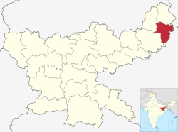 Location of Pakur district in Jharkhand | |
| Country | |
| State | |
| Division | Santhal Pargana |
| Headquarters | Pakur |
| Government | |
| • Lok Sabha constituencies | Rajmahal (shared with Sahebganj district) |
| • Vidhan Sabha constituencies | 3 |
| Area | |
| • Total | 1,805.59 km2 (697.14 sq mi) |
| Population (2011)[1] | |
| • Total | 900,422 |
| • Density | 500/km2 (1,300/sq mi) |
| • Urban | 5.13% |
| Demographics | |
| • Literacy | 50.17 per cent |
| • Sex ratio | 989 |
| Time zone | UTC+05:30 (IST) |
| Website | pakur |
Geography
The district borders Sahibganj district to the north, Murshidabad and Birbhum districts of West Bengal to the east, and Dumka and Godda districts to the west. The west of the district contains the Rajmahal Hills, while the east of the district is mostly flat plain.
Economy
It is famous across the world for its Black stone. It supplies nearly 500 Truck Stone chips daily to Bangladesh. It is generating the highest revenue for Howrah railway Division by supplying Black Stone Chips across India and Coal to Punjab.
In the past, Pakur was a land populated by Santhals and Mal Paharia people. However, over a period of time, demographic composition has gradually changed to the modern era, and the local folks have come to the mainstream of the Indian society.
In 2006 the Ministry of Panchayati Raj named Pakur one of the country's 250 most backward districts (out of a total of 640).[3] It is one of the 21 districts in Jharkhand currently receiving funds from the Backward Regions Grant Fund Programme (BRGF).[3]
Politics
| No. | Constituency | Name | Party | Alliance | Remarks | ||||||||||||||||||||||||||||||||||||||||||||||||||||||||||||||||||||||||||||||||||||||||||||||||||||||||||||||||||||||||||
|---|---|---|---|---|---|---|---|---|---|---|---|---|---|---|---|---|---|---|---|---|---|---|---|---|---|---|---|---|---|---|---|---|---|---|---|---|---|---|---|---|---|---|---|---|---|---|---|---|---|---|---|---|---|---|---|---|---|---|---|---|---|---|---|---|---|---|---|---|---|---|---|---|---|---|---|---|---|---|---|---|---|---|---|---|---|---|---|---|---|---|---|---|---|---|---|---|---|---|---|---|---|---|---|---|---|---|---|---|---|---|---|---|---|---|---|---|---|---|---|---|---|---|---|---|---|---|---|
| 4 | Litipara | Dinesh William Marandi | Jharkhand Mukti Morcha | UPA | |||||||||||||||||||||||||||||||||||||||||||||||||||||||||||||||||||||||||||||||||||||||||||||||||||||||||||||||||||||||||||
| 5 | Pakur | Alamgir Alam | Indian National Congress | UPA | Cabinet Minister | ||||||||||||||||||||||||||||||||||||||||||||||||||||||||||||||||||||||||||||||||||||||||||||||||||||||||||||||||||||||||||
| 6 | Maheshpur | Stephen Marandi | Jharkhand Mukti Morcha | UPA |
|} AdministrationBlocks/MandalsPakur district consists of six community development blocks. The following are the list of the blocks in the Pakur district: DemographicsAccording to the 2011 census Pakur district has a population of 900,422,[1] roughly equal to the nation of Fiji[5] or the US state of Delaware.[6] This gives it a ranking of 465th in India (out of a total of 640).[1] The district has a population density of 498 inhabitants per square kilometre (1,290/sq mi) .[1] Its population growth rate over the decade 2001-2011 was 28.15%.[1] Pakur has a sex ratio of 985 females for every 1000 males,[1] and a literacy rate of 50.17%. Scheduled Castes and Scheduled Tribes make up 3.16% and 42.10% of the population respectively.[1] At the time of the 2011 Census of India, 39.42% of the population in the district spoke Bengali, 36.40% Santali, 11.84% Khortha, 4.90% Malto, 2.83% Hindi, 1.77% Urdu and 1.66% Bhojpuri as their first language.[7]
See also
References
External links
| ||||||||||||||||||||||||||||||||||||||||||||||||||||||||||||||||||||||||||||||||||||||||||||||||||||||||||||||||||||||||||

На других языках
[de] Pakur (Distrikt)
Pakur ist ein Distrikt im indischen Bundesstaat Jharkhand.- [en] Pakur district
[ru] Пакур (округ)
Пакур (хинди पाकुड़ जिला; англ. Pakur) — округ в индийском штате Джаркханд. Образован в 1994 году из части территории округа Сантхал-Паргана. Административный центр — город Пакур. Площадь округа — 1806 км². По данным всеиндийской переписи 2001 года население округа составляло 701 664 человека. Уровень грамотности взрослого населения составлял 30,6 %, что значительно ниже среднеиндийского уровня (59,5 %). Доля городского населения составляла 5,1 %.Другой контент может иметь иную лицензию. Перед использованием материалов сайта WikiSort.org внимательно изучите правила лицензирования конкретных элементов наполнения сайта.
WikiSort.org - проект по пересортировке и дополнению контента Википедии