world.wikisort.org - India
Moradabad district is one of the districts of Uttar Pradesh, India. Moradabad is the district headquarters. Moradabad district is a part of Moradabad division. It is used to be the second most populous district of Uttar Pradesh (out of 75), after Prayagraj[2] till a new district Sambhal was carved out of it in 2011.
Moradabad District | |
|---|---|
District of Uttar Pradesh | |
 Ramganga at Moradabad | |
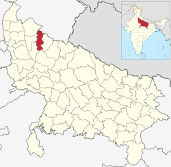 Location of Moradabad district in Uttar Pradesh | |
| Country | |
| State | Uttar Pradesh |
| Division | Moradabad |
| Headquarters | Moradabad |
| Government | |
| • Lok Sabha constituencies | Moradabad |
| Area | |
| • Total | 2,233 km2 (862 sq mi) |
| Population (2011) | |
| • Total | 3,126,507 |
| • Density | 1,400/km2 (3,600/sq mi) |
| Demographics | |
| • Literacy | 45.74 per cent[1] |
| Time zone | UTC+05:30 (IST) |
| Website | moradabad |
The district of Moradabad lies between 28°21´ to 28°16´ north latitude and 78°4´ to 79° east longitude.
Demographics
| Year | Pop. | ±% p.a. |
|---|---|---|
| 1901 | 854,603 | — |
| 1911 | 905,439 | +0.58% |
| 1921 | 859,151 | −0.52% |
| 1931 | 920,336 | +0.69% |
| 1941 | 1,055,828 | +1.38% |
| 1951 | 1,190,434 | +1.21% |
| 1961 | 1,423,487 | +1.80% |
| 1971 | 1,747,420 | +2.07% |
| 1981 | 2,257,867 | +2.60% |
| 1991 | 2,965,293 | +2.76% |
| 2001 | 3,810,983 | +2.54% |
| 2011 | 4,772,006 | +2.27% |
| source:[3] | ||
According to the 2011 census Moradabad district has a population of 4,772,006,[2] roughly equal to the nation of Singapore[4] or the US state of Alabama.[5] This gives it a ranking of 26th in India (out of a total of 640).[2] The district has a population density of 1,284 inhabitants per square kilometre (3,330/sq mi) .[2] Its population growth rate over the decade 2001-2011 was 25.25%.[2]
The residual Moradabad district has a population of 3,126,507. Moradabad has a sex ratio of 903 females for every 1000 males,[2] and a literacy rate of 58.67%. Scheduled Castes make up 436,149 (13.95%) of the population.[2][6]
Religion
After the separation of Sambhal district, Moradabad district became the second Muslim-majority district after Rampur.[7]
Language
At the time of the 2011 Census of India, 84.49% of the population of the district spoke Hindi and 15.20% Urdu as their first language.[8]
Administrative divisions
There is one Lok Sabha constituencies for the district:
- Moradabad composed of Kanth, Thakurdwara, Moradabad Rural, Moradabad City and Barhapur (from Bijnor District).
For election purposes Moradabad District is divided into six Vidhan Sabha constituencies:[9]
- Kanth
- Thakurdwara
- Moradabad Rural
- Moradabad Nagar
- Kundarki
- Bilari
Moradabad District has one division: Moradabad Subdivision. There are five tehsils in Moradabad District and eight blocks.
- In Moradabad Subdivision there are three tehsils: Bilari Tehsil, Kanth Tehsil, Thakurdwara Tehsil;[10] and there are five blocks: Kundarki, Chajlet, Bhagtpur, Dilari and Mundapandey.
Towns and villages
In addition to the city of Moradabad, which is governed as a Municipal Corporation, there are four municipalities: Bahjoi, Bilari, Chandausi, and Thakurdwara. There are six Town Panchayats:[11]
- Bhojpur Dharampur
- Kanth
- Kundarki
- Narauli
- Rustamnagar Sahaspur
- Umri Kalan
- Sherua Dharampur
There are 1210 grams and 584 gram panchayats in the district.[12]
Villages
- Amarpurkashi
Notable people
- Jigar Moradabadi
- Piyush Chawla
- Ponty Chadha
- Robert Vadra
- Sufi Amba Prasad
- Arun Lal
- Govind Swarup
- Javed Jaffrey
- Zainul Abideen/Moradabad Express
See also
- Bhikanpur, Moradabad
- 1888 Moradabad hailstorm
References
- "District-specific Literates and Literacy Rates, 2001". Registrar General, India, Ministry of Home Affairs. Retrieved 10 October 2010.
- "District Census 2011". Census2011.co.in. 2011. Retrieved 30 September 2011.
- Decadal Variation In Population Since 1901
- US Directorate of Intelligence. "Country Comparison:Population". Archived from the original on 13 June 2007. Retrieved 1 October 2011.
Singapore 4,740,737 July 2011 est.
- "2010 Resident Population Data". U. S. Census Bureau. Retrieved 30 September 2011.
Alabama 4,779,736
- MINUTES OF THE 34th MEETING OF EMPOWERED COMMITTEE TO CONSIDER AND APPROVE REVISED PLAN FOR BALANCE FUND FOR THE DISTRICTS OF GHAZIABAD, BAREILLY, BARABANKI, SIDDHARTH NAGAR, SHAHJANPUR, MORADABAD, MUZAFFAR NAGAR, BAHRAICH AND LUCKNOW (UTTAR PRADESH) UNDER MULTI-SECTORAL DEVELOPMENT PROGRAMME IN MINORITY CONCENTRATION DISTRICTS HELD ON 22nd JULY, 2010 AT 11.00 A.M. UNDER THE CHAIRMANSHIP OF SECRETARY, MINISTRY OF MINORITY AFFAIRS. Archived 30 September 2011 at the Wayback Machine F. No. 3/64/2010-PP-I, GOVERNMENT OF INDIA, MINISTRY OF MINORITY AFFAIRS
- "Table C-01 Population by Religion: Uttar Pradesh". censusindia.gov.in. Registrar General and Census Commissioner of India. 2011.
- "Table C-16 Population by Mother Tongue: Uttar Pradesh". www.censusindia.gov.in. Registrar General and Census Commissioner of India.
- "Delimitation of Parliamentary and Assembly Constituencies Order, 2008" (PDF). The Election Commission of India. pp. 461–462.
- The National Panchayat Directory lists Moradabad Tehsil instead of Kanth Teshil. "Reports of National Panchayat Directory: Blocks of Moradabad, Uttar Pradesh". Ministry of Panchayati Raj, Government of India.
- "Reports of National Panchayat Directory: Report on Urban Local Bodies: Uttar Pradesh: Moradabad". Ministry of Panchayati Raj, Government of India. Archived from the original on 13 May 2013. Retrieved 8 May 2013.
- "Reports of National Panchayat Directory: Blocks of Moradabad, Uttar Pradesh". Ministry of Panchayati Raj, Government of India. Archived from the original on 7 September 2014. Retrieved 8 May 2013.
External links
Places adjacent to Moradabad district | ||||||||||||||||
|---|---|---|---|---|---|---|---|---|---|---|---|---|---|---|---|---|
| ||||||||||||||||
Authority control | |
|---|---|
| General |
|
| National libraries | |
На других языках
[de] Moradabad (Distrikt)
Der Distrikt Moradabad (Hindi: मुरादाबाद जिला, Urdu ضلع مرادآباد) ist ein Distrikt des indischen Bundesstaates Uttar Pradesh; Verwaltungssitz ist die namensgebende Stadt Moradabad.- [en] Moradabad district
[ru] Морадабад (округ)
Морадабад (англ. Moradabad) — округ в индийском штате Уттар-Прадеш. Административный центр — город Морадабад. Площадь округа — 3648 км². По данным всеиндийской переписи 2001 года население округа составляло 3 810 983 человека. Уровень грамотности взрослого населения составлял 44,75 %, что значительно ниже среднеиндийского уровня (59,5 %). 23 июля 2012 года из состава округа был выделен самостоятельный округ Самбхал.Другой контент может иметь иную лицензию. Перед использованием материалов сайта WikiSort.org внимательно изучите правила лицензирования конкретных элементов наполнения сайта.
WikiSort.org - проект по пересортировке и дополнению контента Википедии