world.wikisort.org - India
Churachandpur District[1] (Meitei pronunciation: /tʃʊraːˌtʃaːnɗpʊr/), is one of the 16 districts in the southwestern corner of the Indian state of Manipur that covers an area of 4,750 kilometres (2,950 mi). It is named after the Meitei King Churachand Singh, the Maharaja of Manipur Kingdom. Churachandpur district which was previously known as Manipur South District came into existence in the year 1969 along with the district reorganization of Manipur. It stretches between 93° 15’E and 94° 45΄E Longitude and between 24°N and 24° 30 N Latitudes.[7][2]
This article has multiple issues. Please help improve it or discuss these issues on the talk page. (Learn how and when to remove these template messages)
|
Churachandpur [1] | |
|---|---|
District | |
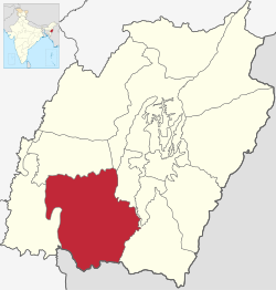 Location of Churachandpur district in Manipur | |
| Coordinates: 24°20′N 93°41′E | |
| Country | |
| State | |
| District | Churachandpur |
| Named for | Churachand Singh, His Highness, the King of Manipur Kingdom |
| Headquarters | Churachandpur[2] |
| Area | |
| • Total | 4,750 km2 (1,830 sq mi) |
| • Rank | 1 (of 9) |
| Elevation (District headquarters) | 914.4 m (3,000.0 ft) |
| Population (2011)[3] | |
| • Total | 300,000+ |
| • Rank | 5 (of 9) |
| • Density | 59/km2 (150/sq mi) |
| • Percent of state | 9.97%[3] |
| Literacy (2001) | |
| • Literacy Rate | 84.29%[3] (Rank 2/9) |
| • Literacy by gender | |
| Language(s) | |
| • Official | Meitei (Manipuri)[lower-alpha 1][4] |
| Time zone | UTC+5:30 (IST) |
| PIN | 795128,[5]
795006 (New Lamka) |
| Telephone code | 03874 |
| Vehicle registration | MN 02 |
| Sex ratio | 969 females per 1000 males[3] |
| Website | churachandpur |
![Khuga Dam in 2006[6]](http://upload.wikimedia.org/wikipedia/en/8/86/Khuga_dam.JPG)
Demographics
As of the 2011 Census of India, Churachandpur district had a population of 271,274,[8] roughly equal to that of Barbados.[9] This gives it a ranking of 575th in India (out of a total of 640 districts).[8] It has a population density of 59 inhabitants per square kilometre (150/sq mi).[8] Its population growth rate over the decade 2001–2011 was 19.03%.[8] Churachandpur has a sex ratio of 969 females for every 1000 males,[8] and a literacy rate of 84.29%.[8][10]
Census towns
There are three census towns in Churachandpur District:[11]
- Rengkai (Most populated town in the district)
- Zenhang Lamka
- Hill town
Educational facilities
Colleges
- Churachandpur Medical College
- Churachandpur Government College
Private Colleges
- Rayburn College[12]
- Evangelical College of Theology, Rengkai[13]
- Trinity College of Seminar, Sielmat[14]
- Sielmat Bible College, Sielmat[15]
- Grace Bible College , New Lamka[16]
Government High School
- Rengkai Government Higher Secondary School[17]
Private Universities
- Sangai International University , Rengkai Road
Health
District Hospital Churachandpur is located within Churachandpur town. Initially it was a dispensary with few staffs and in the year 1968 it became a 50 bedded Civil Hospital which was inaugurated by Shri Baleswar Prasad, Chief Commissioner of Manipur on 8/6/1968. The hospital was extended with another 50 bedded new building inaugurated on 17 May 1985 by the Medical Minister Shri T. Phungzathang Tonsing and became a 100 bedded one. The present Building OPD block was inaugurated on 31/05/2002 and O.T wing on 23/12/2013 and lastly the Trauma Centre on 19/07/2014 by the Hon’ble Chief Minister in presence of Health Minister and Industries Minister. The Government of Manipur approved upgrading the hospital to 200 bedded ward and start the process of making it a Hill Medical College under the leadership of Hon’ble Medical Minister.[18]
Economy
In 2006 the Ministry of Panchayati Raj named Churachandpur one of the country's most impoverished districts (out of a total of 640).[19] It is one of the three districts in Manipur currently[when?] receiving funds from the Backward Regions Grant Fund (BRGF).[19]
Climate
The location is north of Tropic of Cancer in northern hemisphere, it has summer season in March, April and May with warm, hot and sunny weather. Rainy season starts April and last till October. The winter season is cool and dry.
| Climate data for Churachandpur[20] | ||||||||||||
| Month | Jan | Feb | Mar | Apr | May | Jun | July | Aug | Sep | Oct | Nov | Dec |
| High °C | 27 | 28 | 36 | 36 | 34 | 39 | 37 | 39 | 38 | 34 | 32 | 28 |
| Low °C | 7 | 4 | 14 | 18 | 21 | 22 | 24 | 25 | 22 | 19 | 16 | 8 |
Transportation
Airport
Nearest airport from Churachandpur is Imphal Airport at Imphal which is about 60 Km.
Media
The major private television channels/cables are Angels Vision Digital Cable, Hornbill Cable Network, TC Network and Tullou TV.
Government, Politics and Administration
Administration is carried out by the Deputy Commissioners or District Magistrates with support of the District level officer and Block Development officers. The district collector office is located at Tuibong/Tuibuang Town.
The administrative setup of Churachandpur District.[21]
- Sub Divisions & Blocks
- Autonomous District Councils
- Towns
- Police Stations
- Assembly Constituencies
Autonomous district council
At the district level there is the Churachandpur Autonomous District Council created by "The Manipur (Hill Areas) District Council Act, 1971,” passed by Parliament. The Autonomous District Council is to administer areas which have been given autonomy within the states under Manipur (Hill Areas) District Councils Act, 1971. In accordance with this Act Autonomous (Hill) District Council is empowered to maintain and manage of property: movable and immovable, and institutions under their jurisdiction.[22] Churachandpur Autonomous District Council has 24 constituencies.[23]
Notes
- Meitei language (officially known as Manipuri language) is the official language of Manipur. Other regional languages of different places in Manipur may either be predominantly spoken or not in their respective places but "Meitei" is officially used.
References
- "History | Churachandpur District, Government of Manipur | India".
- "About District | Churachandpur District, Government of Manipur | India".
- "Census of India: Provisional Population Totals and Data Products – Census 2011: Manipur". Office of the Registrar General and Census Commissioner, Ministry of Home Affairs, Government of India. 2011. Retrieved 1 June 2011.
- "Report of the Commissioner for linguistic minorities: 47th report (July 2008 to June 2010)" (PDF). Commissioner for Linguistic Minorities, Ministry of Minority Affairs, Government of India. p. 78. Archived from the original (PDF) on 13 May 2012. Retrieved 16 February 2012.
- "Pin Code: 795128, List of Post Offices, CHURACHANDPUR, MANIPUR Pincode.net.in".
- "Khuga Dam | Churachandpur District, Government of Manipur | India".
- "About District | Churachandpur District, Government of Manipur | India". Retrieved 7 February 2020.
- "District Census 2011". Census2011.co.in. 2011. Retrieved 30 September 2011.
- US Directorate of Intelligence. "Country Comparison: Population". Archived from the original on 13 June 2007. Retrieved 1 October 2011.
Barbados 286,705 July 2011 est.
- "Churachandpur Pin Code list, Population density ,literacy rate and total Area with census 2011 details".
- "Towns | Churachandpur District, Government of Manipur | India".
- "Rayburn College – Learn | Labor | Serve". Retrieved 7 February 2020.
- https://ect.edu.in/
- https://www.trinitycollegeandseminary.org/
- "SBC - Independent Church of India".
- "GBC | Teach, Entrust & Witness". Grace Bible College | Teach, Entrust & Witness. Retrieved 7 February 2020.
- "RENGKAI GOVT. HR. SEC SCHOOL - Rengkai, District Churachandpur (Manipur)".
- "Scheme for Strengthening of Drug De-Addiction Services". www.dtc-scheme.in. Retrieved 6 February 2018.
- Ministry of Panchayati Raj (8 September 2009). "A Note on the Backward Regions Grant Fund Programme" (PDF). National Institute of Plural Development. Archived from the original (PDF) on 5 April 2012. Retrieved 27 September 2011.
- "Weather". Archived from the original on 7 February 2020.
- "administrative set-up of the district". Archived from the original on 7 February 2020.
- "Administration of Hill Areas (Tribal areas)" (PDF). Archived (PDF) from the original on 10 September 2020.
- "ADC constituencies of Churachandpur (Lamka)" (PDF). Archived (PDF) from the original on 10 September 2020.
Other sources
- The history and land-holding behind Manipur South District with Special Reference to the Haokip Reserved Land- 1907, T.S Letkhosei Haokip (Manipur University).
- Chinkhopau (1995) Churachandpur District, Churachandpur: Published by Author.
- District Statistical Handbook – Churachandpur: District Statistical Officer.
- Gangte, Thangzam (undated) Churachandpur Chanchin (An Account of Churachandpur)
- Ginsum, H (undated) Lamka Vangkhua (Lamka Town).
- Kamkhenthang, Dr. H (1995) "Lamka Town vis-a-vis Churachandpur", Shan (daily), 21 December.
- Kamkhenthang (1998) "Lamka (Churachandpur)" in B.D. Ray, A.K. Neog & H.K. Mazhari (eds.) Urban Development in North-East India : Potentiality and Problems, New Delhi: Vedams Books.
- Manipur State Archives, Imphal: Manipur State Durbar 1907–1947 – Papers related to the Court of the President of Manipur State Durbar, Hill Misc. Case No. 28 of 1945–46, Phungkhothang Chief of Hiangtam Lamka; also Misc Case No. 504 of 1934 Phungkhothang Chief of Hiangtam Lamka.
External links
Places adjacent to Churachandpur district | ||||||||||||||||
|---|---|---|---|---|---|---|---|---|---|---|---|---|---|---|---|---|
| ||||||||||||||||
Capital: Imphal | |
| State symbols |
|
| Topics |
|
| Languages |
|
| Administration |
|
| Districts |
|
| Municipal Corporation | |
| Municipalities |
|
| Town Councils |
|
| Minor Townships | |
| Sport |
|
Authority control | |
|---|---|
| General |
|
| National libraries | |
На других языках
- [en] Churachandpur district
[ru] Чурачандпур (округ)
Чурачандпур (англ. Churachandpur) — округ в индийском штате Манипур. Является самым большим по площади округом штата. Административный центр — город Чурачандпур. Площадь округа — 4570 км². По данным всеиндийской переписи 2001 года население округа составляло 227 905 человек. Уровень грамотности взрослого населения составлял 70,59 %, что выше среднеиндийского уровня (59,5 %).Другой контент может иметь иную лицензию. Перед использованием материалов сайта WikiSort.org внимательно изучите правила лицензирования конкретных элементов наполнения сайта.
WikiSort.org - проект по пересортировке и дополнению контента Википедии