world.wikisort.org - India
Badaun district is one of the districts of Uttar Pradesh state of India, and Badaun town is the district headquarters. Badaun district is a part of Bareilly division. The district covers an area of 4234 km2. According to the (District Badaun, Govt. Of Uttar Pradesh) mythological stories, Badaun was named after Ahir prince Budh.[1]
This article has multiple issues. Please help improve it or discuss these issues on the talk page. (Learn how and when to remove these template messages)
|
Badaun district | |
|---|---|
District of Uttar Pradesh | |
 | |
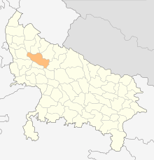
 Location of Badaun district in Uttar Pradesh | |
| Country | |
| State | Uttar Pradesh |
| Division | Bareilly |
| Headquarters | Badaun |
| Tehsils | 6 |
| Government | |
| • Lok Sabha constituencies | Badaun, Aonla (partly) |
| • Vidhan Sabha constituencies | 6 |
| Area | |
| • Total | 4,234 km2 (1,635 sq mi) |
| Population (2011) | |
| • Total | 3,127,621 |
| • Density | 740/km2 (1,900/sq mi) |
| • Urban | 826,000 |
| Demographics | |
| • Literacy | 52.91 per cent |
| Time zone | UTC+05:30 (IST) |
| Major highways | SH33, SH43, SH51, SH18, NH 93 |
| Website | https://badaun.nic.in/ |
History
This section may require cleanup to meet Wikipedia's quality standards. The specific problem is: second paragraph has grammar and punct problems, unidentified Indic script that is not in the source (which itself is quite poor), and has no point of reference in time (i.e., how it relates to the first paragraph from EB). (January 2020) |
After the original British takeover in 1801, this area was part of Moradabad district, although parts were then transferred into Bareilly district in 1805.[2] Then in October 1823, the district was created out of areas previously in both Moradabad and Bareilly districts, and it was originally called Sahaswan district after its headquarters of Sahaswan.[2] The headquarters were moved to Budaun in 1838.[2]
The Encyclopædia Britannica Eleventh Edition wrote of Budaun:[3]
A town and district of British India, in the Rohilkhand division of the United Provinces. The town is near the left bank of the river Sot. [The population as of] 1901 [was] 39,031. There are ruins of an immense fort and a very handsome mosque of imposing size, crowned with a dome, and built in 1223 in great part from the materials of an ancient Hindu temple. The American Methodist mission maintains several girls' schools, and there is a high school for boys. According to tradition, Badaun was founded about A.D. 905, and an inscription, probably of the 12th century, gives a list of twelve Rathor kings reigning at Badaun (called Vodamayuta). The first authentic historical event connected with it, however, was its capture by Kutb-ud-din in 1196, after which it became a very important post on the northern frontier of the Delhi empire. In the 13th century two of its governors, Shams-ud-din Altamsh, the builder of the great mosque referred to above, and his son Rukd-ud-din Firoz, attained the imperial throne. In 1571 the town was burnt, and about a hundred years later, under Shah Jahan, the seat of the governorship was transferred to Bareilly; after which the importance of Badaun declined.
It has been noted by Prof. Goti John that this city was named "Bedamooth" (बेदामूथ) in an ancient inscription (stone writeup, शिलालेख.) (inscription at Lucknow Museum). Then this region was called Panchal (पांचाल). According to the lines on Stone Writeup there was a village "Bhadaunlak" near the city. A Muslim Historian (इतिहासकार) Mr. Roz Khan Lodhi said that here the Ashoka - The Great built a Buddh Vihar & Quila (किला) and he named it BuddhMau (बुद्धमउ). Geographically Badaun City is located near holy river Ganges (गंगा).[4]
Economy
In 2006 the Ministry of Panchayati Raj named Budaun one of the country's 251 special funded cities (out of a total of 640).[5] It is one of the 34 districts in Uttar Pradesh currently receiving funds from the Backward Regions Grant Fund Programme (BRGF) In The Badaun.[5]
Divisions
The district comprises five tehsils: Budaun, Bisauli, Bilsi, Dataganj and Sahaswan.
There are six Vidhan Sabha constituencies in this district: Bisauli, Sahaswan, Bilsi, Badaun, Shekhupur and Dataganj. While Shekhupur and Dataganj are part of Aonla Lok Sabha constituency, rest are part of Badaun Lok Sabha constituency.
Demographics
| Year | Pop. | ±% p.a. |
|---|---|---|
| 1901 | 1,026,192 | — |
| 1911 | 1,054,293 | +0.27% |
| 1921 | 975,684 | −0.77% |
| 1931 | 1,010,467 | +0.35% |
| 1941 | 1,162,322 | +1.41% |
| 1951 | 1,251,152 | +0.74% |
| 1961 | 1,411,657 | +1.21% |
| 1971 | 1,645,967 | +1.55% |
| 1981 | 1,971,946 | +1.82% |
| 1991 | 2,448,338 | +2.19% |
| 2001 | 3,069,426 | +2.29% |
| 2011 | 3,681,896 | +1.84% |
| source:[6] | ||
According to the 2011 census Budaun district has a population of 3,681,896,[7] roughly equal to the nation of Liberia[8] or the US state of Oklahoma.[9] This gives it a ranking of 71st in India (out of a total of 640). The district has a population density of 718 inhabitants per square kilometre (1,860/sq mi). Its population growth rate over the decade 2001-2011 was 20.96%. Badaun has a sex ratio of 859 females for every 1000 males, and a literacy rate of 52.91%. After bifurcation, the district had a population of 3,127,621. Scheduled Castes make up 553,497 (17.70%) of the population.[7]
The major urban areas In the district according to March 2015 estimates are Budaun (3.97 lacs pop.), Ujhani (1.24 lacs pop.), Sahaswan (1.18 lacs pop.) and Kakrala (0.85 lacs pop.)
About 27% population of Budaun district is urban, 28% suburban and remaining 45% rural.
Religion
The majority of the population residing in Budaun is mainly from the two religions Hinduism and Islam. Moreover, Sikhs, Christians and Jains are also some other practiced religions in the region.[10]
Language
At the time of the 2011 Census of India, 89.98% of the population of the district spoke Hindi and 9.93% Urdu as their first language.[11]
Major settlements
Notable people
- Inayat Hussain Khan, Indian classical vocalist
- Kumar Prashant, District Magistrate
References
- "जिले के बारे में | ज़िला बदायूँ उत्तर प्रदेश सरकार | India" (in Hindi). Retrieved 27 October 2021.
- Nevill, H.R. (1907). Budaun: A Gazetteer, Being Volume XV Of The District Gazetteers Of The United Provinces Of Agra And Oudh. Allahabad: Government Press. pp. 97–100, 240. Retrieved 15 April 2021.
- Chisholm, Hugh, ed. (1911). . Encyclopædia Britannica. Vol. 4 (11th ed.). Cambridge University Press. p. 737.
- "District Budaun". badaun.nic.in. Archived from the original on 21 July 2011. Retrieved 1 May 2018.
- Ministry of Panchayati Raj (8 September 2009). "A Note on the Backward Regions Grant Fund Programme" (PDF). National Institute of Rural Development. Archived from the original (PDF) on 5 April 2012. Retrieved 27 September 2011.
- Decadal Variation In Population Since 1901
- "District Census Handbook: Budaun" (PDF). censusindia.gov.in. Registrar General and Census Commissioner of India. 2011.
- US Directorate of Intelligence. "Country Comparison:Population". Archived from the original on 27 September 2011. Retrieved 1 October 2011.
Liberia 3,786,764 July 2011 est.
- "2010 Resident Population Data". U. S. Census Bureau. Archived from the original on 1 January 2011. Retrieved 2011-09-30.
Oklahoma 3,751,351
- "Table C-01 Population by Religion: Uttar Pradesh". censusindia.gov.in. Registrar General and Census Commissioner of India. 2011.
- "Table C-16 Population by Mother Tongue: Uttar Pradesh". www.censusindia.gov.in. Registrar General and Census Commissioner of India.
External links
Places adjacent to Budaun district | ||||||||||||||||
|---|---|---|---|---|---|---|---|---|---|---|---|---|---|---|---|---|
| ||||||||||||||||
Authority control | |
|---|---|
| General |
|
| National libraries | |
На других языках
[de] Badaun (Distrikt)
Der Distrikt Badaun (Hindi बदायूँ जिला, Urdu ضلع بدایوں), oder Budaun,[1] ist ein Distrikt im nordindischen Bundesstaat Uttar Pradesh. Verwaltungssitz ist die Stadt Badaun.- [en] Budaun district
[ru] Бадаун (округ)
Бадаун (хинди बदायूँ जिला, англ. Badaun) — округ в индийском штате Уттар-Прадеш. Административный центр — город Бадаун. Площадь округа — 5168 км².Другой контент может иметь иную лицензию. Перед использованием материалов сайта WikiSort.org внимательно изучите правила лицензирования конкретных элементов наполнения сайта.
WikiSort.org - проект по пересортировке и дополнению контента Википедии