world.wikisort.org - India
Dakshin Dinajpur (Bengali pronunciation: [dokkʰiɳ dinadʒpur]) or South Dinajpur is a district in the Indian state of West Bengal, India. It was created on 1 April 1992 by the division of the erstwhile West Dinajpur District. The Headquarter (sadar) of the district is at Balurghat. It comprises two subdivisions: Balurghat and Gangarampur. According to the 2011 census, it is the third least populous district of West Bengal (out of 23).[1]
Dakshin Dinajpur | |
|---|---|
District | |
     Clockwise from top-left: Dargah of Shah Ata, Panchamukhi Shiva Temple in Aminpur, Manohali Zaimindar Bari, Mounds at Bangarh, Site of Usha and Aniruddha's Marriage | |
 Location of Dakshin Dinajpur in West Bengal | |
 Interactive Map Outlining Dakshin Dinajpur | |
| Country | |
| State | |
| Division | Malda |
| Headquarters | Balurghat |
| Government | |
| • Lok Sabha constituencies | Balurghat |
| • Vidhan Sabha constituencies | Kushmandi, Kumarganj, Balurghat, Tapan, Gangarampur, Harirampur |
| Area | |
| • Total | 2,162 km2 (835 sq mi) |
| Population (2021) | |
| • Total | 1,676,276 |
| • Urban | 236,295 |
| Demographics | |
| • Literacy | 82.36% |
| • Sex ratio | 950 |
| Time zone | UTC+05:30 (IST) |
| Major highways | NH 512 |
| Economy(2021) | 2% of GSDP
Nominal GSDP per capita |
| Website | ddinajpur |
History
The erstwhile Dinajpur District, at the time of the partition of India, was split up into West Dinajpur district and East Dinajpur. The East Dinajpur district, now called Dinajpur, became part of East Pakistan (now Bangladesh). The West Dinajpur district was enlarged in 1956, when States Reorganisation Act recommendations were implemented, with the addition of some areas of Bihar. The district was bifurcated into Uttar Dinajpur and Dakshin Dinajpur on 1 April 1992.[2][3]
Economy
Dakshin Dinajpur is predominantly an agricultural district with a large area of land under cultivation. The district is drained by north-south flowing rivers like Atreyee, Purnabhaba, Tangon and Jamuna River, to give rise to a sizeable, unorganised fishing community.
Dakshin Dinajpur is a "non-large scale industry" but there are a number of medium and small hand loom industries especially Gangarampur block. Internet access is available from most of the cities, even broadband connections are available. There is one State Highway with only 77 km of National Highway No. 512 in the district. A new railway line has been laid between Eklakhi and Balurghat, the district headquarters. Train services were started on 30 December 2004.
In 2006 the Ministry of Panchayati Raj named Dakshin Dinajpur one of the country's 250 most backward districts (out of a total of 640).[4] It is one of the eleven districts in West Bengal currently[when?] receiving funds from the Backward Regions Grant Fund Programme (BRGF).[4]
Divisions
Administrative subdivisions
The district comprises two subdivisions: Balurghat and Gangarampur at Buniadpur. Balurghat subdivision consists of Balurghat municipality and four community development blocks: Hili, Balurghat, Kumarganj and Tapan. Gangarampur subdivision consists of Gangarampur, Buniadpur municipalities and four community development blocks: Gangarampur, Bansihari, Harirampur and Kushmandi.[5] Balurghat is the district headquarters. There are nine police stations, eight development blocks, Three municipalities, 64 gram panchayats and 2317 villages in this district.[5][6]
Other than municipality area, each subdivision contains community development blocs which are divided into rural areas and census towns.[7]
Balurghat subdivision
- Balurghat: municipality
- Hili (Community development block) consists of rural areas only with 5 gram panchayats.
- Balurghat (Community development block) consists of rural areas only with 11 gram panchayats.
- Kumarganj (Community development block) consists of rural areas only with 8 gram panchayats.
- Tapan (Community development block) consists of rural areas only with 11 gram panchayats.
Gangarampur subdivision at Buniadpur
- Buniadpur : Municipality
- Gangarampur : Municipality
- Gangarampur (Community development block) consists of rural areas only with 11 gram panchayats.
- Bansihari (Community development block) consists of rural areas only with 4 gram panchayats.
- Harirampur (Community development block) consists of rural areas only with 6 gram panchayats.
- Kushmandi (Community development block) consists of rural areas only with 8 gram panchayats.
Assembly constituencies
As per order of the Delimitation Commission in respect of the delimitation of constituencies in the West Bengal, the district was divided into six assembly constituencies:[8]
| S No. | Name | Lok Sabha constituency | MLA | Party | |
|---|---|---|---|---|---|
| 37 | Kushmandi (SC) | Balurghat | Rekha Roy | All India Trinamool Congress | |
| 38 | Kumarganj | Toraf Hossain Mandal | All India Trinamool Congress | ||
| 39 | Balurghat | Ashok Lahiri | Bharatiya Janata Party | ||
| 40 | Tapan (ST) | Budhrai Tudu | Bharatiya Janata Party | ||
| 41 | Gangarampur (SC) | Satyendra Nath Ray | Bharatiya Janata Party | ||
| 42 | Harirampur | Biplab Mitra | All India Trinamool Congress | ||
Tapan constituency is reserved for ST candidates. Kushmandi and Gangarampur constituencies are reserved for SC candidates. Along with Itahar assembly constituency from Uttar Dinajpur district, the six assembly constituencies of this district form the Balurghat (Lok Sabha constituency).
Demographics
| Year | Pop. | ±% p.a. |
|---|---|---|
| 1901 | 340,163 | — |
| 1911 | 363,212 | +0.66% |
| 1921 | 319,170 | −1.28% |
| 1931 | 342,245 | +0.70% |
| 1941 | 383,042 | +1.13% |
| 1951 | 448,275 | +1.59% |
| 1961 | 563,598 | +2.32% |
| 1971 | 772,618 | +3.20% |
| 1981 | 989,294 | +2.50% |
| 1991 | 1,230,608 | +2.21% |
| 2001 | 1,503,178 | +2.02% |
| 2011 | 1,676,276 | +1.10% |
| source:[9] | ||
According to the 2011 census Dakshin Dinajpur district has a population of 1,676,276.[1] roughly equal to the nation of Guinea-Bissau.[10] or the US state of Idaho.[11] This gives it a ranking of 295th in India (out of a total of 640).[1] The district has a population density of 753 inhabitants per square kilometre (1,950/sq mi).[1] Its population growth rate over the decade 2001–2011 was 11.16%.[1] Dakshin Dinajpur has a sex ratio of 954 females for every 1000 males[1] and a literacy rate of 73.86%. Scheduled Castes and Scheduled Tribes make up 28.80% and 16.43% of the population respectively.[1]
Religion
| Religion | Population (1941)[13]: 88–91 | Percentage (1941) | Population (2011)[12] | Percentage (2011) |
|---|---|---|---|---|
| Islam |
136,873 | 38.61% | 412,788 | 24.63% |
| Hinduism |
135,299 | 38.16% | 1,232,850 | 73.55% |
| Tribal religion |
82,105 | 23.16% | 2,786 | 0.17% |
| Christianity |
146 | 0.04% | 24,794 | 1.48% |
| Others [lower-alpha 1] | 105 | 0.03% | 3,058 | 0.17% |
| Total Population | 354,528 | 100% | 1,676,276 | 100% |
Dakshin Dinajpur district has a majority Hindu population with over 73% people following Hinduism. Islam is the second-largest religion in the district with over 24% adherents. Christianity is followed by 1.48% of people. Muslims and Christians are almost entirely rural, and the urban population is nearly entirely Hindu. Muslims are a significant minority in Harirampur (49.00%) and Kushmandi (38.86%) CD blocks.
Languages
Bengali is the principal language of the district. The dialect of the region is variously known as Dinajpuri, Rangpuri or Rajbongshi.[15]
According to the 2011 census, 84.41% of the population spoke Bengali, 9.68% Santali, 1.31% Kurukh, 1.25% Sadri and 1.05% Hindi as their first language.[14]
Education
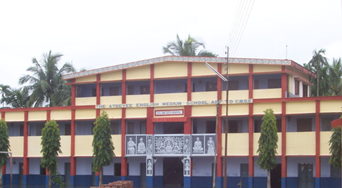
Dakshin Dinajpur University has started functioning from 2021. It is located at Mahinagar, Balurghat. There is a government nursing college at Balurghat. There is one JNV present.There is one D.A.V group school (Atreyee DAV Public School) and a Techno Group school at Balurghat. There are a few good schools in Balurghat and Gangarampur. There are four CBSE affiliated and one CISCE affiliated school in Balurghat. Of late, The Green View English Academy is the only CISCE affiliated school in the entire district. The Atreyee D.A.V Public School has earned several accolades, giving the entire district an honorable position in the academic map of the country. VVM Junior Level National Champion (2018–19), Saswata Bose, is a student of The ADAVPS. Many government schools exist throughout the district.
| Institution Type | Institution Name | Institution Location |
|---|---|---|
| University | Dakshin Dinajpur University | Balurghat |
| Agricultural Universities (India) | Uttar Banga Krishi Viswavidyalaya | Majhian |
| General College | Balurghat College | Balurghat |
| Balurghat Mahila Mahavidyalaya | Balurghat | |
| Buniadpur Mahavidyalaya | Buniadpur | |
| Dewan Abdul Goni College | Harirampur, West Bengal | |
| Gangarampur B.Ed College | Gangarampur | |
| Gangarampur College | Gangarampur | |
| Jamini Majumdar Memorial College | Patiram | |
| Kumarganj College | Kumarganj | |
| Kushmandi Government College | Kushmandi | |
| Nathaniyal Murmu Memorial College | Tapan, Dakshin Dinajpur | |
| S.B.S. Government College, Hili | Hili, Dakshin Dinajpur | |
| Jamini Majumdar Memorial College | Patiram | |
| Dakshin Dinajpur B.Ed College | Fulbari | |
| Balurghat B.Ed.College | Balurghat | |
| Vidyasagar College Of Education | Gangarampur | |
| Dakshin Dinajpur D.Ed College | Tapan, Dakshin Dinajpur | |
| Tebhaga Teachers Training College | Margram | |
| Bahadurpur B.Ed College | Dhkshin Bahadurpur | |
| Bangarh Scholar Teacher's Training Institute | Bolla | |
| Atryee College Of Education | Dangi | |
| Buniadpur Teachers' Training College | Buniadpur | |
| Polytechnic College | Gangarampur Government Polytechnic | Gangarampur |
| Hilli Government Polytechnic | Hili, Dakshin Dinajpur | |
| Industrial training institute | Banshihari Government ITI | Bansihari (community development block) |
| Balurghat Government ITI | Balurghat | |
| Harirampur Government ITI | Harirampur, West Bengal | |
| Hili Government ITI | Hili, Dakshin Dinajpur | |
| Kumarganj Government ITI | Kumarganj | |
| Tafijuddin Ahamed Memorial,Kushmandi Government ITI | Kushmandi | |
| Tapan Government ITI | Tapan, Dakshin Dinajpur | |
| Law College | Balurghat Law College | Balurghat |
| Nursing College | Nursing Training School Dakshin Dinajpur | Balurghat |
Tourist attractions
- Bangarh
- Kaldighi Park (Gangarampur)
- Gour Dighi
- Dhal Dighi
- Bolla Kali Temple
- Khanpur (Tebhaga movement)
- Radha Gobindo Mandir (Tapan)
- Sarongbari
- Mahipal Dighi[16][17]
References
- "District Census 2011". Census2011.co.in. 2011. Retrieved 30 September 2011.
- "Uttar Dinajpur Website". Government of India Portal. Retrieved 10 November 2008.
- "Historical Perspective". Official website of South Dinajpur district from Government of India Portal. Retrieved 10 November 2008.
- Ministry of Panchayati Raj (8 September 2009). "A Note on the Backward Regions Grant Fund Programme" (PDF). National Institute of Rural Development. Archived from the original (PDF) on 5 April 2012. Retrieved 27 September 2011.
- "Directory of District, Sub division, Panchayat Samiti/ Block and Gram Panchayats in West Bengal, March 2008". West Bengal. National Informatics Centre, India. 19 March 2008. Archived from the original on 25 February 2009. Retrieved 8 November 2008.
- "District Profile". Official website of the South Dinajpur district. Retrieved 9 November 2008.
- "Population, Decadal Growth Rate, Density and General Sex Ratio by Residence and Sex, West Bengal/ District/ Sub District, 1991 and 2001". West Bengal. Directorate of census operations. Archived from the original on 19 July 2011. Retrieved 9 November 2008.
- "Press Note, Delimitation Commission" (PDF). Assembly Constituencies in West Bengal. Delimitation Commission. Retrieved 18 November 2008.
- "Census of India Website : Office of the Registrar General & Census Commissioner, India". www.censusindia.gov.in.
- US Directorate of Intelligence. "Country Comparison: Population". Archived from the original on 13 June 2007. Retrieved 1 October 2011.
Guinea-Bissau 1,596,677 July 2011 est.
- "2010 Resident Population Data". U. S. Census Bureau. Archived from the original on 19 October 2013. Retrieved 30 September 2011.
Idaho 1,567,582
- "Table C-01 Population by Religion: West Bengal". censusindia.gov.in. Registrar General and Census Commissioner of India. 2011.
- "CENSUS OF INDIA, 1941 VOLUME VI BENGAL PROVINCE" (PDF). Retrieved 13 August 2022.
- "Table C-16 Population by Mother Tongue: West Bengal". www.censusindia.gov.in. Registrar General and Census Commissioner of India.
- Hernández-Campoy, Juan Manuel; Conde-Silvestre, Juan Camilo (15 February 2012). The Handbook of Historical Sociolinguistics. John Wiley & Sons. ISBN 9781118257265 – via Google Books.
- "DAKSHIN DINAJPUR - West Bengal Tourism, Experience Bengal, Dept. of Tourism, Govt. of W. B." wbtourism.gov.in. Retrieved 3 May 2022.
- "DAKSHIN DINAJPUR - Attractions & activities - West Bengal Tourism, Experience Bengal, Dept. of Tourism, Govt. of W. B." www.wbtourism.gov.in. Retrieved 4 May 2022.
- Including Jainism, Christianity, Buddhism, Zoroastrianism, Judaism, Ad-Dharmis, or not stated
External links
Places adjacent to Dakshin Dinajpur district | ||||||||||||||||
|---|---|---|---|---|---|---|---|---|---|---|---|---|---|---|---|---|
| ||||||||||||||||
Cities, towns and locations in Dakshin Dinajpur district, Malda division | ||||||
|---|---|---|---|---|---|---|
| Cities, municipal and census towns |
|  | ||||
| Locations other than cities and towns |
| |||||
| Related topics |
| |||||
Authority control | |
|---|---|
| General |
|
| National libraries | |
На других языках
[de] Dakshin Dinajpur
Dakshin Dinajpur (Dakshin bedeutet Süd) ist ein Distrikt im indischen Bundesstaat Westbengalen. Verwaltungssitz ist die Stadt Balurghat.- [en] Dakshin Dinajpur district
[ru] Южный Динаджпур
Южный Динаджпур или Дакшин-Динаджпур (англ. South Dinajpur, бенг. দক্ষিণ দিনাজপুর জেলা) — округ в индийском штате Западная Бенгалия. Образован 1 апреля 1992 года. Административный центр округа — Балургхат. Южный Динаджпур граничит с Бангладеш и с округами Малда и Северный Динаджпур.Другой контент может иметь иную лицензию. Перед использованием материалов сайта WikiSort.org внимательно изучите правила лицензирования конкретных элементов наполнения сайта.
WikiSort.org - проект по пересортировке и дополнению контента Википедии