world.wikisort.org - Bangladesh
Rajshahi Division (Bengali: রাজশাহী বিভাগ) is one of the eight first-level administrative divisions of Bangladesh. It has an area of 18,174.4 square kilometres (7,017.2 sq mi)[3] and a population at the 2011 Census of 18,484,858.[4] Rajshahi Division consists of 8 districts, 70 Upazilas (the next lower administrative tier) and 1,092 Unions (the lowest administrative tier).
Rajshahi Division
রাজশাহী বিভাগ | |
|---|---|
Divisions of Bangladesh | |
 Map of Rajshahi Division | |
 Districts of Rajshahi Division | |
| Coordinates: 25°00′N 89°00′E | |
| Country | |
| Capital | Rajshahi |
| Largest City | Rajshahi |
| Government | |
| • Divisional Commissioner | G. S. M. Jafarullah[1] |
| Area | |
| • Total | 18,174.4 km2 (7,017.2 sq mi) |
| Population (2011 census) | |
| • Total | 18,484,858 |
| • Density | 1,017/km2 (2,630/sq mi) |
| Demonym | Rajshahiyo |
| Time zone | UTC+6 (BST) |
| ISO 3166 code | BD-E |
| HDI (2017) | 0.602[2] medium |
| Notable sport teams | Rajshahi Kings, Rajshahi Division |
| Website | rajshahidiv |
The region has historically been dominated by various feudal Rajas, Maharajas and Zamindars.[5] Formerly comprising 16 districts, a new division (Rangpur Division) was formed with the 8 northern districts of the old Rajshahi Division from early 2010.[3]
Etymology and names
The Rajshahi Division is named after Rajshahi District. Dominated by various feudal Rajas, Maharajas and Zamindars of mixed origins throughout history,[5] the name is a compound of the words Raj and Shahi, both of which can be translated into reign or kingdom. Archaic spellings in the English language also included Rajeshae. The capital city of the division was formerly known as Rampur Boalia but was later renamed to Rajshahi too, to match the name of the district.
History
This section needs expansion. You can help by adding to it. (June 2021) |
Economy
Agriculture
Rajshahi is well known for its fruit, particularly for mango and lichi. Rajshahi also produces a lot of crops and vegetables like potato, carrot, rice, onion, wheat, sugarcane, pulses, spices, banana etc. Naogaon is known as the storehouse of food of Bangladesh.
Geography
Rajshahi lies in the west of Bangladesh. To its south is Khulna division, to its east is Dhaka and Mymensingh divisions, to its north is Rangpur division and to the west is West Bengal state of India.
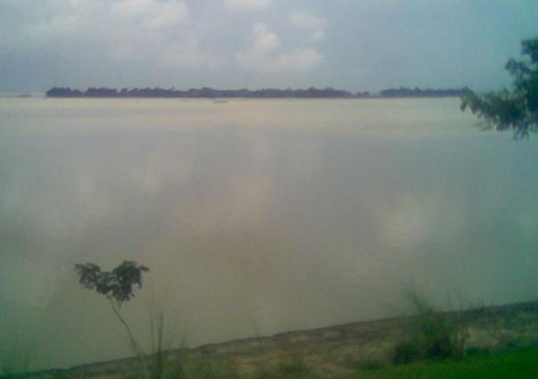
as seen from the highway
The country is entirely flat plains, with several tracts still covered by forest. The division is bordered by the Padma to its west, which forms the international border with India, and the Jamuna to the east. These rivers merge at the southeastern tip of Rajshahi division in Pabna district. Apart from these main rivers, there are numerous tributaries to these rivers such as the Atrai, Karatoya and Mahananda.
This section needs expansion. You can help by adding to it. (June 2021) |
Culture
This section needs expansion. You can help by adding to it. (June 2021) |
Historically Rajshahi division, being in the north-centre of the historical Bengal region, was a centre for Buddhist learning. In the early-modern period Rajshahi town was well known for silk weaving, and Rajshahi silk is still one of its most popular exports. The Varendra Research Museum in Rajshahi is the first of its kind in Bangladesh and houses numerous cultural artifacts from Bengal's ancient past.
Rajshahi division has produced contributions to Bengali literature. Rassundari Devi, the first modern autobiographer in Bengali literature, was born in Pabna, Rajshahi division in 1809.
All festivals of Bangladesh are widely celebrated here. Pohela Baisakh, Bengali New Year, Eid ul-Fitr, Eid ul-Adha, Durga Puja, are all celebrated widely.
Demographics
At the time of the 2011 census, Rajshahi division had a population of 18,484,858. Muslims are 17,248,861 which is 93.31% of the population, while Hindus are 1,081,584 which is 5.85% of the population. Other religions (almost entirely Christianity and indigenous faiths) are only 0.24% of the population and are mainly found among the ethnic minorities.[6]
The vast mass of people speak Bengali. The dialect of the region is similar to that in Malda and Murshidabad of West Bengal, called Varendri. It has more influence from Bihari languages. Ethnic population is 206,919 which is 1.12% of the population. This consists mainly of Munda peoples such as Santals and Mundas as well as the Dravidian Kurukh, who still speak their original languages.[6]
Points of interest
Rajshahi is a well known tourist destination within Bangladesh, with there being many interesting landmarks.
Notable places include:
- Sompur Bihar, a large Buddhist monastery.
- Varendra Research Museum in Rajshahi is one of the foremost museums specializing in history of ancient Bengal.
- Mahasthangarh, home to archaeological sites of Hindu, Buddhist and Muslim periods.
- Puthia Temple Complex and Palaces, the palaces of old Jamidars, some Kilometers drive from Rajshahi city.
- Bagha Mosque, in Bagha thana of Rajshahi District.
- Jamuna Bridge, Sirajganj District
- Uttara Gonobhaban, palace of the famous Queen of Dighapatia, located in Natore district.
- Nabaratna Temple, Sirajganj District
- Kusumba Mosque, Naogaon.
- Sona Mosque, Chapai Nawabgonj
- Chalan Beel, the largest water body in Bangladesh, spreading in Sirajganj, Natore and Pabna districts.
- Shahzadpur Kachharibari, Sirajganj District
Districts
Major cities and towns
The major cities of Rajshahi division are Rajshahi, Natore, Sirajganj, Pabna, Bogra and Chapai Nawabganj.
Education
The major educational institutes in Rajshahi are:
- University of Rajshahi (RU)
- Rajshahi University of Engineering and Technology (RUET)
- North Bengal International University (NBIU)
- Shah Makhdum Management University (SMMU)
- Rajshahi Medical College (RMC)
- EXIM Bank Agriculture University
- Bangladesh Army University of Engineering & Technology
- Rajshahi Science & Technology University[7]
- Shaheed Ziaur Rahman Medical College, Bogra
- Joypurhat Girls Cadet College, Joypurhat
- Rajshahi College
- Rajshahi Govt. City College, Rajshahi
- New Govt. Degree College, Rajshahi
- Rajshahi Cadet College
- Azizul Haque College, Bogra
- Bogra Zilla school
- Pabna Zilla school
- Pabna Cadet College
- Pabna Textile Engineering College
- Govt. Edward College, Pabna
- Pabna University of Science and Technology
- Pabna Medical College, Pabna
- Joypurhat Government College
- Shaheed M. Monsur Ali Medical College, Sirajganj
- Sirajgonj polytechnic Institute, Sirajganj
- Belkuchi Govt. College, Sirajganj
- G S K L High School, Belkuchi, Sirajgonj
- Seroil Government High School, Rajshahi (SGHS),Rajshahi
- Government Laboratory High School Rajshahi
- Rajshahi Collegiate School (RCS), Rajshahi
- Naogaon K.D. Government High School,Naogaon
The University of Rajshahi (established 1953) is the second largest university of Bangladesh with around 50 disciplines and 6 institutes. Rajshahi Collegiate School (established in 1828) is one of the oldest school in the country and Indian sub-continent which became again the best school in Bangladesh in 2018.
Notable residents
- Montazur Rahman Akbar, film-maker, grew up in Akkelpur.[8]
- Group Captain (Rtd.) Saiful Azam, fighter pilot, was Member of Parliament (MP) for Pabna-3 from 1991 to 1996.[9]
- Manzoor Alam Beg, photographer, was born in Rajshahi district in 1931.[10]
- Abdul Hamid Khan Bhashani[citation needed]
- Apu Biswas
- Mohammad Ali Bogra
- General Jayanto Nath Chaudhuri OBE, former Chief of Army Staff of the Indian Army.
- Pramatha Chaudhuri, writer
- Samson H. Chowdhury
- Zahid Hasan
- Amjad Hossain (Member of National Assembly of Pakistan), organiser of Liberation War of Bangladesh in 1971.
- A. B. Mirza Azizul Islam
- Taijul Islam
- Abdul Jalil
- James
- Air Vice Marshal (Rtd.) A. K. Khandker, first Chief of Staff of Bangladesh Air Force (1971–1975), Former Minister, Ministry Planning of People's Republic of Bangladesh
- Mahiya Mahi
- Amiya Bhushan Majumdar, Indian novelist
- Partha Pratim Majumder
- Bande Ali Mia, poet
- Bidya Sinha Saha Mim
- Mohammed Fazle Rabbee, cardiologist, intellectual, murdered in the intellectual killing during the 24 Dec 1971 genocide in Bangladesh
- Mushfiqur Rahim
- Arifur Rahman
- Engineer Habibur Rahman Professional IT Expert, Belkuchi, Sirajgonj
- Tarique Rahman
- Ziaur Rahman
- Khaleda Zia
References
- "List of Divisional Commissioners".
- "Sub-national HDI - Area Database - Global Data Lab". hdi.globaldatalab.org. Retrieved 2018-09-13.
- Sajahan Miah (2012). "Rajshahi Division". In Islam, Sirajul; Miah, Sajahan; Khanam, Mahfuza; Ahmed, Sabbir (eds.). Banglapedia: the National Encyclopedia of Bangladesh (Online ed.). Dhaka, Bangladesh: Banglapedia Trust, Asiatic Society of Bangladesh. ISBN 984-32-0576-6. OCLC 52727562. Retrieved 17 November 2022.
- "Population Census 2011: National Volume-1: Analytical Report" (PDF). Bangladesh Bureau of Statistics. p. 199. Retrieved February 9, 2016.
- Encyclopedia of Bangladesh pp 6
- "Population & Housing Census 2011 (Zila Series & Community Series)". Archived from the original on 2022-09-20. Retrieved 2021-07-23. See individual Zila files for religion and population information
- "Home". rgcc.ac.bd.
- একজন যোদ্ধার গল্প [The story of a warrior]. The Daily Ittefaq (in Bengali). 6 April 2017.
- "Oversee mosque construction to check recurrence of N'ganj-like incident: PM". UNB. 6 September 2016.
- Akter, Bayazid (2012). "Beg, MA". In Islam, Sirajul; Jamal, Ahmed A. (eds.). Banglapedia: National Encyclopedia of Bangladesh (Second ed.). Asiatic Society of Bangladesh.
External links
- E-Rajshahi, An online portal for information and government services managed by Rajshahi City Corporation
Places adjacent to Rajshahi Division | ||||||||||||||||
|---|---|---|---|---|---|---|---|---|---|---|---|---|---|---|---|---|
| ||||||||||||||||
Divisions of Bangladesh | |||||||||
|---|---|---|---|---|---|---|---|---|---|
| |||||||||


| Barisal Division |
|  |
|---|---|---|
| Chittagong Division | ||
| Dhaka Division | ||
| Khulna Division | ||
| Mymensingh Division | ||
| Rajshahi Division | ||
| Rangpur Division | ||
| Sylhet Division | ||
| Authority control |
|
|---|
На других языках
[de] Rajshahi (Division)
Die Division Rajshahi (Bengalisch: রাজশাহী বিভাগ, Rājśāhī bibhāg) ist eine von acht Verwaltungseinheiten Bangladeschs, die den Distrikten übergeordnet und nach ihrer jeweilig größten Stadt benannt sind. Die Fläche umfasst 18.194 km². Sie befindet sich im Nordwesten des Landes. Die Bevölkerungszahl der Division beträgt etwa 20 Mio. Einwohner. Die Verwaltungshauptstadt ist Rajshahi.- [en] Rajshahi Division
[ru] Раджшахи (область)
Раджшахи (бенг. রাজশাহী বিভাগ) — область Бангладеш, расположенная на северо-западе государства. Административный центр — город Раджшахи.Другой контент может иметь иную лицензию. Перед использованием материалов сайта WikiSort.org внимательно изучите правила лицензирования конкретных элементов наполнения сайта.
WikiSort.org - проект по пересортировке и дополнению контента Википедии