world.wikisort.org - Bangladesh
Meherpur (Bengali: মেহেরপুর, pron: meɦeɾpuɾ) is the northwestern district of Khulna Division in southwestern Bangladesh. It is bordered by the Indian state of West Bengal to the west, and by the Bangladeshi districts of Kushtia and Chuadanga to the east.[2] Pre-independence Meherpur was a subdivision of Nadia district.[3] The district has an area of 716.08 square kilometres (276.48 sq mi).
Meherpur District | |
|---|---|
District of Bangladesh | |
    Top:Mujibnagar Upazila,Bottom:Mujibnogor smritisoudho | |
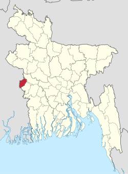 Location of Meherpur District in Bangladesh | |
 Expandable map of Meherpur District | |
| Coordinates: 23.75°N 88.70°E | |
| Country | |
| Division | Khulna Division |
| Area | |
| • Total | 716.08 km2 (276.48 sq mi) |
| Population (2011) | |
| • Total | 655,392 |
| • Density | 920/km2 (2,400/sq mi) |
| Demonym | Meherpur |
| Time zone | UTC+06:00 (BST) |
| Postal code | 7100 |
| HDI (2019) | 0.644[1] medium · 5th of 20 |
| Website | meherpur |
History
According to Ashraf Siddiqui, the district is named after the 16th century dervish Meher Ali Shah.
The Provisional Government of Bangladesh was formed and solemnly sworn in Meherpur's Baidyanathtala village (later renamed as Mujibnagar), on 17 April 1971 under the leadership of Tajuddin Ahmed and Syed Nazrul Islam. The entire Proclamation ceremony was organised by local leaders under the supervision of Momeen Chowdhury and MM Rustom Ali.[4] After that day on 18 April 1971, the Pakistani Army killed 8 people in Amjhupi village. Meherpur became a district in 1983.[4]
Administration
Meherpur district is divided into three upazilas: Gangni Upazila, Meherpur Sadar Upazila and Mujibnagar Upazila.
Demographics
| Year | Pop. | ±% p.a. |
|---|---|---|
| 1974 | 325,314 | — |
| 1981 | 401,727 | +3.06% |
| 1991 | 491,917 | +2.05% |
| 2001 | 591,436 | +1.86% |
| 2011 | 655,392 | +1.03% |
| Sources:[5] | ||
According to the 2011 Bangladesh census, Meherpur District had a population of 655,392, of which 324,634 were males and 330,758 females. Rural population was 571,999 (87.28%) and urban population was 83,393 (12.72%). Meherpur had a literacy rate of 46.27% for the population 7 years and above: 46.87% for males and 45.69% for females.[5]
| Religion | Population (1941)[6]: 84–85 | Percentage (1941) | Population (2011)[5] | Percentage (2011) |
|---|---|---|---|---|
| Islam |
109,443 | 70.94% | 640,751 | 97.77% |
| Hinduism |
41,487 | 26.89% | 7,870 | 1.20% |
| Christianity |
3,104 | 2.01% | 6,627 | 1.01% |
| Others [lower-alpha 2] | 240 | 0.16% | 144 | 0.02% |
| Total Population | 154,274 | 100% | 655,392 | 100% |
Muslims formed 97.77% of the population, Hindus 1.20%, and Christians 1.01%. Other religions were 0.02%.[5]
Economy
Main sources of income: Agriculture 68.95%, non-agricultural labourer 3.24%, industry 0.87%, commerce 13.83%, transport and communication 2.21%, service 3.81%, construction 1.03%, religious service 0.14%, rent and remittance 0.59% and others 5.33%.[2]
See also
- Mujibnagar Upazila
- Districts of Bangladesh
References
- "Sub-national HDI - Area Database - Global Data Lab". hdi.globaldatalab.org. Retrieved 2020-03-18.
- Md Abu Hasan Farooque (2012). "Meherpur District". In Islam, Sirajul; Miah, Sajahan; Khanam, Mahfuza; Ahmed, Sabbir (eds.). Banglapedia: the National Encyclopedia of Bangladesh (Online ed.). Dhaka, Bangladesh: Banglapedia Trust, Asiatic Society of Bangladesh. ISBN 984-32-0576-6. OCLC 52727562. Retrieved 8 October 2022.
- "Nadia keeps a date with history | Kolkata News". The Times of India. Aug 19, 2011. Retrieved 2022-02-23.
- Sajahan Miah (2012). "Proclamation of Independence". In Sirajul Islam and Ahmed A. Jamal (ed.). Banglapedia: National Encyclopedia of Bangladesh (Second ed.). Asiatic Society of Bangladesh.
- "Bangladesh Population and Housing Census 2011 Zila Report – Meherpur" (PDF). bbs.gov.bd. Bangladesh Bureau of Statistics.
- "CENSUS OF INDIA, 1941 VOLUME VI BENGAL PROVINCE" (PDF). Retrieved 13 August 2022.
- Meherpur and Gangani thanas of Nadia district
- Including Jainism, Christianity, Buddhism, Zoroastrianism, Judaism, Ad-Dharmis, or not stated
| Upazilas |
| |
|---|---|---|
| Constituencies |
| |
| Attractions and sites |
| |
| Rivers | ||
| Inhabited areas |
| |
| Educational institutions |
| |
| History |
| |
| Barisal Division |  | |
|---|---|---|
| Chittagong Division | ||
| Dhaka Division |
| |
| Khulna Division | ||
| Mymensingh Division | ||
| Rajshahi Division | ||
| Rangpur Division | ||
| Sylhet Division | ||
Authority control | |
|---|---|
| General | |
| National libraries | |
| Other |
|
This Khulna Division location article is a stub. You can help Wikipedia by expanding it. |
На других языках
- [en] Meherpur District
[ru] Мехерпур (округ)
Мехерпур (бенг. মেহেরপুর জেলা, англ. Meherpur District) — округ на западе Бангладеш, в области Кхулна. Образован в 1984 году из части округа Куштия. Административный центр — город Мехерпур. Площадь округа — 716 км². По данным переписи 2001 года население округа составляло 579 531 человек. Уровень грамотности взрослого населения составлял 25,23 %, что значительно ниже среднего уровня по Бангладеш (43,1 %). 97,5 % населения округа исповедовало ислам, 1,28 % — индуизм и 1,17 % — христианство.Другой контент может иметь иную лицензию. Перед использованием материалов сайта WikiSort.org внимательно изучите правила лицензирования конкретных элементов наполнения сайта.
WikiSort.org - проект по пересортировке и дополнению контента Википедии