world.wikisort.org - Bangladesh
Natore district is a district of Rajshahi Division located in northern Bangladesh.[3] It borders the metropolitan city of Rajshahi, and used to be part of Rajshahi district.
This article needs additional citations for verification. (May 2021) |
Natore district
নাটোর | |
|---|---|
District of Bangladesh | |
     Clockwise from top-left: Uttara Gano Bhaban, Chalan Beel, Gosai Akhra, Halti Beel, Natore Rajbari | |
 Location of Natore in Bangladesh | |
 Expandable map of Natore | |
| Coordinates: 24.41°N 88.93°E | |
| Country | |
| Division | Rajshahi |
| Government | |
| • Deputy Commissioner | Md. Shamim Ahmed |
| Area | |
| • Total | 1,900.05 km2 (733.61 sq mi) |
| Population (2011 census)[1] | |
| • Total | 1,706,673 |
| • Density | 900/km2 (2,300/sq mi) |
| Time zone | UTC+06:00 (BST) |
| Postal code | 6400 |
| HDI (2019) | 0.612[2] medium · 9th of 21 |
History
Natore was the District Headquarters of Rajshahi from 1769 to 1825.[4] Administrative Natore subdivision was established in 1825 under Rajshahi district, on the eve of the shifting of the headquarters.
During the Bangladesh Liberation War in 1971, a battle was fought between the Pakistani army and the freedom fighters of Mukti Bahini on March 29. About 40 members of the Pakistani army including Major Aslam and Captain Ishaq were killed. On 5 May 1971 Pakistani Army killed 42 employees of North Bengal Sugar Mills (Lalpur) including the general manager of the mill, Lieutenant Anwarul Azim. They were killed near a pond in the mill campus. The pond is now known as Shaheed Sagar, and there is a memorial beside the pond.[citation needed]
Geography
This section does not cite any sources. (May 2021) |
Most parts of Natore district are plain land. Chalan Beel, the largest beel in Bangladesh, is in part of Natore district.
Natore District is 1,896.05 km2 (732.07 sq mi). It is bordered by Naogaon and Bogra districts to the north, Pabna and Kushtia districts to the south, Pabna and Sirajganj districts to the east, and Rajshahi district to the west. The road distance from Natore to Dhaka is 220 kilometres. Lalpur is the lowest Average annual rainfall area of Bangladesh.[citation needed]
Etymology
In 1845, Natore Mahakuma was established. The Natore Municipality was established in 1869.[citation needed]
Economy
This section does not cite any sources. (May 2021) |
The economy of Natore is based on agriculture.
There are 2 sugar mills in Natore; North Bengal Sugar Mills Limited and Natore Sugar Mills Limited. They are the enterprises of the Bangladesh Sugar & Food Industries Corporation. Pran Agro Ltd., Ekdala, Natore Sadar (2005) is a private food manufacturing plant of Pran-RFL Group. Jamuna Distillery Limited (1995) is another private industry of Jamuna Group. The distillery produces industrial alcohol, and is situated near Natore Sugar Mills Limited.
Hats, bazaars and fairs
The total number of hats and bazaars are 152. There are 13 fairs. Tebaria Hat, (which is situated 3 km from Natore town) is a traditional hat which sits every Sunday. Tebaria is one of the biggest hats of Natore and Bangladesh.

Demographics
| Year | Pop. | ±% p.a. |
|---|---|---|
| 1974 | 858,619 | — |
| 1981 | 1,067,058 | +3.15% |
| 1991 | 1,387,761 | +2.66% |
| 2001 | 1,521,336 | +0.92% |
| 2011 | 1,706,673 | +1.16% |
| Sources:[1] | ||
According to the 2011 Bangladesh census, Natore District had a population of 1,706,673, of which 854,183 were males and 852,490 females. Rural population was 1,478,665 (86.64%) while the urban population was 228,008 (13.36%). Natore district had a literacy rate of 49.59% for the population 7 years and above: 51.90% for males and 47.29% for females.[1]
| Religion | Population (1941)[5]: 88–89 | Percentage (1941) | Population (2011)[1] | Percentage (2011) |
|---|---|---|---|---|
| Islam |
276,237 | 74.02% | 1,590,919 | 93.22% |
| Hinduism |
85,731 | 22.97% | 103,747 | 6.08% |
| Tribal religion |
9,863 | 2.64% | 3,946 | 0.23% |
| Christianity |
855 | 0.23% | 8,054 | 0.47% |
| Others [lower-alpha 2] | 499 | 0.14% | 7 | 0.00% |
| Total Population | 373,185 | 100% | 1,706,673 | 100% |
Muslims make up 93.22% of the population, while Hindus are 6.08% of the population. The Muslim population has constantly increased, while the Hindu population has generally decreased. The ethnic population is 11,912, mainly Santals and Oraons.[1]
Administrative structure
Upazilas
Natore was the district headquarters of Rajshahi from 1769–1825. At the eve of that replacement, Natore was declared as a Subdivision. That event made Natore the first Subdivision of Bangladesh. Natore was established as a district in 1984.

There are seven upazilas in the district:[3][6]
- Bagatipara Upazila
- Baraigram Upazila
- Gurudaspur Upazila
- Lalpur Upazila
- Naldanga Upazila
- Natore Sadar Upazila
- Singra Upazila
Pourasavas
There are eight pourasavas in Natore district, 4 of them being the seat of upazilas (sub-districts). They are:[citation needed]
- Bagatipara (Bagatipara upazila)
- Bonpara (Baraigram upazila)
- Boraigram (Baraigram Upazila)
- Gurudaspur
- Lalpur Upazila
- Naldanga (Naldanga Upazila)
- Natore
- Singra
Natore town
The town has a population of 120,000; male population percentage is 51.57%, female population percentage is 48.43%. The density of population is 4,825.[citation needed] Chalkbuddhnath, Station bajar, Borgasa, Alaipur, Kanaikhali, Nichabazar, Lalbazar, Madrasamor, Bongojal are the most populated areas of Natore Town. The mayor is Uma Choudhury.[citation needed]
Administration
This section does not cite any sources. (May 2021) |
The Deputy Commissioner is Mohammad Shamim Ahmed . The Superintendent of Police is Liton Kumar Shaha and the Administrator of Zila Porishod is Advocate Sajedur Rahman Khan Chowdhury.
Points of interest
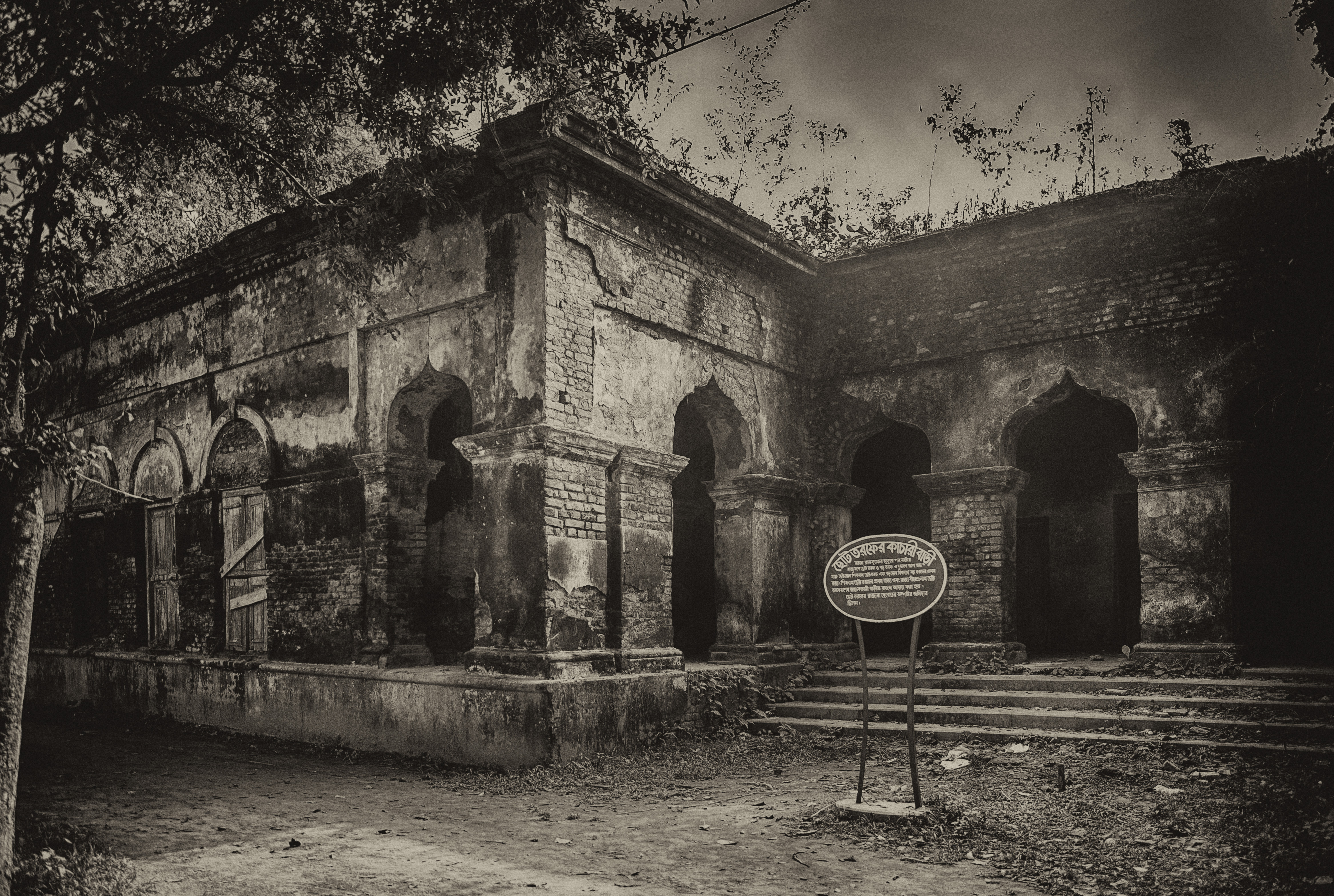
Tourist attractions in Natore include Rani Bhabanir Rajbari, the palace of Rani Bhabani of Natore.[7] It is a historical palace, situated in the Bongojol area nearby Natore zero (Madrasamore/old bus stand). There is a college and schools named after Rani Bhobani.
Chalan Beel is a large natural wetland. During the monsoon, the area of the Bil increases and touches four upazilas (sub-districts) of the district. The picnic parties come to Cholon Bil every season.
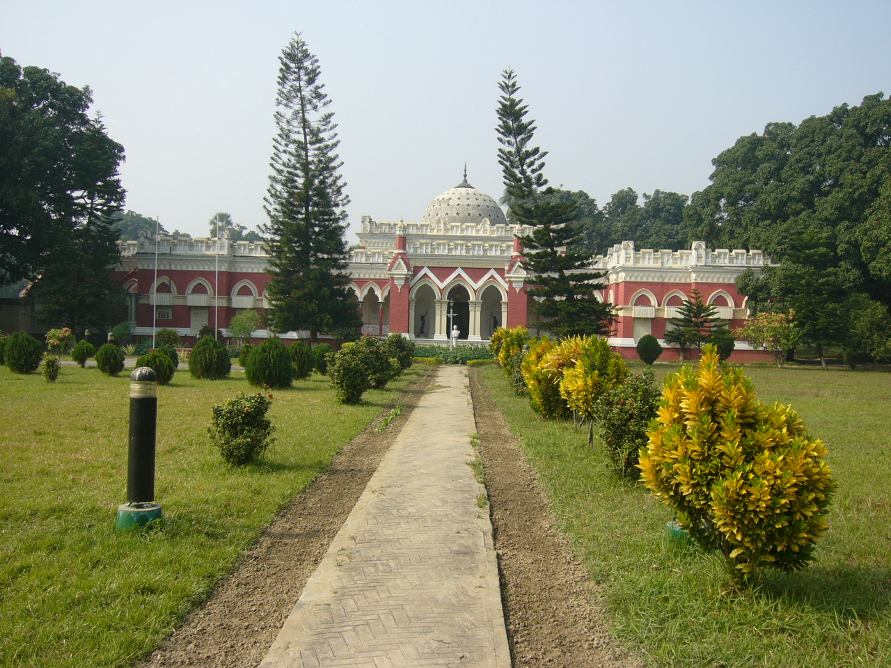
Uttara Gonobhaban (formerly known as Dighapotia Rajbari) is the former residence of the kings of Natore. Today it is the official residence of the Prime Minister in North Bengal.[citation needed]
Notable persons
- Maharaja Jagadindra Nath Roy Bahadur (1868–1925) known as the Maharaja of Natore was a noted Jamindar of Natore from Bengal. He is also noted for his contribution to the game of cricket in British India.[8][9]
- Rani Bhabani (1715–1802) was an independent Jamindar of Natore during 1748-1802 British India.[10]
- Madar Bux (1907 – January 20, 1967) was a Bengali politician. He served in the northern city of Rajshahi
- Ashraf Ali Khan Chowdhury - Bengali lawyer and politician
- Taijul Islam Bangladeshi cricketer
- Zunaid Ahmed Palak – MP
- Farida Parveen, Bangladeshi folk singer
- Sarat Kumar Rai (1876–1946)
- Shankar Gobind Chowdhury is a Bangladesh Awami League politician and the former Member of Parliament of Natore-2. He was the organizer of the Liberation War of Bangladesh.
- M. M. Rahmatullah was a bureaucrat and politician. He was the former Chief Engineer of the Public Works Department and later the chairman of the Capital Development Authority of the Government of Bangladesh. In 2000, he was an electoral candidate from Natore Area for the Parliament of Bangladesh (village-Hulhulia).
- Jadunath Sarkar (1870–1958)
- Banalata Sen of Natore (fictional character)
- Sultana Zaman[11]
See also
- Zamindar of Natore
- Singra Natore Family
- Maharajas of Dighapatia
- Maharajas of Natore
- Rajshahi Division
- Districts of Bangladesh
Notes
- Natore subdivision of Rajshahi district
- Including Jainism, Buddhism, Zoroastrianism, Judaism, Ad-Dharmis, or not stated
References
- "Bangladesh Population and Housing Census 2011 Zila Report – Natore" (PDF). bbs.gov.bd. Bangladesh Bureau of Statistics.
- "Sub-national HDI - Area Database - Global Data Lab". hdi.globaldatalab.org. Retrieved 18 March 2020.
- Md. Rezaul Karim (2012). "Natore District". In Sirajul Islam and Ahmed A. Jamal (ed.). Banglapedia: National Encyclopedia of Bangladesh (Second ed.). Asiatic Society of Bangladesh.
- Natorer Gaurab (The Glory of Natore), edited by Md. Mokshuder Rahman, A Publication of Natore District Administration, December 1989.
- "CENSUS OF INDIA, 1941 VOLUME VI BENGAL PROVINCE" (PDF).
- Mohammad Zakaria (21 May 2014). "59.47% vote in 6th phase upazila polls". Dhaka Tribune. Retrieved 23 November 2014.
- ABM Mahmood (2012). "Rani Bhabani". In Sirajul Islam and Ahmed A. Jamal (ed.). Banglapedia: National Encyclopedia of Bangladesh (Second ed.). Asiatic Society of Bangladesh.
- Mukherji, Raju, Eden Gardens Legend & Romance: Eden Gardens, the heritage cricket venue, celebrated 150 years. Kolkatatoday.com. Retrieved 16 April 2017.
- Division, Bangladesh Ministry of Cabinet Affairs Establishment; Ishaq, Muhammad. Bangladesh District Gazetteers: Rajshahi 1976. Bangladesh Government Press. pp. 240–41. Retrieved 22 April 2017.
- William Hunter, Annals of Rural Bengal.
- Akhter, Shamima (2012). "Zaman, Sultana". In Islam, Sirajul; Jamal, Ahmed A. (eds.). Banglapedia: National Encyclopedia of Bangladesh (Second ed.). Asiatic Society of Bangladesh.
| Barisal Division |
|  |
|---|---|---|
| Chittagong Division | ||
| Dhaka Division | ||
| Khulna Division | ||
| Mymensingh Division | ||
| Rajshahi Division | ||
| Rangpur Division | ||
| Sylhet Division | ||
Authority control | |
|---|---|
| General | |
| National libraries | |
| Other |
|
На других языках
- [en] Natore District
[ru] Натор (округ)
Натор (бенг. নাটোর জেলা, англ. Natore District) — округ на западе Бангладеш, в области Раджшахи. Образован в 1984 году. Административный центр — город Натор. Площадь округа — 1896 км². По данным переписи 2001 года население округа составляло 1 521 359 человек. Уровень грамотности взрослого населения составлял 27 %, что значительно ниже среднего уровня по Бангладеш (43,1 %). 90,47 % населения округа исповедовало ислам, 8,47 % — индуизм.Другой контент может иметь иную лицензию. Перед использованием материалов сайта WikiSort.org внимательно изучите правила лицензирования конкретных элементов наполнения сайта.
WikiSort.org - проект по пересортировке и дополнению контента Википедии