world.wikisort.org - Bangladesh
Jhalokati, also spelled Jhalokathi, (Bengali: ঝালকাঠি) is a district in southern Bangladesh.[2] It is located in the Barisal Division and covers an area of 758.06 km2 It is bounded by Barisal district to the north and east, Barguna district and the Bishkhali river in the south, Lohagara Upazila and Pirojpur district to the west. Annual average temperatures: maximum 33.3 °C, minimum 12.1 °C; annual rainfall 2506 mm. The main rivers in this district are Bishkhali, Dhanshiri, Gabkhan, Sugandha, Jangalia, Bamanda and Bajitpur. "পেয়ারা আর শীতলপাটি, এই নিয়ে ঝালকাঠি" "(Jhalokathi, The land of tasty Guava and Shitolpati)" is the official moto of the district.[3]
Jhalokati
ঝালকাঠি | |
|---|---|
District | |
    From top: Jhalokati Sadar Road, Kirtipasha Zamindar Bari Ruins and Jhalokathi N S Kamil Madrasah Complex | |
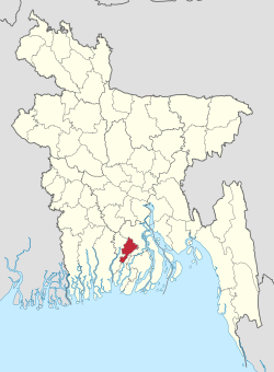 Location of Jhalokati in Bangladesh | |
 Expandable map of Jhalokati District | |
| Coordinates: 22.6431°N 90.2000°E | |
| Country | |
| Division | Barisal Division |
| Government | |
| • Deputy Commissioner | Md. Johar Ali |
| Area | |
| • Total | 758.06 km2 (292.69 sq mi) |
| Population (2011 census) | |
| • Total | 682,669 |
| • Density | 900/km2 (2,300/sq mi) |
| Time zone | UTC+06:00 (BST) |
| HDI (2018) | 0.672[1] medium · 2nd of 21 |
| Website | www |
History
The 2021 Bangladesh ferry fire occurred on the Sugandha River near the town.[4]
Subdivisions
The district is administratively subdivided into 4 upazilas, these are:
Administration
Zilla Parishad Chairman/Administrator: Khan Saifullah Panir (খান সাইফুল্লাহ পনির) [5]
Deputy Commissioner (DC): Md. Johar Ali [6][7]
Transportation
- Roads & Highways:
- Rural communications: Water transport is a major attraction in Jhalokati district. People can travel at a cheap cost by boats and various types of engine boats. Jhalokati is famous for beautiful rivers and canals like Barishal. Tourists can find it enjoyable to travel through boats.
Population
| Year | Pop. | ±% p.a. |
|---|---|---|
| 1974 | 496,791 | — |
| 1981 | 583,102 | +2.31% |
| 1991 | 666,139 | +1.34% |
| 2001 | 694,231 | +0.41% |
| 2011 | 682,669 | −0.17% |
| Sources:[8] | ||
According to the 2011 Bangladesh census, the district had a population of 682,669, of which 329,147 were males and 353,522 females. Rural population was 570,666 (83.59%) while urban population was 112,003 (16.41%). The literacy rate is 66.68% for 7 years and above: 67.59% for males and 65.84% for females.[8]
Religion
| Religion | Population (1941)[9]: 100–101 | Percentage (1941) | Population (2011)[8] | Percentage (2011) |
|---|---|---|---|---|
| Islam |
252,292 | 64.09% | 613,750 | 89.90% |
| Hinduism |
141,259 | 35.89% | 68,572 | 10.04% |
| Others [lower-alpha 2] | 82 | 0.02% | 347 | 0.06% |
| Total Population | 393,633 | 100% | 682,669 | 100% |
A large majority of the district population is Muslim. It has 2475 mosques, 46 Hindu temples and five Buddhist pagodas. The percentage share of minority Hindus and Christians have seen a decline in absolute numbers since the 1981 census.
Media
Print media:
- Prothom Alo (National)
- Kaler kantho (National)
- Samakal (National)
- The Daily Star (National)
Telecommunications:
- BTCL
- Bangla Link
- Teletalk
- Grameen Phone
- Robi etc.
Satellite Television:
- Akash dth.
Notable personalities
- Nachiketa Chakraborty, famous Tollywood singer's family hails from Chechri Rampur village in Kathalia Upazila[10]
See also
- Districts of Bangladesh
- Barisal Division
- Abhaynil
Notes
- Nalchiti, Jhalokati, Rajapur and Kathalia thanas of Bakerganj district
- Including Jainism, Christianity, Buddhism, Zoroastrianism, Judaism, Ad-Dharmis, or not stated
References
- "Sub-national HDI - Area Database - Global Data Lab". hdi.globaldatalab.org. Retrieved 18 March 2020.
- Rahman, Humayun (2012). "Jhalokati District". In Islam, Sirajul; Jamal, Ahmed A. (eds.). Banglapedia: National Encyclopedia of Bangladesh (Second ed.). Asiatic Society of Bangladesh.
- ছবিতে জেলা ব্র্যান্ডিং [District Branding]. Jhalokati District (in Bengali).
- "Bangladesh: Death toll rises to 41 in ferry fire on Sugandha River". Free Press Journal. Retrieved 30 December 2021.
- "ভোট ছাড়াই চেয়ারম্যান হচ্ছেন ১৯ জন". Jugantor. 16 September 2022.
- "List of Deputy Commissioners". Ministry of Public Administration.
- "Officers: Deputy Commissioner's Office".
- "Bangladesh Population and Housing Census 2011 Zila Report – Jhalokati" (PDF). bbs.gov.bd. Bangladesh Bureau of Statistics.
- "CENSUS OF INDIA, 1941 VOLUME VI BENGAL PROVINCE" (PDF). Retrieved 13 August 2022.
- "Shekorer taane Nachiketa ghure gelen Nachiketa". amaderbarisal.com. 18 November 2014. Retrieved 22 September 2019.
| Upazila |  | |
|---|---|---|
| Thana |
| |
| Municipalities | ||
| Barisal Division |  | |
|---|---|---|
| Chittagong Division | ||
| Dhaka Division |
| |
| Khulna Division | ||
| Mymensingh Division | ||
| Rajshahi Division | ||
| Rangpur Division | ||
| Sylhet Division | ||
Authority control | |
|---|---|
| General | |
| National libraries | |
This Barisal Division location article is a stub. You can help Wikipedia by expanding it. |
На других языках
[de] Jhalokathi (Distrikt)
Der Diatrikt Jhalokathi (bengalisch ঝালকাঠি জেলা) ist ein Verwaltungsdistrikt im südlichen Bangladesch, der innerhalb der Division Barishal, der übergeordneten Verwaltungseinheit, liegt. Die im Hauptstadt des Distrikts bildet die gleichnamige Stadt Jhalokathi. Die Gesamtfläche des Distrikt beträgt 707 km². Der Distrikt setzt sich aus den 4 Upazilas Jhalakati Sadar, Kanthalia, Nalchiti und Rajapur zusammen. Jhalokati entstand 1972 als Unterabteilung des Distrikt Barishal und wurde am 1. Februar 1984 zu einem eigenständigen Distrikt aufgewertet.- [en] Jhalokati District
[ru] Джалокати (округ)
Джалокати (бенг. ঝালকাঠি জেলা, англ. Jhalokati District) — округ на юге Бангладеш, в области Барисал. Образован в 1984 году. Административный центр — город Джалокати. Площадь округа — 758 км². По данным переписи 2001 года население округа составляло 696 055 человек. Уровень грамотности взрослого населения составлял 51,2 %, что выше среднего уровня по Бангладеш (43,1 %). Религиозный состав населения: мусульмане — 87,31 %, индуисты — 12,64 %.Другой контент может иметь иную лицензию. Перед использованием материалов сайта WikiSort.org внимательно изучите правила лицензирования конкретных элементов наполнения сайта.
WikiSort.org - проект по пересортировке и дополнению контента Википедии