world.wikisort.org - Bangladesh
Magura (Bengali: মাগুরা) is a district in south-western Bangladesh, situated 176 kilometers from Dhaka. It is a part of Khulna Division.[3] The main mode of transportation is by bus, and no train transport is available.[citation needed]
This article needs additional citations for verification. (October 2009) |
Magura district
মাগুরা | |
|---|---|
District of Bangladesh | |
 Fields in Magura | |
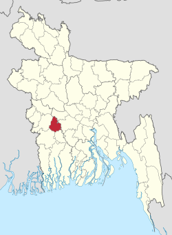 Location of Magura District in Bangladesh | |
 Expandable map of Magura District | |
| Coordinates: 23.40°N 89.40°E | |
| Country | |
| Division | Khulna Division |
| Government | |
| • Deputy Commissioner | Ashraful Alam |
| Area | |
| • Total | 1,048.61 km2 (404.87 sq mi) |
| Population (2011 census) | |
| • Total | 918,419 |
| • Density | 880/km2 (2,300/sq mi) |
| Literacy rate | |
| • Total | 50.6%[1] |
| Time zone | UTC+06:00 (BST) |
| Postal code | 7600 |
| HDI (2019) | 0.660[2] medium · 2nd of 20 |
Administration
Magura district has 4 upazilas. They are:
Geography
Magura District (Khulna Division) with an area of 1048 km2, is bounded by Rajbari district to the north, Jessore and Narail districts to the south, Faridpur district to the east and Jhenaidah district to the west. The district is flat plain in the heart of the Ganges Delta.
Climate
| Climate data for Magura | |||||||||||||
|---|---|---|---|---|---|---|---|---|---|---|---|---|---|
| Month | Jan | Feb | Mar | Apr | May | Jun | Jul | Aug | Sep | Oct | Nov | Dec | Year |
| Average high °C (°F) | 23.4 (74.1) |
27.7 (81.9) |
33.3 (91.9) |
35.6 (96.1) |
34.8 (94.6) |
32.4 (90.3) |
31.4 (88.5) |
31.4 (88.5) |
32.2 (90.0) |
31.4 (88.5) |
28.9 (84.0) |
25.5 (77.9) |
30.7 (87.2) |
| Daily mean °C (°F) | 16.4 (61.5) |
20.2 (68.4) |
26.0 (78.8) |
29.2 (84.6) |
29.6 (85.3) |
28.9 (84.0) |
28.4 (83.1) |
28.6 (83.5) |
28.8 (83.8) |
27.3 (81.1) |
23.2 (73.8) |
18.7 (65.7) |
25.4 (77.8) |
| Average low °C (°F) | 9.4 (48.9) |
12.8 (55.0) |
18.7 (65.7) |
22.9 (73.2) |
24.5 (76.1) |
25.5 (77.9) |
25.5 (77.9) |
25.8 (78.4) |
25.6 (78.1) |
23.3 (73.9) |
17.5 (63.5) |
12.0 (53.6) |
20.3 (68.5) |
| Average precipitation mm (inches) | 11 (0.4) |
19 (0.7) |
40 (1.6) |
85 (3.3) |
183 (7.2) |
323 (12.7) |
302 (11.9) |
288 (11.3) |
242 (9.5) |
156 (6.1) |
25 (1.0) |
7 (0.3) |
1,681 (66) |
| Average relative humidity (%) | 45 | 35 | 32 | 48 | 66 | 74 | 75 | 74 | 71 | 66 | 47 | 44 | 56 |
| Source: National newspapers | |||||||||||||
Demographics
| Year | Pop. | ±% p.a. |
|---|---|---|
| 1974 | 516,711 | — |
| 1981 | 610,698 | +2.42% |
| 1991 | 724,027 | +1.72% |
| 2001 | 824,311 | +1.31% |
| 2011 | 918,419 | +1.09% |
| Sources:[4] | ||
According to the 2011 Bangladesh census, Magura District had a population of 918,419, of which 454,739 were males and 463,380 females. Rural population was 798,005 (86.89%) and urban population was 120,414 (13.11%). Magura had a literacy rate of 50.24% for the population 7 years and above: 52.87% for males and 46.31% for females.[4]
| Religion | Population (1941)[5]: 86–87 | Percentage (1941) | Population (2011)[4] | Percentage (2011) |
|---|---|---|---|---|
| Islam |
183,266 | 59.74% | 753,199 | 82.01% |
| Hinduism |
122,782 | 40.02% | 164,578 | 17.92% |
| Others [lower-alpha 2] | 726 | 0.24% | 642 | 0.07% |
| Total Population | 306,774 | 100% | 918,419 | 100% |
Muslims are 82.01% of the population while Hindus are 17.92% of the population. The Hindu population has stayed constant since 1981.[4]
Notable residents
- Farrukh Ahmed, poet
- Shamsun Nahar Ahmed, Member of Parliament, was from Magura District.[6]
- Syed Ali Ahsan, poet
- Mir Hasem Ali, elected as an MLA of East Bengal Legislative Assembly in 1954.
- Syed Ator Ali, elected as an MPA of East Pakistan Provincial Assembly in 1970, a Political Convenor of Sector No. 8 and 9 during Liberation War.
- M Yousuff Ali, fisheries biologist, policy planner, administrator and advocate for protecting the open water fishery resources.
- Mohammad Asaduzzaman, elected as an MP of Jatiya Sangsad for 3 times.
- Shakib Al Hasan, All-rounder, Bangladesh National Cricket Team
- Muhammad Sohrab Hossain Twice MNA Pakistan, Prominent Minister holding 8 ministry in Sheikh Mujib's cabinet. One of the founding fathers of Bangladesh and President of the first ever meeting in the Jessore District after the Liberation of Bangladesh.
- Kamrul Laila Jolly, former Member of Parliament
- Kazi Salimul Haque Kamal, two-term Member of Parliament for Magura-2
- Kazi Kader Newaj, poet
- Gangadhar Sen Roy, Ayurveda physician and Sanskrit scholar
- Biren Sikder, Former State Minister of Youth and Sports
- Saifuzzaman Shikhor, current MP of Magura-1
References
- "Community Report: Magura" (PDF). Population & Housing Census 2011. Bangladesh Bureau of Statistics. p. 19. Retrieved 10 June 2017.
- "Sub-national HDI - Area Database - Global Data Lab". hdi.globaldatalab.org. Retrieved 2020-03-18.
- Abu Naser Majnu (2012). "Magura District". In Sirajul Islam and Ahmed A. Jamal (ed.). Banglapedia: National Encyclopedia of Bangladesh (Second ed.). Asiatic Society of Bangladesh.
- "Bangladesh Population and Housing Census 2011 Zila Report – Magura" (PDF). bbs.gov.bd. Bangladesh Bureau of Statistics.
- "CENSUS OF INDIA, 1941 VOLUME VI BENGAL PROVINCE" (PDF). Retrieved 13 August 2022.
- চলে গেলেন মাগুরার প্রাক্তন সংসদ সদস্য শামসুন্নাহার আহমেদ [Former Magura MP Shamsunnahar Ahmed has passed away]. Magura News (in Bengali). 26 October 2017.
- Magura subdivision of Jessore district
- Including Jainism, Christianity, Buddhism, Zoroastrianism, Judaism, Ad-Dharmis, or not stated
| Upazila/Thana: | ||
|---|---|---|
| Villages: |
| |
| Barisal Division |
|  |
|---|---|---|
| Chittagong Division | ||
| Dhaka Division | ||
| Khulna Division | ||
| Mymensingh Division | ||
| Rajshahi Division | ||
| Rangpur Division | ||
| Sylhet Division | ||
Authority control | |
|---|---|
| General | |
| National libraries | |
This Khulna Division location article is a stub. You can help Wikipedia by expanding it. |
На других языках
- [en] Magura District
[ru] Магура (округ)
Магура (бенг. মাগুরা জেলা, англ. Magura District) — округ на западе Бангладеш, в области Кхулна. Образован в 1984 году. Административный центр — город Магура. Площадь округа — 1048 км². По данным переписи 2001 года население округа составляло 811 160 человек. Уровень грамотности взрослого населения составлял 28,5 %, что значительно ниже среднего уровня по Бангладеш (43,1 %). 77,89 % населения округа исповедовало ислам, 21,89 % — индуизм.Другой контент может иметь иную лицензию. Перед использованием материалов сайта WikiSort.org внимательно изучите правила лицензирования конкретных элементов наполнения сайта.
WikiSort.org - проект по пересортировке и дополнению контента Википедии