world.wikisort.org - Bangladesh
Lalmonirhat (Bengali: লালমনিরহাট জেলা, Lalmonirhat Jela also Lalmonirhat Zila) is a district, situated at the northern border of Bangladesh. It is a part of the Rangpur Division.[1] Lalmonirhat mahakuma was established as a district on 1 February 1984. It lies north of Kochbihar and Jalpaiguri of West Bengal, south of Ranpur, east of Kurigram and Kochbihar and west of Rangpur and Nilphamari district. The international border line of Lalmonirhat district is 281.6 km long.
Lalmonirhat
লালমনিরহাট | |
|---|---|
District of Bangladesh | |
     Clockwise from top-left: Lost Mosque, Tin Bigha Corridor, Field in Dahagram Union, Teesta Barrage, Kakina Zamindar Bari | |
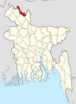 Location of Lalmonirhat District in Bangladesh | |
 Expandable map of Lalmonirhat District | |
| Coordinates: 26.00°N 89.25°E | |
| Country | |
| Division | Rangpur Division |
| Area | |
| • Total | 1,247.371 km2 (481.613 sq mi) |
| Population (2011 census) | |
| • Total | 1,256,099 |
| • Density | 1,000/km2 (2,600/sq mi) |
| Time zone | UTC+06:00 (BST) |
| Postal code | 5500 |
Etymology
At the end of 19th century the workers of the Bengal Duras Railway (BDR) while digging the mud for the installation of rail line, found a red color stone and since then, the place was recognized as Lalmoni. Whereas some legendary opinions that the railway which acquire the land owned by a lady named Lalmoni for which people kept the place after her name as the recognition of her contribution of land for the rail line. Others are of the opinion that in 1783 a woman named Lalmoni along with peasant leader, Nuruldin fought against the English soldiers and land lords for the cause to establish the interest of general peasants and laid down her life against the atrocity of the rulers. The place was named as the Lalmoni as the sign of respect. The word "hat" became adhered to her name in the course of time.[2]
History
Lalmonirhat emerged as a district from mahakuma by the inauguration of then gender and social welfare minister of Bangladesh government Dr. Shafia Khatun on 1 February 1984. After that Lalmonirhat sadar thana was established as a upazila on 18 March 1984. As a result, the number of upazilas in Lalmonirhat district becomes 5 which are Patgram, Hatibandha, Kaliganj, Aditmari and Lalmonirhat Sadar. In that time, Sinai, Rajarhat and Gharialdanga union was added to Kurigram District and the number of union of Lalmonirhat district and municipalities becomes 41 and 1 respectively. Alongside the area of Lalmonirhat Sadar becomes 104 sq. miles. After 1985, Dahagram and Angarpota enclaves became a single union of Patgram upazila and then the total number of union becomes 42.[3]
Subdistricts
There are 5 upazilas, 5 thanas, 45 unions, 354 mouzas and 478 villages in Lalmonirhat.[4] The upazilas are:
- Lalmonirhat Sadar has an area of 259.54 km2. It lies north of Kochbihar of India and Aditmari upazila of Kurigram district, south of Kaunia upazila of Rangpur district and Rajarhat upazila of Kurigram district, east of Phulbai and Rajarhat upazila of Kurigram district, west of Aditmari upazila of Lalmonirhat district and Gangachara upazila of Rangpur district.
- Aditmari has an area of 190.03 km2. It lies north of Kochbihar district of India, south of Gangachar upazila of Rangpur district, east of Lalmonirhat Sadar upazila, west of Kaliganj upazila.
- Kaliganj has an area of 236.96 km2. It lies north of Kochbihar district of India and Hatibandha upazila of Lalmonirhat, south of Gangachara upazila of Rangpur and Kishorganj upazila of Nilphamari district, east of Aditmari upazila, west of Jaldhaka upazila of Nilphamari district.
- Hatibandha has an area of 288.42 km2. It lies north of Kochbihar district of India and Patgram upazila of Lalmonirhat, south of Kaliganj upazila, east of Kochbihar district of India, west of Dimla and Jaldhaka upazila of Nilphamari.
- Patgram has an area of 261.51. It lies north, east and west of Kochbihar district of India and Hatibandha upazila.
Geography
Lalmonirhat is in the north of Bangladesh. There are six rivers in Lalmonirhat district. Teesta is one of the main rivers in this district. The total length of Tista river is 315 km, 115 km of which is in Bangladesh. The total arable land is 98,875 hectares.[5]
Demographics
| Year | Pop. | ±% p.a. |
|---|---|---|
| 1974 | 628,089 | — |
| 1981 | 766,307 | +2.88% |
| 1991 | 953,460 | +2.21% |
| 2001 | 1,109,343 | +1.53% |
| 2011 | 1,256,099 | +1.25% |
| Sources:[6] | ||
According to the 2011 Bangladesh census, Lalmonirhat District had a population of 1,256,099, of which 628,799 were males and 627,300 females. Rural population was 1,117,414 (88.96%) while the urban population was 138,685 (11.04%). Lalmonirhat district had a literacy rate of 46.09% for the population 7 years and above: 49.30% for males and 42.89% for females.[6]
| Religion | Population (1941)[7]: 92–93 | Percentage (1941) | Population (2011)[6] | Percentage (2011) |
|---|---|---|---|---|
| Islam |
188,631 | 52.90% | 1,080,512 | 86.02% |
| Hinduism |
167,158 | 46.88% | 174,558 | 13.90% |
| Others [lower-alpha 2] | 777 | 0.22% | 1,029 | 0.08% |
| Total Population | 356,566 | 100% | 1,256,099 | 100% |
Muslims make up 86.02% of the population, while Hindus are 13.90% of the population.[6]
The dialect of the region is Rangpuria.
Education
Lalmonirhat has 26 colleges, 212 secondary schools, 754 primary schools, 85 madrasas, 3 polytechnical institutes and 1 technical school and college. Lalmonirhat is one of the seven illiteracy free districts in Bangladesh.[8] The literacy rate of Lalmonirhat is 65%.[5]
Economy
Agriculture is the major income source. 72.78% of people are farmers, 10.49% are businessmen, 3.46% are labourers, and 4.45% are employees.[8]
Notable residents
- Sheikh Fazlul Karim, poet, born on 14 April 1883 in Kakina village in Kaliganj thana[9]
Notes
- Lalmonirhat, Kaliganj and Hatibandha thanas of Rangpur district and Patgram thana of Jalpaiguri district
- Including Jainism, Christianity, Buddhism, Zoroastrianism, Judaism, Ad-Dharmis, or not stated
References
- Tanzimul Nayan (2012). "Lalmonirhat District". In Sirajul Islam and Ahmed A. Jamal (ed.). Banglapedia: National Encyclopedia of Bangladesh (Second ed.). Asiatic Society of Bangladesh.
- "Stories (লালমনিরহাট জেলার নামকরণ)". BAngladesh national portal.
- "District background". Bangladesh national portal.
- "Geographical introduction of Lalmonirhat". Bangladesh national portal.
- "Lalmonirhat at a glance". Bangladesh national portal.
- "Bangladesh Population and Housing Census 2011 Zila Report – Lalmonirhat" (PDF). bbs.gov.bd. Bangladesh Bureau of Statistics.
- "CENSUS OF INDIA, 1941 VOLUME VI BENGAL PROVINCE" (PDF). Retrieved 13 August 2022.
- "BBS".
- "Notable residents of Lalmonirhat". Bangladesh national portal.
External links
| Barisal Division |
|  |
|---|---|---|
| Chittagong Division | ||
| Dhaka Division | ||
| Khulna Division | ||
| Mymensingh Division | ||
| Rajshahi Division | ||
| Rangpur Division | ||
| Sylhet Division | ||
На других языках
- [en] Lalmonirhat District
[ru] Лалмонирхат (округ)
Лалмонирхат (бенг. লালমনিরহাট জেলা, англ. Lalmonirhat District) — округ на севере Бангладеш, в области Рангпур. Образован в 1984 году. Административный центр — город Лалмонирхат. Площадь округа — 1241 км². По данным переписи 2001 года население округа составляло 1 088 918 человек. Уровень грамотности взрослого населения составлял 66,6 %, что значительно выше среднего уровня по Бангладеш (43,1 %). Религиозный состав населения: мусульмане — 83,2 %, индуисты — 16,5 %.Другой контент может иметь иную лицензию. Перед использованием материалов сайта WikiSort.org внимательно изучите правила лицензирования конкретных элементов наполнения сайта.
WikiSort.org - проект по пересортировке и дополнению контента Википедии