world.wikisort.org - Bangladesh
Sylhet (Bengali: সিলেট), located in north-east Bangladesh, is the divisional capital and one of the four districts in the Sylhet Division.
Sylhet
সিলেট | |
|---|---|
District of Bangladesh | |
| Sylhet District | |
     Frpm Top:Lalakhal, Bichnakandi, Shah Jalal Dargah, Keane Bridge, view of Jaflong hills, | |
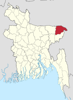 Location of Sylhet District in Bangladesh | |
 Expandable map of Sylhet District | |
| Coordinates: 24°53′N 91°52′E | |
| Country | |
| Division | Sylhet Division |
| Established | 1782 |
| Government | |
| • Deputy Commissioner | M. Kazi Emdadul Islam[1] |
| Area | |
| • Total | 3,452.07 km2 (1,332.85 sq mi) |
| Population (2022 census) | |
| • Total | 3,857,037 |
| • Density | 1,100/km2 (2,900/sq mi) |
| Demonym | Sylheti |
| Literacy rate | |
| • Total | 66% |
| Time zone | UTC+06:00 (BST) |
| Postal code | 3100 |
| HDI (2018) | 0.596[3] medium · 11th of 21 |
| Website | sylhet |
History
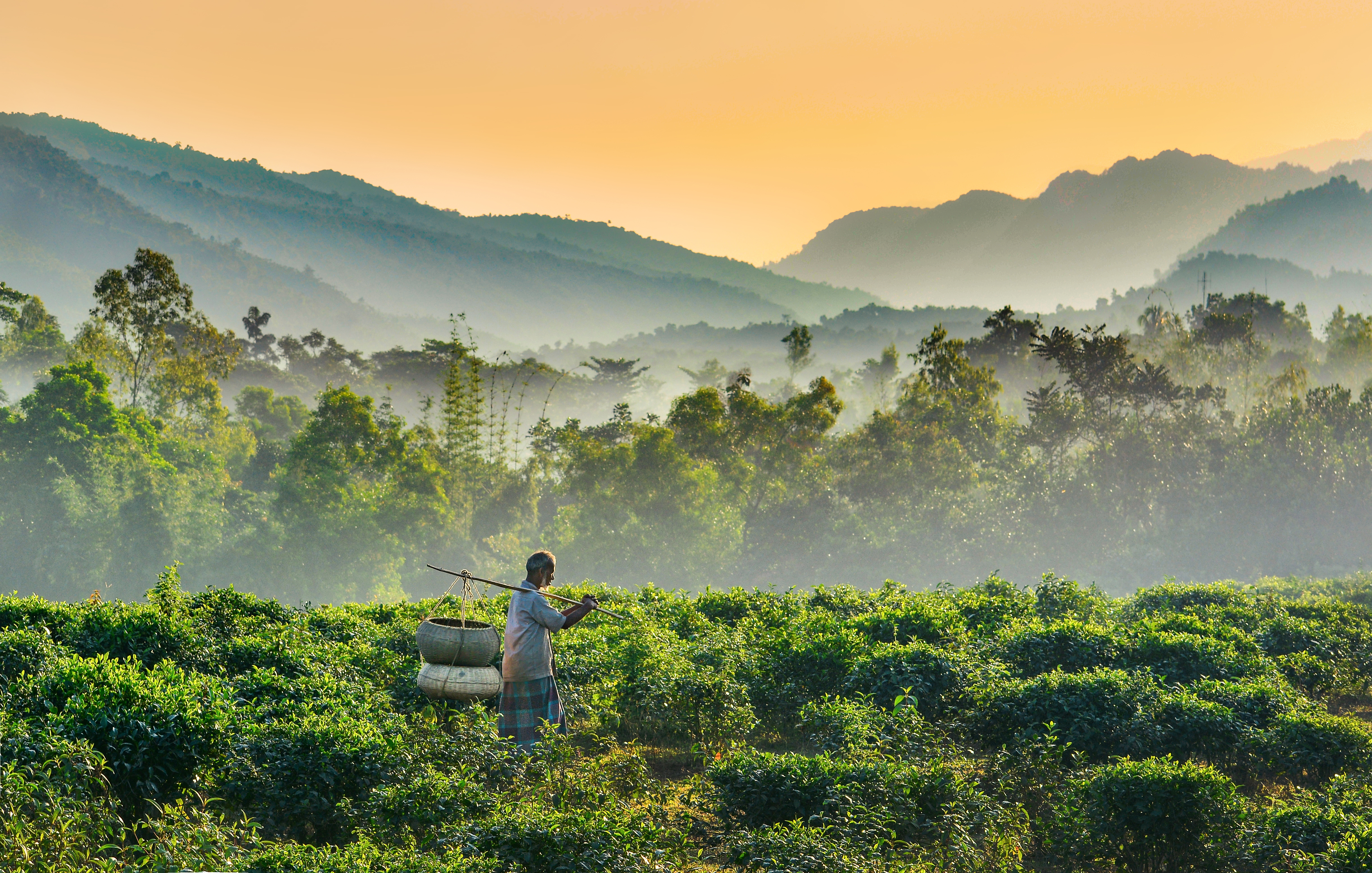
Sylhet district was established on 3 January 1782, and until 1878 it was part of Bengal Province under Dhaka Division. However, in that year, Sylhet was moved to the newly created Assam Province, and it remained as part of Assam up to 1947 (except during the administrative reorganisation of Bengal Province between 1905 and 1912). Sylhet district was divided into five subdivisions and the current Sylhet District was known as the North Sylhet subdivision. In 1947, Sylhet became a part of East Pakistan as a result of a referendum (except 31⁄2 thanas of Karimganj subdivision) as part of Chittagong Division.[4] It was subdivided into four districts in 1983–84 with the current Sylhet District being known as North Sylhet. It became a part of Sylhet Division after its formation in 1995. Sylhet has played a vital role in the Bangladeshi economy. Several of Bangladesh's finance ministers have been Members of Parliament from the city of Sylhet.[4]
Demographics
| Year | Pop. | ±% p.a. |
|---|---|---|
| 1981 | 1,777,784 | — |
| 1991 | 2,153,301 | +1.93% |
| 2001 | 2,555,566 | +1.73% |
| 2011 | 3,434,188 | +3.00% |
| Sources:[5] | ||
According to the 2011 Bangladesh census, Sylhet District had a population of 3,434,188, of which 1,726,965 were males and 1,707,223 females. Rural population was 2,680,639 (78.06%) while the urban population was 753,549 (21.94%). Sylhet district had a literacy rate of 51.18% for the population 7 years and above: 53.48% for males and 48.87% for females.[5]
| Religion | Population (1941)[6]: 36–37 | Percentage (1941) | Population (2011)[5] | Percentage (2011) |
|---|---|---|---|---|
| Islam |
561,124 | 73.34% | 3,180,766 | 92.62% |
| Hinduism |
189,226 | 24.73% | 248,154 | 7.23% |
| Tribal religion |
14,360 | 1.88% | 2,174 | 0.06% |
| Others [lower-alpha 2] | 361 | 0.05% | 3,094 | 0.09% |
| Total Population | 765,071 | 100% | 3,434,188 | 100% |
Muslims make up 92.62% of the population while Hindus are 7.23% of the population. Ethnic population is 12,781, mainly Khasi.[5]
Administration
Sylhet District is divided into thirteen Upazilas.[4]
The upazilas are:
- Balaganj
- Beanibazar
- Bishwanath
- Companiganj
- Dakshin Surma
- Fenchuganj
- Golapganj
- Gowainghat
- Jaintiapur
- Kanaighat
- Osmani Nagar
- Sylhet Sadar
- Zakiganj
Notable people
- M.A.G. Osmani Commander-in-Chief of the Liberation War
- M Saifur Rahman Finance & Planning Minister of BD Parliament (until 2006), and Leader of BNP.
- Shah Jalal, Sufi saint and mystic.
- Shah Paran, Sufi saint.
- Shah Abdul Karim, Baul folk singer, composer.
- Swami Nikhilananda, Ramakrishna Math and Mission Order monk and Founder-Minister, Ramakrishna-Vivekananda Center, New York City 1933-1973
- Swami Gambhirananda, Ramakrish Math and Mission Order monk and President of the Order 1985-1988
- Nurul Islam Nahid, Former Education Minister of Bangladesh
- Govinda Chandra Dev (1 February 1907 – 26 March 1971), known as G. C. Dev, was a professor of philosophy at the University of Dhaka. He was assassinated at the onset of Bangladesh Liberation War of 1971 by the Pakistan Army.
- Abdul Malik (physician), National Professor, Brigadier (rtd.), Cardiologist, Founder and President of National Heart Foundation of Bangladesh.
- Rushanara Ali, first Bangladeshi to be elected as an MP for the British parliament.
- Ajmal Masroor, television presenter, politician and imam, Parliamentary candidate for a UK Parliament constituency.
- Lutfur Rahman (politician), the first elected mayor of the London Borough of Tower Hamlets council.
- Mukhlesur Rahman Chowdhury, former minister and adviser to the president of Bangladesh.
- Humayun Rashid Choudhury, diplomat, UN General Assembly President, Awami League leader and former speaker of National parliament.
- Dilwar Khan, poet.
- Salman Shah, film actor, model.
- Shuvro Dev, playback singer.
- Syed Ahmed (businessman), businessman, British TV personality.
- Badar Uddin Ahmed Kamran, Mayor of Sylhet since 2003
- Enam Ali, restauranteur and founder of the British Curry Awards
See also
- Chowkideki
- Districts of Bangladesh
- List of colleges in Sylhet
- List of people from Sylhet
Notes
- North Sylhet subdivision and Beanibazar thana of Sylhet district
- Including Jainism, Christianity, Buddhism, Zoroastrianism, Judaism, Ad-Dharmis, or not stated
References
- pmis.mopa.gov.bd/pmis/Forms/dclist.php
- "registered through Argeweb". geohive.com. Archived from the original on 26 February 2014.
- "Sub-national HDI – Area Database – Global Data Lab". hdi.globaldatalab.org. Retrieved 18 March 2020.
- Ashfaq Hossain (2012). "Sylhet District". In Sirajul Islam and Ahmed A. Jamal (ed.). Banglapedia: National Encyclopedia of Bangladesh (Second ed.). Asiatic Society of Bangladesh.
- "Bangladesh Population and Housing Census 2011 Zila Report – Sylhet" (PDF). bbs.gov.bd. Bangladesh Bureau of Statistics.
- "CENSUS OF INDIA, 1941 VOLUME IX ASSAM PROVINCE" (PDF). 1941.
External links
![]() Media related to Sylhet District at Wikimedia Commons
Media related to Sylhet District at Wikimedia Commons
Capital: Sylhet | ||
| Upazilas |
| |
| Constituencies |
| |
| Attractions and sites |
| |
| Rivers | ||
| Inhabited areas |
| |
| Schools and colleges |
| |
| Madrasas |
| |
| Universities |
| |
| Transport |
| |
| Organisations |
| |
| History |
| |
| Military |
| |
| Medicine |
| |
| Economy |
| |
| Sports |
| |
| Barisal Division |
|  |
|---|---|---|
| Chittagong Division | ||
| Dhaka Division | ||
| Khulna Division | ||
| Mymensingh Division | ||
| Rajshahi Division | ||
| Rangpur Division | ||
| Sylhet Division | ||
Authority control | |
|---|---|
| General | |
| National libraries | |
| Other |
|
На других языках
[de] Sylhet (Distrikt)
Der Distrikt Sylhet (bengalisch সিলেট জেলা) ist ein Verwaltungsdistrikt im nordöstlichen Bangladesch in der Division Sylhet. Die Distrikthauptstadt heißt ebenfalls Sylhet. Der Distrikt hat 3.434.188 Einwohner (Volkszählung 2011).- [en] Sylhet District
[ru] Силхет (округ)
Силхет (бенг. সিলেট জেলা; англ. Sylhet District) — округ в северо-восточной части Бангладеш, в одноимённой области Силхет. Административный центр — город Силхет. Площадь округа — 3490 км²[1]. По данным переписи 2001 года население округа составляло 2 675 346 человек. Уровень грамотности взрослого населения составлял 46 %, что выше среднего уровня по Бангладеш (43,1 %). 83,57 % населения округа исповедовало ислам, 17,30 % — индуизм.Другой контент может иметь иную лицензию. Перед использованием материалов сайта WikiSort.org внимательно изучите правила лицензирования конкретных элементов наполнения сайта.
WikiSort.org - проект по пересортировке и дополнению контента Википедии