world.wikisort.org - Bangladesh
Chuadanga (Bengali: চুয়াডাঙ্গা, romanized: tʃuaɖaŋga), is a district of the western Khulna Division of Bangladesh. It is bordered by the Indian state of West Bengal to the west, Meherpur District to the northwest, Jessore District to the south, Jhenaidah District to the east, and Kushtia District to the north. Before partition Chuadanga was one of the five subdivisions under Nadia district.[2]
Chuadanga
চুয়াডাঙ্গা | |
|---|---|
District of Bangladesh | |
| Chuadanga District | |
    Top: Bhangbaria in Alamdanga Bottom: Distillery of Carew & Co. | |
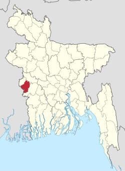 Location of Chuadanga District in Bangladesh | |
 Expandable map of Chuadanga District | |
| Coordinates: 23.60°N 88.70°E | |
| Country | |
| Division | Khulna Division |
| Government | |
| • Deputy Commissioner | Md. Nazrul Islam Sarkar |
| Area | |
| • Total | 1,174.10 km2 (453.32 sq mi) |
| Population (2011 census) | |
| • Total | 1,129,015 |
| • Density | 960/km2 (2,500/sq mi) |
| Time zone | UTC+06:00 (BST) |
| HDI (2019) | 0.644[1] medium · 5th of 20 |
| Website | www |
History
Chuadanga witnessed a number of uprisings during the British rule of India. The uprisings included Wahabi Movement (1831), Faraizi Movement(1838–47), Sepoy Rebellion (1857), Indigo Rebellion (1859–60), Khilafat Movement (1920), Swadeshi Movement (1906), Non-cooperation movement, Violation of Law and Salt Satyagraha (1920–40), and Quit India Movement or August Revolt (1942).[3]
Under British rule, Chuadanga was a sub-division within Nadia District. During partition, in 1947, excepting Krishnanagar thana (still under Nadia in West Bengal). History of Chuadanga can be found in Nadia District Gazetteer during British rule.[4] Chuadanga was the location of more than 100 battles between the Pakistan Army and the pro-independence Mukti Bahini.[3] There is a mass graveyard of the victims of the Bangladesh genocide during the Bangladesh Liberation war behind the Chuadanga Government Hospital.[3]
Geography
Chuadanga district has an area of 1,157.42 km2. It shares domestic borders with the Kushtia District on the northeast, Meherpur on the northwest,[5] and Jhenaidah on the south and southeast. On its southwest lies the Nadia District (in the state of West Bengal in India).[3] In January 2018, the district had the lowest temperature in Bangladesh.[6]
Administration
Until the Partition of India in 1947 Chuadanga sub-division was within Nadia district.
Deputy Commissioner (DC): Mohammad Aminul Islam Khan[7]
Subdivisions
Chuadanga district is divided into four Upazilas which run cities of the same name.
- Chuadanga Sadar Upazila
- Alamdanga Upazila
- Jibannagar Upazila
- Damurhuda Upazila[8]
Demographics
| Year | Pop. | ±% p.a. |
|---|---|---|
| 1981 | 654,135 | — |
| 1991 | 807,164 | +2.12% |
| 2001 | 1,007,130 | +2.24% |
| 2011 | 1,129,015 | +1.15% |
| Sources:[9] | ||
According to the 2011 Bangladesh census, Chuadanga District had a population of 1,129,015, of which 564,819 were males and 564,196 females. Rural population was 822858 (72.88%) and urban population was 306157 (27.12%). Chuadanga had a literacy rate of 45.91% for the population 7 years and above: 46.88% for males and 44.93% for females.[9]
| Religion | Population (1941)[10]: 84–85 | Percentage (1941) | Population (2011)[9] | Percentage (2011) |
|---|---|---|---|---|
| Islam |
156,599 | 63.55% | 1,100,330 | 97.46% |
| Hinduism |
86,734 | 35.20% | 26,514 | 2.35% |
| Tribal religion | 2,009 | 0.82% | 556 | 0.03% |
| Others [lower-alpha 2] | 1,066 | 0.43% | 1,615 | 0.16% |
| Total Population | 246,408 | 100% | 1,129,015 | 100% |
Muslims formed 97.46% of the population, Hindus 2.35%, and others 0.19%.[9]
The population of the district was 987,382 during the 2001 national survey with 50.82% male and female 49.18% compositions.[3]
Economy
Most of this small district is dedicated to agriculture. Occupational distributions clearly show this with agriculture employing 68% of the labour force, while only 12% are involved in commerce. Total cultivable land amounts to 894.20 km2, of which 57% is under some sort of irrigation.[3] Cotton is a cash crop grown in the district and in 2013, cotton was cultivated in 4149 hectares.[11]
Besides agriculture the district is now experiencing industrial growth. Major industries include Zaman Group of Industries, Bangas bread and biscuit, Tallu Spinning mills Ltd, Khatun Plastic Limited, and Carew & Company Bangladesh Limited. Carew & Co (Bangladesh) Ltd (1933), which is situated at Darshana of Damurhuda Upazila of Chuadanga district. Sugar cane is cultivated in Darshana.[12] Carew & Company has a distillery also which is the lone spirit producing plant of Bangladesh, Carew & Company Bangladesh Limited is an enterprise of Bangladesh Sugar & Food Industries Corporation (BSFIC). BSFIC is an autonomous body of Ministry of Industries.[13][14]
Transportation
Chuadanga is connected to four of its neighbouring districts (Kushtia, Jessore, Jhenidah and Meherpur) through inter-district highways and connected to Jessore, Jhenaidah and Kushtia by railway. The district is connected to the rest of the country by five highways and a railway. There are 203 km of finished road, 211 km herring-bone and 132 km mud road. A total length of railway tracks of just over 50 km connects the three railway stations inside the district with the country's railway network. By 2013, five out of the ten stations in the district were shut down due to a lack of manpower.[15]
See also
- Districts of Bangladesh
Notes
- Subdivisions of Chuadanga subdivision excluding Krishnaganj
- Including Jainism, Christianity, Buddhism, Zoroastrianism, Judaism, Ad-Dharmis, or not stated
References
- "Sub-national HDI - Area Database - Global Data Lab". hdi.globaldatalab.org. Retrieved 18 March 2020.
- "Nadia keeps a date with history". The Times of India. 19 August 2011. Retrieved 23 February 2022.
- Ahmed, Rajib (2012). "Chuadanga District". In Islam, Sirajul; Jamal, Ahmed A. (eds.). Banglapedia: National Encyclopedia of Bangladesh (Second ed.). Asiatic Society of Bangladesh.
- Nadia District Gazetteer.
- "Meherpur women becoming solvent by rearing black Bengal goats | Dhaka Tribune". www.dhakatribune.com. 7 March 2018. Retrieved 13 March 2018.
- "Mercury may dip further". The Daily Star. 6 January 2018. Retrieved 13 March 2018.
- "জেলা-প্রশাসক - চুয়াডাঙ্গা জেলা". chuadanga.gov.bd (in Bengali).
- "উপজেলাসমূহ". bangladesh.gov.bd (in Bengali).
- "Bangladesh Population and Housing Census 2011 Zila Report – Chuadanga" (PDF). bbs.gov.bd. Bangladesh Bureau of Statistics.
- "CENSUS OF INDIA, 1941 VOLUME VI BENGAL PROVINCE" (PDF). Retrieved 13 August 2022.
- "10 districts likely to have bumper cotton output". The Daily Star. 7 April 2013. Retrieved 13 March 2018.
- "Sugarcane acreage falling on lower returns". The Daily Star. 21 December 2016. Retrieved 13 March 2018.
- Alam, Niloy. "Carew: Serving liquor since 1897". dhakatribune.com. Dhaka Tribune. Retrieved 24 December 2017.
- Siddique, Abu. "Carew: The discreet distillery". dhakatribune.com. Dhaka Tribune. Retrieved 24 December 2017.
- "Half of Chuadanga rail stations shut down". The Daily Star. 5 August 2013. Retrieved 13 March 2018.
External links
| Upazilas |
| |
|---|---|---|
| Constituencies |
| |
| Inhabited areas |
| |
| Transport |
| |
| Education |
| |
Headquarters: Khulna | ||
| Bagerhat District |  | |
| Chuadanga District | ||
| Jessore District |
| |
| Jhenaidah District | ||
| Khulna District | ||
| Kushtia District |
| |
| Magura District |
| |
| Meherpur District |
| |
| Narail District | ||
| Satkhira District | ||
| Barisal Division |  | |
|---|---|---|
| Chittagong Division |
| |
| Dhaka Division | ||
| Khulna Division | ||
| Mymensingh Division | ||
| Rajshahi Division |
| |
| Rangpur Division | ||
| Sylhet Division | ||
Authority control | |
|---|---|
| General |
|
| National libraries | |
| Other |
|
На других языках
- [en] Chuadanga District
[ru] Чуаданга (округ)
Чуаданга (бенг. চুয়াডাঙ্গা জেলা, англ. Chuadanga District) — округ на западе Бангладеш, в области Кхулна. Образован в 1984 году из части территории округа Куштия. Административный центр — город Чуаданга. Площадь округа — 1157 км². По данным переписи 2001 года население округа составляло 987 382 человека. Уровень грамотности взрослого населения составлял 25,2 %, что значительно ниже среднего уровня по Бангладеш (43,1 %). 96,73 % населения округа исповедовало ислам, 2,96 % — индуизм.Другой контент может иметь иную лицензию. Перед использованием материалов сайта WikiSort.org внимательно изучите правила лицензирования конкретных элементов наполнения сайта.
WikiSort.org - проект по пересортировке и дополнению контента Википедии