world.wikisort.org - Bangladesh
Sylhet (Bengali: সিলেট) is a metropolitan city in northeastern Bangladesh. It is the administrative seat of the Sylhet Division. Located on the north bank of the Surma River at the eastern tip of Bengal, Sylhet has a subtropical climate and lush highland terrain. The city has a population of more than half a million and is one of the largest cities in Bangladesh after Dhaka, Chittagong and Khulna.[2] Sylhet is one of Bangladesh's most important spiritual and cultural centres. Furthermore, it is one of the most economically important cities after Dhaka and Chittagong. The city produces the highest amount of tea and natural gas.
Sylhet
সিলেট | |
|---|---|
Metropolis | |
| Sylhet | |
     From the top: Keane Bridge, Osmani International Airport, Sylhet railway station, Sylhet Circuit House, Shah Jalal Dargah. | |
 Sylhet Location of Sylhet in Bangladesh  Sylhet Sylhet (Bangladesh) | |
| Coordinates: 24°54′N 91°52′E | |
| Country | |
| Division | Sylhet Division |
| District | Sylhet |
| Municipal Board | 1867 |
| Sylhet City Corporation | 9 April 2001 |
| Metropolitan city | 31 March 2009[1] |
| Government | |
| • Type | Mayor–Council |
| • Body | Sylhet City Corporation |
| • Mayor | Ariful Haque Choudhury |
| • Police commissioner | Md. Nisharul Arif, PPM (Bar) |
| Area | |
| • Urban | 58 km2 (22 sq mi) |
| • Metro | 518.43 km2 (200.17 sq mi) |
| Elevation | 35 m (115 ft) |
| Population (2011) | |
| • Metropolis | 526,412[2] |
| • Density | 19,865/km2 (51,450/sq mi) |
| Demonym | Sylheti |
| Time zone | UTC+6 (BST) |
| Postal code | 3100 |
| HDI (2019) | 0.631[3] medium |
| International airport | Osmani International Airport |
| Regional Calling code | +880821 |
| Website | scc |
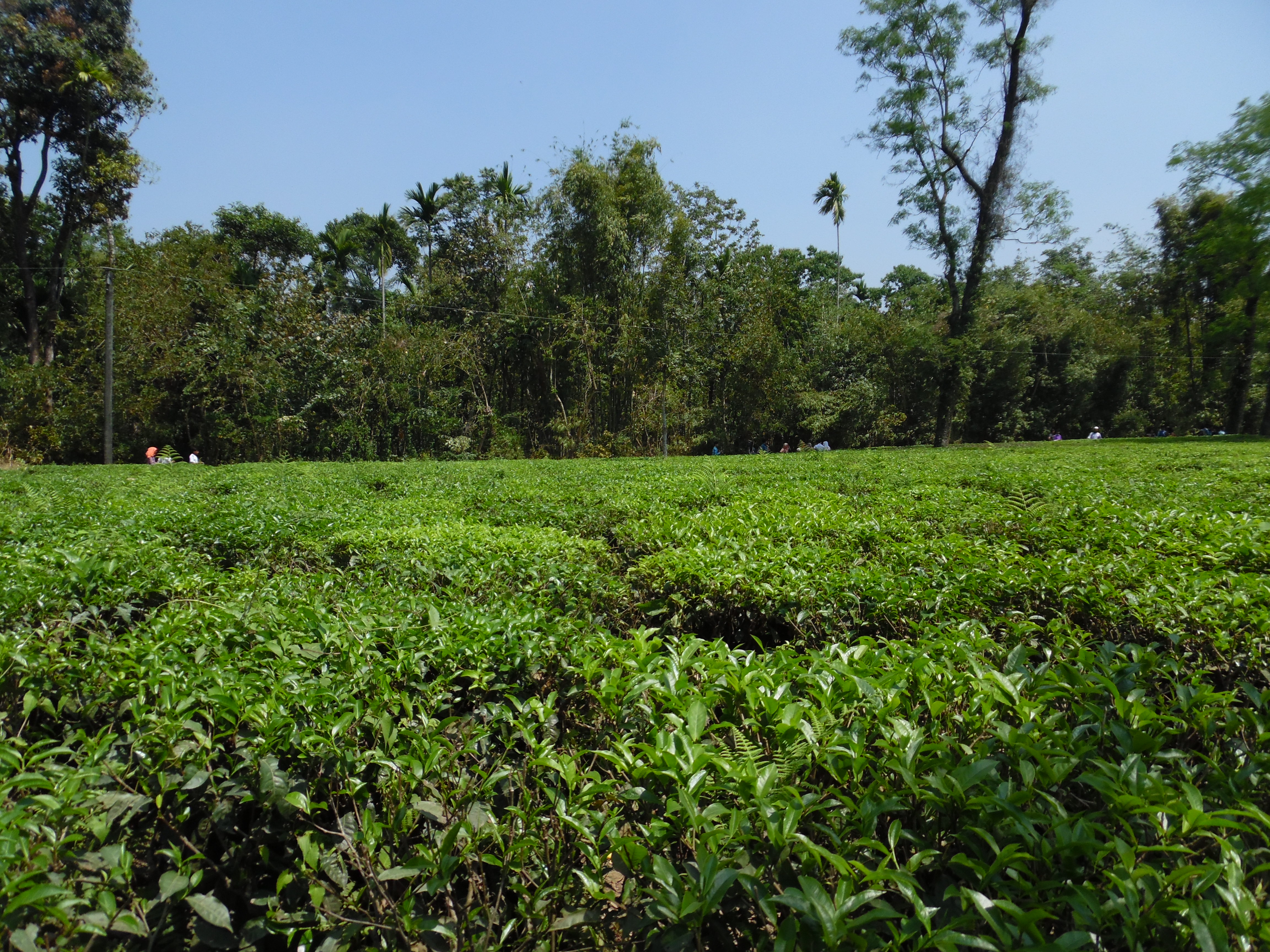
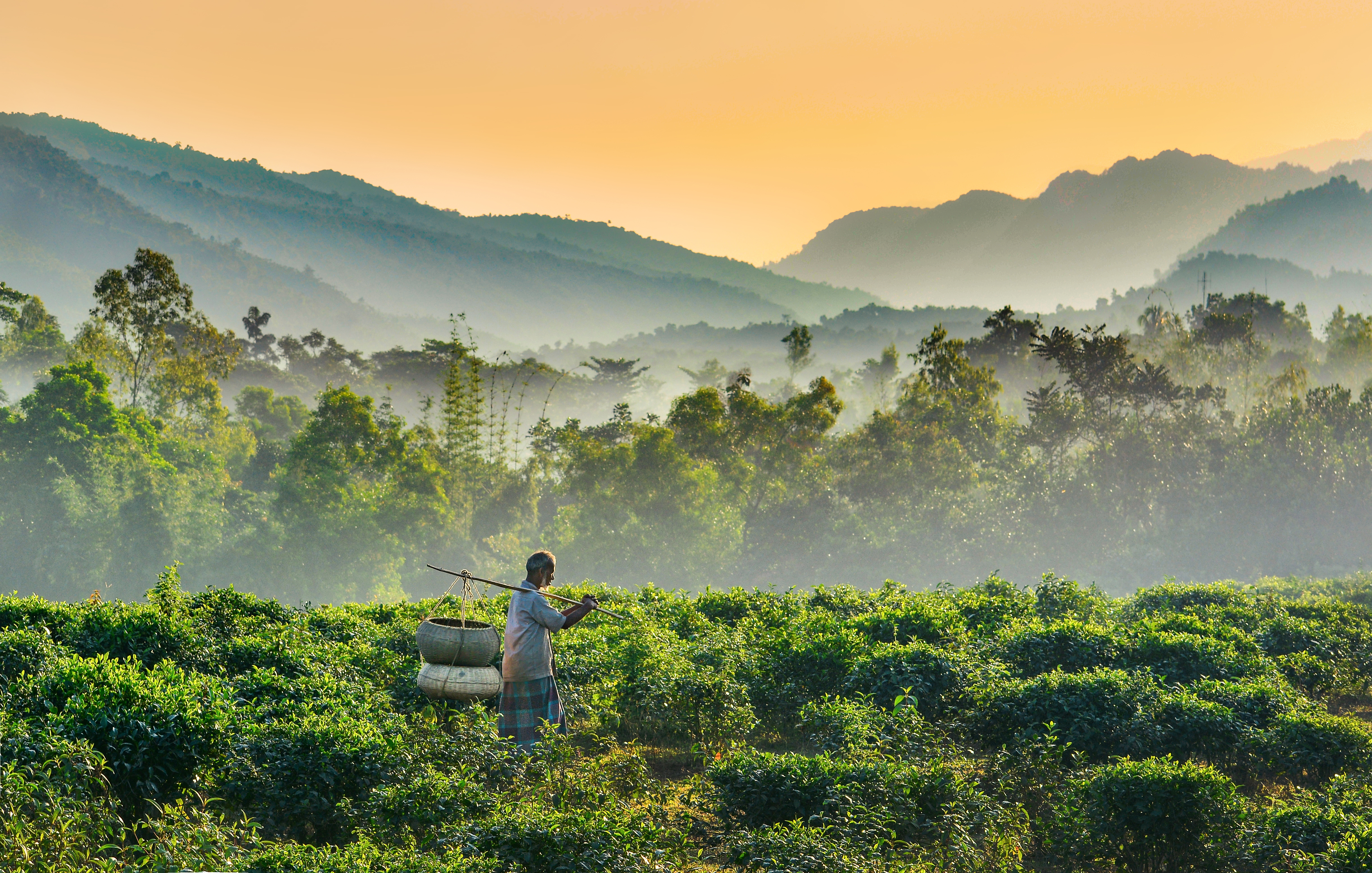
The hinterland of the Sylhet valley is the largest oil and gas-producing region in Bangladesh. It is also the largest hub of tea production in Bangladesh. It is notable for its high-quality cane and agarwood.[4][5] The city is served by the Osmani International Airport, named after General Bangabir M A G Osmani, the Commander-in-Chief of the Mukti Bahini during the Bangladesh Liberation War. People from Sylhet form a significant portion of the Bangladeshi diaspora, particularly in the United Kingdom and the United States and other countries in the Middle East.
Etymology and names
The name of Sylhet descended from Sanskrit word Srihatta (श्रीहट्ट / শ্রীহট্ট) which literally means elegant market.[6] The name Sylhet is an anglicisation of Shilhot (শিলহট). Its origins seem to come from the Sanskrit according to the words of শিলা śilā (meaning stone) and হট্ট haṭṭa (meaning marketplace). These words match the landscape and topography of the hilly region. The shila stones were abundant across Sylhet and the King Gour Govinda is known to have used stones to guard his capital. The word had changed to Shilhot due to the elision of letter-final অ ô in the Bengali language.[7]
After the Conquest of Sylhet in 1303, the city colloquially became nicknamed as Jalalabad (জালালাবাদ). It is made up of two words Jalal (جلال), a name of Arabic origin meaning majesty but in this case referring to Shah Jalal, and Abad (آباد), meaning settlement.[8][9][10] This colloquial name continued to be used in the Mughal period. Currently, in the Sylhet City Corporation, there exists a metropolitan thana known as the Jalalabad Thana as well an area in its 7th ward.[11]
History

In 1303, the Sultan of Lakhnauti Shamsuddin Firoz Shah conquered Sylhet by defeating Gour Govinda.[12] Sylhet was a realm of the Bengal Sultanate. In the 16th-century, Sylhet was controlled by the Baro-Bhuyan zamindars and later became a sarkar (district) of the Mughal Empire.[13] Sylhet emerged as the Mughals' most significant imperial outpost in the east, and its importance remained as such throughout the seventeenth century.[14] British rule began in the 18th century under the administration of the East India Company. Sylhet became a key source of lascars in the British Empire with its ancient seafaring tradition. The Sylhet municipal board was established in 1867.[15] Originally part of the Bengal Presidency and later Eastern Bengal and Assam; the town was part of Colonial Assam between 1874 and 1947 when following a referendum and the partition of British India, it became part of East Pakistan.[12] The Sylhet City Corporation was constituted in 2001. The Government of Bangladesh designated Sylhet a metropolitan area in 2009.[16]
Modern history
In 1995, the Government of Bangladesh declared Sylhet as the sixth divisional headquarters of the country.[17] Sylhet has played a vital role in the Bangladeshi economy. Several of Bangladesh's finance ministers have been Members of Parliament from the city of Sylhet. Badar Uddin Ahmed Kamran was a longtime mayor of Sylhet. Humayun Rashid Choudhury, a diplomat from Sylhet, served as President of the UN General Assembly and Speaker of the Bangladesh National Parliament.
In 2001, the municipality was upgraded to the Sylhet City Corporation. It was made a metropolitan city in 2009.[16]
Geography and climate
Sylhet is located at 24.8917°N 91.8833°E, in the northeastern region of Bangladesh within the Sylhet Division, the Sylhet District and Sylhet Sadar Upazila. Sylhet has a typical Bangladeshi tropical monsoon climate (Köppen Am) bordering on a humid subtropical climate (Cwa) at higher elevations. The rainy season starts from April to October and it is so hot and humid with very heavy showers and thunderstorms almost every day, whilst the short dry season starts from November to February and it is very warm and fairly clear. Nearly 80% of the annual average rainfall of 4,200 millimetres (170 in) occurs between May and September.[18]
The city is located within the region where there are hills and basins which constitute one of the most distinctive regions in Bangladesh. The physiography of Sylhet consists mainly of hill soils, encompassing a few large depressions known locally as "beels" which can be mainly classified as oxbow lakes, caused by tectonic subsidence primarily during the earthquake of 1762.
Geologically, the region is complex having diverse sacrificial geomorphology; high topography of Plio-Miocene age. Available limestone deposits in different parts of the region suggest that the whole area was under the ocean in the Oligo-Miocene. In the last 150 years three major earthquakes hit the city, at a magnitude of at least 7.5 on the Richter Scale, the last one took place in 1918, although many people are unaware that Sylhet lies on an earthquake prone zone.[19]

| Month | Jan | Feb | Mar | Apr | May | Jun | Jul | Aug | Sep | Oct | Nov | Dec | Year |
|---|---|---|---|---|---|---|---|---|---|---|---|---|---|
| Average high °C (°F) | 25.2 (77.4) |
27.1 (80.8) |
30.4 (86.7) |
30.8 (87.4) |
30.8 (87.4) |
30.9 (87.6) |
30.9 (87.6) |
31.6 (88.9) |
31.2 (88.2) |
30.9 (87.6) |
29.2 (84.6) |
26.3 (79.3) |
29.6 (85.3) |
| Average low °C (°F) | 12.9 (55.2) |
14.2 (57.6) |
18.1 (64.6) |
20.8 (69.4) |
22.6 (72.7) |
24.4 (75.9) |
24.9 (76.8) |
25.0 (77.0) |
24.3 (75.7) |
22.5 (72.5) |
18.4 (65.1) |
14.0 (57.2) |
20.2 (68.3) |
| Average rainfall mm (inches) | 8 (0.3) |
31 (1.2) |
146 (5.7) |
372 (14.6) |
569 (22.4) |
796 (31.3) |
834 (32.8) |
621 (24.4) |
548 (21.6) |
232 (9.1) |
30 (1.2) |
13 (0.5) |
4,200 (165.1) |
| Source: WMO[20] | |||||||||||||
Administration
Sylhet is divided into 6 metropolitan thanas(police station) and consists of 27 wards and 224 mahallas. The thanas are:
- Bimanbandar Thana
- Kotwali Thana Google Maps
- Jalalabad Thana Google Maps
- Dakshin Surma Thana Google Maps
- Mogla Bazar Thana Google Maps
- Shah Paran Thana
It is a small city with an area of 26.50 km2.[21] The rapid growth and expansion of Sylhet occurred during the colonial period. Sylhet Municipality was established in 1878. A devastating earthquake demolished almost the entire town on 12 June 1897 following which a modern and European model new town was built on the wreckage. Many new roads were constructed in the late 1890s and Sylhet became really connected to the other parts of the country with the establishment of an extension line of Assam Bengal Railway in 1912–15. From the beginning of the 20th century, the importance of Sylhet increased with the establishment of the tea industry. In the 1950s and 1960s, rapid urbanisation took place in the town, fostered by the expatriate Sylhetis and the process is still ongoing.
On 10 April 2001, Sylhet was changed to a city corporation from a municipal board, and currently the city is administrated by the Sylhet City Corporation. At present, Sylhet is the district-headquarters as well as the divisional headquarters of the districts of Sunamganj, Habiganj, Moulvibazar and Sylhet District. The Sylhet City Corporation is responsible for the services that are provided within the city which includes traffic, roads, garbage collection, water supply, registrations and many others. The corporation consists of the Mayor and 22 other commissioners, and focuses on the development of the city.[22]
Military
Sylhet is strategically important for the Bangladesh Armed Forces. The Bangladesh Army's 17th Infantry Division is based at Jalalabad Cantonment in Sylhet.[23] The cantonment is also home of the School of Infantry and Tactics (SI&T) and the 1st Para-commando Battalion, an elite commando unit of the Bangladesh Army.[citation needed]
Healthcare
Sylhet is also home to many hospitals that strategically provide healthcare to the community such as the Shahid Shamsuddin Hospital District Hospital, Sylhet MAG Osmani Medical College, Jalalabad Ragib-Rabeya Medical College, North East Medical College, Sylhet Women's Medical College, Parkview Medical College, Ibn Sina Hospital Sylhet Ltd, Noorjahan Hospital (pvt) Ltd, Oasis Hospital, Mount Adora Hospital, Square Medical Service, Popular Medical Service, Medinova Medical Service, Labaid Ltd and the Mohanagar Hospital as well as world's leading five star hospital such as the Al Haramain Hospital.[24]
Recently a medical university called Sylhet Medical University has been established in the city. According to the Prime Minister's order to strictly monitor whether medical standards are being properly maintained in medical colleges, a medical university will be set up in each division. According to the order, Chittagong and Rajshahi Medical University have already been established. Sylhet Medical University is the 4th Medical University of the directive.[25][26]
Demographics
According to the 2011 Bangladesh census, the city had a population of 531,663.[2] The population growth rate of the city is 1.73%, which has reduced from 1.93% in 1991.[27] As of 2001, It had average literacy rate of 69.73%.[28] The highest literacy rate was 84.24% in Ward 22 and the lowest was 48.15% in Ward 10 (2001). The total number of households in the city was 55,514.[21]
The majority of the population are Bengali Muslims of Sylheti background, while there are significant minority groups which includes the Bengali Hindus, Bishnupriya Manipuri and others.[29]
Sylheti is spoken by the vast majority of the people, while Standard Bengali is the official language used by the state government and officials.[30][31][32]
The majority of Sylhetis are Muslims (87.2%), other religious groups include Hindus (12.6%) and less than 0.2% of other religions, mainly Buddhists and Christians.[2] The majority of the Muslims are mainly Sunni Hanafis;[33] and there are significant numbers of people who also follow Sufi ideals, the most influential are the teachings of Abdul Latif Fultali.[34]
Economy

The Sylhet Metropolitan Area is one of Bangladesh's main business centres. Sylhet's economy is closely linked with the Bangladeshi diaspora, especially the British Bangladeshi community. The city receives a significant portion of the country's annual remittances, which have driven growth in real estate and construction.[35] A number of shopping centres, restaurants and hotels have opened as a result. Sylhet also relies on religious tourism, with thousands of devotees visiting its Sufi shrines annually, as well as ecotourism in its broader natural hinterland. Nature resorts have been built in the city's outskirts. Several important Bangladeshi companies are based in Sylhet, including Jalalabad Gas Transmission and Distribution, Sylhet Gas Fields and Alim Industries. Biman Bangladesh Airlines operates several flights from Sylhet to the United Kingdom and the Middle East. Roads connect Sylhet with the Indian states of Meghalaya and Assam.
Sylhet's hinterland plays a vital role in the economy of Bangladesh. It is home to the country's largest natural gas fields, sole crude oil field,[36] largest tea plantations, rubber, palm oil, cane, agarwood[5] and citrus farms. Rice production in the region is one of the country's highest. Heavy industries include power plants, fertilizer plants, cement plants and liquefied petroleum gas plants. Other major industries in the region include ceramics, machinery and equipment, ready-made garments and pharmaceuticals. Most of the tea production in Bangladesh is based around Sylhet, and the industry also has significant exports. The area is also known for producing oranges and other similar fruits. One of these fruit is called "Satkara" which is a variety of grapefruit that can be used in pickles and even as an ingredient in traditional Sylheti curry dishes.[citation needed]
Two Bangladeshi finance ministers from the city have been elected to the Jatiyo Sangshad: Saifur Rahman of the Bangladesh Nationalist Party and Abul Maal Abdul Muhith of the Awami League. The present foreign affairs minister DR. A K Abdul Momen who is younger brother of the former finance minister Abdul Muhith represents the Sylhet-1 seat in parliament.
Utility
Sylhet has high rates of electric power shortage and water shortage. According to the Power Development Board, Sylhet is only receiving 50 MW, which is half of the required demand of 100 MW. The city corporation is also supplying only 22,500 gallons of water, far less than the demand of about 65,000.[37] The major sources of water to the city is the tube wells and the Surma River.[citation needed] Tests of tube wells in Sylhet District by the Bangladesh University of Engineering and Technology in 1997 found that about 27.6% contained more arsenic than the acceptable limit set by Bangladesh of 50 micrograms per liter, and 49.2% contained more arsenic than the World Health Organization standard of 10 micrograms per liter.[38] There are about 331 registered restaurants in the city, only 15% maintain sanitary facilities and 85% have unhygienic conditions that are unsafe for the public.[39]
Sports

Cricket is the most popular sport in Sylhet. Bangladesh Premier League franchise Sylhet Sunrisers are based in Sylhet International Cricket Stadium (M.A.G. Osmani Stadium), which was built in 2007 and has a capacity of 18,500 spectators. The Sylhet International Cricket Stadium was renovated in 2013 especially to host matches of 2014 ICC World Twenty20. It is situated near lush green tea gardens on the city fringe.[40] In the National Cricket League Sylhet Division has not won any titles however did win in the One-Day Cricket League in 2001–02 season. Notable players from Sylhet who have played for the Bangladesh national cricket team include Rajin Saleh,[41] Enamul Haque Jr,[42] Tapash Baisya,[43] and Alok Kapali.[44] Chess player Rani Hamid was awarded the FIDE Women's International Master (WIM) title in 1985, while her son Kaiser Hamid was the captain of the Bangladesh national football team in the early 90s.[45]
Transport

The main transport systems used in the city are cycle rickshaws, auto rickshaws (mainly known as baby-taxis or CNGs), buses, mini-buses and cars. There are about 80,000 rickshaws running each day. Bus service prices have increased as of 2008, up to 30% higher, prices ranges from Tk 4 to 15.95.[46]
The N2 is the national highway that connects the city with country's capital and largest city Dhaka as well as with many other parts of the country. The N2 highway is also part of AH1 and AH2- two longest routes of the Asian Highway Network.
Air
The city of Sylhet is served by Osmani International Airport, located at the north of the city. It is Bangladesh's third busiest airport and became an international airport due to the demand of expatriate Bangladeshis and their descendants from the United Kingdom and the United States. The main frequent airlines of the airport are Biman Bangladesh Airlines, US-Bangla Airlines and Novoair. The airport received its first international arrival on 3 November 2002, with Biman arriving from Kuwait via Abu Dhabi en route to Dhaka.[47] Meanwhile, it received first direct international arrival on 15 March 2017 as a direct flight of Dubai based carrier Flydubai landed at the airport.[48] Work started in 2006 to upgrade the airport to international standards, including a new terminal building, a jetway, a taxiway, and expansion of the runway to accommodate wide-bodied aircraft.[49] It was confirmed that in May 2007, Biman will be operating Hajj flights directly from the airport later in 2007.[50] Biman operates direct flight to London from Sylhet.[51] All Bangladeshi airlines operate regular domestic flights to Dhaka and Biman operates regular domestic flights to Cox's Bazar.[52] Government will construct a 34,919 square-metre high-quality international passenger terminal building, cargo building, control tower, parking, taxiway and other important infrastructures to meet the growing demand in line with the increase of passengers and cargo transportation at the airport.[53]
Rail
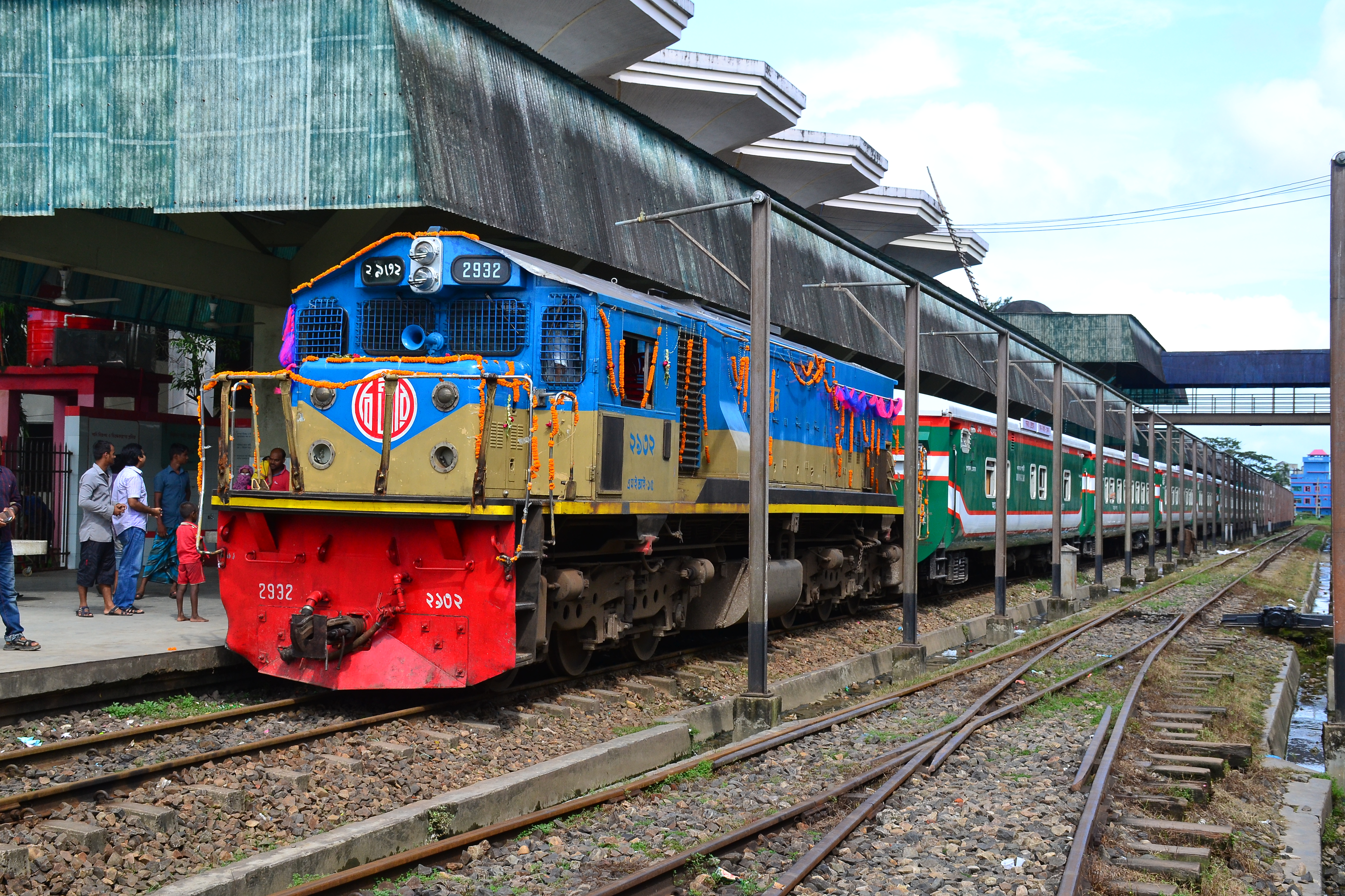
The Sylhet Railway Station is the main railway station providing trains on national routes operated by the state-run Bangladesh Railway. Some important train that origins/terminates :
Towards Dhaka
| Train No. | Train Name | Train Type | Departures |
|---|---|---|---|
| 710 | Parabat Express | Intercity | Daily (except Tue) |
| 718 | Jayantika Express | Intercity | Daily |
| 740 | Upaban Express | Intercity | Daily |
| 774 | Kalni Express | Intercity | Daily (except Fri) |
| 10 | Surma Mail | Daily | |
Towards Chittagong
| Train No. | Train Name | Train Type | Departures |
|---|---|---|---|
| 724 | Udayan Express | Intercity | Daily (except Fri) |
| 720 | Paharika Express | Intercity | Daily (except Fri) |
| 14 | Jalalabad Express | Daily | |
Towards Akahura
| Train No. | Train Name | Train Type | Departures |
|---|---|---|---|
| 18 | Kushiara Express | Daily | |
Education
There are two public universities in Sylhet: Shahjalal University of Science and Technology and Sylhet Agricultural University.[54] There are some prominent colleges in Sylhet such as Jalalabad Cantonment Public School and College, MAG Osmani Medical College, Sylhet, Sylhet Women's Medical College, North East Medical College, Sylhet Engineering College,[55] Sylhet Cadet College, Murari Chand College,[56] Institute of Health Technology, Sylhet, Scholarshome, Blue Bird High School and College, Sylhet Science And Technology College and Sylhet Polytechnic Institute, Sylhet Government Women's College
Notable people
International relations
Sylhet had friendly relations with:
The friendship link with St Albans was established in 1988 when the District council supported a housing project in Sylhet as part of the International Year of Shelter for the Homeless. Sylhet was chosen because it is the area of origin for the largest ethnic minority group in St Albans.[57]
In March 2009, the Mayor of Sylhet, Badar Uddin Ahmed Kamran, signed a Memorandum of Understanding to form another friendship link between Sylhet and Rochdale, home to around 10,000 people with Sylhet heritage, with the Mayor of Rochdale Cllr Keith Swift at the Sylhet City Corporation.[citation needed]
See also
- Sylheti language
- Sylheti Nagari
- Barak Valley
References
- "Bangladesh clamps down on beggars". BBC News. 2 April 2009. Retrieved 2 April 2009.
- "National Volume-3: Urban Area Report" (PDF). Population and Housing Census 2011. Bangladesh Bureau of Statistics. August 2014. pp. 25, 48. Archived from the original (PDF) on 18 May 2015.
- "Sub-national HDI - Area Database - Global Data Lab". hdi.globaldatalab.org. Retrieved 11 July 2021.
- "Sylhet | Bangladesh".
- Siddiquee, Iqbal (19 October 2011). "Agar farming sees export markets". The Daily Star.
- Sylhet: History and Heritage. Bangladesh Itihas Samiti. 1999. p. 588. ISBN 978-984-31-0478-6.
- Rabbani, AKM Golam (7 November 2017). "Politics and Literary Activities in the Bengali Language during the Independent Sultanate of Bengal". Dhaka University Journal of Linguistics. 1 (1): 151–166. Retrieved 7 November 2017 – via banglajol.info.
- Abu Musa Mohammad Arif Billah (2012). "Persian". In Sirajul Islam and Ahmed A. Jamal (ed.). Banglapedia: National Encyclopedia of Bangladesh (Second ed.). Asiatic Society of Bangladesh.
- Sylhet City. Bangla2000. Retrieved 28 November 2008.
- Sufia M. Uddin. Constructing Bangladesh: Religion, Ethnicity, and Language in an Islamic Nation. p. 148.
- Hussain, M Sahul (2014). "Jalalabad Thana". Banglapedia: National Encyclopedia of Bangladesh (Second ed.). Asiatic Society of Bangladesh.
- Tanweer Fazal (2013). Minority Nationalisms in South Asia. Routledge. p. 53. ISBN 978-1-317-96647-0.
- Milton S. Sangma (1994). Essays on North-east India: Presented in Memory of Professor V. Venkata Rao. Indus Publishing. p. 75. ISBN 978-81-7387-015-6.
- Nath, Pratyay (28 June 2019). Climate of Conquest: War, Environment, and Empire in Mughal North India. Oxford University Press.
- "Welcome sylhetcitycorporationbd.org - Justhost.com". www.sylhetcitycorporationbd.org. Archived from the original on 13 October 2018. Retrieved 26 November 2014.
- "Welcome sylhetcitycorporationbd.org - Justhost.com". www.sylhetcitycorporationbd.org. Archived from the original on 4 July 2018. Retrieved 10 September 2016.
- "Basics of Islam". Londoni.
- Monthly Averages for Sylhet, BGD Archived 1 July 2019 at the Wayback Machine MSN Weather. Retrieved 25 May 2009.
- Siddiquee, Iqbal (10 February 2006). "Sylhet growing as a modern urban centre". Our Cities: 15th Anniversary Special. The Daily Star. Retrieved 25 May 2009.
- "Climatological Information". WMO. Retrieved 20 January 2015.
- "Bangladesh Bureau of Statistics" (PDF). Archived from the original (PDF) on 28 September 2007.
- The Sylhet City Corporation Archived 12 December 2009 at the Wayback Machine Swadhinata Trust. Retrieved 26 May 2009.
- "PM launches 17 Infantry Division". Dhaka Tribune. 17 September 2013. Retrieved 24 November 2016.
- "From transit passenger to business tycoon". Khaleej Times. 17 January 2016. Retrieved 2 May 2017.
- আগামীতে ক্ষমতায় এলে প্রতিটি বিভাগে মেডিকেল বিশ্ববিদ্যালয় হবে. Ekushey TV (in Bengali).
- সিলেট মেডিকেল বিশ্ববিদ্যালয় বিল পাস. NTV (in Bengali). Archived from the original on 26 September 2019.
- Bangladesh Bureau of Statistics, Statistical Pocket Book, 2007 (pdf-file) Archived 28 September 2007 at the Wayback Machine 2007 Population Estimate. Retrieved 29 September 2008.
- Area, Population and Literacy Rate by Paurashava −2001 Archived 17 December 2008 at the Wayback Machine Bangladesh Bureau of Statistics. Retrieved 30 May 2009.
- Exploring the Marginalized Samir Ranjan Nath. BRAC. February 2013. Retrieved 26 April 2017.
- "Syloti-Nagri alphabet". omniglot.com.
- "Sylheti unicode chart" (PDF).
- Christina Julios (2008). Contemporary British Identity: English Language, Migrants, and Public Discourse. Ashgate Publishing, Ltd. pp.40–41. ISBN 978-0-7546-7158-9
- "Islam in Bangladesh". OurBangla. Archived from the original on 19 February 2007. Retrieved 3 August 2016.[self-published source]
- Dr David Garbin (17 June 2005). "Bangladeshi Diaspora in the UK : Some observations on socio-culturaldynamics, religious trends and transnational politics" (PDF). University of Surrey. Archived from the original (PDF) on 23 September 2010. Retrieved 3 June 2008.
- "Returning home to build mansion". BBC News. 22 December 2011.
- "Haripur Oilfield". Banglapedia.
- Iqbal Siddiquee (5 May 2009). "Power, water crises grip Sylhet city". The Daily Star. Retrieved 29 May 2009.
- "Arsenic poisons Sylhet water". The Independent. Dhaka. 11 September 1997. Archived from the original on 27 October 2004. Retrieved 29 May 2009 – via Engconsult Ltd.
- Study of Water Quality in Sylhet City and its Restaurants: Health Associated Risk Assessment Archived 1 April 2010 at the Wayback Machine Tehran University of Medical Sciences. Retrieved 29 May 2009.
- Sylhet is the most beautiful test venue in Asia
- Players and Officials – Rajin Saleh Cricinfo. Retrieved 27 May 2009.
- Players and Officials – Enamul Haque jnr Cricinfo. Retrieved 27 May 2009.
- Players and Officials Hasibul Hussain who was the opening bowler in the 1999 World Cup – Tapash Baisya Cricinfo. Retrieved 27 May 2009.
- Players and Officials – Alok Kapali Cricinfo. Retrieved 27 May 2009.
- "দৈনিক জনকন্ঠ || ইতিহাসের সাক্ষী কায়সার হামিদ". দৈনিক জনকন্ঠ.
- Sylhet city bus services hike fares on whim Archived 15 June 2009 at the Wayback Machine New Age Metro. 4 November 2008. Retrieved 25 May 2009.
- Weekly Holiday (22 November 2002). "Biman launches Kuwait-Sylhet flight". Aviatour.
- "First direct international flight lands at Sylhet airport". The Daily Star. 16 March 2017. Retrieved 26 March 2017.
- "Osmani Airport expansion work begins in July". The Daily Star. 13 May 2004.
- "Runway expansion at Osmani Airport nearing completion". New Age. 12 May 2007. Archived from the original on 15 June 2009. Retrieved 14 May 2007.
- "Biman's Sylhet-London-Sylhet direct flight resumes after 9 years". The Daily Star. 4 October 2020. Retrieved 2 January 2021.
- "Biman to launch Sylhet-Cox's Bazar flight from Nov 12". Dhaka Tribune. 10 November 2020. Retrieved 2 January 2021.
- "International terminal at Osmani Airport on the cards". Banglanews24.com. 24 October 2018.
- Shahjalal University of Science and Technology Archived 27 December 2009 at the Wayback Machine Varsity Admission. Retrieved 25 May 2009.
- "Sylhet Engineering College". The Daily Star. 9 November 2008. Retrieved 25 May 2009.
- Islam, Mohammad Shafiqul (25 March 2007). "Inter University Debate Competition: Metropolitan University Team Champion". The Daily Star. Retrieved 25 May 2009.
- "Councillors, mayoralty and town twinning". stalbans.gov.uk. St Albans City & District Council. Retrieved 18 August 2021.
- "Rochdale Township Committee" (PDF). Rochdale Borough Council. 4 July 2019.
External links
![]() Media related to Sylhet at Wikimedia Commons
Media related to Sylhet at Wikimedia Commons
Parabat Express
![]() Sylhet travel guide from Wikivoyage
Sylhet travel guide from Wikivoyage
Ministry of Public Administration Ministry of Local Government, Rural Development and Co-operatives | ||
| Major cities (11) (City Corporations) |
|  |
| Cities (32) (Municipal Corporations) | ||
| Towns |
| |
Capital: Sylhet | ||
| Upazilas |
| |
| Constituencies |
| |
| Attractions and sites |
| |
| Rivers | ||
| Inhabited areas |
| |
| Schools and colleges |
| |
| Madrasas |
| |
| Universities |
| |
| Transport |
| |
| Organisations |
| |
| History |
| |
| Military |
| |
| Medicine |
| |
| Economy |
| |
| Sports |
| |
Authority control | |
|---|---|
| General |
|
| National libraries | |
На других языках
[de] Sylhet
Sylhet (Englisch; Sylheti: সিলট, Silaṭ, Silot; Bengalisch: সিলেট, Sileṭ, Silet; früher শ্রীহট্ট, Śrīhaṭṭa, Shrihatta) ist eine Großstadt im asiatischen Staat Bangladesch. Sie ist die Hauptstadt der gleichnamigen Verwaltungsregion Sylhet im Nordosten des Landes und hatte 2011 knapp 480.000 Einwohner.- [en] Sylhet
[ru] Силхет
Си́лхет[2] (бенг. সিলেট) — один из крупнейших городов Бангладеш. Административный центр округа Силхет и области Силхет.Другой контент может иметь иную лицензию. Перед использованием материалов сайта WikiSort.org внимательно изучите правила лицензирования конкретных элементов наполнения сайта.
WikiSort.org - проект по пересортировке и дополнению контента Википедии