world.wikisort.org - Bangladesh
Barisal (/ˌbʌr əˈsɑːl/ or /ˈbær əˌsɔːl/; Bengali: বরিশাল, pronounced [boɾiʃal]),[lower-alpha 1] officially known as Barishal,[4] is a major city that lies on the banks of the Kirtankhola river in south-central Bangladesh. It is the largest city and the administrative headquarter of both Barisal District[lower-alpha 2] and Barisal Division. It is one of the oldest municipalities and river ports of the country. Barisal municipality was established in the year 1876 during the British rule in India and upgraded to City Corporation on 25 July 2002.[6] Barisal is Bangladesh's third largest information technology and financial hub. The city consists of 30 wards and 50 mahallas with a population of 328,278 according to the 2011 national census and with the voter of about 2.48 lakhs according to the 2018 voter list of city election. The area of the city is 58 km2.[7] The city was once called the Venice of the East or the Venice of Bengal.[8]
Barisal
বরিশাল | |
|---|---|
City | |
| Barishal | |
        From top: Guthia Mosque, University of Barisal, Durga Sagar lake, Oxford Mission Church, Brojomohun College, Barisal Museum, Bell's Park aka Bangabandhu Udyan, Barisal Launch Terminal, | |
| Nickname: Venice of the East | |
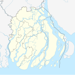 Barisal Location of Barisal in Bangladesh  Barisal Barisal (Bangladesh) | |
| Coordinates: 22.710°N 90.363°E | |
| Country | Bangladesh |
| Division | Barisal Division |
| District | Barisal District |
| Municipality established | 1876 |
| City Corporation | 2002 |
| Granted city status | 19 April 2001[1] |
| Government | |
| • Type | Mayor–Council |
| • Body | Barishal City Corporation |
| • Mayor | Serniabat Sadiq Abdullah |
| • Police commissioner | Md. Saiful Islam, BPM(Bar) |
| Area | |
| • Urban | 58 km2 (22 sq mi) |
| Elevation | 1 m (4 ft) |
| Population (2011)[3] | |
| • City | 328,278 |
| • Density | 10,524/km2 (27,260/sq mi) |
| • Metro | 385,093 |
| Time zone | UTC+6 (BST) |
| Postal code | 8200 |
| Calling code | 0431 |
| National calling code | +880 |
| Police | Barishal Metropolitan Police |
| Domestic airport | Barisal Airport |
| Website | www |
History
Barisal was conquered by Muhammad bin Bakhtiyar Khalji and was later a significant territory of the Delhi Sultanate and Bengal Sultanate. After the decline of the Suri Empire, the territory became a semi-independent area in the Mughal period because of heavy fighting between the Muslims and Hindu chiefs, although most parts of the city were totally under the control of the governors of the proto-industrialised Bengal Subah. In course of time, it fell under the Bengal Nawabs. Raja Ramranjan Chakravarty was put as a de jure king during the Bengal Presidency of the British, later passed to East Pakistan at independence and finally Bangladesh.[citation needed]
In ancient times, it was called Chandradwip (চন্দ্রদ্বীপ), while furing the Medieval Islamic times it was also known as Ismailpur & Bacola (বাকলা) in Europe. Ralph Fitch, the first ever Englishman, a leather merchant, known to have visited Bengal in the mid 1580s, described Barisal in his journal as, "From Chatigan in Bengal, I came to Bacola; the king whereof is a Gentile, a man very well disposed and delighted much to shoot in a gun. His country is very great and fruitful, and hath store of rice, much cotton cloth, and cloth of silk. The houses are very fair and high built, the streets large, and people naked, except a little cloth about their waist. The women wear a great store of silver hoops about their necks and arms, and their legs are ringed with silver and copper, and rings made from elephants' teeth."[9]
The central city of this region is the city of Barisal. It is one of the biggest river ports in Bangladesh. It is a city with nearly 0.38 million people and a divisional headquarters, medical college, cadet college, some pharmaceutical industries, textile industries and the Bangladesh Inland Water Transport Authority's head office. Barisal is fast growing city of the country stands on the Kirtankhola River. Country's first short landing and take off airport has been completed in Barisal and a private Airlines named Air Bengal has begun its regular air flight between Dhaka Hazrat Shahjalal Airport and Barisal.[citation needed]
"Barisal guns" is a natural phenomenon named after Barisal; it is kind of a booming sound heard near lakes and rivers which is due to seismic activity under water, first heard in this region by the British in the 19th century.[citation needed]
Population
Demographics
According to provisional results of the 2011 national census, the population of Barisal (areas under the jurisdiction of the Barisal city corporation) stands at 328,278.[3] By gender, the population was 51.63% male and 48.37% female.[7]
The literacy rate among the urban people of Barisal is 75.3%,[10] which is significantly higher than the national average of 56.5%.[citation needed]
Most people in Barisal are Bengalis. The long-standing inhabitants of the city are known as Barisaliya and they have a distinctive dialect. Apart from them, the city population is composed of people from neighboring upazilas and districts (Patuakhali, Bhola, Pirojpur, Jhalakati, Barguna).[citation needed]
Religion
The majority of Barisal's people are Muslims (89.30%), mainly Sunni Islam of the Hanafi school. Other religious groups include Hindus (9.7%), and very few numbers of other religions, mainly Christians (.98%) and Buddhists (0.01%).[11]
Since 2015, the Catholic minority has its own Roman Catholic Diocese of Barisal.[citation needed]
Geography

Barisal city occupies an area of 58 km2.
Barisal District, with an area of 2790.51 km2, is bounded by Madaripur, Shariatpur, Chandpur and Lakshmipur districts on the north, Patuakhali, Barguna and Jhalokati District on the south, Bhola and Lakshmipur districts on the east, Jhalokati, Pirojpur and Gopalganj districts on the west. Several rivers flow across Barisal including the Kirtankhola, Arial Khan, Khoyrabad, Kalijira and Sandha.
Climate
Barisal has a climate on the border between a dry-winter humid subtropical climate (Köppen (Cwa) and a tropical savanna climate (Aw).
| Month | Jan | Feb | Mar | Apr | May | Jun | Jul | Aug | Sep | Oct | Nov | Dec | Year |
|---|---|---|---|---|---|---|---|---|---|---|---|---|---|
| Average high °C (°F) | 25.5 (77.9) |
28.5 (83.3) |
32.4 (90.3) |
33.5 (92.3) |
33.4 (92.1) |
32.0 (89.6) |
31.2 (88.2) |
31.4 (88.5) |
31.7 (89.1) |
31.7 (89.1) |
29.8 (85.6) |
26.8 (80.2) |
30.7 (87.3) |
| Daily mean °C (°F) | 17.9 (64.2) |
21.5 (70.7) |
25.9 (78.6) |
28.3 (82.9) |
28.9 (84.0) |
28.7 (83.7) |
28.2 (82.8) |
28.4 (83.1) |
28.2 (82.8) |
27.2 (81.0) |
23.6 (74.5) |
19.2 (66.6) |
25.5 (77.9) |
| Average low °C (°F) | 12.0 (53.6) |
15.4 (59.7) |
20.5 (68.9) |
23.8 (74.8) |
24.9 (76.8) |
25.8 (78.4) |
25.7 (78.3) |
25.8 (78.4) |
25.4 (77.7) |
23.7 (74.7) |
18.9 (66.0) |
13.6 (56.5) |
21.3 (70.3) |
| Average rainfall mm (inches) | 10.3 (0.41) |
26.1 (1.03) |
52.4 (2.06) |
103.7 (4.08) |
199.0 (7.83) |
401.7 (15.81) |
409.9 (16.14) |
342.6 (13.49) |
284.4 (11.20) |
185.5 (7.30) |
48.5 (1.91) |
5.9 (0.23) |
2,070 (81.50) |
| Average rainy days | 2 | 4 | 4 | 8 | 12 | 16 | 20 | 19 | 13 | 7 | 3 | 1 | 109 |
| Average relative humidity (%) | 81 | 78 | 76 | 80 | 83 | 88 | 90 | 89 | 89 | 87 | 84 | 83 | 84 |
| Source: Bangladesh Meteorological Department[12][13][14] | |||||||||||||
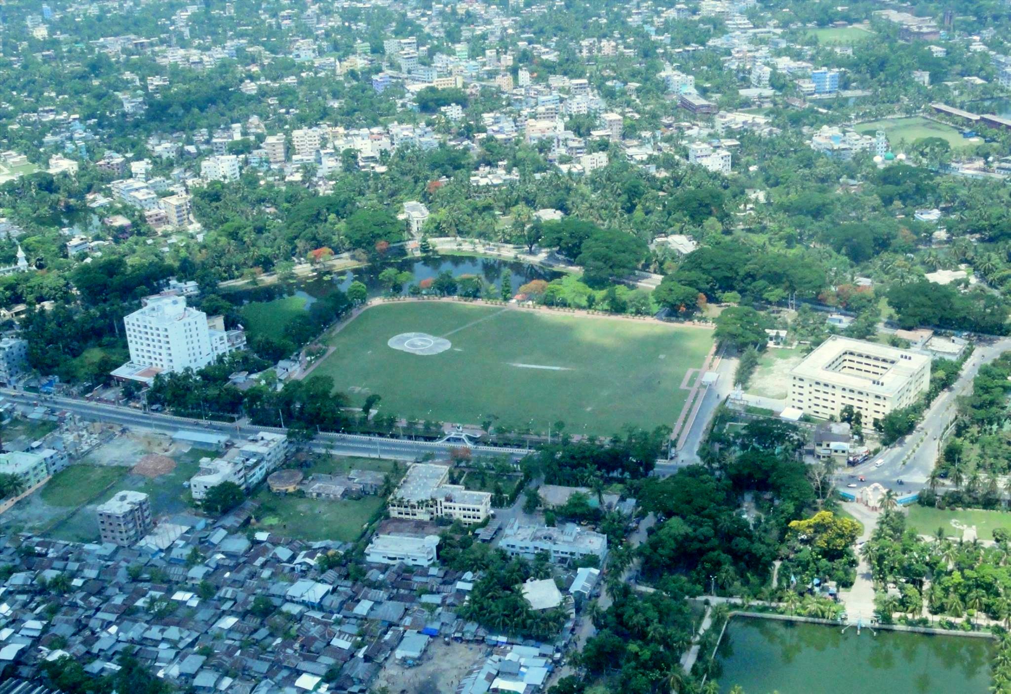
Points of interest
 Durga Sagar in Madhabpasha
 Baitul Aman Jame Masjid Complex
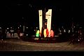 Shohel Chattar, Bibir Pukur Par
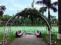 Padma Pukur, Barisal
 Bell's Park aka Bangabandhu Udyan
 30 Godown Freedom Fighters Monument
 Barisal collectorete building
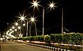 Barisal city at night
 collectorete pond


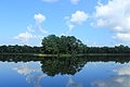
Durga Sagar: with an area of about 2,500 hectare, is the largest pond or dighi of southern Bangladesh. It is located at Madhabpasa village of babuganj upazila, about 11 km away from Barisal town. Locally it is known as Madhabpasha Dighi. According to a desire of Rani Durgavati, mother of Raja Joynarayan, the dighi was dug in 1780 (1187 BS). There are coconut trees around the dighi which together with the dighi are bounded by brick-walls. In the middle of the dighi, there is an island with bushes. Migratory birds usually come here during winter. The surrounding areas of the dighi has now been turned into a picnic spot. Madhabpasha was a capital of the kingdom of Chandradvipa.[citation needed]
- Durga Sagar
- Baitul Aman Jame Masjid Complex
- Oxford Mission Church
- Bell's Park aka Bangubandhu Udyan
- Rupatoli area
- 30 Godown
- Planet Park
- Muktijoddha Park
- Narikel Bagan & Horticulture (Agriculture Training Institute)
- Lakhutia Zamindar Bari
- Korapur Miah Bari Masjid
- Shankar Math
- Town Hall
- Sher-e-Bangla Memorial Museum
- Bir Sreshtho Captain Mohiuddin Jahangir Library and Museum
- Jibanananda Das Museum
- Dapdapia Bridge
- Bibir Pukur[15][16]
- Shahid Shukkur-Gafur Memorial Park, Amanatganj
- Taltali Bridge, Amanatganj
- Padma Pukur (Pond of Lotus)
- Kali Mandir founded by the Poet Mukunda Das
- BadhyaBhumi Monument (বধ্যভূমি স্মৃতিসৌধ)
- Bangladesh Rice Research Institute Regional Centre (Coconut Garden)
Architecture

Barisal's buildings are too diverse to be characterised by any particular architectural style, and have been built over a long period of time.
Some well known heritage buildings are:
- Guthia Baitul Aman Jame Mashjid Complex
- Kamalapur Mosque
- Rammohan Samadhi Mandir
- Sujabad Kella
- Sangram Kella
- Sharkal Fort
- Girja Mahalla
- Bangabondhu Uddyan
- Ebadullah Mosque
- Kasai Mosque
- Oxford Mission Church
- Shankar Math
- Kali Bari of Mukunda Das
- Joint Mosque at Bhatikhana
- Aswini kumar town hall
- Charkella
- Durgasagar Dighi
- One domed Qasba Mosque
- Fakir Bari Jame Mosjid
- Housing Estate Jame Mosjid
- Barisal Zilla School Building
Sports
Cricket and football are the two most popular sports in Barisal while tennis and kabaddi are also popular. There is a national stadium in the city known as Barisal Divisional Stadium (also known as Abdur Rab Serniabad Stadium). It is a multi-purpose stadium and has a capacity of 15,000 spectators. It is currently used mostly for cricket matches. It is also used for football and other sports. Besides different organization share to stage a show there occasionally. Notable players from Barisal who have played for the national team include Shahriar Nafees, Sohag Gazi, Kamrul Islam Rabbi and Fazle Mahmud.[citation needed]
There is a regional sports training centre under Bangladesh Krira Shiksha Pratisthan (BKSP) situated at Rahamatpur in Barisal[17] Barisal is also home to the Bangladesh Premier League franchise Fortune Barishal.
Transport
This section does not cite any sources. (June 2022) |
Air
Barisal Airport is a domestic airport. Biman Bangladesh Airlines, Novoair and US-Bangla Airlines use this port. Active air-route is Barisal-Dhaka-Barisal.
River port
Barisal River Port is the second largest river port of Bangladesh. It's the most popular way of communication for the people of Barisal to Dhaka, the capital city. It is also a popular transport system with other districts like Bhola, Barguna, Lakshmipur.
Road
Barisal is connected to most other regions of the country via the N8 national highway. There are two bus terminals in Barisal, Nathullabad Central Bus terminal and Rupatali Bus Terminal, which connect Barisal to other districts.
Education

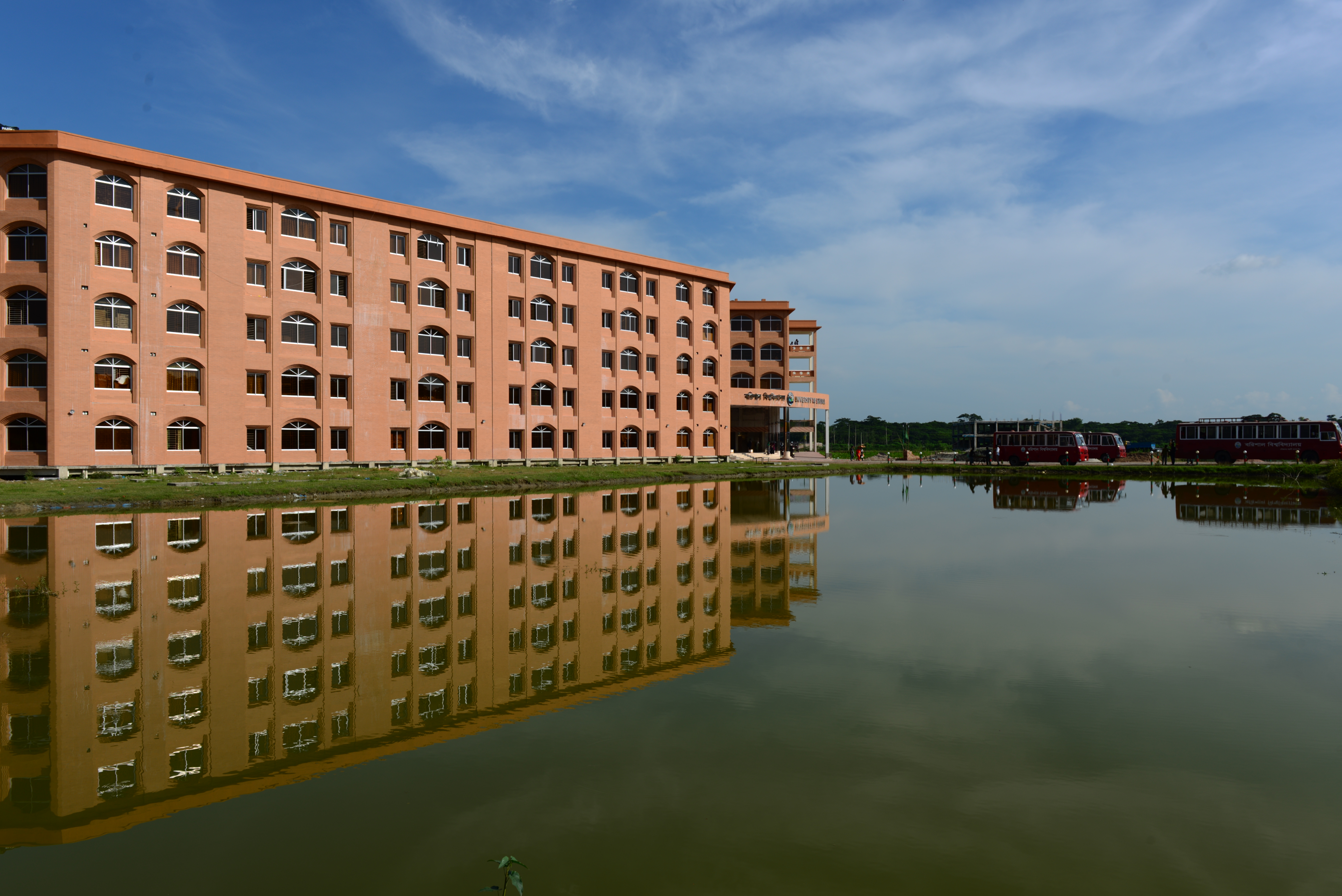
Barisal is home to many educational institutions. Govt. Brojomohan College is the oldest institution of higher education in the city, founded in 1889. There is a public university University of Barisal and two private universities, a government medical college Sher-e-Bangla Medical College (SBMC), a textile engineering college Shaheed Abdur Rab Serniabat Textile Engineering College and an engineering college Barisal Engineering College. There are also educational institutions like Barisal Zilla School, Barisal Cadet College, Govt. Syed Hatem Ali College, Government Women's College, Govt. Barisal College, Amrita Lal Dey College, Barisal Govt. Girls High School, Barisal Model School and College and Barisal Asmat Ali Khan Institution (A.K. School). Besides these there are three teacher training colleges, a Government Polytechnic institute, two technical institutes, a homeopathic college and a social welfare training centre.[citation needed]
Major institutions include:
- Amrita Lal Dey College
- Barisal Cadet College
- Barisal Engineering College
- Barisal Government Women's College
- Barisal Govt. Polytechnic Institute
- Barisal Zilla School
- Brojomohun College
- Government Syed Hatem Ali College
- Shaheed Abdur Rab Serniabat Textile Engineering College
- Sher-e-Bangla Medical College
- University of Barisal
Media
Barisal is a center for the newspaper, periodical and book publishers. Some locally published newspapers and periodicals are:
Newspapers
- Daily Ajker Barisal
- Daily Ajker Barta
- Daily Ajker Poribartan
- Daily Banglar Bone
- Daily Barisal Barta
- Daily Barisal Bhorer Alo
- Daily Barisal Pratidin
- Daily Bhorer Angikar
- Daily Biplobi Bangladesh
- Daily Dakkhinanchal
- Daily Motobad
- Daily Satya Songbad
- Daily Shahnama
Source:[18]
Periodicals
- Bakerganj Parikrama
- Chirantan Bangla
- Upakul
- Gournadi Parikrama
- Khadem
- Jago Nare
Notable people
See also
- Barisal City Corporation
- Barisal District
- Barisal Division
Notes
References
- "Barisal City Master Plan". Urban Development Directorate - Government of Bangladesh. Archived from the original on 14 April 2015. Retrieved 14 April 2015.
- "Barisal City Corporation, Bangladesh" (PDF). ICLEI. Archived from the original (PDF) on 12 April 2015. Retrieved 12 April 2015.
- "Population & Housing Census-2011" (PDF). Bangladesh Bureau of Statistics. p. 38. Archived from the original (PDF) on 8 December 2015. Retrieved 15 December 2015.
- "Bangladesh changes English spellings of five districts". Bdnews24.com. Dhaka. 2 April 2018. Retrieved 2 April 2018.
- Mahadi Al Hasnat (2 April 2018). "Mixed reactions as govt changes English spellings of 5 district names". Dhaka Tribune. Retrieved 8 April 2018.
- Tapan Palit (2012). "Barisal City Corporation". In Sirajul Islam and Ahmed A. Jamal (ed.). Banglapedia: National Encyclopedia of Bangladesh (Second ed.). Asiatic Society of Bangladesh.
- "Barisal City Corporation". Barisal City Corporation. Archived from the original on 2013-07-23. Retrieved 2014-09-19.
- "Our Cities: Beyond the Capital". 15th Anniversary Special. The Daily Star. 10 February 2006.
- Ryley, J. Horton (1998). Ralph Fitch, England's pioneer to India and Burma : his companions and contemporaries ; with his remarkable narrative told in his own words (Reprint [der Ausg.] London, Fisher Unwin, 1899. ed.). New Delhi [u.a.]: Asian Educational Services. p. 118. ISBN 9788120613249.
- "Bangladesh Bureau of Statistics Region Census 2011 page 30" (PDF). Bangladesh Bureau of Statistics. Archived from the original (PDF) on 2014-11-13. Retrieved 2014-09-20.
- "..:: Bangladesh Bureau of Statistics ::.. Region Census 2011 page 28" (PDF). Bangladesh Bureau of Statistics. Archived from the original (PDF) on 2014-09-24. Retrieved 2014-09-20.
- "Climate of Bangladesh" (PDF). Bangladesh Meteorological Department. pp. 19–23. Archived from the original (PDF) on 24 December 2018. Retrieved 24 December 2018.
- "Normal Monthly Rainy Day" (PDF). Bangladesh Meteorological Department. Archived from the original on 9 July 2017. Retrieved 24 December 2018.
- "Normal Monthly Humidity" (PDF). Bangladesh Meteorological Department. Archived from the original on 24 December 2018. Retrieved 24 December 2018.
- "Barisal Bibir Pukur needs attention". New Age. 30 June 2017. Retrieved 2018-11-23.
- Ghosh, Sushanta (8 July 2017). "Bibir Pukur lies neglected". The Daily Star. Retrieved 2018-11-23.
- "BKSP-Banglapedia". Retrieved 10 July 2014.
- পত্র-পত্রিকা [Newspapers]. Barisal (in Bengali). Bangladesh National Portal. Archived from the original on 28 September 2019. Retrieved 19 June 2017.
External links
Cities, towns and locations in Barisal District | |||||||||||||||||||||
|---|---|---|---|---|---|---|---|---|---|---|---|---|---|---|---|---|---|---|---|---|---|
| Cities, municipal and towns |
| ||||||||||||||||||||
| Neighbourhoods and localities |
| ||||||||||||||||||||
| See also |
| ||||||||||||||||||||
Ministry of Public Administration Ministry of Local Government, Rural Development and Co-operatives | ||
| Major cities (11) (City Corporations) |
|  |
| Cities (32) (Municipal Corporations) | ||
| Towns |
| |
Authority control | |
|---|---|
| General |
|
| National libraries | |
На других языках
[de] Barishal
Barishal (bengalisch বরিশাল IAST .mw-parser-output .Latn{font-family:"Akzidenz Grotesk","Arial","Avant Garde Gothic","Calibri","Futura","Geneva","Gill Sans","Helvetica","Lucida Grande","Lucida Sans Unicode","Lucida Grande","Stone Sans","Tahoma","Trebuchet","Univers","Verdana"}Bariśāl; auch Barisal) ist eine Stadt im Süden von Bangladesch, ca. 70 km entfernt von der bengalischen Küste. Die über 328.000 Einwohner zählende Stadt ist Sitz der Verwaltung der gleichnamigen Division und des gleichnamigen Distrikts.- [en] Barisal
[ru] Барисал
Бариса́л (бенг. বরিশাল) — один из крупнейших городов Бангладеш. Расположен в одноимённом округе на юге Бангладеш, возле Бенгальского залива. Население муниципалитета — ок. 210 374 человек (оценочно на 2008 год). Площадь — 19.99 км². Барисал стал муниципалитетом в 2003 году. Город называют «Венецией Востока»[1].Другой контент может иметь иную лицензию. Перед использованием материалов сайта WikiSort.org внимательно изучите правила лицензирования конкретных элементов наполнения сайта.
WikiSort.org - проект по пересортировке и дополнению контента Википедии