world.wikisort.org - Bangladesh
Muladi (Bengali: মুলাদী) is an Upazila of Barishal District in the Division of Barishal, Bangladesh.[1]
Muladi
মুলাদী | |
|---|---|
Upazila | |
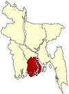
 Muladi Location in Bangladesh | |
| Coordinates: 22°54.9′N 90°24.9′E | |
| Country | |
| Division | Barishal Division |
| District | Barishal District |
| Government | |
| • MP | Golam Kibria Tipu |
| Area | |
| • Total | 261.02 km2 (100.78 sq mi) |
| Population (2011) | |
| • Total | 174,775 |
| • Density | 659/km2 (1,710/sq mi) |
| Time zone | UTC+6 (BST) |
| Website | Official Map of the Muladi Upazila |
Geography
Muladi is located at 22.9153°N 90.4150°E. It has a total area of 261.02 km2. It borders Gosairhat Upazila on the north, Barisal Sadar Upazila on the south, Hizla and Mehendiganj Upazilas on the east and Kalkini, Gournadi and Babuganj Upazilas on the west.
Demographics
| Year | Pop. (000) | ±% |
|---|---|---|
| 1981 | 146 | — |
| 1991 | 171 | +17.1% |
| 2001 | 183 | +7.0% |
| 2011 | 175 | −4.4% |
| Source: Bangladesh Bureau of Statistics[2] | ||
According to the 2011 Bangladesh census, Muladi Upazila had 38,394 households and a population of 174,775, 18.5% of whom lived in urban areas. 11.1% of the population was under the age of 5. The literacy rate (age 7 and over) was 56.0%, compared to the national average of 51.8%. The people of Muladi are 98.12% muslim,1.86% Hindu.[3][4]
Main occupations
51.17% of the population work in agriculture, 20.67% as agricultural labourers, 3.18% as wage labourers, 7.52% in commerce, 7.13% in services, 2.5% in fishing and 7.83% in other occupations.
Land use
Cultivable land covers 26159.45 hectares and fallow land 237.56 hectares; single crop 42%, double crop 50% and treble crop land 8%. 74% of cultivable land is under irrigation.
Land control
Among the peasants, 29% are landless, 7.09% marginal, 32.82% small, 27% intermediate and 4.09% rich; cultivable land per head 0.14 hectare.
Land value
The market value of land of the first grade is approximately 5000 Tk per 0.01 hectares.
Crops and fruits
The main crops are Paddy, wheat, sweet potatoes, pulses, brinjal and betel leaves, and the main fruits are mangoes, jackfruits, bananas, blackberries, coconuts, lychee, palms, betel nuts and amra. The extinct or nearly extinct crops are Jute, tobacco, mustard seeds, groundnuts, garlic, sugar cane, arahar, china and kaun.
Administration
Muladi thana was established in 1967 and was turned into an upazila in 1983.
Muladi Upazila is divided into Muladi Municipality and seven union parishads: Batamara, Char Kalekhan, Gachhua, Kazir Char, Muladi, Nazirpur, and Safipur. The union parishads are subdivided into 77 mauzas and 102 villages.[2]
Upazila Chairman : Tariqul Hasan Khan Mithu
Woman Vice Chairman :Samima Nasrin
Vice Chairman :
Upazila Nirbahi Officer (UNO) : Nur Mohammad Hossaini
Education
There are 6 colleges, 30 high schools, 5 junior schools, 78 government primary schools, 50 non-government primary schools, 17 madrasas and a kindergarten. The noted educational institutions are Bheduriachar Government Primary School (1892) and Tayak Tomchar Government Primary School (1845).
Educational institutions in Muladi Upazila include:
- Muladi Govt. College
- Charlakhsmipur Fazil Madrasah (Established -1937)
- Laxmipur High School (Established:1964), Luxmipur
- Patarchar Luxmipur Govt. Primary School (Est. 1911)
- Laxmipur Govt.Primary School (Established:1956), Luxmipur
- Arif Mahmud Degree College
- Muladi M.J Govt. High School (Bir Sreshtho and martyr of Bangladesh Liberation War Mohiuddin Jahangir was a student of this school)
- Purba Hosnad Moha Biddaloy, Gachua, Hosnabad
- Gachua Abdul Kader High School (Established: 1971)
- Paiksha Hosnabad High School, Paiksha
- Muladi Islamia Senior Madrassa
- South Kazirchar High School (Established: 1939)
- Kazirchar Secondary School (established: 1939)
- Bahadurpur Fazlur Rahim Sharif Secondary School (Established: 1963)
- Nazirpur United Degree College
- Nazirpur High School
- Nazirpur Girls' School
- Jalalpur Secondary School
- Nazirpur Boro Bari Shikhon School
- Ramarpole Aferuddin Memorial High School (founded by Mohammad Abul Kashem Laal Miah Mridha)
- A.B.R. High School, Alimabad, Jagorani High School, Tayka
- Islamia Shishu Shodon (orphanage), founded by Faruqe Ahmed at East Nazirpur,
- Banimordon High School, Banimordon
- Charpadma Rashidia islamia fazil madrasha,Safipur
- Banimordon Fazil Madrassa
- Shaheed Altaf Mahamud Secondary School.
- VP-Md. Rana Khan-Charkalekhan Ideal Degree College
- Charkalekhan Ideal High School
- Charkalekhan Nesaria Fazil Madrasa
- Sayeder Gaon High School (Established:1928)
- BDCH Complex including a High School & a government Primary School (Established; 1993)
- Balarampur Govt. Primary School, Balarampur
- Safipur High School
- Safipur Govt. Primary School (Established; 1921)
- Haji Badrul Hossain Degree College
Notable residents
Altaf Mahmud (he was a musician, cultural activist, and martyred freedom fighter of the Bangladesh Liberation War).
See also
- Upazilas of Bangladesh
- Districts of Bangladesh
- Divisions of Bangladesh
References
- Md. Mizanur Rahman (2012). "Muladi Upazila". In Sirajul Islam and Ahmed A. Jamal (ed.). Banglapedia: National Encyclopedia of Bangladesh (Second ed.). Asiatic Society of Bangladesh.
- "District Statistics 2011: Barisal" (PDF). Bangladesh Bureau of Statistics. Archived from the original (PDF) on 13 November 2014. Retrieved 14 July 2014.
- "Community Report: Barisal" (PDF). Population & Housing Census 2011. Bangladesh Bureau of Statistics. Retrieved 15 August 2018.
- "Population and Housing Census 2011: Bangladesh at a Glance" (PDF). Bangladesh Bureau of Statistics. Archived from the original (PDF) on 28 July 2014. Retrieved 21 July 2014.
External links
Другой контент может иметь иную лицензию. Перед использованием материалов сайта WikiSort.org внимательно изучите правила лицензирования конкретных элементов наполнения сайта.
WikiSort.org - проект по пересортировке и дополнению контента Википедии
