world.wikisort.org - Bangladesh
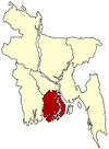
Kawkhali (Bengali: কাউখালী) is an upazila of Pirojpur District in the Division of Barisal, Bangladesh.[1]
Kawkhali
কাউখালী | |
|---|---|
Upazila | |
 Kawkhali Location in Bangladesh | |
| Coordinates: 22°37.2′N 90°4.2′E | |
| Country | |
| Division | Barisal Division |
| District | Pirojpur District |
| Area | |
| • Total | 79.64 km2 (30.75 sq mi) |
| Population (1991) | |
| • Total | 70,347 |
| • Density | 880/km2 (2,300/sq mi) |
| Time zone | UTC+6 (BST) |
| Website | Official Map of the Kawkhali Upazila |
Geography
Kawkhali is located at 22.6203°N 90.0694°E. It has 13,763 households and a total area of 79.64 km2.
Demographics
According to the 1991 Bangladesh census,[2] Kawkhali had a population of 70,347, of whom 37,391 were aged 18 or older. Males constituted 50.46% of the population, and females 49.54%. Kawkhali had an average literacy rate of 50.4% (7+ years), compared to the national average of 32.4%.[3]
Administration
Kawkhali Upazila is divided into five union parishads: Amrajuri, Chirapara Parshaturia, Kawkhali, Sayna Raghunathpur, and Shial Kati. The union parishads are subdivided into 45 mauzas and 59 villages.[4]
Kawkhali town
Kawkhali is a small town and its communication depends on rivers and roads. It has a launch & steamer station which dates from the British period. The Gabkhan Channel starts from Kawkhali near the village of Ashoa. On it many ships run from Mongla seaport to Dhaka.
See also
- Upazilas of Bangladesh
- Districts of Bangladesh
- Divisions of Bangladesh
References
- Tapan Kumar Roy (2012). "Kawkhali Upazila (Pirojpur District)". In Sirajul Islam and Ahmed A. Jamal (ed.). Banglapedia: National Encyclopedia of Bangladesh (Second ed.). Asiatic Society of Bangladesh.
- "US Gazetteer files: 2010, 2000, and 1990". United States Census Bureau. 2011-02-12. Archived from the original on 2002-05-27. Retrieved 2011-04-23.
- "Population Census Wing, BBS". Archived from the original on 2005-03-27. Retrieved November 10, 2006.
- "District Statistics 2011: Pirojpur" (PDF). Bangladesh Bureau of Statistics. Archived from the original (PDF) on 13 November 2014. Retrieved 14 July 2014.
Другой контент может иметь иную лицензию. Перед использованием материалов сайта WikiSort.org внимательно изучите правила лицензирования конкретных элементов наполнения сайта.
WikiSort.org - проект по пересортировке и дополнению контента Википедии
