world.wikisort.org - Bangladesh
Rangabali is an Upazila of Patuakhali District in the Division of Barisal, Bangladesh.[1]
Rangabali | |
|---|---|
Upazila | |
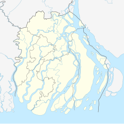 Rangabali Location in Barisal division, Bangladesh | |
| Coordinates: 21°56′N 90°26′E | |
| Country | |
| Division | Barisal Division |
| District | Patuakhali District |
| Area | |
| • Total | 470.12 km2 (181.51 sq mi) |
| Population | |
| • Total | 103,003 |
| • Density | 220/km2 (570/sq mi) |
| Time zone | UTC+6 (BST) |
Location
Rangabali Upazila is located in the southernmost part of Patuakhali District in the chars of the Bay of Bengal. Chalitabunia and Agunmukha rivers and Char Biswas in the north, Ramnabad Channel and Kalapara Upazila in the west, Char Kurri-Mukri in Char Fasson Upazila in the east and Bay of Bengal in the south.
Administrative Areas
At present there are 6 unions in Rangabali upazila. Administrative activities of the whole upazila are under Rangabali police station.
Unions:
- Rangabali Sadar Union
- Bara Baishadia Union
- Chhoto Baishdia Union
- Char Momtaz Union
- Chalitabunia Union
- Maudubi Union (formed from Bara Baishadia Union)
History
Naming of Upazila: The exact history of naming of Rangabali upazila is not known. However, it is said that due to the creation of new shelf in the sea, the sand of this shelf was red in the evolution of time. The word 'red' is locally known as 'ranga'. This is the origin of the name "Rangabali". Historians say that in 184, some Rakhine people fled the state of Arakan and settled in the area. From then on, settlement started in this area.
Origin of the Upazila: The administrative approval of Rangabali Upazila was given on 6 June 2011 at the 105th meeting of Nikar (National Implementation Committee for Administration Reform). Following this, Bangladesh Gazette was published on 13 June 2011. The Upazila was inaugurated in 2012.
Demographics
The current population as per 2011 census is 103,003. Of this the entire population is rural. Muslims make up 101,046 (98.10%) and Hindus 1,868 (1.81%).[2]
Notable Social Organizations
- Rangabali Press Club
- Rangabali Youth Society (RYS)
References
- Rajib Mondal (2012). "Rangabali Upazila". In Sirajul Islam and Ahmed A. Jamal (ed.). Banglapedia: National Encyclopedia of Bangladesh (Second ed.). Asiatic Society of Bangladesh.
- "Community Tables: Patuakhali district" (PDF). bbs.gov.bd. 2011.
| Upazila/Thana: | ||
|---|---|---|
Capital: Barisal | ||
| Barguna District |
|  |
| Barisal District |
| |
| Bhola District |
| |
| Jhalokati District | ||
| Patuakhali District | ||
| Pirojpur District | ||
This Barisal Division location article is a stub. You can help Wikipedia by expanding it. |
Другой контент может иметь иную лицензию. Перед использованием материалов сайта WikiSort.org внимательно изучите правила лицензирования конкретных элементов наполнения сайта.
WikiSort.org - проект по пересортировке и дополнению контента Википедии