world.wikisort.org - Bangladesh
Patharghata (Bengali: পাথরঘাটা উপজেলা) is an Upazila of Barguna District[1] in the Division of Barisal, Bangladesh.
| ||||||||||||||||||||||||||||||||||||||||||||||||||||||||||||||||||||||||||||||||||||||||||||||||||||||||||||||||||||||||||||
This article may be expanded with text translated from the corresponding article in Bangla. (January 2020) Click [show] for important translation instructions.
|
Patharghata Upazila
পাথরঘাটা উপজেলা | |
|---|---|
Upazila | |
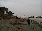
Skyline of Patharghata, Bangladesh | |
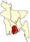
 Patharghata Upazila Location in Bangladesh | |
| Coordinates: 22°2.7′N 89°58.1′E | |
| Country | |
| Division | Barisal Division |
| District | Barguna District |
| Area | |
| • Total | 387.36 km2 (149.56 sq mi) |
| Population (1991) | |
| • Total | 134,635 |
| • Density | 350/km2 (900/sq mi) |
| Time zone | UTC+6 (BST) |
| Website | Official Map of the Patharghata Upazila |
Geography
Patharghata is located at 22.0458°N 89.9689°E. It has 25,610 households and a total area of 387.36 km2.
Demographics
As of the 1991 Bangladesh census, Patharghata has a population of 134635. Males constitute 50.56% of the population, and females 49.44%. This Upazila's eighteen up population is 68751. Patharghata has an average literacy rate of 66.4% (7+ years), and the national average of 32.4% literate.[4]
Administration
Patharghata Upazila is divided into Patharghata Municipality and seven union parishads: Char Duani, Kakchira, Kalmegha, Kathaltali, Nachnapara, Patharghata, and Raihanpur. The union parishads are subdivided into 42 mauzas and 66 villages.[5]
Patharghata Municipality is subdivided into 9 wards and 9 mahallas.[5]
| No. | Name of the Union |
|---|---|
| 1 | Charduani |
| 2 | Kakchira |
| 3 | Kalmegha |
| 4 | Kanthaltali |
| 5 | Nachna Para |
| 6 | Patharghata |
| 7 | Raihanpur |
See also
- Upazilas of Bangladesh
- Districts of Bangladesh
- Divisions of Bangladesh
References
- Safiuddin Ahmed (2012). "Patharghata Upazila". In Sirajul Islam and Ahmed A. Jamal (ed.). Banglapedia: National Encyclopedia of Bangladesh (Second ed.). Asiatic Society of Bangladesh.
- "NASA Earth Observations: Rainfall (1 month - TRMM)". NASA/Tropical Rainfall Monitoring Mission. Retrieved 30 January 2016.
- "NASA Earth Observations Data Set Index". NASA. Retrieved 30 January 2016.
- "Population Census Wing, BBS". Archived from the original on 2005-03-27. Retrieved November 10, 2006.
- "District Statistics 2011: Barguna" (PDF). Bangladesh Bureau of Statistics. Archived from the original (PDF) on 13 November 2014. Retrieved 14 July 2014.
- "Union Parishad List of Patharghata Upazila". Local Government Engineering Department (LGED). Retrieved 23 November 2020.
Другой контент может иметь иную лицензию. Перед использованием материалов сайта WikiSort.org внимательно изучите правила лицензирования конкретных элементов наполнения сайта.
WikiSort.org - проект по пересортировке и дополнению контента Википедии


