world.wikisort.org - Bangladesh
Wazirpur (Bengali: উজিরপুর) is an Upazila of Barisal District in the Division of Barisal, Bangladesh.[1]
This article needs additional citations for verification. (August 2015) |
Uzirpur
উজিরপুর | |
|---|---|
Upazila | |
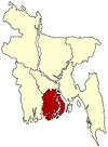
 Uzirpur Location in Bangladesh | |
| Coordinates: 22°48.7′N 90°14.7′E | |
| Country | |
| Division | Barisal Division |
| District | Barisal District |
| Area | |
| • Total | 248.35 km2 (95.89 sq mi) |
| Population (1991) | |
| • Total | 227,115 |
| • Density | 910/km2 (2,400/sq mi) |
| Time zone | UTC+6 (BST) |
| Website | Official Map of the Wazirpur Upazila |

Geography
Wazirpur is located at 22.8111°N 90.2444°E. It has 44,480 households and a total area of 248.35 km2.
Demographics
According to the 1991 Bangladesh census, Wazirpur had a population of 227,115. Males constituted 50.8% of the population, and females 49.2%. The number of residents aged 18 or over was 114,254. Wazirpur has an average literacy rate of 47.7% (7+ years), compared to the national average of 32.4%. There are 22 colleges and 50 primary schools in Wazirpur.[2]
Administration
Wazirpur Upazila is divided into nine union parishads: Bamrail, Barakotha, Guthia, Harta, Jalla, Otra, Satla, Shikarpur and Sholak. The union parishads are subdivided into 118 mauzas and 125 villages.[3]
Notable residents
- Major M. A. Jalil, freedom fighter and politician, was born at Wazirpur in 1942.[4]
- Sardar Fazlul Karim, philosopher, was born at Atipara village in 1925.[5]
- Manabendra Mukherjee (singer)[citation needed]
See also
- Upazilas of Bangladesh
- Districts of Bangladesh
- Divisions of Bangladesh
References
- Md. Mizanur Rahman (2012). "Wazirpur Upazila". In Sirajul Islam and Ahmed A. Jamal (ed.). Banglapedia: National Encyclopedia of Bangladesh (Second ed.). Asiatic Society of Bangladesh.
- "Population Census Wing, BBS". Archived from the original on 2005-03-27. Retrieved November 10, 2006.
- "District Statistics 2011: Barisal" (PDF). Bangladesh Bureau of Statistics. Archived from the original (PDF) on 13 November 2014. Retrieved 14 July 2014.
- Khan, Muazzam Hussain (2012). "Jalil, Major Mohammad Abdul". In Islam, Sirajul; Jamal, Ahmed A. (eds.). Banglapedia: National Encyclopedia of Bangladesh (Second ed.). Asiatic Society of Bangladesh.
- "Sardar Fazlul Karim remembered in Barisal". The Daily Star. 25 August 2014.
Другой контент может иметь иную лицензию. Перед использованием материалов сайта WikiSort.org внимательно изучите правила лицензирования конкретных элементов наполнения сайта.
WikiSort.org - проект по пересортировке и дополнению контента Википедии
