world.wikisort.org - Bangladesh
Gournadi (Bengali: গৌরনদী) is an administrative unit of Barishal District in the Division of Barishal, Bangladesh.[1] Many popular persons born and in this region.Some important persons who fought for our independence which we have achieved in 16 December 1971.
Gournadi
গৌরনদী | |
|---|---|
Upazila | |
|
From top: Kasba Masjid, Mahilara Sarkar Math and Kamalapur Masjid Skyline of Gournadi, Bangladesh | |
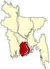
 Gournadi Location in Bangladesh | |
| Coordinates: 22°58.4′N 90°13.8′E | |
| Country | Bangladesh |
| Division | Barisal Division |
| District | Barisal District |
| Area | |
| • Total | 144.18 km2 (55.67 sq mi) |
| Population (2001) | |
| • Total | 180,219 |
| • Density | 1,200/km2 (3,200/sq mi) |
| Time zone | UTC+6 (BST) |
| Website | gournadi |
Geography
Gournadi is located at 22.9736°N 90.2306°E. It has 37,047 households and a total area of 144.18 km2.
Demographics
According to the 2001 Bangladesh census, Gournadi had a population of 180,219. Males constituted 51.03% of the population, and females 48.97%. Gournadi had an average literacy rate of 59.4% (7+ years).[2]
Administration
Gournadi Upazila is divided into Gournadi Municipality and seven union parishads: Barthi, Batajore, Chandshi, Khanjapur, Mahilara, Nalchira, and Sarikal. The union parishads are subdivided into 108 mauzas and 109 villages.[3]
Gournadi Online/Offline Media/Newspaper/Portal
See also
- Gournadi
- Upazilas of Bangladesh
- Districts of Bangladesh
- Divisions of Bangladesh
- West Showra Alim Madrasha
- Sarikal Union
- Batajor Union
- Nalchira Union
- Berthi Union
- Mahilara Union
References
- Md Mizanur Rahman (2012). "Gaurnadi Upazila". In Sirajul Islam and Ahmed A. Jamal (ed.). Banglapedia: National Encyclopedia of Bangladesh (Second ed.). Asiatic Society of Bangladesh.
- "Census Results by Upazila/Thana" (PDF). Bangladesh Bureau of Statistics. 2001. Archived from the original (PDF) on 2007-07-04. Retrieved 2008-08-27.
- "District Statistics 2011: Barisal" (PDF). Bangladesh Bureau of Statistics. Archived from the original (PDF) on 13 November 2014. Retrieved 14 July 2014.
Другой контент может иметь иную лицензию. Перед использованием материалов сайта WikiSort.org внимательно изучите правила лицензирования конкретных элементов наполнения сайта.
WikiSort.org - проект по пересортировке и дополнению контента Википедии


