world.wikisort.org - Bangladesh
Kushtia (Bengali: কুষ্টিয়া) is a city in the Khulna Division of southwestern Bangladesh. Kushtia is the second largest municipality in Bangladesh and the eleventh largest city in the country. The second largest city in Khulna division. It is one of the commercial cities.[6] It serves as the headquarters of Kushtia Sadar Upazila and Kushtia District.[3]
Kushtia
কুষ্টিয়া | |
|---|---|
      from top: Kushtia city skyline, Porimol Tower, Lovely Tower, Tomb of Lalon, Tagore kuthibari, Hardinge Bridge | |
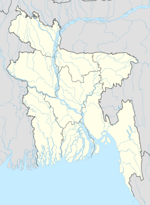 Kushtia Location in Bangladesh | |
| Coordinates: 23.910125°N 89.123115°E | |
| Country | |
| Division | Khulna Division |
| District | Kushtia District |
| Subdistrict | Kushtia Sadar Upazila |
| Municipality | 1 April 1869 [1] |
| Government | |
| • Type | Mayor–Council |
| • Body | Kushtia Municipality |
| • Paura Mayor | Md. Anwar Ali [2] |
| Area | |
| • Urban | 66.00 km2 (25.48 sq mi) |
| • Metro | 120.23 km2 (46.42 sq mi) |
| Population (2018 [4]) | |
| • Urban | 418,312 |
| • Urban density | 6,300/km2 (16,000/sq mi) |
| • Metro | 550,000 |
| • Metro density | 4,600/km2 (12,000/sq mi) |
| • Rank | 13th |
| Time zone | UTC+6 (Bangladesh Time) |
| Postal code | 7000[5] |
| National Dialing Code | +880 |
Education
According to Banglapedia, Dinmani Secondary School, founded in 1930, Kushtia Zilla School (1960), Kumarkhali M N High School and Mohini Mohan High School (1944) are notable secondary schools.[3] [7]
References
- "History of Kushtia municipality". Retrieved 2019-10-07.
- "Mayor of Kushtia city's civic body". News24.com. Retrieved 2019-10-07.
- Bhuiyan, Md Abu Taher (2012). "Kushtia Sadar Upazila". In Islam, Sirajul; Jamal, Ahmed A. (eds.). Banglapedia: National Encyclopedia of Bangladesh (Second ed.). Asiatic Society of Bangladesh.
- "কুষ্টিয়া পৌরসভা". municipality.kushtia.gov.bd.
- Staff. "ZIP Code database of Bangladesh". Geopostcodes.com. Retrieved 11 June 2008.
- "NGA GeoNames Database". National Geospatial-Intelligence Agency. Retrieved 2 January 2015.
- "Home". kumarkhalimnsecondaryschool.jessoreboard.gov.bd.
External links
Wikivoyage has a travel guide for Kushtia.
Authority control | |
|---|---|
| General | |
| National libraries | |
This Khulna Division location article is a stub. You can help Wikipedia by expanding it. |
На других языках
- [en] Kushtia
[ru] Куштия
Куштия или Куштиа[4](бенг. কুষ্টিয়া) — город и муниципалитет на западе Бангладеш, административный центр одноимённого округа. Муниципалитет был основан в 1969 году. Площадь города равна 13,31 км². По данным переписи 2001 года, в городе проживало 86 066 человек, из которых мужчины составляли 51,34 %, женщины — соответственно 48,66 %. Плотность населения равнялась 6466 чел. на 1 км². Уровень грамотности взрослого населения составлял 64,1 % (при среднем по Бангладеш показателе 43,1 %).Текст в блоке "Читать" взят с сайта "Википедия" и доступен по лицензии Creative Commons Attribution-ShareAlike; в отдельных случаях могут действовать дополнительные условия.
Другой контент может иметь иную лицензию. Перед использованием материалов сайта WikiSort.org внимательно изучите правила лицензирования конкретных элементов наполнения сайта.
Другой контент может иметь иную лицензию. Перед использованием материалов сайта WikiSort.org внимательно изучите правила лицензирования конкретных элементов наполнения сайта.
2019-2025
WikiSort.org - проект по пересортировке и дополнению контента Википедии
WikiSort.org - проект по пересортировке и дополнению контента Википедии