world.wikisort.org - India
North 24 Parganas (abv. 24 PGS (N)) or sometimes North Twenty Four Parganas is a district in southern West Bengal, of eastern India. North 24 Parganas extends in the tropical zone from latitude 22° 11′ 6″ north to 23° 15′ 2″ north and from longitude 88º20' east to 89º5' east. Barasat is the district headquarters of North 24 Parganas. North 24 Parganas is West Bengal's most populous district[3] and also (since 2014) the most populated district in the whole of India. It is the tenth-largest district in the State by area.
This article needs additional citations for verification. (September 2022) |
North 24 Parganas | |
|---|---|
District | |
      Clockwise from top-left: Mangal Pandey Park in Barrackpore Cantonment, Matua Mahasangha headquarters in Thakurnagar, Lal Masjid in Berachampa, Baranagar Ramakrishna Mission, Chandraketugarh, Dakshineswar Kali temple | |
 Location of North 24 Parganas in West Bengal | |
 Interactive Map Outlining North 24 Parganas | |
| Coordinates: 22°08′N 88°30′E | |
| Country | |
| State | |
| Division | Presidency |
| Headquarters | Barasat |
| Government | |
| • Lok Sabha constituencies | Bangaon, Barrackpore, Dum Dum, Barasat, Basirhat |
| • Vidhan Sabha constituencies | Bagda, Bangaon Uttar, Bangaon Dakshin, Gaighata, Swarupnagar, Baduria, Habra, Ashoknagar, Amdanga, Bijpur, Naihati, Bhatpara, Jagatdal, Noapara, Barrackpore, Khardaha, Dum Dum Uttar, Panihati, Kamarhati, Baranagar, Dum Dum, Madhyamgram, Barasat, Bidhannagar, Rajarhat New Town, Rajarhat Gopalpur, Deganga, Haroa, Minakhan, Sandeshkhali, Basirhat Dakshin, Basirhat Uttar, Hingalganj |
| Area | |
| • Total | 4,094 km2 (1,581 sq mi) |
| Population (2011) | |
| • Total | 10,009,781 |
| • Density | 2,400/km2 (6,300/sq mi) |
| Demographics | |
| • Literacy | 84.95 percent[1] |
| • Sex ratio | 949 |
| Time zone | UTC+05:30 (IST) |
| Major highways | NH 12, NH 112 |
| HDI (2004) | |
| Average annual precipitation | 1579 mm |
| Website | www |
History
| Year | Pop. | ±% p.a. |
|---|---|---|
| 1901 | 1,016,001 | — |
| 1911 | 1,166,158 | +1.39% |
| 1921 | 1,239,719 | +0.61% |
| 1931 | 1,357,831 | +0.91% |
| 1941 | 1,711,806 | +2.34% |
| 1951 | 2,114,097 | +2.13% |
| 1961 | 3,127,685 | +3.99% |
| 1971 | 4,207,420 | +3.01% |
| 1981 | 5,529,497 | +2.77% |
| 1991 | 7,281,881 | +2.79% |
| 2001 | 8,934,286 | +2.07% |
| 2011 | 10,009,781 | +1.14% |
| source:[4] | ||
British Raj
The territory of Greater 24 Parganas were under the Satgaon (ancient Saptagram, now in Hoogly district) administration during the Mughal era and later it was included in Hoogly chakla (district under post-Mughal Nawabi rule) during the rule of Murshid Quli Khan. In 1757, after the Battle of Plassey, Nawab Mir Jafar conferred the Zamindari of 24 parganas and janglimahals (small administrative units) upon the British East India Company. These Parganas are: 1. Akbarpur, 2. Amirpur, 3. Asimabad, 4. Balia, 5. Baridhati, 6. Basandhari, 7. Calcutta, 8. Dakshin Sagar, 9. Garh, 10. Hathiagarh, 11. Ikhtiarpur, 12. Kharijuri, 13. Khaspur, 14. Maidanmal or Mednimall, 15. Magura, 16. Mayda, 17. Manpur, 18. Murnagacha, 19. Paika, 20. Pechakul, 21. Satal, 22. Shahnagar, 23. Shahpur, and 24. Uttar Pargana (O'Mally, L.S.S. (1914) Bengal District Gazetteers: 24 Parganas. Page 44). Since then, this entire territory is known as 'Twentyfour Parganas'.
In 1751, the Company assigned John Zephaniah Holwell as zemindar of the District.[5] In 1759, after the Bengali War of 1756–1757, the Company assigned it to Lord Clive as a personal Jaghir (zamindari) and after his death it again came under the direct authority of the company.
In 1793, during the rule of Lord Cornwallis, entire Sunderbans were in Twentyfour Parganas. In 1802, some parganas on the western banks of river Hoogly were included into it. These parganas were in Nadia earlier. In 1814, a separate collectorate was established in Twenty-four Parganas. In 1817, Falta and Baranagar and in 1820, some portions of Nadia's Balanda and Anwarpur were encompassed to it. In 1824, portions of Barasat, Khulna and Bakhargunge (now in Bangladesh) were also included to it. In 1824, the district headquarters was shifted from Kolkata to Baruipur, but in 1828, it was removed to Alipore. In 1834, the district was split into two districts – Alipore and Barasat, but later these were united again.
In 1905, some portion of this district around the Sunderbans was detached and linked to Khulna and Barishal. These parts remained in Bangladesh territories where Jessore's Bangaon was joined to Twentyfour Pargana after the 1947 partition.
After Independence
In 1980, an administrative reform committee under the chairmanship of Dr. Ashok Mitra suggested splitting the district into two and as per the recommendation of the committee in 1983, on 1 March 1986, two new districts – North 24 Parganas (24 PGS (N)) and South 24 Parganas (24 PGS (S)) were created. The North 24 Parganas which was included in the Presidency division has been formed with five sub-divisions of the Greater 24 Parganas, namely Barasat Sadar (Headquarters), Barrackpore, Basirhat, Bangaon, and Bidhannagar (a satellite township of Kolkata, popularly known as Salt Lake).
On 1 August 2022, the Chief Minister of West Bengal Mamata Banerjee announced to create two more districts named Ichamati district consisting Bangaon subdivision and a yet unnamed district consisting Basirhat subdivision by bifurcating the district for better development and smooth administration purpose.[6]
Geography
The district lies within the Ganga–Brahmaputra delta. The major distributary of river Ganga that is river Hooghly flows along the western border of the district. There are many other distributory branches, sub-branches of Ganga river and other local rivers, which include the Ichhamati, Jamuna, and Bidyadhari.
Economy
People are mainly engaged in farming, fishing and other agricultural activities. The average size of agricultural landholdings is about 3.2 Bighas. North 24 Parganas is one of the less economically backward districts of West Bengal, but there is chronic poverty in the southern half of the District (the Sundarbans area)
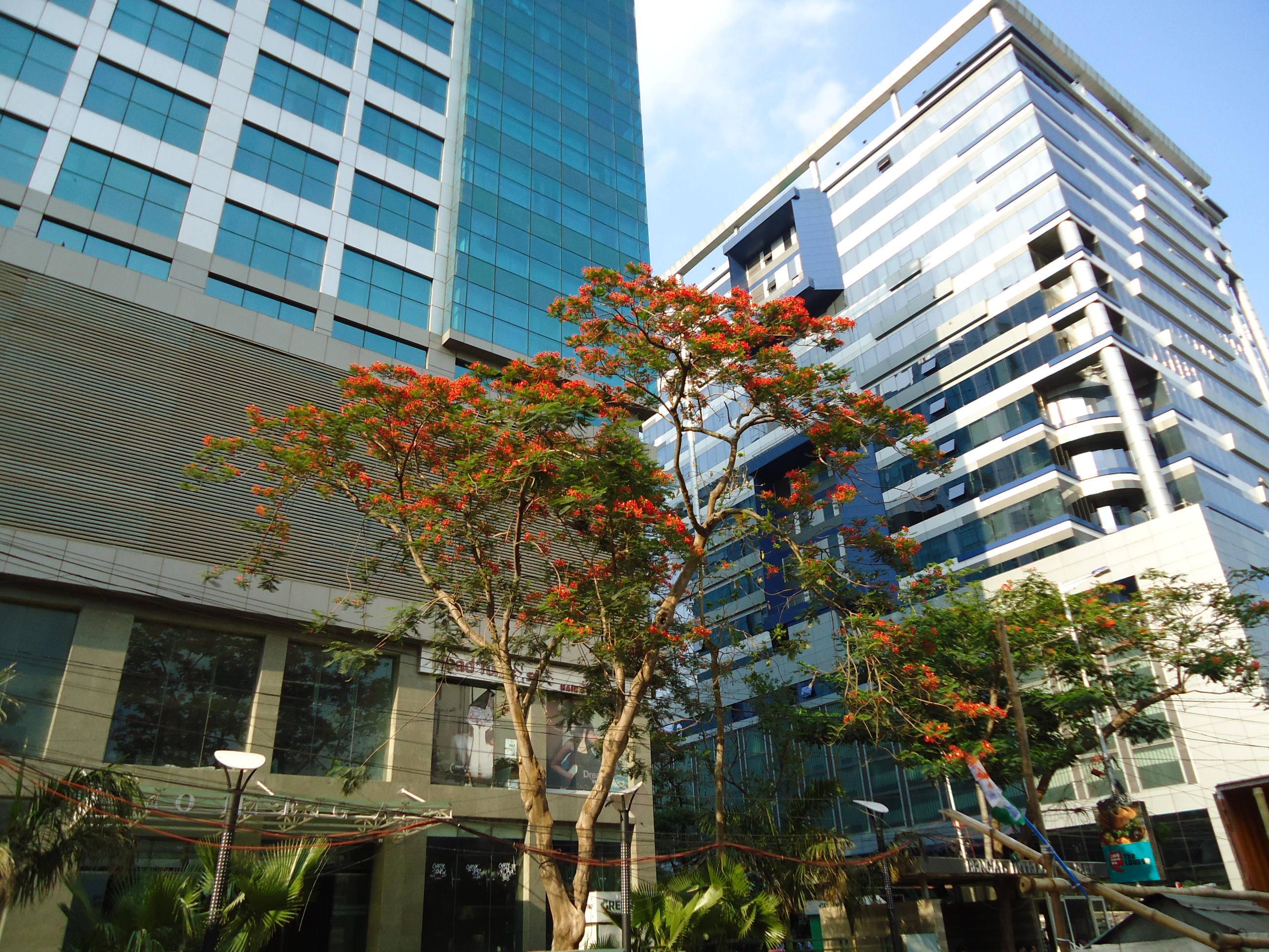
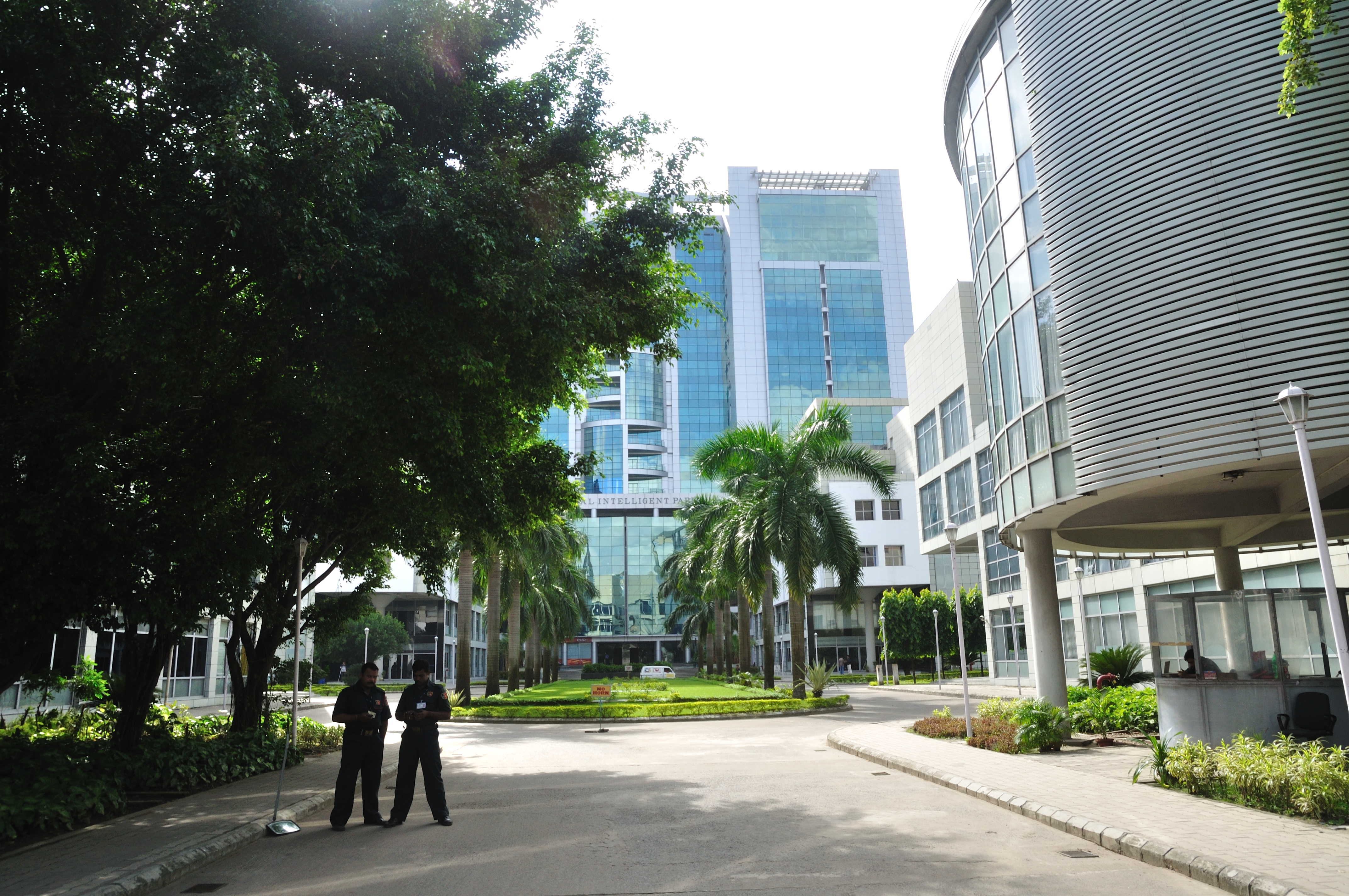
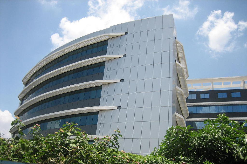
The information technology hub of Kolkata is at this district, which is the centre of some of the notable IT/ITES Indian and multinational companies. Approximately 1,500 companies have their offices in Sector V.[7] Majority of the corporate offices are situated in Sector V and Sector III. Around 3.5 Lakh (by 2017) people are employed in Salt Lake City.
Divisions
Administrative subdivisions
The district comprises five subdivisions: Barrackpore, Barasat Sadar, Basirhat, Bangaon and Bidhannagar.
- Barrackpore Subdivision consists of 16 municipalities (Kanchrapara, Halisahar, Naihati, Bhatpara, Garulia, Barrackpore, North Barrackpur, New Barrackpur, Titagarh, Khardaha, Panihati, Kamarhati, Baranagar, Dum Dum, North Dumdum and South Dumdum) and 2 community development blocks: Barrackpore I and Barrackpore II.
- Barasat Sadar Subdivision consists of five municipalities (Barasat, Habra, Ashoknagar Kalyangarh, Madhyamgram, and Gobardanga) and 7 community development blocks: Barasat I, Barasat II, Amdanga, Deganga, Habra I, Habra II and Rajarhat (now shifted to Bidhannagar Subdivision).[8]
- Bongaon Subdivision, consists of Bangaon municipality and three community development blocks: Bagdah, Bangaon and Gaighata.
- Basirhat Subdivision consists of three municipalities (Basirhat, Baduria and Taki) and ten community development blocks: Baduria, Basirhat I, Basirhat II, Haroa, Hasnabad, Hingalganj, Minakhan, Sandeshkhali I, Sandeshkhali II, Swarupnagar.[9]
- Bidhannagar Subdivision consists of Bidhannagar Municipal Corporation and one community development blocks Rajarhat.
Barasat is the district headquarters. There are 35 police stations, 22 development blocks, 27 municipalities, 200 gram panchayats and 1599 villages in this district.[9][10]
Other than municipality area, each subdivision contains community development blocks which in turn are divided into rural areas and census towns. In total there are 48 urban units: 27 municipalities and 20 census towns and 1 cantonment board.[10][11]
Barrackpore subdivision
- 16 municipalities: Kanchrapara, Halisahar, Naihati, Bhatpara, Garulia, Barrackpore, North Barrackpur, New Barrackpur, Titagarh, Khardaha, Panihati, Kamarhati, Baranagar, Dum Dum, North Dumdum and South Dumdum.[12]
- One Cantonment Board: Barrackpur Cantonment.
- One more census town: Ichhapur Defence Estate.
- Barrackpore I (Community development block) consists of rural areas with 8 gram panchayats and three census towns: Jetia, Garshyamnagar and Kaugachhi.
- Barrackpore II (Community development block) consists of rural areas with 6 gram panchayats and six census towns: Jafarpur, Talbandha, Muragachha, Patulia, Ruiya and Chandpur.
- Panchayet: Duttapukur
Barasat Sadar subdivision
- 5 municipalities: Barasat, Habra, Ashoknagar Kalyangarh, Madhyamgram and Gobardanga.
- Barasat I (Community development block) consists of rural areas with 9 gram panchayats and 1 census town: Duttapukur.
- Barasat II (Community development block) consists of rural areas only with 7 gram panchayats.
- Amdanga (Community development block) consists of rural areas only with 8 gram panchayats.
- Deganga (Community development block) consists of rural areas only with 13 gram panchayats.
- Habra I (Community development block) consists of rural areas with 7 gram panchayats and 3 census towns: Nokpul, Maslandapur and Sadpur.
- Habra II (Community development block) consists of rural areas with 8 gram panchayats and 2 census towns: Bara Bamonia and Guma.
- Rajarhat (Community development block) (now shifted to Bidhannagar Subdivision)[8] consists of rural areas with 6 gram panchayats (after Mahishbathan II gram panchayat being shifted to Bidhannagar Municipal Corporation,[13] number of gram panchayats becomes 5) and 1 census town: Raigachhi.
Bangaon subdivision
- 1 municipality: Bangaon.
- Bagdah (Community development block) consists of rural areas only with 9 gram panchayats.
- Bangaon (Community development block) consists of rural areas only with 16 gram panchayats.
- Gaighata (Community development block) consists of rural areas with 13 gram panchayats and seven census towns: Chandpara(7,113), Chhekati (4,995), Sonatikiri (6,919), Dhakuria (10,165), Chikanpara (9,594), Shimulpur (20,803) and Bara (5,172).
Basirhat subdivision
- Three municipalities: Basirhat, Baduria and Taki.
- Baduria (Community development block) consists of rural areas only with 14 gram panchayats.
- Basirhat I (Community development block) consists of rural areas only with 7 gram panchayats.
- Basirhat II (Community development block) consists of rural areas with 9 gram panchayats and one census town: Dhanyakuria.
- Haroa (Community development block) consists of rural areas only with 8 gram panchayats.
- Hasnabad (Community development block) consists of rural areas only with 9 gram panchayats.
- Hingalganj (Community development block) consists of rural areas only with 9 gram panchayats.
- Minakhan (Community development block) consists of rural areas only with 8 gram panchayats.
- Sandeshkhali I (Community development block) consists of rural areas only with 8 gram panchayats.
- Sandeshkhali II (Community development block) consists of rural areas only with 8 gram panchayats.
- Swarupnagar (Community development block) consists of rural areas only with 10 gram panchayats.
Bidhannagar subdivision
This subdivision consists of the[9] Bidhannagar Municipal Corporation.
- Rajarhat (Community development block) is also shifted to this subdivision now.[8]
Assembly constituencies
As per order of the Delimitation Commission in respect of the delimitation of constituencies in the West Bengal, the district is divided into 33 assembly constituencies:[14][15]
| Sl. No. | Name | Lok Sabha constituency | MLA | Party | |
|---|---|---|---|---|---|
| 94 | Bagdah (SC) | Bangaon | Biswajit Das | All India Trinamool Congress | |
| 95 | Bangaon Uttar (SC) | Ashok Kirtania | Bharatiya Janata Party | ||
| 96 | Bangaon Dakshin (SC) | Swapan Majumder | Bharatiya Janata Party | ||
| 97 | Gaighata (SC) | Subrata Thakur | Bharatiya Janata Party | ||
| 98 | Swarupnagar (SC) | Bina Mondal | All India Trinamool Congress | ||
| 99 | Baduria | Basirhat | Abdur Rahim Quazi | All India Trinamool Congress | |
| 100 | Habra | Barasat | Jyotipriya Mallick | All India Trinamool Congress | |
| 101 | Ashokenagar | Narayan Goswami | All India Trinamool Congress | ||
| 102 | Amdanga | Barrackpore | Rafiqur Rahaman | All India Trinamool Congress | |
| 103 | Bijpur | Subodh Adhikary | All India Trinamool Congress | ||
| 104 | Naihati | Partha Bhowmick | All India Trinamool Congress | ||
| 105 | Bhatpara | Pawan Singh | Bharatiya Janata Party | ||
| 106 | Jagatdal | Somenath Shyam Ichini | All India Trinamool Congress | ||
| 107 | Noapara | Manju Basu | All India Trinamool Congress | ||
| 108 | Barrackpore | Raj Chakraborty | All India Trinamool Congress | ||
| 109 | Khardaha | Dum Dum | Sovandeb Chattopadhyay | All India Trinamool Congress | |
| 110 | Dum Dum Uttar | Chandrima Bhattacharya | All India Trinamool Congress | ||
| 111 | Panihati | Nirmal Ghosh | All India Trinamool Congress | ||
| 112 | Kamarhati | Madan Mitra | All India Trinamool Congress | ||
| 113 | Baranagar | Tapas Roy | All India Trinamool Congress | ||
| 114 | Dum Dum | Bratya Basu | All India Trinamool Congress | ||
| 115 | Rajarhat New Town | Barasat | Tapash Chatterjee | All India Trinamool Congress | |
| 116 | Bidhannagar | Sujit Bose | All India Trinamool Congress | ||
| 117 | Rajarhat Gopalpur | Dum Dum | Aditi Munshi | All India Trinamool Congress | |
| 118 | Madhyamgram | Barasat | Rathin Ghosh | All India Trinamool Congress | |
| 119 | Barasat | Chiranjeet Chakraborty | All India Trinamool Congress | ||
| 120 | Deganga | Rahima Mondal | All India Trinamool Congress | ||
| 121 | Haroa | Basirhat | Haji Nurul Islam | All India Trinamool Congress | |
| 122 | Minakhan (SC) | Usha Rani Mondal | All India Trinamool Congress | ||
| 123 | Sandeshkhali (ST) | Sukumar Mahata | All India Trinamool Congress | ||
| 124 | Basirhat Dakshin | Dr. Saptarshi Banerjee | All India Trinamool Congress | ||
| 125 | Basirhat Uttar | Rafikul Islam Mondal | All India Trinamool Congress | ||
| 126 | Hingalganj (SC) | Debes Mandal | All India Trinamool Congress | ||
- Bagdah, Bangaon Uttar and Dakshin, Gaighata, Swarupnagar, Rajarhat-New Town, Haroa, Minakhan and Hingalganj constituencies are reserved for Scheduled Castes (SC) candidates while Sandeshkhali is reserved for Schedule Tribe (ST).
- Bagdaha, Bangaon Uttar and Dakshin, Gaighata, Swarupnagar, and Kalyani and Haringhata (two assembly constituencies from Nadia) assembly constituencies form the Bangaon (Lok Sabha constituency) which is reserved for Schedule Caste (SC) candidate.[16]
- Habra, Ashoknagar, Rajarhat-New Town, Bidhannagar, Madhyagram, Barasat, Deganga assembly constituencies form the Barasat (Lok Sabha constituency).[16]
- Khardaha, Dum Dum, Dum Dum Uttar, Panihati, Kamarhati, Baranagar, Rajarhat Gopalpur assembly constituencies form the Dum Dum (Lok Sabha constituency).[16]
- Amdanga, Bijpur, Naihati, Bhatpara, Jagatdal, Noapara, Barrackpore assembly constituencies form the Barrackpore (Lok Sabha constituency).[16]
- Baduria, Haroa, Minakhan, Sandeshkhali, Basirhat Uttar, Basirhat Dakshin, Hingalganj constituencies are part of the Basirhat (Lok Sabha constituency), which also contains one assembly segment from South 24 Parganas district.[16]
Education
Universities


- Indian Statistical Institute[17]
- Maulana Abul Kalam Azad University of Technology
- West Bengal State University
- JIS University
- Techno India University
- Brainware University
- Adamas University
- University of Calcutta (Technological Campus)
- Jadavpur University (Second Campus)
- Aliah University
- Netaji Subhas Open University
- Amity University
- Sister Nivedita University
- St. Xavier's University, Kolkata
Colleges

- Narula Institute of Technology[18]
- Brahmananda Keshab Chandra College
- Prasanta Chandra Mahalanobis Mahavidyalaya[19]
- Acharya Prafulla Chandra College
- Basirhat College
- College of Medicine & Sagore Dutta Hospital
- Guru Nanak Institute of Dental Sciences and Research
- Guru Nanak Institute of Technology
- Bhairab Ganguly College
- Bidhannagar College
- Ramakrishna Mission Vivekananda Centenary College
- Barasat Government College
- Barasat College
- Barrackpore Rastraguru Surendranath College
- Government College of Engineering and Leather Technology
- Gobardanga Hindu College
- Dinabandhu Mahavidyalay
- Sree Chaitanya College
- Institute of Engineering and Management
- Taki Government College
- Vivekananda College, Madhyamgram
- Guru Nanak Institute of Pharmaceutical Science and Technology
- Netaji Satabarshiki College, Ashokenagar
Schools

- Bagdah high School[20]
- Baranagore Ramakrishna Mission Ashrama High School[21]
- Central Modern School
- Sodepur High School
- St. Xavier's Institution (Panihati)
- Adamas International School
- Aditya Academy (Senior Secondary)
- Auxilium Convent School
- Barrackpore Government High School
- Berachampa Deulia Uchcha Vidyalaya
- Kendriya Vidyalaya Barrackpore (Army)
- Rahara Ramakrishna Mission Boys' Home High School
- Ramakrishna Vivekananda Mission Vidyabhavan Barrackpore
- Stratford Day School, Habra
- Kalyangarh Bidya Mandir, Ashokenagar
- Kalyangarh Balika Bidyamandir, Ashokenagar
Culture


This district is rich in culture. Many famous places like Dakshineswar Kali Temple, Baranagar Math[22] (first monastery of Ramakrishna Order) are situated in this district. Many places of this district are famous for festivals – Helencha, Habra, Barrackpore, Barasat, Naihati and Madhyamgram are for Kali puja, Bangaon, Baranagar, Basirhat are for Durga puja, Ashoknagar Kalyangarh is for Jagatdhatri puja, Berachampa is for Basanti puja etc.
Transport
Railways
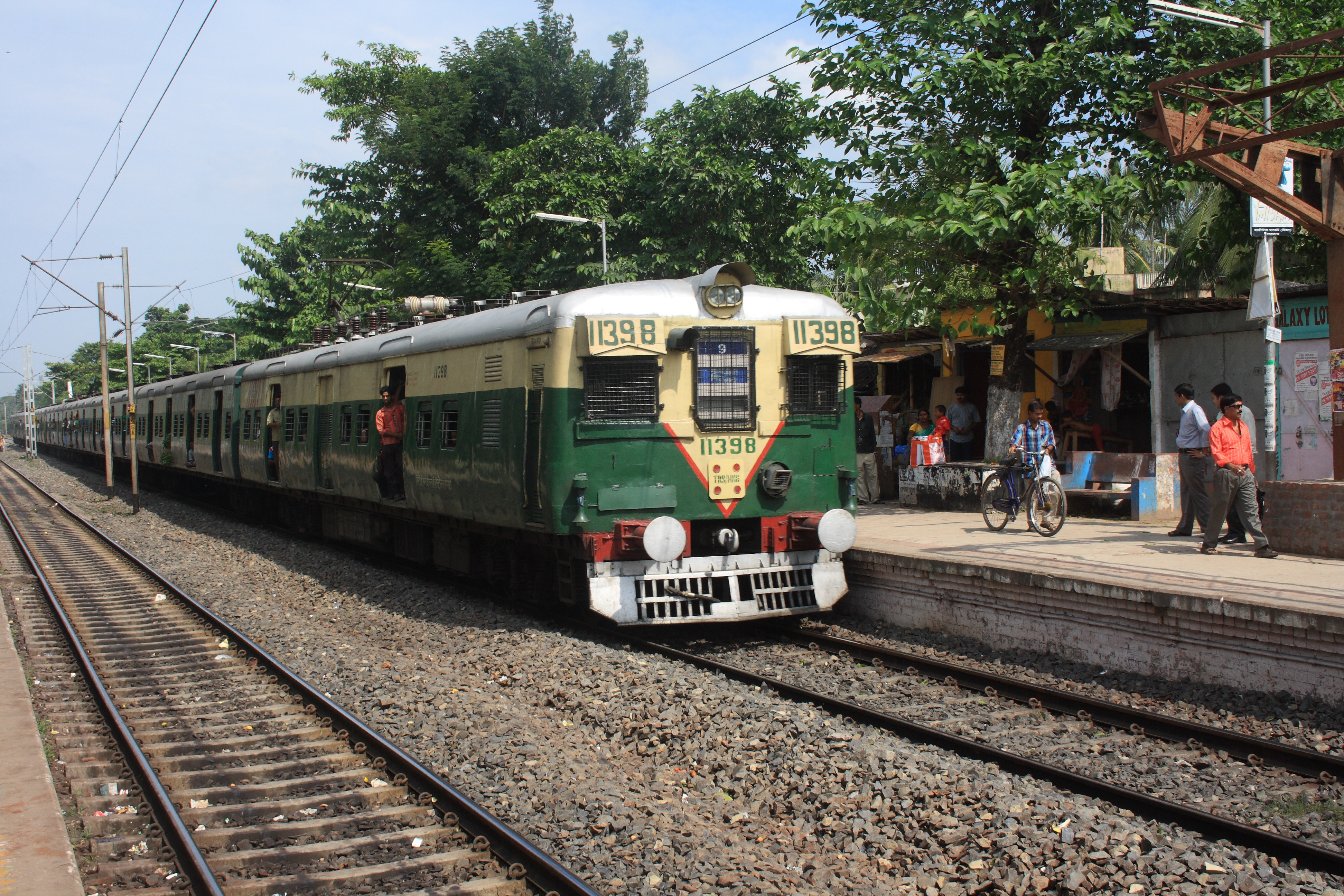
The electrified suburban rail network of the ER is extensive and penetrates far and deep into the neighbouring districts of Kolkata, South 24 Parganas, Nadia, Howrah, Hooghly etc.
The Circular Rail encircles the entire city of Kolkata, and also used to provide an offshoot to connect the Dum Dum Airport, but now it is limited up to Dum Dum Cantonment. Jessore Road and Biman Bandar railway stations are closed for the construction work of Noapara–Dum Dum Airport–Barasat Metro rail (Kolkata Metro Line 4).[23]
Metro rail is also a transport medium of this district's people. Four stations of Kolkata Metro Line 1 are located here, Dum Dum metro station at Dum Dum, Baranagar metro station at Baranagar, Dakshineswar metro station at Dakshineswar and Noapara metro station at Noapara, Baranagar.[24]
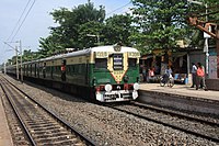 Kolkata Suburban EMU Train
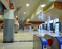 Kolkata Metro's largest station Noapara metro station at Noapara, Baranagar

Airports

The Netaji Subhash Chandra Bose International Airport (IATA code:CCU), which is at Dum Dum (previously known as Dum Dum Airport) in North 24 Parganas, is the only airport serving the city Kolkata. It operates both domestic and international flights. It is a gateway to North-East India, Bangkok, and Bangladesh. The number of people using the airport has consistently increased over the last few years.
Roadways
The road network is fairly well developed. Sparsed across by state-highways, it provides a convenient means of transport. NH 12 connects the district with northern and southern region of the state and its sub road NH 112 connect the district headquarter Barasat with the border town Bangaon and Petrapole, the largest land port of India.
Demographics
According to the 2011 census North 24 Parganas district has a population of 10,009,781,[3][25] roughly equal to the nation of Bolivia[26] or the US state of Michigan.[27] This gave it a ranking of second in India (out of a total of 640) and first in its state.[3] However, in 2014 the Thane district (in Maharashtra), which had been ranked first in India in 2011, was divided into two, thus promoting North 24 Parganas District to first in India. The district has a population density of 2,463 inhabitants per square kilometre (6,380/sq mi).[3] Its population growth rate over the decade 2001–2011 was 12.86%.[3] North Twenty Four Parganas has a sex ratio of 949 females for every 1000 males,[3] and a literacy rate of 84.95%. Scheduled Castes and Scheduled Tribes make up 21.67% and 2.64% of the population respectively.[3]
- Population Density: 2959 per square km
- Sex ratio: 982 females per 1000 males
- Growth Rate (1991–2000): 24.64% (approximately 2.5% per annum)
- Literacy rate (excluding 0–6 age group), in percentage: 87.66 (highest in West Bengal).[28]
- Male: 93.14; Female: 81.81
Religion
| Religion | Population (1941)[30]: 80–81 | Percentage (1941) | Population (2011)[29] | Percentage (2011) |
|---|---|---|---|---|
| Hinduism |
927,418 | 57.09% | 7,352,769 | 73.46% |
| Islam |
648,920 | 39.95% | 2,584,684 | 25.82% |
| Tribal religion |
41,105 | 2.53% | 2,930 | 0.03% |
| Others [lower-alpha 2] | 6,994 | 0.43% | 69,398 | 0.69% |
| Total Population | 1,624,437 | 100% | 10,009,781 | 100% |
Hinduism is the main religion in the district, and especially dominates urban areas where they are nearly 90% of the population. Most Muslims are rural, and in the rural areas Hindus and Muslims are in equal proportions. In Bongaon and Sandeshkhali regions, Hindus, mainly descendants of refugees from Bangladesh, dominate the rural population. But in the rest of the district, Muslims dominate the rural population. Muslims are in majority in Amdanga (58.48%), Barasat II (73.81%), Deganga (70.92%), Baduria (65.48%), Basirhat I (68.54%), Basirhat II (70.10%), Harora (61.12%), Minakhan (51.60%) and Hasnabad (56.51%) blocks. Muslims are significant minorities in Swarupnagar (47.58%), Habra II (48.76%), Barasat I (44.08%) and Rajarhat (39.89%) CD blocks.
Languages
According to the 2011 census, 88.91% of the population spoke Bengali, 7.69% Hindi and 2.28% Urdu as their first language.[31]
Flora and fauna
The district is also home to the Bibhutibhushan Wildlife Sanctuary, which was established in 1985 and has an area of 0.6 km2 (0.2 sq mi).[32]
Health facilities
- District Hospitals: 10 with 2500 beds
- Sub Divisional Hospitals: 14 with 1870 beds
- State General Hospitals: 18 with 1870 beds
- ESI Hospital: 01 with 200 beds
- Rural Hospitals: 07 with 228 beds
- Block Primary Health Centers: 15
Notable people
This article's list of residents may not follow Wikipedia's verifiability policy. (June 2021) |
- Abhishek Chatterjee, actor
- Jeet Ganguly, musician
- Sanghamitra Bandyopadhyay, Director Indian Statistical Institute
- Shiboprosad Mukherjee, film director
- Ujjwal Maulik, Computer Scientist
- Dola Banerjee, athlete
- Rahul Banerjee, athlete
- Bankim Chandra Chatterjee, writer, novelist
- Manik Bandopadhay, writer, novelist
- Rani Rashmoni, philanthropist
- Titumir, freedom fighter
- Lokenath Brahmachari, mystic
- Bibhutibhushan Bandyopadhyay, writer, novelist
- Ramprasad Sen, poet
- Shyamal Mitra, musician
- Muhammad Shahidullah, educationist, writer, philologist and linguist
- Arunoday Mondal, physician
- Pramatha Nath Bose, Geologist and Paleontologist
- Prabhavathi Devi Saraswathi, Bengali writer and novelist.
- Ishwar Chandra Gupta, Bengali poet and writer
- Rakhaldas Bandyopadhyay, archeologist
- Dinabandhu Mitra, Bengali novelist
- Tanmoy Bhattacharya, politician
- Goutam Deb, politician
Citations
- "Provisional Population Totals Paper 1 of 2011 : West Bengal". Census of India. Retrieved 18 March 2016.
- "West Bengal Human Development Report 2004" (PDF).
- "District Census 2011". Census2011.co.in. 2011. Retrieved 30 September 2011.
- Decadal Variation In Population Since 1901. censusindia.gov.in.
- McCabe, Joseph (1920) "Holwell, John Zephaniah", A biographical dictionary of modern rationalists, Watts & Co., London, pp. 356–357, p. 357, OCLC 262462698.
- "West Bengal to get 7 new districts, announces CM Mamata Banerjee". LiveMint. 1 August 2022. Retrieved 3 August 2022.
- Chakraborti, Suman. "Soon, smart composting units at Sector V offices | Kolkata News". The Times of India. Retrieved 20 April 2020.
- "Change of guard". www.telegraphindia.com.
- "Directory of District, Sub division, Panchayat Samiti/ Block and Gram Panchayats in West Bengal, March 2008". West Bengal. National Informatics Centre, India. 19 March 2008. Archived from the original on 25 February 2009. Retrieved 1 December 2008.
- "District at a glance". Official website of the North 24 Parganas district. Archived from the original on 2 June 2008. Retrieved 1 December 2008.
- "Population, Decadal Growth Rate, Density and General Sex Ratio by Residence and Sex, West Bengal/ District/ Sub District, 1991 and 2001". West Bengal. Directorate of census operations. Retrieved 1 December 2008.
- "Page on Barrackpore subdivision". Official website of North 24 Parganas district. Archived from the original on 25 March 2010. Retrieved 1 December 2008.
- "bmcwbgov.in". Archived from the original on 6 August 2019. Retrieved 18 August 2019.
- "Press Note, Delimitation Commission" (PDF). Assembly Constituencies in West Bengal. Delimitation Commission. Retrieved 21 November 2008.
- "list of MPs & MLAs of N 24 PGS". Archived from the original on 18 January 2014. Retrieved 12 May 2018.
- "Assembly under Bangaon Lok Sabha". www.indiastatelections.com.
- "ISI Kolkata Campus". Archived from the original on 3 July 2019. Retrieved 11 November 2012.
- "Narula Institute of Technology". NIT. Retrieved 8 May 2018.
- "Prasanta Chandra Mahalanobis Mahavidyalaya | NAAC Accredited College". Prasanta Chandra Mahalanobis Mahavidyalaya.
- "Bagdah High School - Bagdah, North 24 Parganas - Reviews, Fee Structure, Admission Form, Address, Contact, Rating - Directory".
- "Ramakrishna Mission Ashrama, Baranagar Mission". Retrieved 17 May 2015.
- "Brief history of Baranagar Math". Tamakrishna Mission, Baranagar. Archived from the original on 18 November 2013. Retrieved 8 July 2013.
- "Services End on Kolkata's Circular Railway to Facilitate Metro's Construction". 13 October 2016.
- Gupta, Jayanta (21 November 2012). "March 2013 date for Noapara Metro". The Times of India. Archived from the original on 4 September 2013. Retrieved 30 May 2013.
- Yeshwantrao, Nitin (1 April 2011). "Population explosion across Thane district worries officials". The Times of India. Retrieved 18 March 2016.
- US Directorate of Intelligence. "Country Comparison:Population". Archived from the original on 13 June 2007. Retrieved 1 October 2011.
Bolivia 10,118,683 July 2011 est.
- "2010 Resident Population Data". U. S. Census Bureau. Retrieved 30 September 2011.
Michigan 9,883,640
- "District wise Literacy rate in West Bengal 2001–2011 census". www.updateox.com. Retrieved 18 March 2016.
- "Table C-01 Population by Religion: West Bengal". censusindia.gov.in. Registrar General and Census Commissioner of India. 2011.
- "CENSUS OF INDIA, 1941 VOLUME VI BENGAL PROVINCE" (PDF). Retrieved 13 August 2022.
- 2011 Census of India, Population By Mother Tongue
- Indian Ministry of Forests and Environment. "Protected areas: West Bengal". Archived from the original on 23 August 2011. Retrieved 25 September 2011.
- Barrackpore, Barasat and Basirhat subdivisions
- Including Jainism, Christianity, Buddhism, Zoroastrianism, Judaism, Ad-Dharmis, or not stated
External links
Places adjacent to North 24 Parganas district | ||||||||||||||||
|---|---|---|---|---|---|---|---|---|---|---|---|---|---|---|---|---|
| ||||||||||||||||
Cities, towns, locations and neighbourhoods in North 24 Parganas district, Presidency division | |||||||||
|---|---|---|---|---|---|---|---|---|---|
| Municipal cities/ towns and Census towns |  | ||||||||
| Locations other than cities and towns |
| ||||||||
| Neighbourhoods of other cities and towns in the district | |||||||||
| Related topics |
| ||||||||
North 24 Parganas district topics | |||||||||
|---|---|---|---|---|---|---|---|---|---|
| General |
| ||||||||
| Subdivisions | |||||||||
| Municipalities | |||||||||
| Community development blocks |
| ||||||||
| Rivers | |||||||||
| Transport |
| ||||||||
| Railway stations | |||||||||
| Institutes of higher learning | 
| ||||||||
| Lok Sabha constituencies |
| ||||||||
| Vidhan Sabha constituencies |
| ||||||||
| Former Vidhan Sabha constituencies | |||||||||
| See also |
| ||||||||

На других языках
[de] Uttar 24 Pargana
Der Distrikt Uttar 24 Pargana (bengalisch উত্তর চব্বিশ পরগণা জেলা) oder North Twenty Four Parganas („nördliche 24 Parganas“) ist ein Distrikt im indischen Bundesstaat Westbengalen. Seit der Aufteilung des Distrikts Thane in Maharashtra im August 2014 ist Uttar 24 Pargana mit mehr als 10 Millionen Einwohnern der bevölkerungsreichste Distrikt Indiens. Hauptstadt ist die 25 km nordöstlich vom Stadtzentrum Kalkuttas gelegene Stadt Barasat, die noch zur Agglomeration Kalkutta gehört.- [en] North 24 Parganas district
[ru] Северные 24 парганы
Северные 24 парганы (англ. North 24 Parganas, бенг. উত্তর চব্বিশ পরগণা জেলা) — округ в индийском штате Западная Бенгалия. Образован в 1986 году. Расположен на юге Западной Бенгалии. Административный центр округа — Барасат. Среди округов Западной Бенгалии, занимает 10-е место по площади, первое по количеству жителей и 3-е по плотности населения (более 2000 чел. на кв. км).Другой контент может иметь иную лицензию. Перед использованием материалов сайта WikiSort.org внимательно изучите правила лицензирования конкретных элементов наполнения сайта.
WikiSort.org - проект по пересортировке и дополнению контента Википедии