world.wikisort.org - India
Paschim Medinipur district or West Midnapore district (also known as Midnapore West) is one of the districts of the state of West Bengal, India. It was formed on 1 January 2002 after the Partition of Midnapore into Paschim Medinipur and Purba Medinipur. On 4 April 2017, the Jhargram subdivision was converted into a district. GDP of West Midnapore district is 12 billion USD.
This article has multiple issues. Please help improve it or discuss these issues on the talk page. (Learn how and when to remove these template messages)
|
Paschim Medinipur | |
|---|---|
District | |
      Clockwise from top-left: Nabaratna Temple in Pathra, Takshashila building at IIT Kharagpur, Kurumbera Fort, Vidyasagar University in Midnapore, Gongoni Danga, Kangsabati River | |
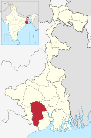 Location of Paschim Medinipur in West Bengal | |
 Interactive Map Outlining Paschim Medinipur | |
| Country | |
| State | |
| Division | Midnapore |
| Headquarters | Midnapore |
| Government | |
| • Lok Sabha constituencies | Medinipur, Ghatal, Jhargram (ST) – all have assembly segments in adjoining districts, Arambagh – with one assembly segment in the district |
| • Vidhan Sabha constituencies | Dantan, Keshiary, Kharagpur Sadar, Narayangarh, Sabang, Pingla, Kharagpur, Debra, Daspur, Ghatal, Chandrakona, Garbeta, Salboni, Keshpur, Medinipur |
| Area | |
| • Total | 6,308 km2 (2,436 sq mi) |
| Population (2011) | |
| • Total | 4,776,909 |
| • Density | 760/km2 (2,000/sq mi) |
| • Urban | 11.9 per cent |
| Demographics | |
| • Literacy | 79.04 per cent |
| • Sex ratio | 960 |
| Time zone | UTC+05:30 (IST) |
| Major highways | NH 6, NH 60 |
| HDI (2004) | |
| Average annual precipitation | 2,111 mm |
| Website | www |
Geography
Paschim Medinipur, located in the south-western part of West Bengal, was created with the partition of the erstwhile Midnapore district, then the largest district of India, on 1 January 2002. It ranks second in terms of geographical area (9,295.28 km2) amongst the districts of the state, next to South 24-Parganas (9,960 km2). It ranks third in terms of rural population (4.58 million) following South 24-Parganas (5.82 million) and Murshidabad (5.13 million). It ranked fourth in terms of percentage of tribal population (14.87) following Jalpaiguri (18.87), Purulia (18.27) and Dakshin Dinajpur (16.12) in 2011.[2]
Broadly speaking, there are two natural divisions of the district. NH 14 and NH 16 (old numbering NH 60) from Bankura to Balasore, cuts across the district and roughly is the dividing line between the two natural divisions. To the east of this road, the soil is fertile alluvial and the area is flat. To the west, the Chota Nagpur Plateau gradually slopes down creating an undulating area with infertile laterite rocks and soil. The landscape changes from dense dry deciduous forests in the west to marshy wetlands in the east.[2]
The alluvial portion may be further subdivided into two divisions. First, it is a strip of purely deltaic country nearer to the Hooghly and the Rupnarayan, intersected by numerous rivers and watercourses subject to tidal influences. Second, it is rest of the eastern half of the district. It is a monotonous rice plain with numerous waterways and tidal creeks intersecting it. The tidal creeks are lined with embankments to prevent flooding of the fields. Much of the area is water-logged.[2]
Floods and drought
Paschim Medinipur district is subject to both floods and drought. Ghatal and parts of Kharagpur subdivision covering an area of 142,647 hectares (1,426.47 km2) are flood prone. Water logging during the rainy season affects Ghatal and the southern parts of Kharagpur subdivision and results in loss of crops in such areas as Sabang, Pingla and Narayangarh CD Blocks.335,248 hectares (3,352.48 km2) Medinipur Sadar subdivision is drought prone. Although the district is away from the sea, cyclones hit it frequently in October–November.[2]
Major cities and towns
Midnapore is the district headquarters. Kharagpur is the largest city in the district. Other important towns and cities in the district include: Kharagpur, Ghatal, Belda, Chandrakona, Ramjibanpur, Garbeta, Balichak, Dantan, Mohanpur, Keshiari, Keshpur, Narayangarh, Sabang, Daspur.Goaltore, Debra
Villages
Paschim Medinipur district is home to the most villages of any district in India. The 2011 census lists Paschim Medinipur as having 8,694 villages, of which 7,600 are populated, and 1,094 are uninhabited. The district with the next highest number of villages, Mayurbhanj, in the state of Odisha, has 3,950 villages, 3,751 of which are inhabited.
Economy and politics
In 2006 the Ministry of Panchayati Raj named Paschim Medinipur one of the country's 250 most backward districts (out of a total of 640).[3] It is one of the eleven districts in West Bengal currently receiving funds from the Backward Regions Grant Fund Programme (BRGF).[3]
106 districts spanning 10 states across India, described as being part of Left Wing Extremism activities, constitute the Red corridor. In West Bengal the districts of Paschim Medinipur, Bankura, Purulia and Birbhum are part of the Red corridor. However, as of July 2016, there has been no reported incidents of Maoist related activities from these districts for the previous 4 years.[4] In the period 2009–2011 LWE violence resulted in more than 500 deaths and a similar number missing in Paschim Medinipur district.[5]
Divisions
Paschim Medinipur district is divided into the following administrative subdivisions:[6]
| Subdivision | Headquarters | Area km2 | Population (2011) | Rural population % (2011) | Urban population % (2011) |
|---|---|---|---|---|---|
| Medinipur Sadar | Midnapore | 2,441.50 | 1,435,321 | 86.05 | 13.95 |
| Kharagpur | Kharagpur | 2,913.17 | 2,293,909 | 85.67 | 14.33 |
| Ghatal | Ghatal | 953.09 | 1,047,679 | 87.94 | 12.06 |
Administrative subdivisions
The district comprises three subdivisions: Kharagpur, Medinipur Sadar and Ghatal. Kharagpur subdivision consists of Kharagpur municipality and ten community development blocks: Dantan–I, Dantan–II, Pingla, Kharagpur–I, Kharagpur–II, Sabang, Mohanpur, Narayangarh, Keshiari and Debra. Medinipur Sadar subdivision consists of Midnapore municipality and six community development blocks: Medinipur Sadar, Garhbeta–I, Garhbeta–II, Garhbeta–III, Keshpur and Shalboni. Ghatal subdivision consists of five municipalities (Ramjibanpur, Chandrakona, Khirpai, Kharar and Ghatal) and five community development blocks: Chandrakona–I, Chandrakona–II, Daspur–I, Daspur–II and Ghatal.[7]
Midnapore is the district headquarters. There are 28 police stations, 21 development blocks, 7 municipalities and 290 gram panchayats in this district.[7][8]
Other than municipality area, each subdivision contains community development blocks which in turn are divided into rural areas and census towns. In total there are 11 urban units: 7 municipalities and 4 census towns.
Kharagpur subdivision
- One municipality: Kharagpur.
- Dantan I community development block consists of rural areas with 9 gram panchayats and one census town: Chaulia
- Dantan II community development block consists of rural areas only with 7 gram panchayats.
- Pingla community development block consists of rural areas only with 10 gram panchayats.
- Kharagpur I community development block consists of rural areas with 7 gram panchayats and two census towns: Kharagpur Railway Settlement and Kalaikunda.
- Kharagpur II community development block consists of rural areas only with 9 gram panchayats.
- Sabang community development block consists of rural areas only with 13 gram panchayats.
- Mohanpur community development block consists of rural areas only with 5 gram panchayats.
- Narayangarh community development block consists of rural areas with 16 gram panchayats and one census town: Deuli.
- Keshiari community development block consists of only rural areas with 9 gram panchayats.
- Debra community development block consists of rural areas with 14 gram panchayats and one census town: Balichak.
Medinipur Sadar subdivision
- One municipality: Midnapore.
- Midnapore Sadar community development block consists of rural areas only with 9 gram panchayats.
- Garhbeta I community development block consists of rural areas with 12 gram panchayats and two census towns: Garbeta and Amlagora
- Garhbeta II community development block consists of rural areas only with 10 gram panchayats.
- Garhbeta III community development block consists of rural areas with 8 gram panchayats and three census towns: Durllabhganj, Dwari Geria and Naba Kola.
- Keshpur community development block consists of rural areas only with 15 gram panchayats.
- Salboni community development block consists of rural areas only with 10 gram panchayats.
Ghatal subdivision
- Five municipalities: Ramjibanpur, Chandrakona, Khirpai, Kharar and Ghatal.
- Chandrakona I community development block consists of rural areas only with 6 gram panchayats.
- Chandrakona II community development block consists of rural areas only with 6 gram panchayats.
- Daspur I community development block consists of rural areas only with 10 gram panchayats.
- Daspur II community development block consists of rural areas only with 14 gram panchayats.
- Ghatal community development block consists of rural areas only with 12 gram panchayats.
Assembly Constituencies
There are 15 assembly constituencies in Paschim Medinipur district. They belong to four Lok Sabha constituencies. Medinipur and Ghatal constituencies both comprise six constituencies of Paschim Medinipur district and one from Purba Medinipur district. Jhargram constituency contains two constituencies of Paschim Medinipur district, while Arambagh contains one constituency.
| No. | Name | Lok Sabha constituency | MLA | Party | |
|---|---|---|---|---|---|
| 219 | Dantan | Medinipur | Bikram Chandra Pradhan | All India Trinamool Congress | |
| 223 | Keshiary (ST) | Paresh Murmu | All India Trinamool Congress | ||
| 224 | Kharagpur Sadar | Hiran Chatterjee | Bharatiya Janata Party | ||
| 225 | Narayangarh | Surja Kanta Atta | All India Trinamool Congress | ||
| 226 | Sabang | Ghatal | Manas Bhunia | All India Trinamool Congress | |
| 227 | Pingla | Ajit Maity | All India Trinamool Congress | ||
| 228 | Kharagpur | Medinipur | Dinen Roy | All India Trinamool Congress | |
| 229 | Debra | Ghatal | Humayun Kabir | All India Trinamool Congress | |
| 230 | Daspur | Mamata Bhunia | All India Trinamool Congress | ||
| 231 | Ghatal (SC) | Sital Kapat | Bharatiya Janata Party | ||
| 232 | Chandrakona (SC) | Arambagh | Arup Dhara | All India Trinamool Congress | |
| 233 | Garbeta | Jhargram | Uttara Singha | All India Trinamool Congress | |
| 234 | Salboni | Srikanta Mahata | All India Trinamool Congress | ||
| 235 | Keshpur (SC) | Ghatal | Seuli Saha | All India Trinamool Congress | |
| 236 | Medinipur | Medinipur | June Malia | All India Trinamool Congress | |
Demographics
| Year | Pop. | ±% p.a. |
|---|---|---|
| 1901 | 1,520,130 | — |
| 1911 | 1,537,618 | +0.11% |
| 1921 | 1,453,390 | −0.56% |
| 1931 | 1,525,569 | +0.49% |
| 1941 | 1,738,975 | +1.32% |
| 1951 | 1,830,743 | +0.52% |
| 1961 | 2,380,446 | +2.66% |
| 1971 | 3,035,385 | +2.46% |
| 1981 | 3,697,899 | +1.99% |
| 1991 | 4,486,279 | +1.95% |
| 2001 | 5,193,411 | +1.47% |
| 2011 | 5,913,457 | +1.31% |
| source:[9] | ||
According to the 2011 census Paschim Medinipur district has a population of 5,913,457,[10] roughly equal to the nation of Eritrea[11] or the US state of Missouri.[12] This gives it a ranking of 14th in India (out of a total of 640).[10] The district has a population density of 636 inhabitants per square kilometre (1,650/sq mi) .[10] Its population growth rate over the decade 2001–2011 was 14.44%.[10] Paschim Medinipur has a sex ratio of 960 females for every 1000 males,[10] and a literacy rate of 79.04%. After bifurcation the district had a population of 4,776,909. In the divided district, Scheduled Castes and Scheduled Tribes make up 892,763 (18.69%) and 546,167 (11.43%) of the population respectively.[10]
Religion
| Religion | Population (1941)[14]: 75 | Percentage (1941) | Population (2011)[13] | Percentage (2011) |
|---|---|---|---|---|
| Hinduism |
1,021,908 | 81.87% | 4,072,759 | 85.26% |
| Tribal religion |
123,895 | 9.93% | 72,511 | 1.52% |
| Islam |
101,645 | 8.14% | 592,587 | 12.41% |
| Others [lower-alpha 1] | 717 | 0.06% | 39,052 | 0.81% |
| Total Population | 1,248,165 | 100% | 4,776,909 | 100% |
Hindus are the majority population.[15]
Language
At the time of the 2011 census, 87.15% spoke Bengali, 6.29% Santali and 2.49% Hindi as their first language. Other languages spoken in the district include Telugu, Urdu and Koda.[16]
Culture
Tourism

- Patachitra Village (Naya, Pingla)
- Gopegarh Heritage Park
- Hatibari Forest banglow and Jhilli Pakhiralay
- Gurguripal Heritage Park
- Parimalkanan park, CKT
- Gangani Garhbeta
- Rameshwar Temple, near Rohini (On the bank of Subarnarekha river with nearby green forest called Tapoban)
- Gourya Temple, near Kharagpur
- Bisnu Temple, Kultikri
- Rashikananda Memorial, Rohini
- Mogolmari Boudhabihar, Mogolmari, Dantan
- Prayag Film City, Midnapore Film City or Chandrakona Film City at Chandrakona Road[17]
Notable personalities
- Khudiram Bose – Mohobani, situated under the Keshpur Police Station in the Medinipur. One of the youngest martyrs of the Indian Independence Movement.
- Iswar Chandra Vidyasagar – Birsingha, a key figure of the Bengal Renaissance. He was a philosopher, academic educator, writer, translator, printer, publisher, entrepreneur, reformer and philanthropist.
- Rajnarayan Basu, writer and proponent of Young Bengal movement.He served as the headmaster of Midnapore Zilla School (later known as Midnapore Collegiate School) which was also the forerunner of Midnapore College.
- Hemchandra Kanungo, an Indian nationalist and a member of the Anushilan Samiti.He was one of the creators of the Calcutta flag, based on which the first flag of independent India
- Birendranath Sasmal, social activista lawyer and political leader. He was known as Deshpran because of his work for the country and for his efforts in the Swadeshi movement. He was born in Contai, in undivided Midnapore district.
- Satish Chandra Samanta, social activist
- Nirmal Jibon Ghosh, revolutionary
- Huseyn Shaheed Suhrawardy, Chief Minister of Bengal during British period, Prime Minister of Pakistan and founder of the Awami League
- Narayan Chandra Rana, Rana has left his mark in many branches of Astrophysics and in Amateur Astronomy in India.
- Soumya Sankar Bose – Midnapore
- Mahasweta Devi, writer and Magsaysay Award winner
- Byomkes Chakrabarti, Linguist, writer and poet - Kharar & Jhargram
- Souhardya De, Orientalist and Bal Puraskar recipient 2021
- Tamal Bandyopadhyay, Indian business journalist
- Anirban Bhattacharya, actor in Tollywood movies
Education
Schools
- Midnapur Collegiate School
- Aligunj Rishi Raj Narayan Balika Vidyalaya
- Belda Gangadhar Academy[18]
- Benapur High School
- Birsingha Bhagabati Vidyalaya
- Borai High School
- Chandrakona Jirat High School
- DAV Public School, Midnapur
- Debra Harimati Saraswat Vidyamandir
- DAV Model School, IITKGP
- Ghatal Vidyasagar High School
- Griffins International School[19]
- Godapiasal Mahatma Gandhi Memorial High School
- Jalchak Nateswari Netaji Vidyayatan
- Belda Gangadhar Academy
- Jankapur High School
- Kharagpur Atulmoni Polytechnic High School
- Keranitola Shree Shree Mohanananda Vidyamandir
- Kharagpur Silver Jubilee High School
- Midnapur Collegiate Girls' High School
- Midnapore Town School
- Ramkrishna Mission Vidyabhaban
- Vidyasagar Shishu Niketan
- Midnapore Mission Girls' High School
Jhakra high school
Universities and colleges


- Ambigeria Government College
- Belda College
- Bhatter College
- Chaipat S.P.B. Mahavidyalaya
- Chandrakona Vidyasagar Mahavidyalaya
- Debra Thana Sahid Kshudiram Smriti Mahavidyalaya
- Dr B C Roy Institute of Medical Sciences & Research
- Garhbeta College
- Gourav Guin Memorial College
- Government General Degree College, Mohanpur
- Government General Degree College, Keshiary
- Hijli College
- IIT Kharagpur
- Institute of Science & Technology
- K.D. College of Commerce and General Studies
- Kharagpur College
- Keshiary Government College
- Kharagpur Homoeopathic Medical College and Hospital
- Midnapore College (Autonomous) (formerly known as Day college)
- Midnapore City College
- Midnapore Homoeopathic Medical College and Hospital
- Midnapore Law College
- Midnapore Medical College and Hospital
- Oriental Institute of Science and Technology
- Narajole Raj College
- Paramedical College
- Pingla Thana Mahavidyalaya
- Raja Narendra Lal Khan Women's College
- Sabang Sajanikanta Mahavidyalaya
- Salboni Government College
- Sankrail Anil Biswas Smriti Mahavidyalaya
- Santal Bidroha Sardha Satabarsiki Mahavidyalaya
- Medinipur Sadar Government Polytechnic
- Sukumar Sengupta Mahavidyalaya
- Vidyasagar Teachers' Training College, Midnapore
- Vidyasagar University
- Vivekananda Satavarshiki Mahavidyalaya
- P G Institute of Medical Sciences, Chandrakona Town
Healthcare
The table below (all data in numbers) presents an overview of the subdivision-wise medical facilities available and patients treated, after the separation of Jhargram, in the hospitals, health centres and sub-centres in 2014 in Paschim Medinipur district.[20]
| Subdivision | Health & Family Welfare Dept, WB | Other state govt depts |
Local bodies |
Central govt depts / PSUs |
NGO / private nursing homes |
Total | Total number of beds |
Total number of doctors |
Indoor patients |
Outdoor patients | |||
|---|---|---|---|---|---|---|---|---|---|---|---|---|---|
| Hospitals |
Rural hospitals |
Block primary health centres |
Primary health centres | ||||||||||
| Medinipur Sadar | 2 | 5 | 1 | 15 | 3 | - | 1 | 26 | 53 | 2,117 | 323 | 121,486 | 1,375,817 |
| Kharagpur | 2 | 8 | 2 | 27 | 2 | 1 | 2 | 54 | 98 | 1841 | 197 | 93,110 | 1,814,309 |
| Ghatal | 1 | 4 | 1 | 15 | - | - | - | 46 | 67 | 988 | 66 | 46,006 | 742,984 |
| Paschim Medinipur district | 5 | 17 | 24 | 77 | 5 | 1 | 3 | 126 | 208 | 4,946 | 586* | 260,602 | 3,933,110 |
- Excluding nursing homes
Notes
- Including Jainism, Christianity, Buddhism, Zoroastrianism, Judaism, Ad-Dharmis, or not stated
References
- "West Bengal Human Development Report 2004" (PDF).
- "District Human Development Report: Paschim Medinipur" (PDF). Chapter I Introduction and Human Development Indices for Paschim Mednipur. Development and Planning Department, Government of West Bengal, 2011. Archived from the original (PDF) on 29 March 2017. Retrieved 25 July 2016.
- Ministry of Panchayati Raj (8 September 2009). "A Note on the Backward Regions Grant Fund Programme" (PDF). National Institute of Rural Development. Archived from the original (PDF) on 5 April 2012. Retrieved 27 September 2011.
- Singh, Vijayita. "Red Corridor to be redrawn". The Hindu, 25 July 2016. Retrieved 1 August 2016.
- "District Human Development Report: Paschim Medinipur" (PDF). May 2011. Page 271. Development & Planning Department, Government of West Bengal. Archived from the original (PDF) on 29 March 2017. Retrieved 31 July 2016.
- "District Statistical Handbook 2014 Paschim Medinipur". Table 2.2, 2.4(a). Department of Statistics and Programme Implementation, Government of West Bengal. Archived from the original on 29 July 2017. Retrieved 23 October 2016.
- "Directory of District, Sub division, Panchayat Samiti/ Block and Gram Panchayats in West Bengal, March 2008". West Bengal. National Informatics Centre, India. 19 March 2008. Archived from the original on 25 February 2009. Retrieved 6 December 2008.
- "Administration Setup". Official website of Purba Medinipur district. Archived from the original on 25 April 2008. Retrieved 6 December 2008.
- Decadal Variation In Population Since 1901
- "District Census 2011". Census2011.co.in. 2011. Retrieved 30 September 2011.
- US Directorate of Intelligence. "Country Comparison:Population". Archived from the original on 13 June 2007. Retrieved 1 October 2011.
Eritrea 5,939,484 July 2011 est.
- "2010 Resident Population Data". U. S. Census Bureau. Retrieved 30 September 2011.
Missouri 5,988,927
- "Table C-01 Population by Religion: West Bengal". censusindia.gov.in. Registrar General and Census Commissioner of India. 2011.
- "CENSUS OF INDIA, 1941 VOLUME VI BENGAL PROVINCE" (PDF). Retrieved 13 August 2022.
- "C-1 Population By Religious Community". Census. Retrieved 10 July 2021.
- "Table C-16 Population by Mother Tongue: West Bengal". www.censusindia.gov.in. Registrar General and Census Commissioner of India.
- "Shah Rukh Khan inaugurates the Prayag Film City in Chandrakona | NG". Archived from the original on 25 April 2012. Retrieved 4 December 2012.
- "Home". bga1919.in.
- "Covid19 Challenge: Griffins International School, Kharagpur online learning". www.educationworld.in/. 10 June 2020.
- "District Statistical Handbook 2014 Paschim Medinipur". Table 3.1, 3.3. Department of Statistics and Programme Implementation, Government of West Bengal. Archived from the original on 29 July 2017. Retrieved 17 November 2016.
External links
- Official website
- Map of old Medinipur district (district has now been split)
 Midnapore travel guide from Wikivoyage
- Kharagpur travel guide from Wikivoyage
- Jhargram travel guide from Wikivoyage
Places adjacent to Paschim Medinipur district | ||||||||||||||||
|---|---|---|---|---|---|---|---|---|---|---|---|---|---|---|---|---|
| ||||||||||||||||
Cities, towns and locations in Paschim Medinipur District, Medinipur division | ||||||||
|---|---|---|---|---|---|---|---|---|
| Cities, municipal and census towns |
|  | ||||||
| Locations other than cities and towns | ||||||||
| Related topics |
| |||||||
Authority control | |
|---|---|
| General |
|
| National libraries | |
На других языках
[de] Paschim Medinipur
Paschim Medinipur (bengalisch .mw-parser-output .Beng{font-size:110%}পশ্চিম মেদিনীপুর, Paścim Medinīpur Pashchim Medinipur; Englisch: Midnapore West) ist ein Distrikt im Westen des indischen Bundesstaats Westbengalen.- [en] Paschim Medinipur district
[ru] Западный Миднапур
Западный Миднапур или Пашчим-Мединипур (англ. Paschim Medinipur, бенг. পশ্চিম মেদিনীপুর জেলা) — округ в индийском штате Западная Бенгалия. Образован в 1 января 2003 года в результате разделения округа Миднапур. Административный центр округа — Мидинипур[1]. Западный Миднапур граничит со штатом Орисса и с округами Восточный Миднапур, Пурулия, Банкура, Хугли и Хаура.Другой контент может иметь иную лицензию. Перед использованием материалов сайта WikiSort.org внимательно изучите правила лицензирования конкретных элементов наполнения сайта.
WikiSort.org - проект по пересортировке и дополнению контента Википедии