world.wikisort.org - India
Amroha district is one of the 75 districts of Uttar Pradesh state in northern India.[2] Amroha town is the district headquarters. According to the Government of India, the district is one of the Minority Concentrated Districts on the basis of the 2001 census data on population, socio-economic indicators and basic amenities indicators.[3]
This article needs additional citations for verification. (July 2022) |
Amroha district | |
|---|---|
District of Uttar Pradesh | |
 Rauza Haz, Shah Abbas Badr-e-Chisti in Amroha | |
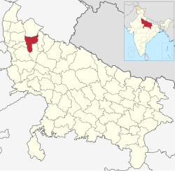 Location of Amroha district in Uttar Pradesh | |
| Country | |
| State | Uttar Pradesh |
| Division | Moradabad |
| Headquarters | Amroha |
| Government | |
| • Lok Sabha constituencies | Amroha |
| Area | |
| • Total | 2,321 km2 (896 sq mi) |
| Population (2011) | |
| • Total | 1,840,221 |
| • Density | 790/km2 (2,100/sq mi) |
| • Urban | 56% |
| Demographics | |
| • Literacy | 50.21 per cent[1] |
| Time zone | UTC+05:30 (IST) |
| Average annual precipitation | 1,120 mm |
| Website | https://amroha.nic.in/ |
The district is bounded on the north by Bijnor District, on the east and southeast by Moradabad District, on the south by Badaun District, and on the west by the River Ganges, across which lie the Bulandshahr, Hapur, and Meerut districts. State Highways 72 and 73 penetrate the city and act as major routes.
History
The Battle of Amroha was fought between the Mongols and Alauddin Khilji on 20 December 1305. Alauddin won the battle. Later, the territory occupied by the present district was part of the Sambhal sarkar of Delhi subah under the Mughal empire. Later it came under the control of Awadh. In 1801, the administration of this territory was ceded to the British East India Company by the Nawab of Awadh. On 24[4] April 1997, this district was carved out by separating Amroha, Dhanora and Hasanpur tehsils of the erstwhile Moradabad district. In 2012, this district was renamed from Jyotiba Phule Nagar district to Amroha district.[2]
Demographics
According to the 2011 census 'Amroha District' has a population of 1,840,221,[5] roughly equal to the nation of Kosovo[6] or the US state of Nebraska.[7] This gives it a ranking of 258th in India (out of a total of 640).[5] The district has a population density of 818 inhabitants per square kilometre (2,120/sq mi).[5] Its population growth rate over the decade 2001-2011 was 22.66%.[5] Amroha has a sex ratio of 907 females for every 1,000 males,[5] and a literacy rate of 65.7%. Scheduled Castes make up 17.28% of the population.[5]
Religion
|
Tehsil |
Hindus |
Muslims |
Others |
| 45.32% | 53.94% | 0.74% | |
| 66.34% | 32.22% | 1.44% | |
| 69.32% | 30.35% | 0.33% |
Even though the district is Hindu majority, Muslims form a significant minority and dominate urban areas. As per the 2011 census out of 9 Census towns Muslims are majority in 7 while Hindus are majority in Gajraula (77.33%) and Dhanaura (66.38%) towns.[8]
Language
At the time of the 2011 Census of India, 80.10% of the population of the district spoke Hindi and 19.70% Urdu as their first language.[9]
| Year | Pop. | ±% p.a. |
|---|---|---|
| 1901 | 328,739 | — |
| 1911 | 348,293 | +0.58% |
| 1921 | 330,488 | −0.52% |
| 1931 | 354,024 | +0.69% |
| 1941 | 406,143 | +1.38% |
| 1951 | 457,922 | +1.21% |
| 1961 | 550,228 | +1.85% |
| 1971 | 681,551 | +2.16% |
| 1981 | 891,539 | +2.72% |
| 1991 | 1,155,742 | +2.63% |
| 2001 | 1,499,068 | +2.64% |
| 2011 | 1,840,221 | +2.07% |
| source:[10] | ||
Notable people
- Kalpana Iyer, Famous TV actress
- Ahmad Hasan Amrohi, Islamic scholar
- Kamal Amrohi, filmmaker, lyricist, actor, director, husband of Meena Kumari
- Jaun Elia, poet and columnist
- Mohammad Shami, cricketer
- Syed Sadequain Ahmed Naqvi, artist
- Dr Naseem uz Zafar Baquiri, poet, lyricist, doctor
- Iqbal Mehdi, artist
- Nawab Waqar ul Mulk, educationalist, politician
- K.A. Nizami, historian
- Nisar Ahmed Faruqi, Education
- Mashhoor Amrohi, Actor
- Shandar Amrohi, Actor, Film Maker
- Tajdar Amrohi, Actor, Film Maker
- Saiyed Zegham Murtaza, Journalist, Columnist, Author, Blogger and Documentary Film Maker
- Faraz Haider, Director, Actor, Film Maker
- Waseem Amrohi, Entrepreneur and Digital Media Marketer
- Dr. Azeem Amrohvi, Poet and Critic
- Kafeel Azar Amrohi, Urdu Poet
- Bhuvnesh Chandra Sharma, Bhuvan Amrohi, Urdu Poet, Writer
Media
University in Amroha has several active media groups which continuously give the populace Hindi news updates on Amroha:
- Amar Ujala[11]
- Dainik Bhaskar
- Dainik Jagran
- Awam-e-hind
- Amroha ki Ekta(Hindi Weekly newspaper)
References
- "District-specific Literates and Literacy Rates, 2001". Registrar General, India, Ministry of Home Affairs. Retrieved 10 October 2010.
- "Important Cabinet Decisions". Lucknow: Information and Public Relations Department. Retrieved 17 January 2013.
- "Press Information Bureau English Releases". Pib.nic.in. Retrieved 13 June 2012.
- "District Amroha, Government of Uttar Pradesh | Renowned for Dholak and Mango | India". Retrieved 4 April 2022.
- "District Census 2011". Census2011.co.in. 2011. Retrieved 30 September 2011.
- US Directorate of Intelligence. "Country Comparison:Population". Archived from the original on 13 June 2007. Retrieved 1 October 2011.
Kosovo 1,825,632 July 2011 est.
- "2010 Resident Population Data". U. S. Census Bureau. Archived from the original on 19 October 2013. Retrieved 30 September 2011.
Nebraska 1,826,341
- "Table C-01 Population by Religion: Uttar Pradesh". censusindia.gov.in. Registrar General and Census Commissioner of India. 2011.
- "Table C-16 Population by Mother Tongue: Uttar Pradesh". www.censusindia.gov.in. Registrar General and Census Commissioner of India.
- Decadal Variation In Population Since 1901
- "Hindi Newspapers". Amar Ujala. Retrieved 13 July 2016.
External links
Places adjacent to Amroha district | ||||||||||||||||
|---|---|---|---|---|---|---|---|---|---|---|---|---|---|---|---|---|
| ||||||||||||||||
Rickard, J (7 April 2010), Battle of Amroha, 20 December 1305, historyofwar.org
На других языках
[de] Amroha (Distrikt)
Der Distrikt Amroha (Hindi अमरोहा ज़िला; Urdu ضلع امروہہ), bis 2012 Distrikt Jyotiba Phule Nagar (Hindi योतिबा फुले नगर), ist ein Verwaltungsdistrikt im nordindischen Bundesstaat Uttar Pradesh.- [en] Amroha district
[ru] Джьотибапхуленагар
Джьотибапхуленагар (англ. Jyotiba Phule Nagar) — округ в индийском штате Уттар-Прадеш. Административный центр — город Амроха. Площадь округа — 2321 км². По данным всеиндийской переписи 2001 года население округа составляло 1 499 068 человек. Уровень грамотности взрослого населения составлял 49,47 %, что ниже среднеиндийского уровня (59,5 %).Другой контент может иметь иную лицензию. Перед использованием материалов сайта WikiSort.org внимательно изучите правила лицензирования конкретных элементов наполнения сайта.
WikiSort.org - проект по пересортировке и дополнению контента Википедии