world.wikisort.org - India
Amroha is a city in the state of Uttar Pradesh in India. It is located north-west of Moradabad, near the Ganga River. It is the administrative headquarters of the Amroha district.
This article needs additional citations for verification. (June 2019) |
Amroha | |
|---|---|
City | |
 Amroha railway station | |
 Amroha Location in Uttar Pradesh, India  Amroha Amroha (India) | |
| Coordinates: 28°54′15.95″N 78°28′3.10″E | |
| Country | |
| State | Uttar Pradesh |
| District | Amroha |
| Elevation | 210 m (690 ft) |
| Population (2011)[2] | |
| • Total | 198,471 |
| Language | |
| • Official | Hindi[3] |
| • Additional official | Urdu[3] |
| Time zone | UTC+5:30 (IST) |
| PIN | 244221[4] |
| Telephone code | 05922 |
| Vehicle registration | UP-23 |
| Website | www |
Geography
Amroha is located north-west of Moradabad, near the Sot (सोत) River. Being just 130 km away, Amroha's weather is very similar to Delhi. The city is divided into localities and blocks. The climate of the Amroha is similar to other districts of Western Uttar Pradesh situated at the base of Himalaya which becomes hot in summer and dry & cold in winter.
Demographics
Amroha is a city in Uttar Pradesh. As per the 2011 census, Amroha had a population of 198,471. Population of children within the age group of 0–6 is 28323 which is 14.27% of total population of Amroha (NPP). In Amroha Nagar Palika Parishad, the female sex ratio is of 925 against state average of 912. Moreover, child sex ratio in Amroha is around 950 compared to Uttar Pradesh state average of 902. The total number of literates in Amroha was 198,471, which constituted 53.5% of the population with male literacy of 57.2% and female literacy of 49.3%. The effective literacy rate of 7+ population of Amroha was 62.4%, of which male literacy rate was 66.7% and female literacy rate was 57.6%. The Scheduled Castes and Scheduled Tribes population was 12,039 and 14 respectively. Amroha had 33903 households in 2011.[2]
Economy
Amroha is known for its production of mangoes.[5] Some of the industries in Amroha include cotton & textiles, and small-scale production of cotton cloth, hand-loom weaving, pottery making, sugar milling and secondary ones are carpet manufacturing, wood handicrafts and dholak manufacturing.
Connectivity
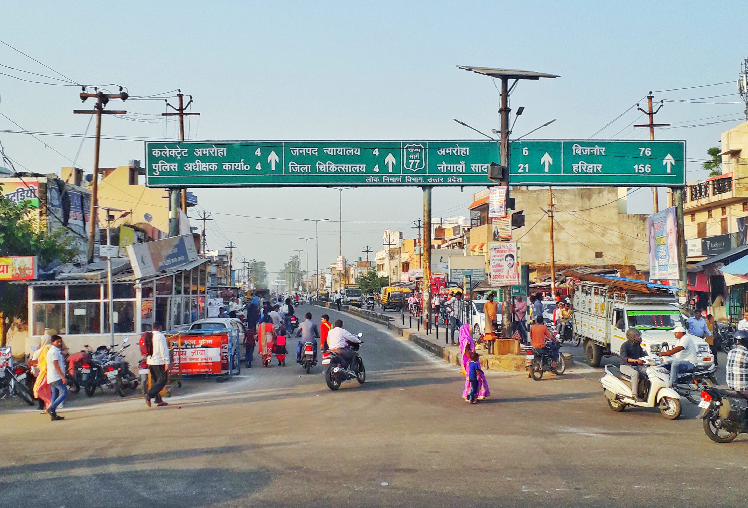
Amroha is well connected through Railways and Road with Indian capital New Delhi. Amroha railway station is situated on Delhi-Moradabad line and all passenger trains & most of the express trains stop here. Amroha railway station is on a line built by Oudh and Rohilkhand Railway, 868 miles from Kolkata. Amroha is about 5 km away from NH 24, a four-lane highway which connects New Delhi to Lucknow.
Landmark places
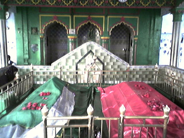


Amrohas has many tourist attractions. Vasudev Temple for Hindus and Dargah Shah Wilayat of Sufi saint Syed Husain Sharaf-ud-din Soharwardi Amrohi Syed are visited by people across the country. The Sufi Shah wilyata came to Amroha from Wasit, Iraq in 13th century. At his resting place, scorpions never sting. [6][7]
Notable people
- Ahmad Hasan Amrohi, Indian Islamic scholar and freedom fighter
- Azeem Amrohvi, Indian Urdu poet
- Bilal Amrohi, Indian actor, grandson of Kamal Amrohi
- Ahmad Saeed Kazmi Islamic scholar from Multan, Pakistan who migrated from Amroha in 1935[8]
- Eqbal Mehdi, Pakistani artist
- Izaz Ali Amrohi, Indian Hanafi scholar of Islam
- Jaun Elia, Urdu poet
- Javed Khan Amrohi, Indian actor
- K. A. Nizami, Indian historian and diplomat
- Kamal Amrohi, Indian film director and writer
- Khayal Amrohvi, Pakistani writer and educationist
- Mahboob Ali, Indian politician
- Mashhoor Amrohi, Indian actor, grandson of Kamal Amrohi
- Mohammed Shami, Indian national cricketer
- Mustajab Shelle, Indian painter and writer
- Nasim Amrohvi, Pakistani Urdu lexicographer and writer
- Waqar-ul-Mulk, Indian Muslim politician
- Nisar Ahmed Faruqi, Indian Sufi scholar of Islam
- Qaem Amrohi, Pakistani Urdu poet and philosopher
- Rais Amrohvi, Pakistani writer, elder brother of Jaun Elia
- Saiyed Zegham Murtaza, Journalist, Columnist, Author, Blogger and Documentary Film Maker
- Sadequain, Pakistani artist and calligraphist
- Syed Mahmood Naqvi, Indian earth scientist
- Syed Wajih Ahmad Naqvi, Indian marine scientist
See also
- Amrohi Syed
References
- "Uttar Pradesh (India): State, Major Agglomerations & Cities – Population Statistics, Maps, Charts, Weather and Web Information". citypopulation.de. Retrieved 1 January 2021.
- "Census of India- Amroha". www.censusindia.gov.in. Retrieved 18 December 2019.
- "52nd Report of the Commissioner for Linguistic Minorities in India" (PDF). nclm.nic.in. Ministry of Minority Affairs. Archived from the original (PDF) on 25 May 2017. Retrieved 20 December 2018.
- "Amroha Pin code". citypincode.in. Retrieved 21 March 2014.
- "अमरोही आम की नायाब क़लमी क़िस्में". BBC. 7 August 2004. Retrieved 8 January 2021.
- Unlock Pending Karma and Its Correction: Law of Karma through Astrology and Transformation through Mythology. Notion Press. 11 January 2021. ISBN 9781637453216.
- Uttar Pradesh District Gazetteers: Moradabad. Government of Uttar Pradesh. 1968.
- The Journal of Political Science. Department of Political Science, Government College. 1995. p. 126.
External links
Authority control | |
|---|---|
| General |
|
| National libraries | |
На других языках
[de] Amroha
Amroha ist eine Stadt im nordindischen Bundesstaat Uttar Pradesh.- [en] Amroha
Другой контент может иметь иную лицензию. Перед использованием материалов сайта WikiSort.org внимательно изучите правила лицензирования конкретных элементов наполнения сайта.
WikiSort.org - проект по пересортировке и дополнению контента Википедии