world.wikisort.org - India
Chandauli district is a district of Uttar Pradesh state of India, and Chandauli town is the district headquarters. Chandauli district is a part of Varanasi Division. Chandauli became a separate district for the first time on 20 May 1997.
Chandauli district | |
|---|---|
District of Uttar Pradesh | |
 Rajdari Waterfalls | |
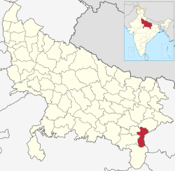 Location of Chandauli district in Uttar Pradesh | |
| Country | |
| State | Uttar Pradesh |
| Division | Varanasi |
| Headquarters | Chandauli |
| Government | |
| • Lok Sabha constituencies | Chandauli |
| Area | |
| • Total | 2,484.70 km2 (959.35 sq mi) |
| Population (2011) | |
| • Total | 1,952,756 |
| • Density | 790/km2 (2,000/sq mi) |
| • Urban | 242,553 |
| Demographics | |
| • Literacy | 80.9% |
| • Sex ratio | 984 |
| Languages | |
| • Official language | Hindi |
| • Additional official | Urdu |
| • Regional | Bhojpuri |
| Time zone | UTC+05:30 (IST) |
| Website | chandauli |
Deen Dayal Upadhyay Nagar, a city in the district has the busiest railway station in the North East of Uttar Pradesh. The district includes the Chandraprabha (nature) Sanctuary and a number of waterfalls, including at Devdari and Rajdari. The District contributes to Indian GDP by providing the various cereals from the district including paddy and wheat. Popularly known as the "Dhaan Ka Katora of Uttar Pradesh" because of fertile lands of the Gangetic Plain. Chanduali district made big contributions at the time of freedom movements.[citation needed] In Chanduali there is a village named Ghoswan and Khakhara which is known for the protest against the British for the freedom of India. Chandauli district has its own railway station named Chandauli Majhwar railway station near to district headquarters.
The district has five Vidhan Sabha seats and one member of parliament seat.
Economy
In 2006 the Ministry of Panchayati Raj named Chandauli one of the country's 250 most backward districts (out of a total of 640).[1] It is one of the 34 districts in Uttar Pradesh currently receiving funds from the Backward Regions Grant Fund Programme (BRGF).[1]
Demographics
| Year | Pop. | ±% p.a. |
|---|---|---|
| 1901 | 354,167 | — |
| 1911 | 356,001 | +0.05% |
| 1921 | 361,609 | +0.16% |
| 1931 | 387,128 | +0.68% |
| 1941 | 459,271 | +1.72% |
| 1951 | 544,097 | +1.71% |
| 1961 | 659,347 | +1.94% |
| 1971 | 780,732 | +1.70% |
| 1981 | 1,001,246 | +2.52% |
| 1991 | 1,274,839 | +2.45% |
| 2001 | 1,643,251 | +2.57% |
| 2011 | 1,952,756 | +1.74% |
| source:[2] | ||
According to the 2011 census Chandauli district has a population of 1,952,756,[4] roughly equal to the nation of Lesotho[5] or the US state of New Mexico.[6] This gives it a ranking of 238th in India (out of a total of 640).[4] The district has a population density of 768 inhabitants per square kilometre (1,990/sq mi).[4] Its population growth rate over the decade 2001-2011 was 18.83%.[4] Chandauli has a sex ratio of 913 females for every 1,000 males. Scheduled Castes and Scheduled Tribes made up 22.88% and 2.14% of the population respectively.[4]
Languages
At the time of the 2011 Census of India, 81.06% of the population in the district spoke Hindi, 17.60% Bhojpuri and 1.16% Urdu as their first language.[7]
Bhojpuri is the local language of Chandauli. The Bhojpuri variant of Kaithi is the indigenous script of Bhojpuri language.[8]
References
- Ministry of Panchayati Raj (8 September 2009). "A Note on the Backward Regions Grant Fund Programme" (PDF). National Institute of Rural Development. Archived from the original (PDF) on 5 April 2012. Retrieved 27 September 2011.
- Decadal Variation In Population Since 1901
- "Table C-01 Population by Religion: Uttar Pradesh". censusindia.gov.in. Registrar General and Census Commissioner of India. 2011.
- "District Census Handbook: Chandauli" (PDF). censusindia.gov.in. Registrar General and Census Commissioner of India. 2011.
- US Directorate of Intelligence. "Country Comparison:Population". Archived from the original on 27 September 2011. Retrieved 1 October 2011.
Lesotho 1,924,886
- "2010 Resident Population Data". U. S. Census Bureau. Archived from the original on 19 October 2013. Retrieved 30 September 2011.
New Mexico - 2,059,179
- "Table C-16 Population by Mother Tongue: Uttar Pradesh". www.censusindia.gov.in. Registrar General and Census Commissioner of India.
- Grierson, George Abraham (1881). A handbook to the Kayathi character. The Library of Congress. Calcutta, Thacker, Spink, and co.
External links
Places adjacent to Chandauli district | ||||||||||||||||
|---|---|---|---|---|---|---|---|---|---|---|---|---|---|---|---|---|
| ||||||||||||||||
Authority control | |
|---|---|
| General |
|
| National libraries | |
На других языках
- [en] Chandauli district
[ru] Чандаули (округ)
Чандаули (хинди चन्दौली जिला, англ. Chandauli) — округ в индийском штате Уттар-Прадеш. Административный центр — город Чандаули. Площадь округа — 2554 км².Другой контент может иметь иную лицензию. Перед использованием материалов сайта WikiSort.org внимательно изучите правила лицензирования конкретных элементов наполнения сайта.
WikiSort.org - проект по пересортировке и дополнению контента Википедии