world.wikisort.org - India
Kushinagar is a district of the state of Uttar Pradesh in India situated in the easternmost part of the state. It has the administrative headquarters at Ravindra Nagar Dhoos. The district is named such after the town Kushinagar, a Buddhist pilgrimage site where Gautama Buddha attained parinirvana in the 5th century BCE. Since the independence of India, Kushinagar district was a part of Deoria District and came into existence on 13 May 1994 as a separate district division. It was earlier known as Padrauna and thereafter was renamed Kushinagar on 19 June 1997.
Kushinagar district | |
|---|---|
District of Uttar Pradesh | |
| Kushinagar district | |
 Buddha cremation stupa, Kushinagar | |
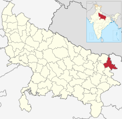 Location of Kushinagar district in Uttar Pradesh | |
| Country | |
| State | Uttar Pradesh |
| Division | Gorakhpur |
| Established as Padrauna | 13 May 1994 |
| Name Changed from Padrauna to Kushinagar | 19 June 1997 |
| Headquarters | Padrauna |
| Tehsils | Padrauna Sadar, Khadda, Kushinagar/Kasia, Hata, Tamkuhiraj, Captanganj |
| Government | |
| • Member of Parliament (Kushinagar) | Vijay Kumar Dubey |
| • Lok Sabha constituencies | Kushinagar |
| • Vidhan Sabha constituencies | Padrauna Sadar, Khadda, Ramkola, Hata, Fazilnagar, Tamkuhiraj, Kushinagar |
| Area | |
| • Total | 2,873.5 km2 (1,109.5 sq mi) |
| Population (2011) | |
| • Total | 3,564,544 |
| • Density | 1,200/km2 (3,200/sq mi) |
| • Urban | 4.87% |
| Language
Official=Hindi,Urdu Regional=Bhojpuri Demographics | |
| • Literacy | 67.66 per cent |
| • Sex ratio | 955 |
| Time zone | UTC+05:30 (IST) |
| Vehicle registration | UP 57 |
| Major highways | NH 27 and NH 727 (previously NH 28 and NH 28B) |
| Website | kushinagar |
Location
Kushinagar District is bounded on the northeast by West Champaran and Gopalganj districts of Bihar, on the south by Deoria District and on the west by Gorakhpur and Maharajganj districts. It is part of Gorakhpur Division.
Economy
In 2006 the Ministry of Panchayati Raj named Kushinagar one of the country's 250 most backward districts (out of a total of 640).[1] It is one of the 34 districts in Uttar Pradesh currently receiving funds from the Backward Regions Grant Fund Programme (BRGF).[1]
Transport
The Indian Government has approved a project for the construction of an International Airport which would be completed till 2019.[citation needed] In 2017, Uttar Pradesh Government has approved a project for develop Kushinagar bus station as an International Bus Station.[citation needed] Daily Buses from Gorakhpur to Tamkuhi Road and Gorakhpur to Padrauna through Kasia are available at Railway Station Bus Depot Gorakhpur.[citation needed]
Padrauna, Ramkola, Kaptanganj, Dudahi and Tamkuhi Road are some cities connected with train facility in the district.
On 20th October 2021 the international airport was officially inaugurated during the Abhidhamma Day celebrations in Kushinagar.
Demographics
According to the 2011 census Kushinagar district has a population of 3,564,544,[3] roughly equal to the nation of Lithuania[4] or the US state of Connecticut.[5] This gives it a ranking of 81st in India (out of a total of 640).[3] The district has a population density of 1,226 inhabitants per square kilometre (3,180/sq mi).[3] Its population growth rate over the decade 2001-2011 was 23.08%.[3] Kushinagar has a sex ratio of 955 females for every 1000 males,[3] and a literacy rate of 67.66%. Scheduled Castes and Scheduled Tribes made up 15.27% and 2.25% of the population respectively.[3]
According to 2011 Census, 77.67% of the population in the district spoke Bhojpuri and 21.79% Hindi as their first language.[6]
Bhojpuri is the local language of Kushinagar. The Bhojpuri variant of Kaithi is the indigenous script of Bhojpuri language.[7]
| Year | Pop. | ±% p.a. |
|---|---|---|
| 1901 | 738,315 | — |
| 1911 | 804,023 | +0.86% |
| 1921 | 820,780 | +0.21% |
| 1931 | 876,462 | +0.66% |
| 1941 | 977,561 | +1.10% |
| 1951 | 1,043,419 | +0.65% |
| 1961 | 1,184,272 | +1.27% |
| 1971 | 1,401,482 | +1.70% |
| 1981 | 1,746,618 | +2.23% |
| 1991 | 2,255,120 | +2.59% |
| 2001 | 2,891,667 | +2.52% |
| 2011 | 3,564,544 | +2.11% |
| source:[8] | ||
References
- Ministry of Panchayati Raj (8 September 2009). "A Note on the Backward Regions Grant Fund Programme" (PDF). National Institute of Rural Development. Archived from the original (PDF) on 5 April 2012. Retrieved 27 September 2011.
- "Table C-01 Population by Religion: Uttar Pradesh". censusindia.gov.in. Registrar General and Census Commissioner of India. 2011.
- "District Census Handbook: Kushinagar" (PDF). censusindia.gov.in. Registrar General and Census Commissioner of India. 2011.
- US Directorate of Intelligence. "Country Comparison:Population". Archived from the original on 13 June 2007. Retrieved 1 October 2011.
Lithuania 3,535,547 July 2011 est.
- "2010 Resident Population Data". U. S. Census Bureau. Archived from the original on 19 October 2013. Retrieved 30 September 2011.
Connecticut 3,574,097
- "Table C-16 Population by Mother Tongue: Uttar Pradesh". www.censusindia.gov.in. Registrar General and Census Commissioner of India.
- Grierson, George Abraham (1881). A handbook to the Kayathi character. The Library of Congress. Calcutta, Thacker, Spink, and co.
- "Decadal Variation In Population Since 1901". www.censusindia.gov.in. Retrieved 6 February 2021.
External links
Places adjacent to Kushinagar district | ||||||||||||||||
|---|---|---|---|---|---|---|---|---|---|---|---|---|---|---|---|---|
| ||||||||||||||||
Authority control | |
|---|---|
| General |
|
| National libraries | |
На других языках
[de] Kushinagar (Distrikt)
Der Distrikt Kushinagar (Hindi: कुशीनगर जिला, Urdu کشی نگر ضلع), 1994 bis 1997 Distrikt Padrauna, ist ein Distrikt des indischen Bundesstaats Uttar Pradesh. Seinen Namen trägt der Distrikt nach der buddhistischen Pilgerstätte Kushinagar, dem Todesort des Buddha. Verwaltungszentrum und größte Stadt des Distrikts Kushinagar ist Padrauna.- [en] Kushinagar district
[ru] Кушинагар (округ)
Кушинагар (англ. Kushinagar) — округ в индийском штате Уттар-Прадеш. Получил своё название от священного места паломничества буддизма — города Кушинагара. Административный центр — город Падарауна. Площадь округа — 2909 км². По данным всеиндийской переписи 2001 года население округа составляло 2 893 196 человек. Уровень грамотности взрослого населения составлял 46,94 %, что ниже среднеиндийского уровня (59,5 %).Другой контент может иметь иную лицензию. Перед использованием материалов сайта WikiSort.org внимательно изучите правила лицензирования конкретных элементов наполнения сайта.
WikiSort.org - проект по пересортировке и дополнению контента Википедии