world.wikisort.org - India
Jamtara district (Hindi: जामताड़ा जिला, Bengali: জামতাড়া জেলা, Santali: ᱡᱟᱢᱛᱟᱲᱟ ᱦᱚᱱᱚᱛ) is one of the twenty-four districts of Jharkhand state in eastern India. Jamtara town is the administrative headquarters of this district. The district is situated between 23°10′ and 24°05′ north latitudes and 86°30′ and 87°15′ east longitudes.
This article needs additional citations for verification. (May 2008) |
Jamtara district | |
|---|---|
District of Jharkhand | |
 | |
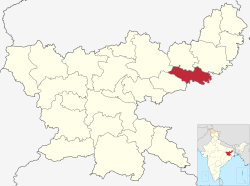 Location of Jamtara district in Jharkhand | |
| Coordinates (Jamtara): 23°57′36″N 86°48′00″E | |
| Country | |
| State | |
| Division | Santal Pargana |
| Headquarters | Jamtara |
| Government | |
| • Lok Sabha constituencies | 1. Dumka (shared with Dumka district) |
| • Vidhan Sabha constituencies | 3 |
| Area | |
| • Total | 1,801.98 km2 (695.75 sq mi) |
| Population (2011) | |
| • Total | 791,042 |
| • Density | 440/km2 (1,100/sq mi) |
| Demographics | |
| • Literacy | 63.73% |
| • Sex ratio | 959 |
| Time zone | UTC+05:30 (IST) |
| Website | jamtara |
Economy
In 2006 the Indian government named Jamtara one of the country's 250 most backward districts (out of a total of 640).[1] It is one of the 21 districts in Jharkhand currently receiving funds from the Backward Regions Grant Fund Programme (BRGF).[1]
Politics
| No. | Constituency | Name | Party | Alliance | Remarks | |||||||||||||||||||||||||||||||||||||||||||||||||||||||
|---|---|---|---|---|---|---|---|---|---|---|---|---|---|---|---|---|---|---|---|---|---|---|---|---|---|---|---|---|---|---|---|---|---|---|---|---|---|---|---|---|---|---|---|---|---|---|---|---|---|---|---|---|---|---|---|---|---|---|---|---|
| 8 | Nala | Rabindra Nath Mahato | Jharkhand Mukti Morcha | UPA | Speaker | |||||||||||||||||||||||||||||||||||||||||||||||||||||||
| 9 | Jamtara | Irfan Ansari | Indian National Congress | UPA |
|} AdministrationBlocks/MandalsJamtara district consists of 06 Blocks. The following are the list of the Blocks inJamtara district: DivisionsThere are three Vidhan Sabha constituencies in the district: Nala, Jamtara and Sarath (shared with Deoghar district). All three constituencies are part of Dumka Lok Sabha constituency. DemographicsAccording to the 2011 census Jamtara district has a population of 791,042,[2] roughly equal to the nation of Comoros[3] or the US state of South Dakota.[4] This gives it a ranking of 486th in India (out of a total of 640).[2] The district has a population density of 439 inhabitants per square kilometre (1,140/sq mi) .[2] Its population growth rate over the decade 2001-2011 was 21%.[2] Jamtara has a sex ratio of 959 females for every 1000 males,[2] and a literacy rate of 63.73%. Scheduled Castes and Scheduled Tribes make up 9.21% and 30.40% of the population respectively.[2] 69.6% are Hindu, 20.78% Muslim, and 8.67% Sarna. At the time of the 2011 Census of India, 30.18% of the population spoke Bengali, 29.10% Santali, 27.93% Khortha, 5.92% Hindi and 3.61% Urdu as their first language.[5] See also
References
External links
| |||||||||||||||||||||||||||||||||||||||||||||||||||||||

На других языках
[de] Jamtara (Distrikt)
Jamtara ist ein Distrikt im indischen Bundesstaat Jharkhand.- [en] Jamtara district
[ru] Джамтара (округ)
Джамтара (хинди जामताड़ा जिला; англ. Jamtara) — округ в индийском штате Джаркханд. Образован в 2001 году из части территории округа Думка. Административный центр — город Джамтара. Площадь округа — 1802 км². По данным всеиндийской переписи 2001 года население округа составляло 653 081 человек.Другой контент может иметь иную лицензию. Перед использованием материалов сайта WikiSort.org внимательно изучите правила лицензирования конкретных элементов наполнения сайта.
WikiSort.org - проект по пересортировке и дополнению контента Википедии