world.wikisort.org - Japan
Kita (北区, Kita-ku, "Northern ward") is a special ward located in Tokyo Metropolis, Japan. The English translation of its Japanese self-designation is City of Kita. The ward was founded on March 15, 1947.
Kita
北区 | |
|---|---|
| Kita City | |
 Asukayama Park in Ōji, Kita, Tokyo | |
 Flag  Emblem | |
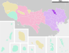
 Location of Kita in Tokyo Metropolis | |
 Kita Location in Japan | |
| Coordinates: 35°45′N 139°44′E | |
| Country | Japan |
| Region | Kantō |
| Prefecture | Tokyo Metropolis |
| Government | |
| • Mayor | Yosōta Hanakawa |
| Area | |
| • Total | 20.61 km2 (7.96 sq mi) |
| Population (October 1, 2020[1]) | |
| • Total | 355,213 |
| • Density | 17,234/km2 (44,640/sq mi) |
| Time zone | UTC+09:00 (JST) |
| Website | www |
| Symbols | |
| Flower | Rhododendron |
| Tree | Cherry blossom |
As of May 1, 2015, the ward has an estimated population of 340,287, and a population density of 16,510 persons per km2. The total area is 20.61 km2.
Districts and neighborhoods
|
|
|
History
The area was a collection of rural villages and towns until the 1880s, when it was connected by rail to central Tokyo (Oji Station opening in 1883). Parts of the area joined Tokyo City in 1932 as the Ōji (former Ōji and Iwabuchi towns) and Takinogawa (former Takinogawa town) Wards. Kita was officially formed in 1947 by the merger of these wards.[2]
Geography
The name Kita, meaning "north," reflects the location among the wards of Tokyo. To its north lie the cities of Kawaguchi and Toda in Saitama Prefecture. To the east, south and west lie other special wards: Adachi, Arakawa, Itabashi, Bunkyō, and Toshima.
Four rivers run through Kita:
- Arakawa River
- Sumida River
- Shakujii River
- Shingashi River
Famous sites
- Asukayama Park[3]
- Ukima Park
- Chūō Park (formerly Camp Oji)
- Kyu-Furukawa Gardens,[4] designated a National Place of Scenic Beauty.
- Nanushi-no-taki Park[5]
- Oji Shrine,[6][7] one of the Tokyo Ten Shrines (東京十社, Tokyo Jissha).[8]
- Oji Inari shrine[9]
Economy
The head office of Seiyu Group is in Kita.[10]
Education

The city's public elementary and middle schools are operated by the City of Kita Board of Education.
The city's public high schools are operated by the Tokyo Metropolitan Government Board of Education.
- Asuka High School (東京都立飛鳥高等学校)
- Akabane Commercial High School (東京都立赤羽商業高等学校)
- Kirigaoka High School (東京都立桐ケ丘高等学校)
- Oji Technical High School (東京都立王子総合高等学校)
The following private domestic schools are in the ward:
- Seigakuin Junior & Senior High School (for boys) – Nakazato[11]
- Joshi Seigakuin Junior & Senior High School (for girls) – Nakazato[12]
The following international schools are in the ward:
- Lycée Français International de Tokyo (French)
- L'École du Juste Milieu (French-English)
- Tokyo Korean Junior and Senior High School (North Korean)
The following universities are in the ward:
- Tokyo University of Social Welfare
- Tokyo Seitoku University
Transportation
Rail
- JR East
- Tōhoku Main Line, Takasaki Line, Utsunomiya Line: Oku, Akabane Stations
- Saikyō Line (Akabane Line): Itabashi, Jujo, Akabane, Kita Akabane, Ukima Funado Stations
- Keihin-Tōhoku Line: Tabata, Kami Nakazato, Ōji, Higashi Jujo, Akabane Stations
- Yamanote Line: Tabata Station
- Tokyo Metropolitan Bureau of Transportation Tokyo Sakura Tram: Nishigahara-yonchome, Takinogawa-ichome, Asukayama, Oji-ekimae, Sakaecho, Kajiwara Stations
- Tokyo Metro Namboku Line: Nishigahara, Ōji, Ōji Kamiya, Shimo, Akabane Iwabuchi Stations
- Saitama Rapid Railway Line (Sainokuni Stadium Line): Akabane-Iwabuchi Station
Highways
- Shuto Expressway C2 Central Loop (Itabashi JCT – Kasai JCT)
- Route 17 (Nakasendō)
Notable people from Kita
- Kōbō Abe, Japanese writer, playwright, musician, photographer, inventor and novelist
- Elephant Kashimashi, rock band[13]
- Kyoko Fukada, model, actress, and singer
- Megumi Hayashibara, seiyuu, musician, singer, writer, radio DJ and TV talk show host, certified nurse
- Hikaru Ijuin, radio and television personality
- Kiyoshi Kodama, actor and TV personality
- Kazuya Yoshii, singer-songwriter and musician[14] (The Yellow Monkey)
- KOHH, rapper (Real Name: Yuki Chiba, Nihongo: 千葉雄喜, Chiba Yūki)
- Yuichi Nakamaru, singer-songwriter, actor, television personality, radio host, and a member of KAT-TUN
International relations
Kita has a sister city relationship with Xuanwu District, Beijing, China.
It is also twinned with the following cities in Japan.
See also
References
- "Population by District". Tokyo Statistical Yearbook. Retrieved July 15, 2022.
- "歴史年表|東京都北区". Archived from the original on March 4, 2016. Retrieved April 28, 2015.
- "Oji, a greenery historic town with budget-friendly attractions". Tokyo Travel. Retrieved December 21, 2017.
- "Kyu Furukawa Gardens". Official Tokyo Travel Guide. Retrieved December 21, 2017.
- "Oji, a greenery historic town with budget-friendly attractions". Tokyo Travel. Retrieved December 21, 2017.
- "Oji Jinja Shrine". Official Tokyo Travel Guide. Retrieved December 21, 2017.
- "Oji, a greenery historic town with budget-friendly attractions". Tokyo Travel. Retrieved December 21, 2017.
- "Tokyo Ten Jinja Shrine". Retrieved December 21, 2017.
- "Oji, a greenery historic town with budget-friendly attractions". Tokyo Travel. Retrieved December 21, 2017.
- "Corporate Data Archived 2008-04-18 at the Wayback Machine." Seiyu Group. Retrieved on May 19, 2009.
- "English." Seigakuin Junior & Senior High School. Retrieved on January 10, 2019. "Seigakuin Junior & Senior High School 3-12-1 Nakazato, Kita-ku, Tokyo 114-8502 JAPAN"
- "English." Joshi Seigakuin Junior & Senior High School. Retrieved on January 10, 2019. "Joshi Seigakuin Junior & Senior High School 3-12-2 Nakazato, Kita-ku, Tokyo 114-8574 JAPAN"
- "北区シティプロモーション事業「東京都北区赤羽×エレファントカシマシ」を開催!". Kita City. November 8, 2018. Retrieved January 5, 2020.
- "吉井和哉|Yoshii Kazuya Official Website".
External links
- Kita City Official Website (in Japanese)
| Districts |
|  | ||||||
|---|---|---|---|---|---|---|---|---|
| Schools |
| |||||||
| Colleges and universities |
| |||||||
| Landmarks |
| |||||||
| Major stations |
| |||||||
This list is incomplete. | ||||||||
| 2,000,000 and more | |
|---|---|
| 1,000,000–1,999,999 | |
| 500,000–999,999 | |
| 200,000–499,999 |
|
Authority control | |
|---|---|
| General | |
| National libraries | |
| Scientific databases | |
| Other |
|
На других языках
[de] Kita (Tokio)
Kita (jap. 北区, -ku) ist einer der 23 Stadtbezirke Tokios, der Hauptstadt Japans.- [en] Kita, Tokyo
[es] Kita (Tokio)
Kita (北区, Kita-ku?) es una región especial de la Metrópolis de Tokio, en Japón. Es común que se autodenomine "Ciudad de Kita". En 2008, la población era de 332.410 habitantes, con una densidad de 16.140 personas por km², en un área de 20,59 km².[ru] Кита (специальный район)
Кита (яп. 北区 Кита-ку) — один из 23 специальных районов Токио. По данным на 1 мая 2020 года численность населения составляла 355 257 чел., плотность населения — 17,237 чел./км². Общая площадь района составляет 20,61 км².Другой контент может иметь иную лицензию. Перед использованием материалов сайта WikiSort.org внимательно изучите правила лицензирования конкретных элементов наполнения сайта.
WikiSort.org - проект по пересортировке и дополнению контента Википедии