world.wikisort.org - Japan
Ōshima (大島町, Ōshima-machi) is a town located in Ōshima Subprefecture, Tokyo Metropolis, Japan. As of 1 February 2016[update], the town had an estimated population of 7,762, and a population density of 85.5 persons per km². Its total area is 90.76 square kilometres (35.04 sq mi).
Ōshima
大島町 | |
|---|---|
Town | |
Ōshima Town Hall | |
|
Flag Seal | |
Location of Ōshima in Tokyo Metropolis | |
 Ōshima 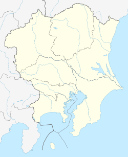 Ōshima Ōshima (Kanto Area) | |
| Coordinates: 34°45′0.5″N 139°21′19.8″E | |
| Country | Japan |
| Region | Kantō |
| Prefecture | Tokyo Metropolis |
| First official recorded | 620 AD |
| Town settled | April 1, 1955 |
| Government | |
| • Mayor | Toshihiro Mitsuji (from April 2015) |
| Area | |
| • Total | 90.76 km2 (35.04 sq mi) |
| Population (June 1, 2016) | |
| • Total | 7,762 |
| • Density | 85.5/km2 (221/sq mi) |
| Time zone | UTC+9 (Japan Standard Time) |
| Phone number | 04992-2-1443 |
| Address | 1-1-14 Motomachi, Ōshima-machi, Tokyo 100-0101 |
| Climate | Cfa |
| Website | www |
| Symbols | |
| Flower | Camellia japonica |
| Tree | Camellia japonica |
Geography
Ōshima Town covers the island of Izu Ōshima, in the Izu archipelago in the Philippine Sea, 120 kilometres (75 mi) south of central Tokyo.
Climate
| Climate data for Izu Ōshima (1991−2020 normals, extremes 1938−present) | |||||||||||||
|---|---|---|---|---|---|---|---|---|---|---|---|---|---|
| Month | Jan | Feb | Mar | Apr | May | Jun | Jul | Aug | Sep | Oct | Nov | Dec | Year |
| Record high °C (°F) | 20.9 (69.6) |
21.0 (69.8) |
22.2 (72.0) |
25.5 (77.9) |
28.4 (83.1) |
32.3 (90.1) |
34.3 (93.7) |
35.9 (96.6) |
33.7 (92.7) |
29.7 (85.5) |
24.8 (76.6) |
23.1 (73.6) |
35.9 (96.6) |
| Average high °C (°F) | 11.0 (51.8) |
11.6 (52.9) |
14.2 (57.6) |
18.2 (64.8) |
21.9 (71.4) |
24.3 (75.7) |
27.8 (82.0) |
29.5 (85.1) |
26.7 (80.1) |
22.0 (71.6) |
17.8 (64.0) |
13.4 (56.1) |
19.9 (67.8) |
| Daily mean °C (°F) | 7.5 (45.5) |
7.8 (46.0) |
10.4 (50.7) |
14.4 (57.9) |
18.2 (64.8) |
21.0 (69.8) |
24.6 (76.3) |
26.0 (78.8) |
23.4 (74.1) |
18.9 (66.0) |
14.5 (58.1) |
10.0 (50.0) |
16.4 (61.5) |
| Average low °C (°F) | 3.9 (39.0) |
4.0 (39.2) |
6.6 (43.9) |
10.7 (51.3) |
14.8 (58.6) |
18.4 (65.1) |
22.2 (72.0) |
23.5 (74.3) |
20.8 (69.4) |
16.1 (61.0) |
11.3 (52.3) |
6.5 (43.7) |
13.2 (55.8) |
| Record low °C (°F) | −3.3 (26.1) |
−4.0 (24.8) |
−1.9 (28.6) |
0.1 (32.2) |
6.4 (43.5) |
10.4 (50.7) |
12.4 (54.3) |
16.0 (60.8) |
12.4 (54.3) |
7.2 (45.0) |
3.0 (37.4) |
−3.0 (26.6) |
−4.0 (24.8) |
| Average precipitation mm (inches) | 137.3 (5.41) |
146.0 (5.75) |
238.4 (9.39) |
247.4 (9.74) |
256.5 (10.10) |
328.8 (12.94) |
255.9 (10.07) |
191.7 (7.55) |
341.3 (13.44) |
405.2 (15.95) |
192.8 (7.59) |
117.6 (4.63) |
2,858.9 (112.56) |
| Average snowfall cm (inches) | trace | 1 (0.4) |
0 (0) |
0 (0) |
0 (0) |
0 (0) |
0 (0) |
0 (0) |
0 (0) |
0 (0) |
0 (0) |
0 (0) |
2 (0.8) |
| Average precipitation days (≥ 1.0 mm) | 7.1 | 7.7 | 11.5 | 10.6 | 10.6 | 12.6 | 10.3 | 8.4 | 12.0 | 12.0 | 9.6 | 7.6 | 120 |
| Average snowy days | 0.2 | 0.3 | 0 | 0 | 0 | 0 | 0 | 0 | 0 | 0 | 0 | 0 | 0.5 |
| Average relative humidity (%) | 64 | 66 | 70 | 74 | 79 | 85 | 87 | 86 | 83 | 79 | 74 | 68 | 76 |
| Mean monthly sunshine hours | 153.7 | 145.4 | 158.1 | 174.2 | 179.7 | 125.1 | 150.8 | 190.1 | 141.0 | 131.4 | 140.3 | 147.6 | 1,837.2 |
| Source: JMA[1][2] | |||||||||||||
History

It is uncertain when human settlement first began on Ōshima, but archaeological finds from the Jōmon period have been discovered, and the island is mention from early Nara period documents. It is mentioned in historical records for its many volcanic eruptions. After the start of the Meiji period, in 1878, the island came under the control of Tokyo-fu and was organized into six villages (Okada, Motomura, Senzu, Nomashi, Sashikiji and Habuminato) under Oshima subprefecture on April 1, 1908. The six villages were merged to form Ōshima Town on April 1, 1955.
In the mid-1930s, Izu Ōshima became a popular suicide destination after three schoolgirls jumped into the active volcano in the center of the island. In 1935 alone, more than 800 suicides were recorded.[3]
The central volcano on the island, Mount Mihara erupted in 1965 and again in 1986, forcing the temporary evacuation of the inhabitants.
On 16 October 2013, Typhoon Wipha passed over the island, dropping 80 cm (31 in) of rain in 24 hours and causing a landslide that killed 35 people.[4]
Economy
Fishing and seasonal tourism are the mainstays of the economy of Ōshima.
Transportation
Airport

- Ōshima Airport
Harbor
- Port of Okada
- Port of Motomachi
Education
Ōshima town operates three public elementary schools and three public junior high schools.
Junior high schools:
- Dai-ichi (No. 1 or First) (大島町立第一中学校)[5]
- Daini (No. 2 or Second) (大島町立第二中学校)[6]
- Daisan (No. 3 or Third) (大島町立第三中学校)[7]
Elementary schools:
- Sakura Elementary School (大島町立さくら小学校)[8]
- Tsubaki Elementary School (大島町立つばき小学校)[9]
- Tsutsuji Elementary School (大島町立つつじ小学校)[10]
The Tokyo Metropolitan Board of Education operates two high schools in the municipality. Ōshima High School is an agriculture school known for producing baseball players, and Ōshima International Maritime Academy is a marine biology school. Ōshima High School is attended primarily by children native to the island. Ōshima International Maritime Academy draws students from mainland Tokyo and neighboring Izu in order to participate in its marine biology program.
Sister city relations
![]() - Hilo, Hawaii, United States
- Hilo, Hawaii, United States
Local attractions
The island is known for its Camellia Festival, Hanabi Festival, five black sand beaches, and several onsen.
References
- 観測史上1~10位の値(年間を通じての値). JMA. Retrieved February 23, 2022.
- 気象庁 / 平年値(年・月ごとの値). JMA. Retrieved February 23, 2022.
- "Japan's Fiery Pit of Death". Chicago Tribune. May 10, 1936. Retrieved June 5, 2016.
- Kyodo, Jiji. "Izu-Oshima Island holds memorial for mudslide victims of Typhoon Wipha". The Japan Times. Retrieved 8 December 2013.
- "Home". Dai-ichi Junior High School. Retrieved 2022-11-05.
- "Home". Daini Junior High School. Retrieved 2022-11-05.
- "Home". Third Junior High School. Retrieved 2022-11-05.
- "Home". Sakura Elementary School. Retrieved 2022-11-05.
- "Home". Tsubaki Elementary School. Retrieved 2022-11-05.
- "Home". Tsutsuji Elementary School. Retrieved 2022-11-05.
External links
- Ōshima Town Official Website (in Japanese)
Authority control | |
|---|---|
| General | |
| National libraries | |
| Scientific databases | |
| Other |
|
На других языках
[de] Ōshima (Tokio)
Ōshima (jap. 大島町, -machi, dt. „große Insel“) ist eine Kleinstadt in der japanischen Präfektur Tokio. Sie umfasst die gesamte Insel Izu-Ōshima, die größte der Izu-Inseln. Die Gemeinde gehört administrativ zur Unterpräfektur Ōshima.- [en] Ōshima, Tokyo
[fr] Ōshima (Tokyo)
Ōshima (大島町, Ōshima-machi?) est un bourg de la sous-préfecture d'Ōshima, dans la préfecture de Tokyo, au Japon.[it] Ōshima (Tokyo)
La Cittadina di Ōshima (大島町 Ōshima-machi?) è una municipalità del Giappone facente parte dell'omonima Sottoprefettura di Ōshima, il cui territorio ricade sotto la giurisdizione del Governo Metropolitano di Tokyo. Il territorio comunale coincide con quello di Izu Ōshima, la più grande delle isole Izu, arcipelago al largo delle coste centro-orientali di Honshū, l'isola più grande del Giappone.[ru] Осима (посёлок)
Осима (яп. 大島町 О:сима-мати) — посёлок в Японии, находящийся в округе Осима префектуры Токио. Площадь посёлка составляет 91,06 км²[1], население — 7104 человека (1 октября 2020)[2], плотность населения — 78,01 чел./км².Другой контент может иметь иную лицензию. Перед использованием материалов сайта WikiSort.org внимательно изучите правила лицензирования конкретных элементов наполнения сайта.
WikiSort.org - проект по пересортировке и дополнению контента Википедии