world.wikisort.org - Japan
Mitaka (三鷹市, Mitaka-shi) is a city in the western portion of Tokyo Metropolis, Japan. As of 1 March 2021[update], the city had an estimated population of 190,403, and a population density of 12,000 persons per km².[1] The total area of the city was 16.42 square kilometres (6.34 sq mi).[2]
Mitaka
三鷹市 | |
|---|---|
City | |
Clockwise from top: Mitaka City Hall; Inokashira Park; the Ghibli Museum; the entrance of International Christian University campus | |
 Flag  Seal | |
 Location of Mitaka in Tokyo | |
 Mitaka | |
| Coordinates: 35°41′0.8″N 139°33′34.3″E | |
| Country | Japan |
| Region | Kantō |
| Prefecture | Tokyo |
| Government | |
| • Mayor | Takashi Kawamura (since April 2019) |
| Area | |
| • Total | 16.42 km2 (6.34 sq mi) |
| Population (March 2021) | |
| • Total | 190,403 |
| • Density | 12,000/km2 (30,000/sq mi) |
| Time zone | UTC+9 (Japan Standard Time) |
| Symbols | |
| • Tree | Ginkgo biloba |
| • Flower | Malus halliana |
| Phone number | 042-558-1111 |
| Address | 1-1-1 Nozaki, Mitaka-shi, Tokyo 181-8555 |
| Website | Official website |


Geography
Mitaka is located on the Kantō Plain, just outside the 23 special wards of Tokyo Metropolis, which are on its eastern borders. The Tamagawa Aqueduct canal, which runs alongside Mitaka station, has an important place in history, built in 1653 to feed the local metropolis. It is also the place where novelist Osamu Dazai died by suicide in 1948. The National Astronomical Observatory of Japan is located in Mitaka.
Surrounding municipalities
Tokyo Metropolis
Climate
Mitaka has a Humid subtropical climate (Köppen Cfa) characterized by warm summers and cool winters with light to no snowfall. The average annual temperature in Mitaka is 14.5 °C. The average annual rainfall is 1647 mm with September as the wettest month. The temperatures are highest on average in August, at around 26.0 °C, and lowest in January, at around 3.1 °C.[3]
Demographics
Per Japanese census data,[4] the population of Musashino increased rapidly in the 1950s and 1960s. In 1994 there were 2,585 foreign residents in Mitaka, including 726 from North and South Korea, 713 from China, 441 from the United States, 114 from the Philippines, and 108 from the United Kingdom. Of all municipalities in Japan, Mitaka had the highest proportion of Chinese returnees.[5]
| Year | Pop. | ±% |
|---|---|---|
| 1920 | 5,725 | — |
| 1930 | 8,218 | +43.5% |
| 1940 | 24,247 | +195.0% |
| 1950 | 54,820 | +126.1% |
| 1960 | 98,038 | +78.8% |
| 1970 | 155,693 | +58.8% |
| 1980 | 164,526 | +5.7% |
| 1990 | 165,564 | +0.6% |
| 2000 | 171,612 | +3.7% |
| 2010 | 186,028 | +8.4% |
History
The area of present-day Mitaka was part of ancient Musashi Province. In the post-Meiji Restoration cadastral reform of 22 July 1878, the area became part of Kitatama District in Kanagawa Prefecture. The village of Mitaka was created on 1 April 1889 with the establishment of modern municipalities law. Kitatama District was transferred to the administrative control of Tokyo Metropolis on 1 April 1893. Mitaka was raised to town status in 1940. In 1949, the Mitaka incident, one of a series of unexplained fatal train accidents around the same period of time, occurred at Mitaka Station.[6] Mitaka City was officially founded on 3 November 1950. A motion to merge with neighboring Musashino City failed in 1955 by only a single vote in the Mitaka city assembly.
Government
Mitaka has a mayor-council form of government with a directly elected mayor and a unicameral city council of 28 members. Mitaka contributes two members to the Tokyo Metropolitan Assembly. In terms of national politics, the city is part of Tokyo 22nd district of the lower house of the Diet of Japan.
Economy
Mitaka is primarily a bedroom community for Tokyo. A number of animation studios, including Pierrot[7] and Telecom Animation Film[8] have their corporate headquarters in Mitaka. A short-lived video game manufacturer TAD Corporation was founded and headquartered in the same location.[9][10][11] Subaru Tecnica International has its headquarters in Mitaka.[12]
Education
Colleges and universities
- Graduate University for Advanced Studies – Department of Astronomical Science, School of Physical Sciences
- International Christian University – Japan's oldest and largest American-style university, founded on 15 June 1949.
- Japan Lutheran College
- Kyorin University – School of Medicine, Kyorin University Hospital and Nursing School
- Tokyo Union Theological Seminary
- University of Tokyo – the Institute of Astronomy, Faculty of Science; Mitaka International Hall of Residence[13]
- Kokugakuin Tochigi Junior College
Primary and secondary schools
- Mikata city operates 15 public elementary schools and seven public middle schools. There is also one private elementary school and three private middle schools.
- Mitaka Secondary School (東京都立三鷹中等教育学校) is operated by the Tokyo Metropolitan Government Board of Education. There are also four private high schools, including part of the campus of the International Christian University High School.
Private primary and secondary schools:
- Taisei High School
- Kokugakuin Kugayama Junior High/High School
- Hosei University Junior and Senior High School (法政大学中学高等学校)
- Musashi International School [14]
Transportation
Railway
![]() JR East – Chuo Main Line
JR East – Chuo Main Line
![]() Keio Corporation - Keio Inokashira Line
Keio Corporation - Keio Inokashira Line
Highway
 Chūō Expressway
 Tokyo Gaikan Expressway
Local attractions
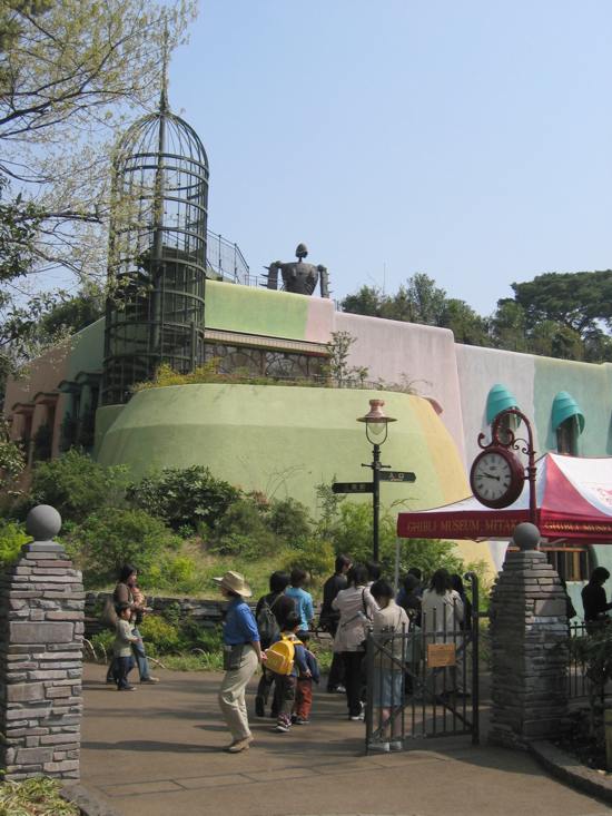
- Ghibli Museum
- Inokashira Park
- Nogawa Park
- Yuzo Yamamoto Memorial Museum
Notable people from Mitaka
- Ryo Kimura, actor
- Yūko Tsushima, author, fiction writer, essayist and critic
- Satoshi Ohno, singer, actor, and member of Arashi
- Eiji Wentz, singer, actor, entertainer, and member of the singer-songwriter duo WaT
- Tsubasa Honda, actress, model
- Hiroki Azuma, cultural critic, novelist, and philosopher
- Yoshikazu Tanaka, businessman, founder of GREE, Inc.
- Masahiro Chono, professional wrestler (originally from Seattle, Washington)
See also
- Mitaka incident
- Inokashira Park dismemberment incident
References
- "Mitaka city official statistics" (in Japanese). Japan.
- Mitaka City home page
- Mitaka climate data
- Mitaka population statistics
- Maher, John C. (1995), "The Kakyo: Chinese in Japan", Journal of Multilingual and Multicultural Development, 16 (1–2): 125–138, doi:10.1080/01434632.1995.9994596 - (published online 14 September 2010) CITED: p. 135."
- The Three Big Rail Mysteries that Defined Japan’s Summer of 1949
- "Company Profile Archived 2010-02-12 at the Wayback Machine." Studio Pierrot. Retrieved on 26 February 2010.
- " Archived 2011-09-12 at the Wayback Machine."
- Latest Status Info
- Image Trademark Trademark Application of TAD CORPORATION – Serial Number 74117580 :: Justia Trademarks
- 74117580 – Trademarks411, Trademark Search Made Simple
- STI company profile. Retrieved on 2 October 2012.
- "Housing Office | Housing Information | Mitaka International Hall of Residence".
- "." Formerly Little Angels International School. Retrieved on 28 June 2022. "Musashi International School (Mitaka Campus) [...] 9-7-14,Shimorenjaku, Mitaka-shi, Tokyo 181-0013, Japan." – Japanese address:(三鷹校)[...] 〒181-0013 東京三鷹市下連雀9-7-14"
External links
- Mitaka City Official Website (in Japanese)
Authority control | |
|---|---|
| General | |
| National libraries | |
| Other |
|
На других языках
[de] Mitaka
Mitaka (jap. .mw-parser-output .Hani{font-size:110%}三鷹市, -shi) ist eine Stadt in der Präfektur Tokio westlich von Tokio.- [en] Mitaka, Tokyo
[es] Mitaka (Tokio)
Mitaka (三鷹市, Mitaka-shi?) es una ciudad localizada en Tokio, (Japón), fundada el 3 de noviembre de 1950.[1] Su población estimada para el año 2003 es de 175 995 habitantes. El Museo Ghibli está situado en esta ciudad, al igual que la Universidad Cristiana Internacional.[2][ru] Митака
Мита́ка[1] (яп. 三鷹市 Митака-си) — город в Японии, находящийся в префектуре Токио. Площадь города составляет 16,5 км²[2], население — 195 558 человек (1 октября 2020)[3], плотность населения — 11 852,00 чел./км². Город расположен на острове Хонсю в префектуре Токио региона Канто. С ним граничат города Мусасино, Коганеи, Тёфу, Футю[4].Другой контент может иметь иную лицензию. Перед использованием материалов сайта WikiSort.org внимательно изучите правила лицензирования конкретных элементов наполнения сайта.
WikiSort.org - проект по пересортировке и дополнению контента Википедии