world.wikisort.org - Japan
The Kanto region (関東地方, Kantō-chihō) is a geographical area of Honshu, the largest island of Japan.[3] In a common definition, the region includes the Greater Tokyo Area and encompasses seven prefectures: Gunma, Tochigi, Ibaraki, Saitama, Tokyo, Chiba and Kanagawa. Slightly more than 45 percent of the land area within its boundaries is the Kanto Plain. The rest consists of the hills and mountains that form land borders with other regions of Japan.
This article may be expanded with text translated from the corresponding article in Japanese. (October 2013) Click [show] for important translation instructions.
|
This article needs additional citations for verification. (December 2008) |
Kanto region
関東地方 | |
|---|---|
Region | |
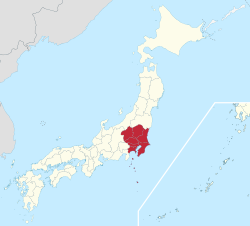 The Kanto region in comparison to the rest of Japan | |
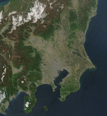
 Closeup map of the areas within the Kanto region | |
| Country | Japan |
| Area | |
| • Total | 32,423.90 km2 (12,518.94 sq mi) |
| Population (October 1, 2010) | |
| • Total | 42,607,376 |
| • Density | 1,300/km2 (3,400/sq mi) |
| GDP | |
| • Total | $2.1 trillion |
| • Per capita | $50,000 |
| Time zone | UTC+9 (JST) |

As the Kanto region contains Tokyo, the capital and largest city of Japan, the region is considered the center of Japan's politics and economy. According to the official census on October 1, 2010, by the Japan Statistics Bureau, the population was 42,607,376,[4] amounting to approximately one third of the total population of Japan.
Other definitions
The Kantō regional governors' association (関東地方知事会, Kantō chihō chijikai) assembles the prefectural governors of Ibaraki, Tochigi, Gunma, Saitama, Chiba, Tokyo, Kanagawa, Yamanashi, Nagano and Shizuoka.[5][6]
The Kantō Regional Development Bureau (関東地方整備局, Kantō chihō seibi-kyoku) of the Ministry of Land, Infrastructure, Transport and Tourism in the national government is responsible for eight prefectures generally (Ibaraki, Tochigi, Gunma, Saitama, Chiba, Tokyo, Kanagawa, Yamanashi) and parts of the waterways in two others (Nagano and Shizuoka).[7] The Kanto Bureau of Economy, Trade and Industry (関東経済産業局, Kantō keizai-sangyō-kyoku) is responsible for eleven prefectures: Ibaraki, Tochigi, Gunma, Saitama, Chiba, Tokyo, Kanagawa, Niigata, Yamanashi, Nagano and Shizuoka.[8]The Kantō regional governors' association (関東地方知事会, Kantō chihō chijikai) assembles the prefectural governors of Ibaraki, Tochigi, Gunma, Saitama, Chiba, Tokyo, Kanagawa, Yamanashi, Nagano and Shizuoka.[9][10]
In the police organization of Japan, the National Police Agency's supervisory office for Kantō (関東管区警察局, Kantō kanku keisatsu-kyoku) is responsible for the Prefectural police departments of Ibaraki, Tochigi, Gunma, Saitama, Chiba, Kanagawa, Niigata, Yamanashi, Nagano and Shizuoka.[11] Tokyo is not part of Kantō or any NPA region, its police has a dedicated liaison office with the national agency of its own.[citation needed]
The Kantō Regional Development Bureau (関東地方整備局, Kantō chihō seibi-kyoku) of the Ministry of Land, Infrastructure, Transport and Tourism in the national government is responsible for eight prefectures generally (Ibaraki, Tochigi, Gunma, Saitama, Chiba, Tokyo, Kanagawa, Yamanashi) and parts of the waterways in two others (Nagano and Shizuoka).[12] The Kanto Bureau of Economy, Trade and Industry (関東経済産業局, Kantō keizai-sangyō-kyoku) is responsible for eleven prefectures: Ibaraki, Tochigi, Gunma, Saitama, Chiba, Tokyo, Kanagawa, Niigata, Yamanashi, Nagano and Shizuoka.[13]
Geography
The surface geology of the Kanto Plain is the Quaternary alluvium and diluvium. The low mountain vegetation at an altitude of about 500 to 900 m in and around the plain is an evergreen broad-leaved forest zone. The distribution height range of laurel forests is 900m in Hakone, about 800m in Tanzawa and Takao, about 700m in Okutama, Oku Musashi and Oku Chichibu, about 600m in Nishijoshu, Akagiyama, Ashio Mountains and Tsukuba Mountains and about 500m in Kitage and Nasu Mountains.
Over the evergreen broad-leaved forest are deciduous broad-leaved forests such as beech, birch, and quercus crispula. In addition, coniferous forests such as Abies veitchii and Betula ermanii spread above the deciduous broad-leaved forest from an altitude of about 1100 m higher than the lower limit of the deciduous broad-leaved forest.
Mountains are spread out such as the Taishaku Mountains, Mt. Takahara, Mt. Nasu, Mt. Yamizo, and Mt. The Kanto Plain, which is the largest plain in Japan. Just north of the Enna Hills is Japan's largest alluvial fan Nasuno at the foot of Mt. The Kujukuri Plain. The southern part of Chiba prefecture is the Boso hills. The area around Kasumigaura in Ibaraki prefecture is the Joso plateau and Hitachi plateau. Gunma prefecture and the Chichibu region of Saitama prefecture are basins. Rivers such as the Arakawa and Edo rivers pour into Tokyo Bay, and the Kinugawa and Tone rivers flow into the Pacific Ocean in Inubōsaki.
Tokyo Bay is surrounded by the Boso Peninsula and the Miura Peninsula, facing the west side of Chiba Prefecture, a part of Tokyo and the east side of Kanagawa Prefecture, and borders the Pacific Ocean from Uraga Suido. The coastal area is an industrial area. The south side of Kanagawa Prefecture faces Sagami Bay and Sagami Nada. The southern coast of Ibaraki Prefecture faces Kashima Nada. The Sagami Trough, which was the epicenter of the two Kanto earthquakes, passes through Sagami Bay. Efforts are being made to take safety measures against earthquakes in various places.
The highest point is the summit of Mt. Nikko-Shirane (Mt. Oku-Shirane) on the border between Nikko City, Tochigi Prefecture and Katashina Village, Gunma Prefecture. It is the eighth highest point in Japan's prefectures. It is also the highest point north of Kanto (Kanto, Tohoku, Hokkaido). The highest points of the prefectures are Mt. Sanpo (2483m) in Saitama, Mt. Kumotori (2017m) in Tokyo, Mt. Hiru (1673m) in Kanagawa, Mt. Yamizo (1022m) in Ibaraki, and Mt. Atago (408m) in Chiba. Atagoyama in Chiba Prefecture is the lowest among the highest peaks in each prefecture.
The region experiences a humid subtropical climate with a summer to fall precipitation maximum (Cfa/Cwa).
History
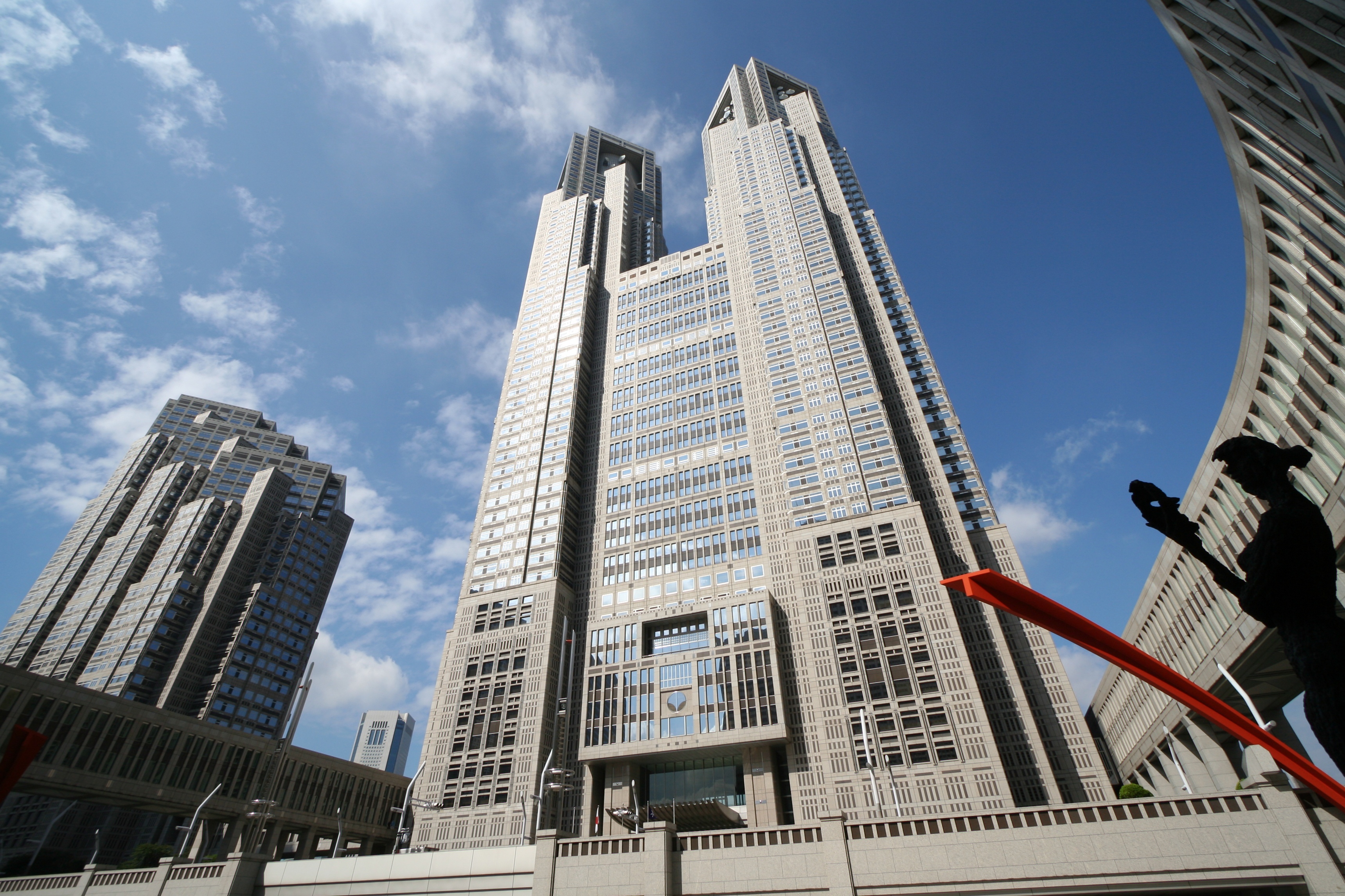
The heartland of feudal power during the Kamakura period and again in the Edo period, Kanto became the center of modern development. Within the Greater Tokyo Area and especially the Tokyo-Yokohama metropolitan area, Kanto houses not only Japan's seat of government but also the nation's largest group of universities and cultural institutions, the greatest population and a large industrial zone. Although most of the Kanto plain is used for residential, commercial or industrial construction, it is still farmed. Rice is the principal crop, although the zone around Tokyo and Yokohama has been landscaped to grow garden produce for the metropolitan market.[citation needed]
A watershed moment of Japan's modern history took place in the late Taishō period: the Great Kanto earthquake of 1923. The quake, which claimed more than 100,000 lives and ravaged the Tokyo and Yokohama areas, occurred at a time when Japan was still reeling from the economic recession in reaction to the high-flying years during World War I.[citation needed]
Operation Coronet, part of Operation Downfall, the proposed Allied invasion of Japan during World War II, was scheduled to land at the Kantō plain. Most of the United States military bases on the island of Honshu are situated on the Kantō plain. These include Naval Air Facility Atsugi, Yokota Air Base, Yokosuka Naval Base, and Camp Zama.[citation needed]
The name Kanto literally means "East of the Barrier". The name Kanto is nowadays generally considered to mean the region east (東) of the Hakone checkpoint (関所). An antonym of Kanto, "West of the Barrier" means Kansai region, which lies western Honshu and was the center of feudal Japan.[citation needed]
After the Great Kanto earthquake many people in Kanto started creating art with different varieties of colors. They made art of earthquake and small towns to symbolize the small towns destroyed in the quake.[citation needed]

Subdivisions
North and South
The most often used subdivision of the region is dividing it to "North Kantō" (北関東, Kita-Kantō), consisting of Ibaraki, Tochigi, and Gunma Prefectures, and "South Kantō" (南関東, Minami-Kantō), consisting of Saitama (sometimes classified North),[citation needed][by whom?] Chiba, the Tokyo Metropolis (sometimes singulated),[citation needed] and Kanagawa Prefectures.[citation needed] South Kantō is often regarded as synonymous with the Greater Tokyo Area. As part of Japan's attempts to predict earthquakes, an area roughly corresponding to South Kantō has been designated an 'Area of Intensified Observation' by the Coordinating Committee for Earthquake Prediction.[14]
The Japanese House of Representatives' divides it into the North Kantō (北関東, Kita-Kantō) electorate which consists of Ibaraki, Tochigi, Gunma and Saitama Prefectures, Tokyo electorate, and the South Kantō (南関東, Minami-Kantō) electorate which consists of Chiba, Kanagawa and Yamanashi Prefectures. (Note that Yamanashi is out of Kantō region in the orthodox definition.)
Keirin's South Kantō (南関東, Minami-Kantō) consists of Chiba, Kanagawa and Shizuoka Prefectures.
East and West
This division is not often but sometimes used.
- East Kantō (東関東, Higashi-Kantō): Ibaraki, Tochigi and Chiba Prefectures.
- West Kantō (西関東, Nishi-Kantō): Gunma, Saitama, Tokyo, Kanagawa (and sometimes Yamanashi) Prefectures.
Inland and Coastal
This division is sometimes used in economics and geography. The border can be modified if the topography is taken for prefectural boundaries.
- Inland Kantō (関東内陸部, Kantō nairiku-bu): Tochigi, Gunma, Saitama (and sometimes Yamanashi) Prefectures.
- Coastal Kantō (関東沿岸部, Kantō engan-bu): Ibaraki, Chiba, Tokyo and Kanagawa Prefectures.
Greater Kantō
The Japanese national government defines the National Capital Region (首都圏, Shuto-ken) as Kantō region plus Yamanashi Prefecture. Japan's national public broadcaster NHK uses Kantō-kō-shin-etsu (関東甲信越) involving Yamanashi, Nagano and Niigata Prefectures for regional programming and administration.
Cities
This section does not cite any sources. (March 2020) |
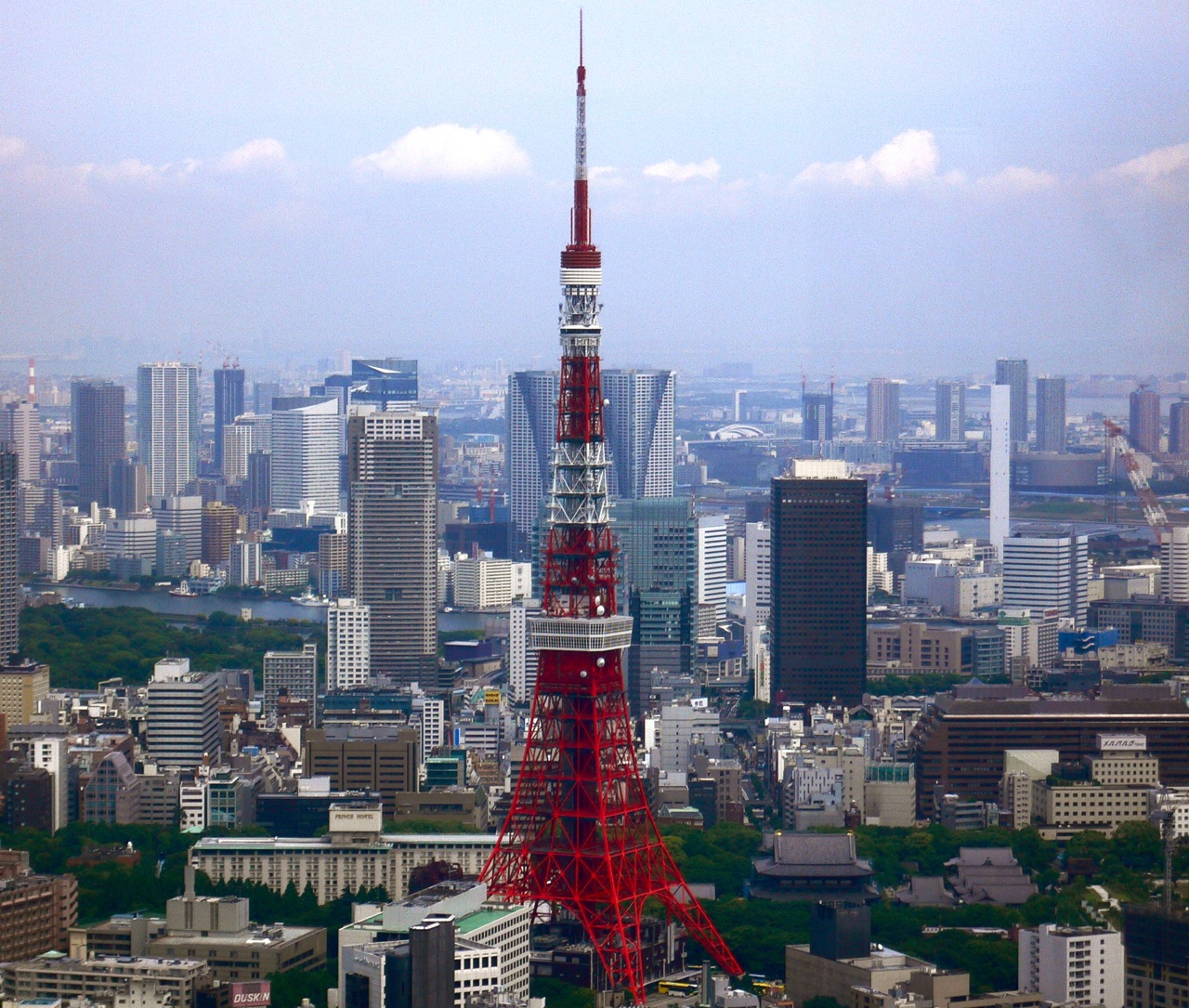
The Kantō region is the most highly developed, urbanized, and industrialized part of Japan. Tokyo and Yokohama form a single industrial complex with a concentration of light and heavy industry along Tokyo Bay. Other major cities in the area include Kawasaki (in Kanagawa Prefecture); Saitama (in Saitama Prefecture); and Chiba (in Chiba Prefecture). Smaller cities, farther away from the coast, house substantial light and automotive industries. The average population density reached 1,192 persons per square kilometer in 1991.
Economy
The Kantō region largely corresponds to the Tokyo metropolitan area with the exception that it does not contain Yamanashi prefecture.
The Tokyo metropolitan area has the largest city economy in the world and is one of the major global center of trade and commerce along with New York City, Los Angeles, Shanghai, Paris, Seoul and London.
Greater Tokyo Area 2005
- 2005 average exchange rate (1 US Dollar = 110.22 Yen)[15]
| Prefecture | Gross Prefecture Product (in billion Yen) |
Gross Prefecture Product (in billion US$) |
|---|---|---|
| Tokyo | 92,269 | 837 |
| Kanagawa | 31,184 | 282 |
| Saitama | 20,650 | 187 |
| Chiba | 19,917 | 180 |
| Ibaraki | 10,955 | 99 |
| Tochigi | 8,195 | 74 |
| Gunma | 7,550 | 68 |
Source[16]
GDP (purchasing power parity)
The agglomeration of Tokyo is the world's largest economy, with the largest gross metropolitan product at purchasing power parity (PPP) in the world according to a study by PricewaterhouseCoopers.[17]
Kanto Region Metropolitan Employment Area
| Year | 2010 | 1995 | 1980 |
|---|---|---|---|
| Employed Persons 000's | 16,234 | 16,381 | 12,760 |
| Production (billion US$) | 1,797 | 1,491 | 358 |
| Production Manufacturing (billion US$) | 216 | 476 | 159 |
| Private Capital Stock (billion US$) | 3,618 | 2,631 | 368 |
| Social Overhead Capital (billion US$) | 1,607 | 1,417 | 310 |
| 1 US Dollar (Japanese yen) | 87.780 | 94.060 | 226.741 |
Sources:,[18] Conversion rates - Exchange rates - OECD Data
Population
The population of Kanto region is very similar to that of Greater Tokyo Area[19][better source needed] except that it does not contain Yamanashi Prefecture and contains the rural populations throughout the region.
Per Japanese census data,[20] and Kanto region's data,[21] population has continuously grown but the population growth rate has slowed since early 1992.
The Kanto region at 2018 has a population at around 43.3 million people.[22]
| Year | Pop. | ±% |
|---|---|---|
| 1920 | 11,127,000 | — |
| 1930 | 13,773,000 | +23.8% |
| 1940 | 16,866,000 | +22.5% |
| 1950 | 18,241,000 | +8.2% |
| 1960 | 23,003,000 | +26.1% |
| 1970 | 29,496,000 | +28.2% |
| 1980 | 34,896,000 | +18.3% |
| 1990 | 38,542,000 | +10.4% |
| 2000 | 40,433,711 | +4.9% |
| 2010 | 42,607,376 | +5.4% |
| 2018 | 43,300,000 | +1.6% |
See also
- Geography of Japan
- Kantō dialect
- Kantō Fureai Trail, aka Capital Region Nature Trail, a collection of hiking trails circumnavigating the entire Kantō Region
- Kanto, a fictional region in the Pokémon franchise which is based on Kantō
Notes
Citations
- "International comparison of GDP of Japan's Prefectures: Tokyo's GDP is bigger than Indonesia's?!". realestate.co.jp. August 13, 2015. Archived from the original on May 1, 2018. Retrieved February 3, 2017.
- "Yearly Average Rates". UKForex. Archived from the original on March 16, 2015. Retrieved February 3, 2017.
- Nussbaum, Louis-Frédéric. (2005). "Kanto" in Japan Encyclopedia, pp. 478-479, p. 478, at Google Books
- "政府統計の総合窓口". E-stat.go.jp. Archived from the original on October 4, 2011. Retrieved December 31, 2012.
- Saitama prefectural government: Kantō regional governors' association (in Japanese)
- Chiba prefectural government: Kantō regional governors' association (in Japanese)
- MLIT: Kanto Regional Development Bureau (in Japanese)
- METI: Kanto Bureau of Economy, Trade and Industry, Organizational overview (in Japanese)
- Saitama prefectural government: Kantō regional governors' association (in Japanese)
- Chiba prefectural government: Kantō regional governors' association (in Japanese)
- National Police Agency: Kantō regional police supervision office, Jurisdiction (in Japanese)
- MLIT: Kanto Regional Development Bureau (in Japanese)
- METI: Kanto Bureau of Economy, Trade and Industry, Organizational overview (in Japanese)
- Avances en prevención de desastres sísmicos en Japón. Outline of countermeasures for the Tōkai earthquake (Section B) Archived 2011-07-20 at the Wayback Machine N Honda, published March 1994, accessed 2011-03-25
- "Annual Average Exchange Rate". Archived from the original on April 1, 2009. Retrieved December 28, 2018.
- 平成19年度県民経済計算 Archived 2010-12-20 at the Wayback Machine
- "City Mayors reviews the richest cities in the world in 2005". www.citymayors.com. Archived from the original on September 18, 2012. Retrieved February 12, 2009.
- Yoshitsugu Kanemoto. "Metropolitan Employment Area (MEA) Data". Center for Spatial Information Science, The University of Tokyo. Archived from the original on May 2, 2019. Retrieved June 21, 2016.
- Tokyo MEA
- Tokyo 1995-2020 population statistics
- Kanto Region 1920-2000 population statistics
- Kanto 2020
Sources
- Nussbaum, Louis-Frédéric and Käthe Roth. (2005). Japan encyclopedia. Cambridge: Harvard University Press. ISBN 978-0-674-01753-5; OCLC 58053128
 This article incorporates public domain material from Kanto. Library of Congress Country Studies.
External links
 Media related to Kantō region at Wikimedia Commons
Regions and administrative divisions of Japan | |||||||||||||||||
|---|---|---|---|---|---|---|---|---|---|---|---|---|---|---|---|---|---|
| |||||||||||||||||
| Regions |  | ||||||||||||||||
| 47 Prefectures |
| ||||||||||||||||
| |||||||||||||||||
Authority control | |
|---|---|
| General | |
| National libraries | |
| Other | |
На других языках
- [en] Kantō region
[ru] Канто (регион)
Канто́[1] (яп. 関東地方 Канто:-тихо:, букв. «регион на восток от заставы») — регион острова Хонсю, наиболее высокоразвитая и урбанизированная часть Японии. В нём находятся столица государства — Токио, резиденция императора и правительство Японии.Другой контент может иметь иную лицензию. Перед использованием материалов сайта WikiSort.org внимательно изучите правила лицензирования конкретных элементов наполнения сайта.
WikiSort.org - проект по пересортировке и дополнению контента Википедии