world.wikisort.org - Japan
Toyama Prefecture (富山県, Toyama-ken) is a prefecture of Japan located in the Chūbu region of Honshu.[2] Toyama Prefecture has a population of 1,044,588 (1 June 2019) and has a geographic area of 4,247.61 km2 (1,640.01 sq mi). Toyama Prefecture borders Ishikawa Prefecture to the west, Gifu Prefecture to the south, Nagano Prefecture to the east, and Niigata Prefecture to the northeast.
This article needs additional citations for verification. (December 2013) |
Toyama Prefecture
富山県 | |
|---|---|
Prefecture | |
| Japanese transcription(s) | |
| • Japanese | 富山県 |
| • Rōmaji | Toyama-ken |
 | |
 Flag  Emblem | |
| Anthem: Toyama Prefecture Goes to Town | |
 | |
| Coordinates: 36°43′N 137°9′E | |
| Country | Japan |
| Region | Chūbu (Hokuriku) |
| Island | Honshu |
| Capital | Toyama |
| Subdivisions | Districts: 2, Municipalities: 15 |
| Government | |
| • Governor | Hachiro Nitta |
| Area | |
| • Total | 4,247.61 km2 (1,640.01 sq mi) |
| • Rank | 33rd |
| Population (June 1, 2019) | |
| • Total | 1,044,588 |
| • Rank | 37th |
| • Density | 250/km2 (640/sq mi) |
| ISO 3166 code | JP-16 |
| Website | pref.toyama.jp |
| Symbols | |
| Bird | Ptarmigan[1] |
| Fish | Japanese amberjack Pasiphaea japonica Firefly squid[1] |
| Flower | Tulip (Tulipa)[1] |
| Tree | Tateyama Cedar (Cryptomeria japonica)[1] |

Toyama is the capital and largest city of Toyama Prefecture, with other major cities including Takaoka, Imizu, and Nanto.[3] Toyama Prefecture is part of the historic Hokuriku region, and the majority of prefecture's population lives on Toyama Bay, one of the largest bays in Japan. Toyama Prefecture is the leading industrial prefecture on the Japan Sea coast and has the advantage of cheap electricity from abundant hydroelectric resources. Toyama Prefecture contains the only known glaciers in East Asia outside of Russia, first recognized in 2012, and 30% of the prefecture's area is designated as national parks.[4]
History
Historically, Toyama Prefecture was Etchū Province.[5] Following the abolition of the han system in 1871, Etchū Province was renamed Niikawa Prefecture, but Imizu District was given to Nanao Prefecture. In 1872 Imizu District was returned by the new Ishikawa Prefecture.
In 1876, Niikawa Prefecture was merged into Ishikawa Prefecture but the merger was void in 1881 and the area was re-established as Toyama Prefecture.[citation needed]
The Itai-itai disease occurred in Toyama around 1950.
Geography
Toyama Prefecture is bordered by Ishikawa Prefecture to the west, Niigata to the northeast, Nagano to the southeast, Gifu to the south and Sea of Japan to the north.
As of April 1, 2012, 30% of the total land area of the prefecture was designated as Natural Parks, namely the Chūbu-Sangaku and Hakusan National Parks; Noto Hantō Quasi-National Park; and six Prefectural Natural Parks.[6]
Municipalities
Due to the mergers in the 2000s, Toyama has the fewest municipalities of any prefecture in Japan with 10 cities, 2 districts, 4 towns, and 1 village (before the mergers took place, the prefecture had 9 cities, 18 towns, and 8 villages).

Mergers
List of governors of Toyama Prefecture (from 1947)
- Tetsuji Tachi (館 哲二) (19 April 1947 to 15 November 1947)
- Takekuni Takatsuji (高辻 武邦) (16 November 1947 to 30 September 1956)
- Minoru Yoshida (吉田 実) (1 October 1956 to 1 December 1969)
- Kōkichi Nakata (中田 幸吉) (30 December 1969 to 18 September 1980)
- Yutaka Nakaoki (中沖 豊) (11 November 1980 to 8 November 2004)
- Takakazu Ishii (石井 隆一) (9 November 2004 to 8 November 2020)
- Hachirō Nitta (新田 八朗) (9 November 2020 to present)
Economy
Agriculture
In 2014 Toyama contributed approximately 2.5% of Japan's rice production[7] and makes use of abundant water sources originating from Mount Tate. It also has many fisheries along its Sea of Japan coastline.
Manufacturing
Toyama is famous for its historical pharmaceutical industry which remains a top manufacturing industry in the prefecture in terms of manufacturing shipment value followed by electronic parts and devices (industrial robots, general machinery, etc.), and metal products (aluminum, copper etc.) manufacturing.
Energy

Kurobe Dam generates electricity for the Kansai Electric Power Company. It is located on the Kurobe River in Toyama Prefecture.
Demographics
Per Japanese census data,[8][9] the population of Toyama has been relatively stable since 1950.
| Year | Pop. | ±% |
|---|---|---|
| 1920 | 724,000 | — |
| 1930 | 779,000 | +7.6% |
| 1940 | 823,000 | +5.6% |
| 1950 | 1,009,000 | +22.6% |
| 1960 | 1,033,000 | +2.4% |
| 1970 | 1,030,000 | −0.3% |
| 1980 | 1,103,000 | +7.1% |
| 1990 | 1,120,000 | +1.5% |
| 2000 | 1,120,851 | +0.1% |
| 2010 | 1,093,247 | −2.5% |
| 2020 | 1,044,588 | −4.5% |
Transportation
Rail
Tokyo: 2 hr 7 min via Hokuriku Shinkansen
Osaka: 3 hr via Hokuriku Shinkansen and Thunderbird Limited Express
- The Hokuriku Shinkansen line is scheduled to extend to Osaka in the future, and will shorten the Osaka-Toyama trip to approximately 1 hr 40 min.
Expressway
Air
- Toyama Airport (TOY)
Domestic
International
- Shanghai: 2 hr 30 min via Shanghai Airlines
- Dalian: 2 hr 30 min via China Southern Airlines
- Seoul: 1 hr 50 min via Asiana Airlines
- Vladivostok: 2 hr 40 min via Vladivostok Airlines
Culture
UNESCO World Heritage Cultural Sites
Gokayama Historical Village (Nanto City)
National Treasures of Japan
Zuiryū-ji Temple (Takaoka City)
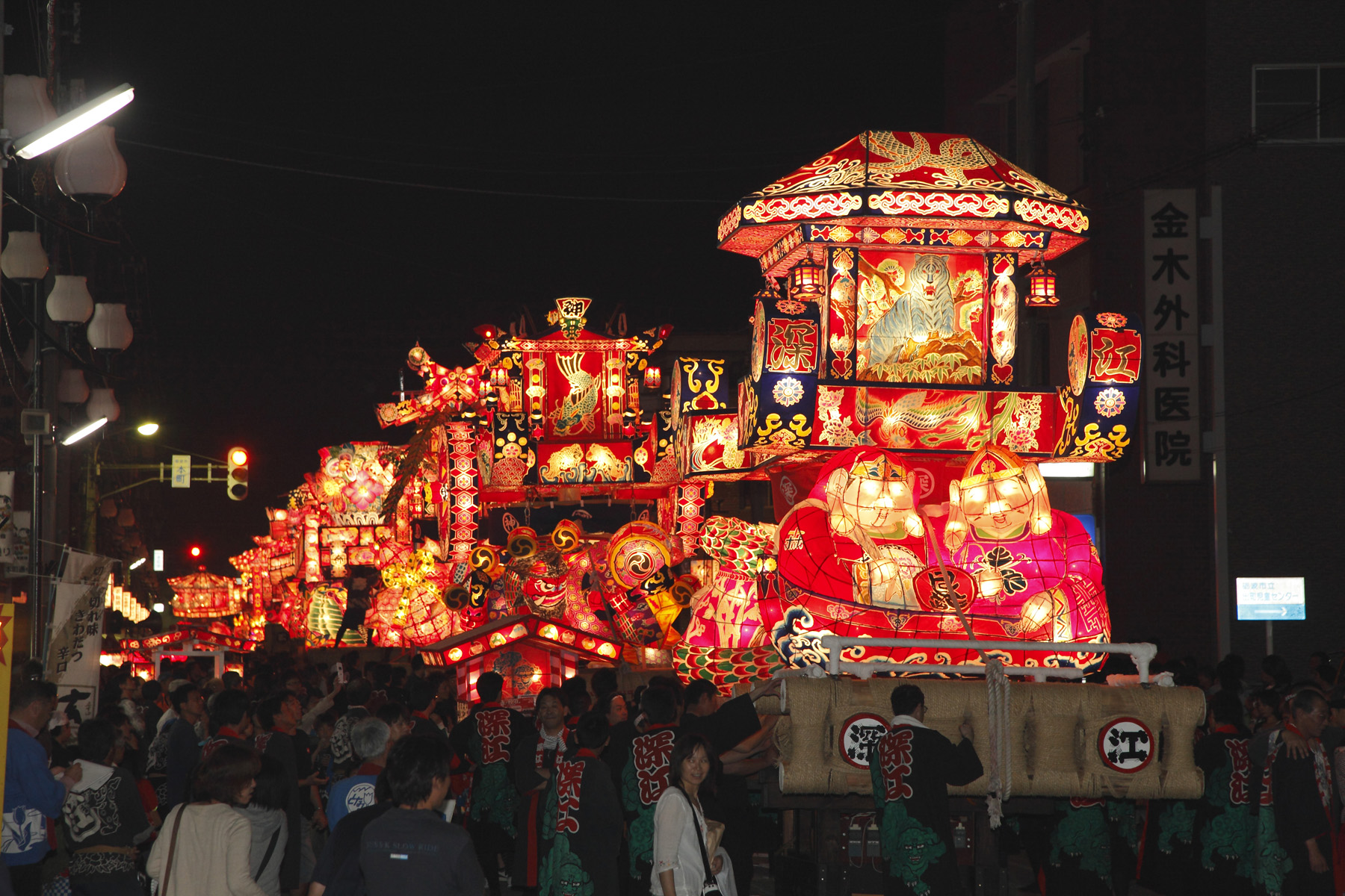
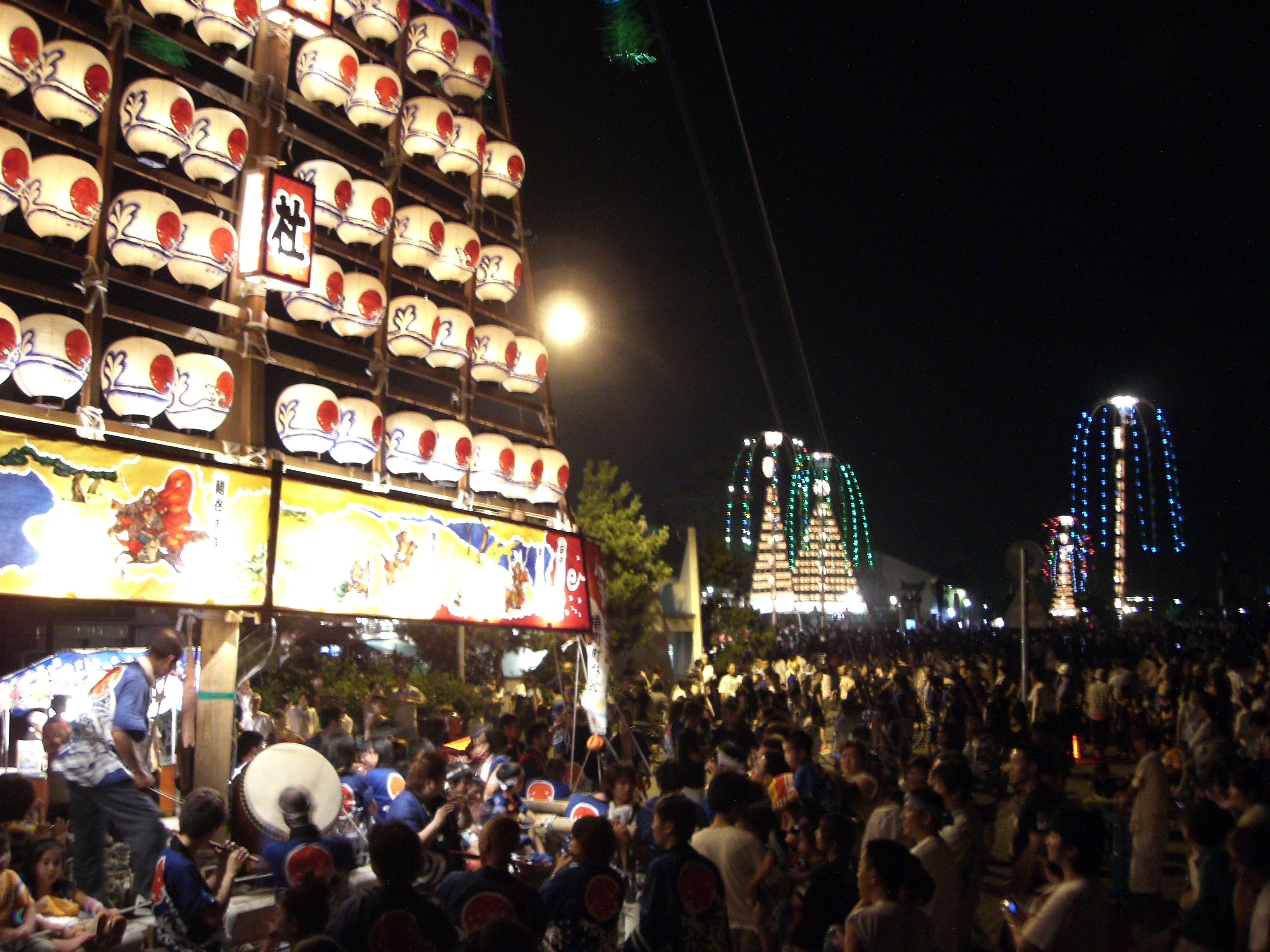
Festivals
This section does not cite any sources. (December 2013) |
Spring
- All Japan Chindon Competition (Toyama City (Toyama Castle Park), Mid April
- Tonami Tulip Fair (Tonami City), May
- Marumage Festival (Himi City), May 17
Summer
- Sassa Narimasa Sengoku Era Festival (Toyama City), Late July
- Japan Wildlife Film Festival (Toyama Prefecture), Early August
Fall
- Toyama Festival (Toyama City), Sept. 1
- Owara Kaze no Bon (Toyama City (Yatsuo Area)), Sept. 1-3
Winter
- Nanto Toga Soba Festival (Nanto City (Toga Village Area)), Mid Feb.
Regional Foods
- Trout Sushi (Masuzushi)
- White Shrimp (Shiro Ebi)
- Matured Yellow Tail (Buri)
- Firefly Squid (Hotaru Ika)
- Fish Paste (Kamaboko)
Regional sake
- Tateyama (立山)
- Narimasa (成政)
- Masuizumi (満寿泉)
- Sanshoraku (三笑楽)
Sports
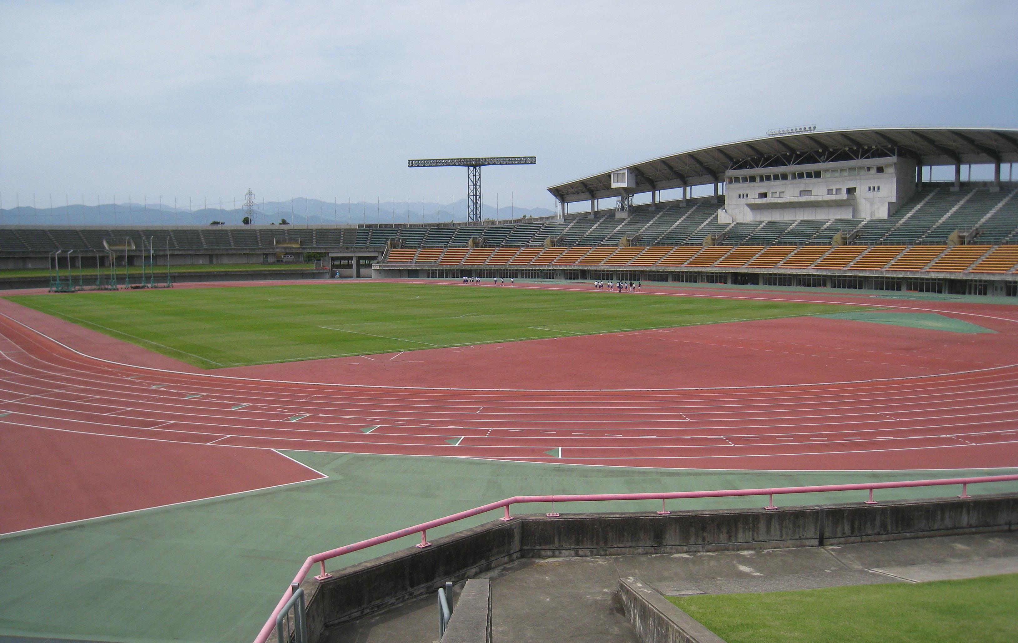
The sports teams listed below are based in Toyama.
Football
- Kataller Toyama (Toyama City)
Basketball
- Toyama Grouses (Toyama City)
Baseball
- Toyama Thunderbirds (Toyama City)
Rugby Union
- Takaoka Mariners (Takaoka)
Tourism
- Tateyama Kurobe Alpine Route
- kurobe Gorge Railway
- Unazuki Onsen
- Gokayama(UNESCO World Heritage Site)
- Mitsui Outlet Park, Hokuriku Oyabe
International Links
 China, Liaoning Province - May 9, 1984
 Brazil, São Paulo State - July 18, 1985
 United States, Oregon State- October 19, 1991
 Russia, Primorsky Region - August 26, 1992
 India, Andhra Pradesh State - December 29, 2015[10]
Notes
- 富山県の魅力・観光>シンボル. Toyama Prefectural website (in Japanese). Toyama Prefecture. Retrieved 9 September 2011.
- Nussbaum, Louis-Frédéric. (2005). "Toyama prefecture" in Japan Encyclopedia, p. 991, p. 991, at Google Books; "Hokuriku" at p. 344, p. 344, at Google Books.
- Nussbaum, "Toyama" at p. 991, p. 991, at Google Books.
- Matsutani, Minoru (April 6, 2012). "First glaciers in Japan recognised". The Japan Times. Retrieved May 20, 2012.
- Nussbaum, "Provinces and prefectures" at p. 780, p. 780, at Google Books.
- "General overview of area figures for Natural Parks by prefecture" (PDF). Ministry of the Environment. Retrieved 29 June 2012.
- "米の生産 〔2014年〕" (in Japanese). Retrieved May 11, 2015.
- Toyama 1995-2020 population statistics
- Toyama 1920-2000 population statistics
- "Andhra Pradesh inks pact with Toyama Prefecture". The Hindu. December 29, 2015. Retrieved February 17, 2019.
References
- Nussbaum, Louis-Frédéric and Käthe Roth. (2005). Japan encyclopedia. Cambridge: Harvard University Press. ISBN 978-0-674-01753-5; OCLC 58053128
- Prefecture, N. (2022). Toyama Prefecture- The East Asia Local and Regional Government Congress. Retrieved 1 July 2022, from https://www3.pref.nara.jp/eastasia_e/1080.html
- McClean, C. (2022). 10 Fun Facts About Toyama Prefecture, Japan - Multicultural Kid Blogs. Retrieved 1 July 2022, from https://multiculturalkidblogs.com/2021/11/15/toyama-prefecture/
External links
- Official Toyama Prefecture Homepage
- Toyama Prefecture International Center
- National Archives of Japan Toyama Map (1891)
Toyama (capital) | ||
| Core city |
| |
| Cities |
| |
| Districts | ||
List of mergers in Toyama Prefecture | ||
Regions and administrative divisions of Japan | |||||||||||||||||
|---|---|---|---|---|---|---|---|---|---|---|---|---|---|---|---|---|---|
| |||||||||||||||||
| Regions |  | ||||||||||||||||
| 47 Prefectures |
| ||||||||||||||||
| |||||||||||||||||
Authority control | |
|---|---|
| General | |
| National libraries | |
| Other |
|
На других языках
[de] Präfektur Toyama
Die Präfektur Toyama (jap. 富山県, Toyama-ken) ist eine der Präfekturen Japans. Sie liegt in der Region Chūbu auf der Insel Honshū. Sitz der Präfekturverwaltung ist Toyama.- [en] Toyama Prefecture
[ru] Тояма (префектура)
Тояма (яп. 富山県 Тояма-кэн) — префектура в Японии, расположена в районе Тюбу на острове Хонсю, Япония. Административный центр префектуры — город Тояма.Другой контент может иметь иную лицензию. Перед использованием материалов сайта WikiSort.org внимательно изучите правила лицензирования конкретных элементов наполнения сайта.
WikiSort.org - проект по пересортировке и дополнению контента Википедии