world.wikisort.org - Japan
Hyōgo Prefecture (兵庫県, Hyōgo-ken) is a prefecture of Japan located in the Kansai region of Honshu.[1] Hyōgo Prefecture has a population of 5,469,762 (as of 1 June 2019[update]) and has a geographic area of 8,400 square kilometres (3,200 sq mi). Hyōgo Prefecture borders Kyoto Prefecture to the east, Osaka Prefecture to the southeast, and Okayama Prefecture and Tottori Prefecture to the west.
Hyōgo Prefecture
兵庫県 | |
|---|---|
Prefecture | |
| Japanese transcription(s) | |
| • Japanese | 兵庫県 |
| • Rōmaji | Hyōgo-ken |
 | |
 Flag  Symbol | |
| Anthem: Hyōgo Kenminka[note 1] | |
 | |
| Coordinates: 34°41′26.94″N 135°10′59.08″E | |
| Country | |
| Region | Kansai |
| Island | Honshu |
| Capital | Kobe |
| Subdivisions | Districts: 8, Municipalities: 41 |
| Government | |
| • Governor | Motohiko Saitō (from August 2021) |
| Area | |
| • Total | 8,400.94 km2 (3,243.62 sq mi) |
| • Rank | 12th |
| Population (1 June 2019) | |
| • Total | 5,469,762 |
| • Rank | 7th |
| • Density | 650/km2 (1,700/sq mi) |
| ISO 3166 code | JP-28 |
| Website | web |
| Symbols | |
| Bird | Oriental white stork (Ciconia boyciana) |
| Flower | Nojigiku (Chrysanthemum japonense) |
| Tree | Camphor tree (Cinnamomum camphora) |

Kōbe is the capital and largest city of Hyōgo Prefecture, and the seventh-largest city in Japan, with other major cities including Himeji, Nishinomiya, and Amagasaki.[2] Hyōgo Prefecture's mainland stretches from the Sea of Japan to the Seto Inland Sea, where Awaji Island and a small archipelago of islands belonging to the prefecture are located. Hyōgo Prefecture is a major economic center, transportation hub, and tourist destination in western Japan, with 20% of the prefecture's land area designated as Natural Parks. Hyōgo Prefecture forms part of the Keihanshin metropolitan area, the second-most-populated urban region in Japan after the Greater Tokyo area and one of the world's most productive regions by GDP.
History

1.□Kobe city (divided between Harima and Settsu)
2.■Settsu (Hanshin South office)
3.■Settsu (Hanshin North office)
4.■Harima East office
5.■Harima North office
6.■Harima Central office
7.■Harima West office
9.■Tanba office
8.■Tajima office
10.■Awaji office
Areas beyond Harima West belonged to Mimasaka (north) and Bizen (south)
Present-day Hyōgo Prefecture includes the former provinces of Harima, Tajima, Awaji, and parts of Tanba and Settsu.[3]
In 1180, near the end of the Heian period, Emperor Antoku, Taira no Kiyomori, and the Imperial court moved briefly to Fukuhara, in what is now the city of Kobe. There the capital remained for five months.
Himeji Castle, a UNESCO World Heritage Site, is in the city of Himeji.
Southern Hyōgo Prefecture was severely devastated by the 6.9 Mw Great Hanshin earthquake of 1995, which destroyed major parts of Kobe and Awaji, as well as Takarazuka and neighboring Osaka Prefecture, killing nearly 6,500 people.
Geography


| Year | Pop. | ±% p.a. |
|---|---|---|
| 1890 | 1,551,367 | — |
| 1903 | 1,833,957 | +1.30% |
| 1913 | 2,143,791 | +1.57% |
| 1920 | 2,301,799 | +1.02% |
| 1925 | 2,454,679 | +1.29% |
| 1930 | 2,646,301 | +1.51% |
| 1935 | 2,923,249 | +2.01% |
| 1940 | 3,221,232 | +1.96% |
| 1945 | 2,821,892 | −2.61% |
| 1950 | 3,309,935 | +3.24% |
| 1955 | 3,620,947 | +1.81% |
| 1960 | 3,906,487 | +1.53% |
| 1965 | 4,309,944 | +1.99% |
| 1970 | 4,667,928 | +1.61% |
| 1975 | 4,992,140 | +1.35% |
| 1980 | 5,144,892 | +0.60% |
| 1985 | 5,278,050 | +0.51% |
| 1990 | 5,405,040 | +0.48% |
| 1995 | 5,401,877 | −0.01% |
| 2000 | 5,550,574 | +0.54% |
| 2005 | 5,590,601 | +0.14% |
| 2010 | 5,588,133 | −0.01% |
| 2015 | 5,536,989 | −0.18% |
| source:[4] | ||
Hyōgo has coastlines on two seas: to the north, the Sea of Japan, to the south, the Seto Inland Sea. On Awaji Island, Hyōgo borders the Pacific Ocean coastline in the Kii Channel. The northern portion is sparsely populated, except for the city of Toyooka, and the central highlands are only populated by tiny villages. Most of Hyōgo's population lives on the southern coast, which is part of the Osaka-Kobe-Kyoto metropolitan area. Awaji is an island that separates the Inland Sea and Osaka Bay, lying between Honshu and Shikoku.
Summertime weather throughout Hyōgo is hot and humid. As for winter conditions in Hyōgo, the north of Hyōgo tends to receive abundant snow, whilst the south receives only the occasional flurry.
Hyōgo borders on Osaka Prefecture, Kyoto Prefecture, Tottori Prefecture and Okayama Prefecture.
As of 31 March 2008,[update] 20% of the total land area of the prefecture was designated as Natural Parks, namely the Sanin Kaigan and Setonaikai National Parks; Hyōnosen-Ushiroyama-Nagisan Quasi-National Park; and Asago Gunzan, Harima Chūbu Kyūryō, Inagawa Keikoku, Izushi-Itoi, Kasagatayama-Sengamine, Kiyomizu-Tōjōko-Tachikui, Onzui-Chikusa, Seiban Kyūryō, Seppiko-Mineyama, Tajima Sangaku, and Taki Renzan Prefectural Natural Parks.[5]
Current municipalities

Islands
Two major artificial islands are located Hyōgo Prefecture:
National parks
- Sanin Kaigan National Park
- Setonaikai National Park
- Hyōnosen-Ushiroyama-Nagisan Quasi-National Park
 Hyōnosen-Ushiroyama-Nagisan Quasi-National Park (Mt. Hyonosen view from Yabu)
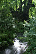 Hyōnosen-Ushiroyama-Nagisan Quasi-National Park (Torokawataira in Kami)
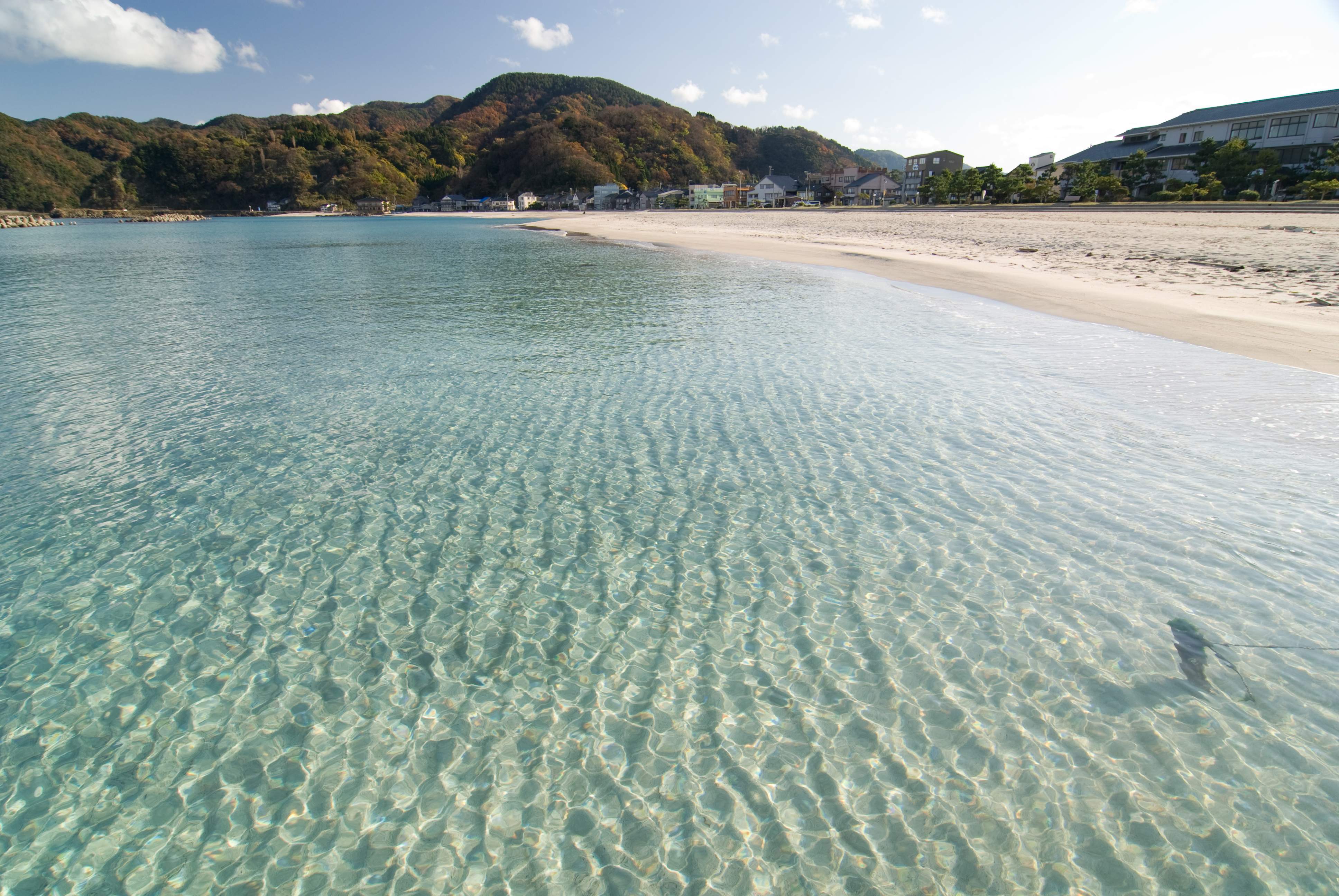
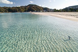 Sanin Kaigan National Park (Takeno Beach in Toyooka)
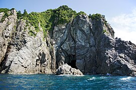 Sanin Kaigan National Park (Tajima-mihonoura of Sanin Coast in Shinonsen)


Mergers
Future mergers
The city of Akō and the only town in Akō District (Kamigōri), were scheduled to merge and the city would still retain the name Akō. Akō District would be defunct if the merger was successful.[6] However, the merger hasn't taken place.
Economy
As in all prefectures nationwide, agriculture, forestry, and fisheries play a big role in the economy of Hyogo Prefecture.[7] Hyōgo Prefecture also has an IT industry, many heavy industries, metal and medical, Kobe Port being one of the largest ports in Japan. Kobe Port also hosts one of the world's fastest supercomputers,[8] and Hyogo Prefecture passed laws to keep Kobe Port free of nuclear weapons (a nuclear-free zone) since the year 1975.
Hyōgo is a part of the Hanshin Industrial Region. There are two research institutes of Riken, natural sciences research institute in Japan, in Kobe and Harima. "SPring-8", a synchrotron radiation facility, is in Harima.
Culture
National Treasures of Japan
- Himeji Castle in Himeji (UNESCO World Heritage Site)
- Jōdo-ji in Ono
- Ichijō-ji in Kasai
- Kakurin-ji in Kakogawa
- Taisan-ji in Kobe
- Chōkō-ji in Katō
- Chorakuji in Kami, Hyōgo (Mikata)


Important Preservation Districts for Groups of Historic Buildings in Japan
- Kitano-chō Yamamoto-dōri
- Izushi
- Sasayama
 Kitano-chō Yamamoto-dōri
 Izushi
 Sasayama


Museums
- Hyōgo Prefectural Museum of Art in Nada Ward, Kobe.
- Kobe City Museum in Chuo Ward, Kobe.
- Kobe Maritime Museum in Chuo Ward, Kobe.
- KOSETSU Museum of Art in Higashinada Ward, Kobe.
- Hakutsuru Fine Art Museum in Higashinada Ward, Kobe.
- Himeji City Museum of Art in Himeji.
- Asago Art Village in Asago.
- Ashiya City Museum of Art & History in Ashiya.
- TEKISUI MUSEUM OF ART in Ashiya.
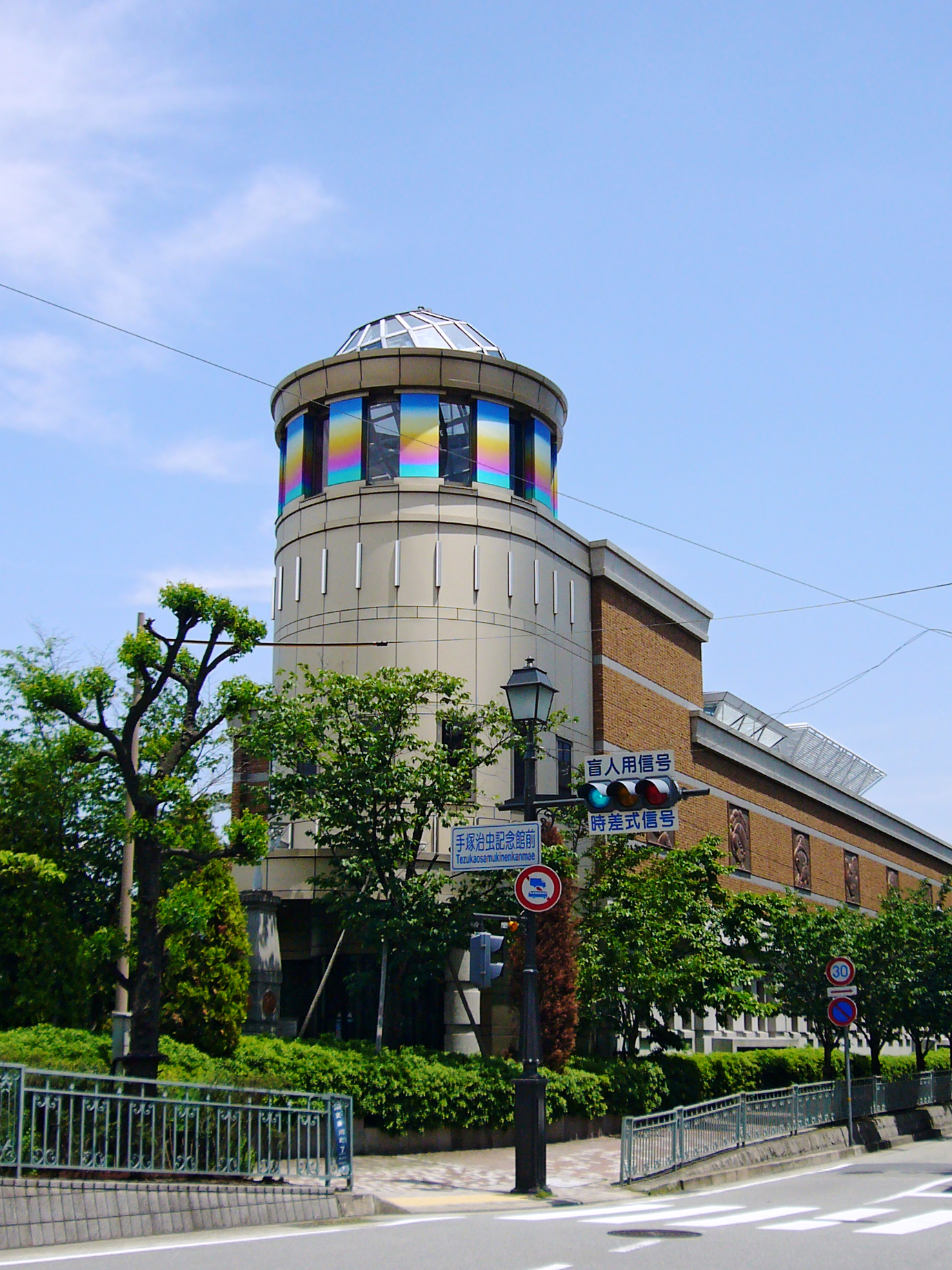
- Osamu Tezuka Manga Museum in Takarazuka.
 Kobe City Museum in Kobe.
 KOSETSU Museum of Art in Kobe.
 Himeji City Museum of Art in Himeji.
 Asago Art Village in Asago.
 Osamu Tezuka Manga Museum in Takarazuka.


Education
Universities
Amagasaki
- Sonoda Women's University
- St. Thomas University (ex-Eichi University) – closed in 2015
Takarazuka
- Takarazuka University
- Koshien University
Sanda
- Kwansei Gakuin University (Sanda Campus)
Nishinomiya
- Kobe College
- Kwansei Gakuin University
- Otemae University
- Mukogawa Women's University
Ashiya
- Ashiya University
Kobe
- Kobe University
- Kobe University of Commerce
- Kobe Gakuin University
- Kobe City University of Foreign Studies
- Kobe Women's University
- Kobe Shukugawa Gakuin University
- Kobe Institute of Computing
- Konan University
- University of Marketing and Distribution Sciences
- University of Hyogo
Kato
- Hyogo University of Teacher Education
Akashi
- University of Hyogo
Kakogawa
- Hyogo University
Himeji
- Himeji Institute of Technology
- Himeji Dokkyo University
- Himeji Kinki University
- University of Hyogo
Akō
- University of Hyogo
High schools
There are 163 public and 52 private high schools within Hyogo prefecture. Of the public high schools, some are administered by the Hyogo prefectural government, whilst the others are administered by local municipalities.
- Ashiya International Secondary School, founded 2003
Sports

The sports teams listed below are based in Hyōgo.
Football (soccer)
- Vissel Kobe (Kobe)
- INAC Kobe Leonessa (Women's) (Kobe)
Baseball
- Orix Buffaloes (Kobe)
- Hanshin Tigers (Nishinomiya)
Volleyball
- Hisamitsu Springs (Kobe)
- JT Marvelous (Nishinomiya)
Rugby
Basketball
- Nishinomiya Storks (Nishinomiya)
Tourism
A popular troupe of Takarazuka Revue plays in Takarazuka.
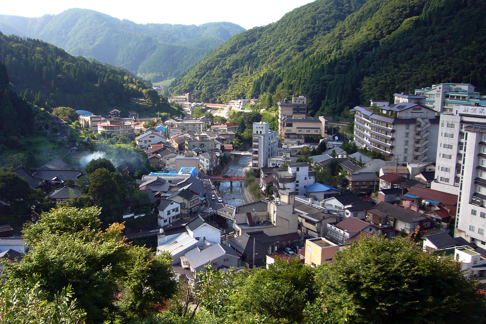
Arima Onsen in the south of the province in Kita-ku, Kobe is one of the Three Ancient Springs in Japan. The north of Hyogo Prefecture has sightseeing spots such as Kinosaki Onsen, Izushi, and Yumura Onsen. Takeda Castle in Asago is often referred to locally as the "Machu Picchu of Japan". The matsuba crab and Tajima beef are both national delicacies.[9]
 Arima Onsen, Kobe
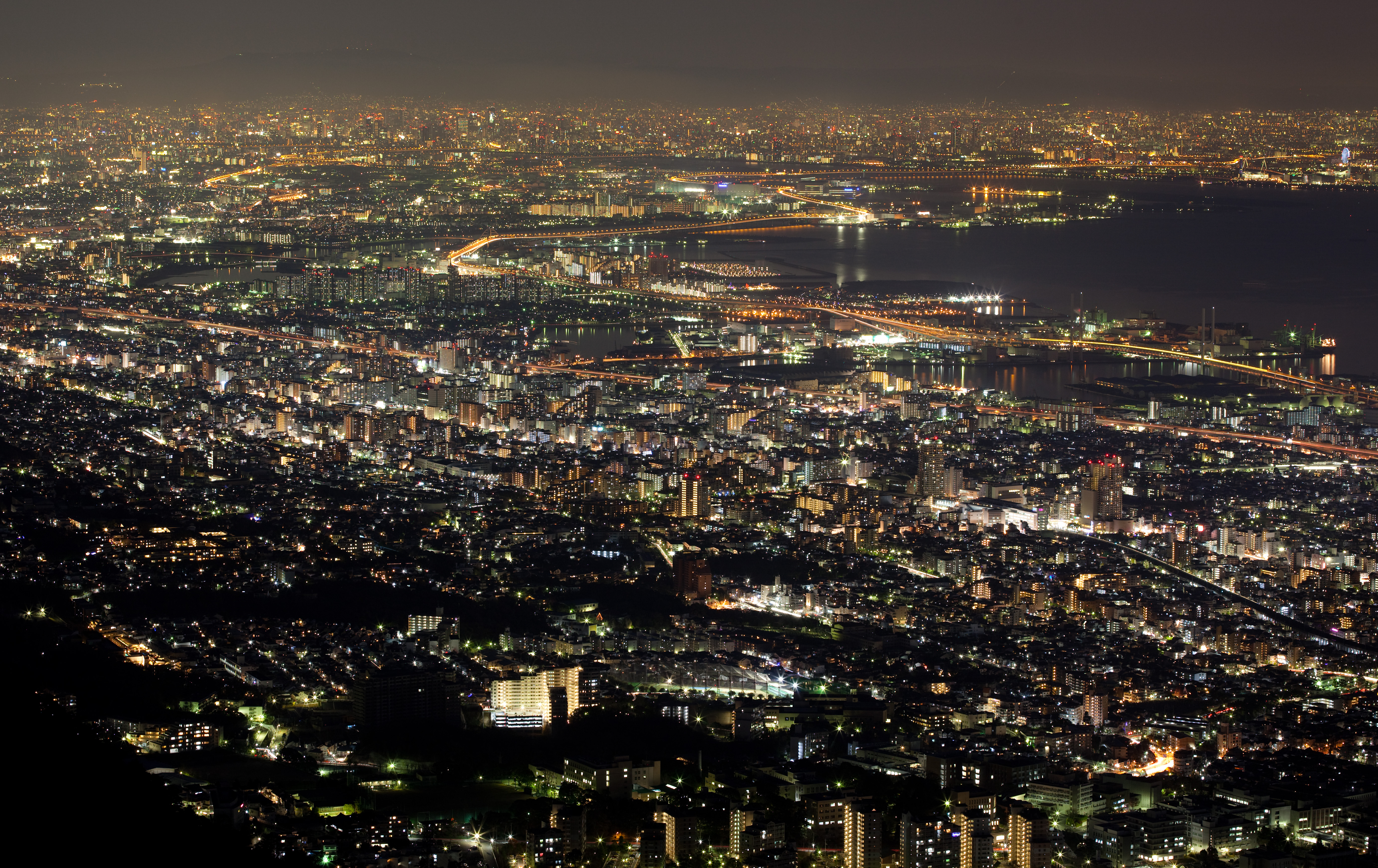
 Million-dollar view, Kobe
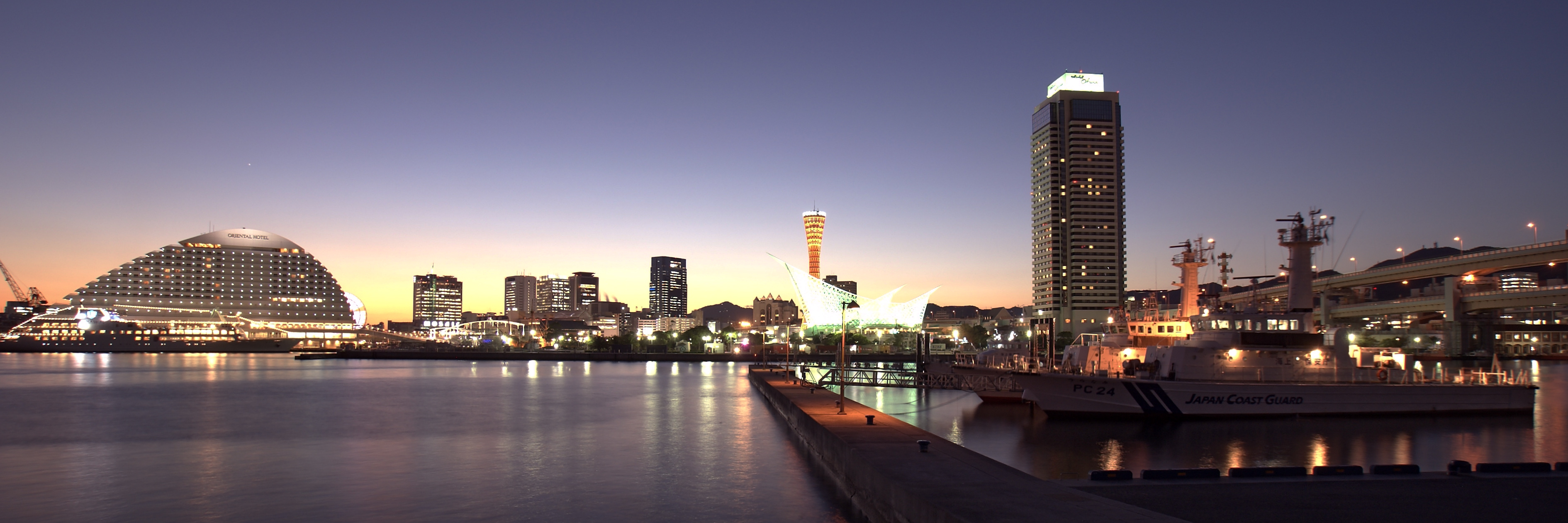
 Harborland – Meriken Park area in Kobe
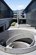
 Awaji Yumebutai in Awaji
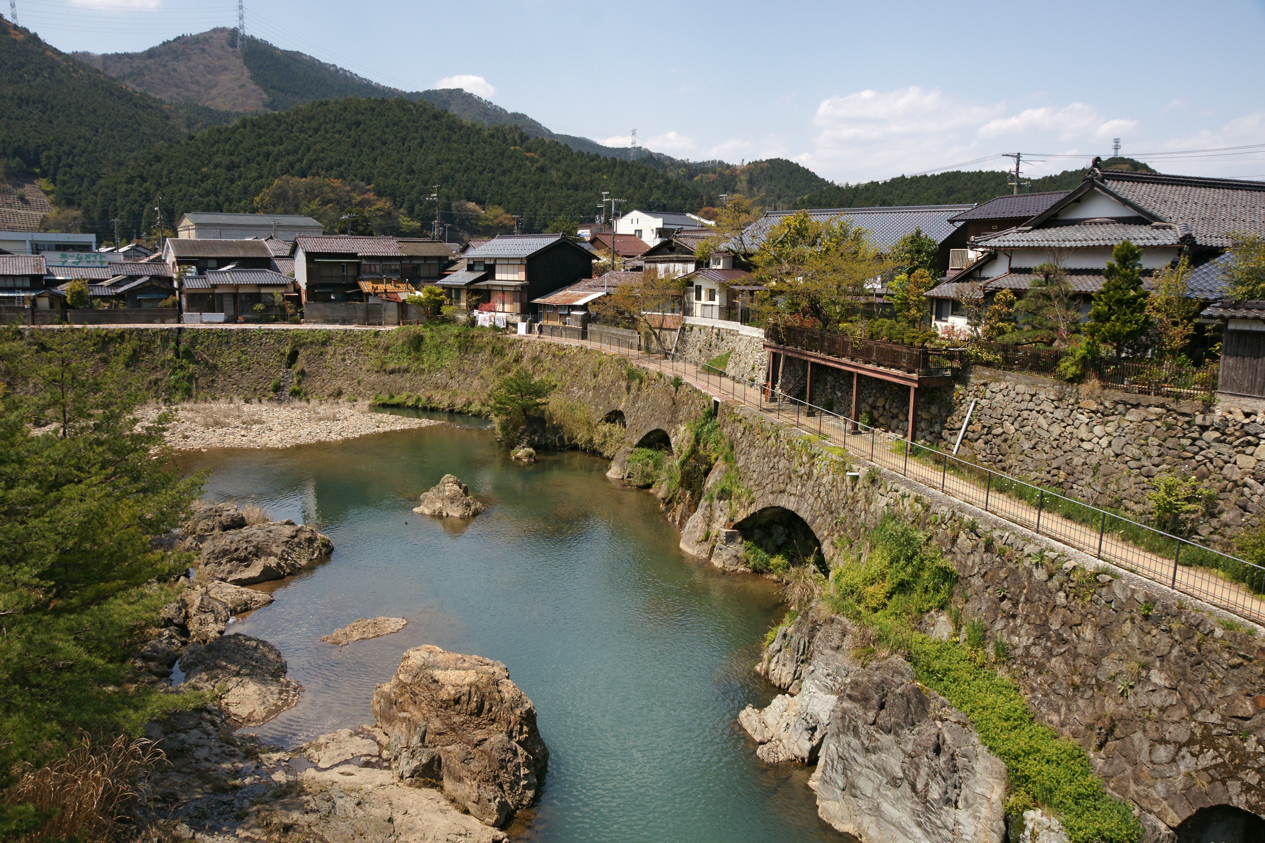
 Kuchiganaya in Asago
 Kinosaki Onsen
 Yumura Onsen
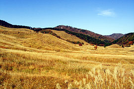 Tonomine highland in Kamikawa
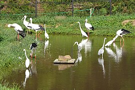 Toyooka Stork Park
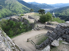 Takeda Castle


Festivals and events


- Miyuki Street New Year's midnight traditional sale, Himeji
- Nishinomiya Shrine's Ebisu Festival in January
- Yanagihara Ebisu Festival in January, Kobe
- Tada Shrine's Genji Festival in April, Kawanishi
- Kobe Festival and Parade in May
- Aioi Peron Festival in May
- Himeji Yukata Festival in June
- Dekansho Bon Dancing Festival in August, Sasayama
- Nada Fighting Festival, Himeji
- Kobe Luminarie in December
- Ako Chushingura Parade
Transportation
Rail
- JR West
- San'yō Shinkansen
- JR Kobe Line
- Wadamisaki Line
- San'yō Main Line
- San'in Line
- Fukuchiyama Line (JR Takarazuka Line)
- Kakogawa Line
- Bantan Line
- Kishin Line
- Akō Line
- Hankyu Railway
- Kobe Line
- Kobe Kosoku Line
- Itami Line
- Imazu Line
- Koyo Line
- Takarazuka Line
- Nose Railway
- Myoken Line
- Nissei Line
- Shintetsu
- Arima Line
- Kobe Kosoku Line
- Sanda Line
- Kōen-Toshi Line
- Ao Line
- Kobe Municipal Subway
- Seishin-Yamate Line
- Kaigan Line
- Hokushin Line
- Hojo Railway (Ao-Hojo)
- Hanshin Railway
- Main Line
- Kobe Kosoku Line
- Mukogawa Line
- Hanshin Nanba Line
- Sanyo Railway
- Main Line
- Aboshi Line
- Chizu Express
- Kitakinki Tango Railway
- Miyazu Line
People movers
- Kobe New Transit
- Port Liner
- Rokkō Liner
Road
Expressways
- Chūgoku Expressway
- San'yō Expressway
- Kobe-Awaji-Naruto Expressway
- Meishin Expressway
- Maizuru-Wakasa Expressway
- Bantan Expressway
- Second Shinmei road
- Hanshin Expressway
National highways
- Route 2
- Route 9
- Route 28
- Route 29
- Route 43
- Route 171
- Route 173
- Route 174 (Sannomiya-Kobe Port)
- Route 175
- Route 176
- Route 178
- Route 179
- Route 250
- Route 312
- Route 372
- Route 373
- Route 426
- Route 427
- Route 428
- Route 429
- Route 436
- Route 477
- Route 482
- Route 483
Ports
- Kobe Port – Mainly international container hub port
- Akashi Port
- Shikama Port – Mainly Shōdo Island route ferry
Airport
Notable people
This section does not cite any sources. (January 2013) |
- Ume Aoki, manga artist
- Mana Ashida, child actress from Nishinomiya
- Koichi Domoto, singer of KinKi Kids
- Heath, musician, singer-songwriter and bassist of X Japan is from Amagasaki
- Hiro Fujiwara, manga artist
- Miracle Hikaru, comedian and impersonator is from Toyooka
- Kanō Jigorō, founder of the martial art Judo
- Jun, musician, singer-songwriter and guitarist of Phantasmagoria is from Kobe
- Shinji Kagawa, footballer from Kobe
- Tomoya Kanki, drummer of One Ok Rock
- Takumi Kawanishi (J-pop idol singer and dancer, member of JO1)
- Tomomi Ogawa, bassist of Scandal
- Itzuki Yamazaki, professional wrestler from Ieshima
- Kaoru, guitarist of Dir En Grey
- Ayaka Kimura, actress, former singer of Coconuts Musume is from Kobe
- Keiko Kitagawa, actress from Pretty Guardian Sailor Moon and Buzzer Beat was born in Kobe
- Miho Komatsu, singer and songwriter from Kobe
- Yūji Kuroiwa, politician from Kobe, current governor of Kanagawa Prefecture
- Kamui Kobayashi, former Sauber and Toyota Racing driver from Amagasaki
- Chisa Maekawa, singer of Girl Next Door
- Kiyomatsu Matsubara, ichthyologist, herpetologist and marine biologist
- Aya Matsuura, singer is from Himeji
- Ryuto Kazuhara, vocalist of Generations from Exile Tribe is from Amagasaki
- Mina Myoui – American-born Japanese singer of South Korean group Twice. Raised in Nishinomiya
- Hiro Matsushita – Businessman, former driver in Champ Car series. Chairman of Swift Engineering & Swift Xi
- Miyavi, musician, although born in Konohana-ku, Osaka grew up in Kawanishi
- Minako Nishiyama, contemporary artist
- Masamune Shirow, manga artist was born in Kobe
- So Taguchi, outfielder for the Chicago Cubs
- Masahiro Tanaka, pitcher for the New York Yankees
- Nagaru Tanigawa, creator of the Haruhi Suzumiya series was born in Kinki
- Tsuneko Taniuchi, contemporary performance artist
- Fumito Ueda, video game creator of Ico, Shadow of the Colossus, and The Last Guardian
- Juri Ueno, Japanese Academy Award-winning actress best known for her performances in Swing Girls and the live-action adaptation of Nodame Cantabile, is from Kakogawa
- Shota Yasuda, guitarist of Kanjani Eight is from Amagasaki
- Piko, musician, Vocaloid singer born in Kobe, Hyōgo
Sister regions
Hyogo entered a sister state relationship with Washington state in the United States on October 22, 1963, the first such arrangement between Japan and the United States.[10][11]
In 1981, a sister state agreement was drawn up between Hyogo and the state of Western Australia in Australia.[12] To commemorate the 10th anniversary of this agreement in 1992, the Hyogo Prefectural Government Cultural Centre was established in Perth.[13]
See also
- Banshu Yamasaki Iris Garden
- Fastest Computer in the world
Notes
- The Hyōgo Prefectural Government has expressed the view that the "Prefectural song does not exist" and denied the fact that currently, this song has been enacted in 1947.
Citations
- Nussbaum, Louis-Frédéric. (2005). "Hyōgo prefecture" in Japan Encyclopedia, pp. 363-365, p. 363, at Google Books; "Kansai" in Japan Encyclopedia, p. 477, p. 477, at Google Books.
- Nussbaum, "Kobe" in Japan Encyclopedia, p. 537, p. 537, at Google Books.
- Nussbaum, "Provinces and prefectures" in Japan Encyclopedia, p. 780, p. 780, at Google Books.
- Statistics Bureau of Japan
- "General overview of area figures for Natural Parks by prefecture" (PDF). Ministry of the Environment. Archived (PDF) from the original on 21 April 2012. Retrieved 4 February 2012.
- City.ako.hyogo.jp Archived 2006-07-08 at the Wayback Machine
- "XII Income of Agriculture, Forestry and Fisheries" (PDF). Ministry of Agriculture, Forestry and Fisheries. Archived (PDF) from the original on 2015-09-19. Retrieved 2017-10-02.
- "RIKEN Advanced Institute for Computational Science". Archived from the original on 2017-09-26. Retrieved 2017-10-02.
- "JAL Guide to Japan – Matsuba Crab". Archived from the original on 2015-04-05. Retrieved 2015-04-02.
- Camden, Jim (August 20, 2013). "Washington, Japan celebrate 50 years". Spokesman-Review. Archived from the original on March 11, 2018. Retrieved March 11, 2018.
- "Celebrating 50 years with Hyogo, Japan". Washington State Library. August 19, 2013. Archived from the original on March 11, 2018. Retrieved March 11, 2018.
- "Sister Cities – City of Perth". Archived from the original on 2015-05-30.
- Hyogo.com.au Archived 2015-04-02 at the Wayback Machine
General references
- Nussbaum, Louis-Frédéric and Käthe Roth (2005). Japan Encyclopedia. Cambridge, Mass.: Harvard University Press. ISBN 978-0-674-01753-5. OCLC 58053128.
External links
- Official Hyōgo prefecture homepage
- Hyōgo prefecture tourist guide
- Hyōgo Business & Cultural Center
- Medical Services in Hyōgo prefecture
Kobe (capital) | ||||
| Kobe |
| |||
| Core cities |
| |||
| Special cities | ||||
| Cities | ||||
| Districts | ||||
List of mergers in Hyōgo Prefecture | ||||
Regions and administrative divisions of Japan | |||||||||||||||||
|---|---|---|---|---|---|---|---|---|---|---|---|---|---|---|---|---|---|
| |||||||||||||||||
| Regions |  | ||||||||||||||||
| 47 Prefectures |
| ||||||||||||||||
| |||||||||||||||||
Authority control | |
|---|---|
| General | |
| National libraries | |
| Scientific databases | |
| Other |
|
На других языках
[de] Präfektur Hyōgo
Die Präfektur Hyōgo (jap. 兵庫県, Hyōgo-ken) ist eine der Präfekturen Japans. Sie liegt in der Region Kansai nordwestlich von Osaka auf der Insel Honshū. Sitz der Präfekturverwaltung ist Kōbe.- [en] Hyōgo Prefecture
[ru] Хиого
Хио́го[k 1], или Хёго[k 2] (яп. 兵庫県 Хё:го-кэн) — префектура Японии, которая находится в регионе Кинки. Площадь префектуры составляет 8396,16 км²[10], население — 5 542 763 человека (1 августа 2014)[11], плотность населения — 660,15 чел./км². Центр префектуры — город Кобе.Другой контент может иметь иную лицензию. Перед использованием материалов сайта WikiSort.org внимательно изучите правила лицензирования конкретных элементов наполнения сайта.
WikiSort.org - проект по пересортировке и дополнению контента Википедии