world.wikisort.org - Japan
Kagawa Prefecture (香川県, Kagawa-ken) is a prefecture of Japan located on the island of Shikoku.[3] Kagawa Prefecture has a population of 949,358 (as of 2020)[2] and is the smallest prefecture by geographic area at 1,877 square kilometres (725 sq mi).[1] Kagawa Prefecture borders Ehime Prefecture to the southwest and Tokushima Prefecture to the south.
This article needs additional citations for verification. (October 2018) |
Kagawa Prefecture
香川県 | |
|---|---|
Prefecture | |
| Japanese transcription(s) | |
| • Japanese | 香川県 |
| • Rōmaji | Kagawa-ken |
 Takamatsu, the capital of Kagawa Prefecture | |
 Flag  Symbol | |
| Anthem: Kagawa kenminka | |
 | |
| Country | |
| Region | Shikoku |
| Island | Shikoku |
| Capital | Takamatsu |
| Subdivisions | Districts: 5, Municipalities: 17 |
| Government | |
| • Governor | Toyohito Ikeda |
| Area | |
| • Total | 1,876.80 km2 (724.64 sq mi) |
| • Rank | 47th |
| Population (September 1, 2020)[2] | |
| • Total | 949,358 |
| • Rank | 40th |
| • Density | 510/km2 (1,300/sq mi) |
| ISO 3166 code | JP-37 |
| Website | www.pref.kagawa.jp |
| Symbols | |
| Bird | Lesser cuckoo (Cuculus poliocephalus) |
| Flower | Olive (Olea europaea) |
| Tree | Olive (Olea europaea) |
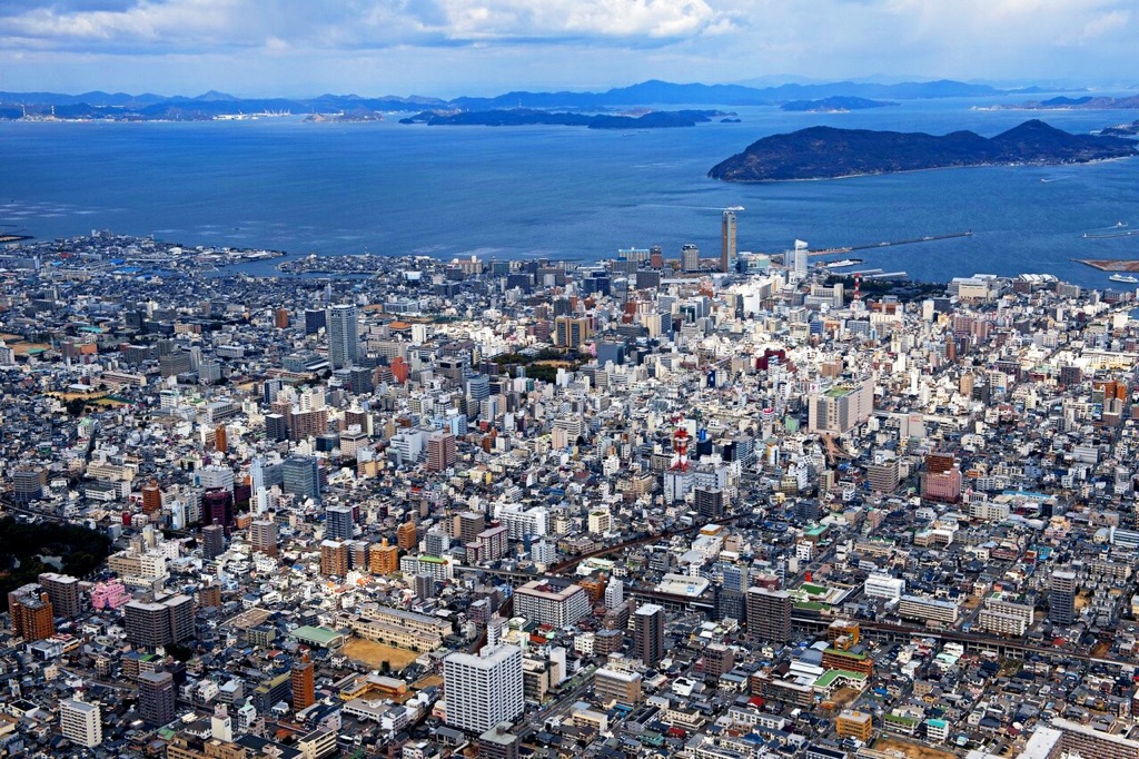
Takamatsu is the capital and largest city of Kagawa Prefecture,[4] with other major cities including Marugame, Mitoyo, and Kan'onji. Kagawa Prefecture is located on the Seto Inland Sea across from Okayama Prefecture on the island of Honshu, which is connected by the Great Seto Bridge. Kagawa Prefecture includes Shōdoshima, the second-largest island in the Seto Inland Sea, and the prefecture's southern land border with Tokushima Prefecture is formed by the Sanuki Mountains.
History
Kagawa was formerly known as Sanuki Province.[5]
For a brief period between August 1876 and December 1888, Kagawa was made a part of Ehime Prefecture.[6]
Battle of Yashima
Located in Kagawa's capital city, Takamatsu, the mountain of Yashima was the battlefield for one of the best-known struggles between the Heike and Genji clans.
Geography
Kagawa comprises the northeast corner of Shikoku, bordering Ehime Prefecture on the west and Tokushima Prefecture on the south, with a coastline on the Seto Inland Sea facing Okayama Prefecture and the Kansai. The Sanuki Mountains run along the southern border.
Kagawa is currently the smallest prefecture, by area, in Japan. Kagawa is a relatively narrow prefecture located between the mountains of Shikoku and the sea.
As of April 1, 2012, 11% of the total land area of the prefecture was designated as Natural Parks, namely Setonaikai National Park and Ōtaki-Ōkawa Prefectural Natural Park.[7]
Cities

City Town


Eight cities are located in Kagawa Prefecture:
| Place name | Area (km2)[1] | Population (2020)[2] | Map | |
|---|---|---|---|---|
| Rōmaji | Kanji | |||
| 東かがわ市 | 152.86 | 28,305 | ||
| 観音寺市 | 117.83 | 56,639 | ||
| 丸亀市 | 111.83 | 109,165 | ||
| 三豊市 | 222.70 | 61,839 | ||
| 坂出市 | 92.49 | 50,577 | ||
| さぬき市 | 158.63 | 46,723 | ||
| 高松市 | 375.42 | 417,814 | ||
| 善通寺市 | 39.93 | 31,620 | ||
Towns
Kagawa has eight towns organized into five districts. Many were created after 1999 through mergers, as part of a national effort to reduce the number of small towns and villages.[8]
| Place name | Area (km2)[1] | Population (2020)[2] | District[9] | Map | |
|---|---|---|---|---|---|
| Rōmaji | Kanji | ||||
| 綾川町 | 109.75 | 22,730 | Ayauta | ||
| 琴平町 | 8.47 | 8,466 | Nakatado | ||
| まんのう町 | 194.45 | 17,324 | Nakatado | ||
| 三木町 | 75.78 | 26,859 | Kita | ||
| 直島町 | 14.22[lower-alpha 1] | 3,026 | Kagawa | ||
| 小豆島町 | 95.59 | 13,646 | Shōzu | ||
| 多度津町 | 24.39 | 22,813 | Nakatado | ||
| 土庄町 | 74.38 | 12,915 | Shōzu | ||
| 宇多津町 | 8.10 | 18,897 | Ayauta | ||
Mergers
Economy
Kagawa has a nominal GDP of approximately 3,802 billion yen.[10] Kagawa's major export industries, in order of export value, include: transportation equipment, electrical equipment, chemical products, general machinery, mineral fuels, manufactured goods, raw materials, and foodstuff.[11]
Foods

Sanuki udon (a type of udon noodle) is the most famous local food of Kagawa Prefecture. In 2008, there were over 700 udon restaurants in this prefecture alone.[12]
Aside from udon, Kagawa is also famous for "hone-tsuki-dori", seasoned chicken thigh cooked on the bone. Originating from Marugame City, the dish has now become a popular dish in izakaya restaurants across the country.
Olives and olive-related products have also come to be recognized as Kagawa foods. As the first place in Japan to successfully cultivate olives, Kagawa has been producing olive-related products since 1908. As well as winning both domestic and international awards for the quality of its olive oil, Kagawa has also created two offshoot food brands from its olive industry - "olive beef" and "olive yellowtail". Waste organic matter from olive pressing is used as feed for cattle and the Yellowtail Amberjack. Due to the high amount of polyphenol in the olive waste, the flesh of the respective meats does not oxidize or lose color easily.
Other local specialties include wasanbon sugar sweets, sōmen noodles and shōyu soy sauce. Rare sugar researches are thriving and have discovered mass production culture enzymes. D-tagatose 3-epimerase is an enzyme that catalyzes the reversible epimerization reaction of the 3rd carbon of ketose.
Demographics
As of October 2020, Kagawa Prefecture had an estimated population of 950,244. This was .54% lower than the population in the 2000 census, being 1,022,890. The area of the prefecture is 1,877km, and the population density is 506.3/km.[13]
Education
Universities
- Kagawa University in Takamatsu
- Kagawa Prefectural College of Health Sciences
- Shikoku Gakuin University in Zentsuji
- Takamatsu University
- Tokushima Bunri University in Sanuki
Sports
The sports teams listed below are based in Kagawa.
Baseball
- Kagawa Olive Guyners
Basketball
- Kagawa Five Arrows (Takamatsu)
Football (Soccer)
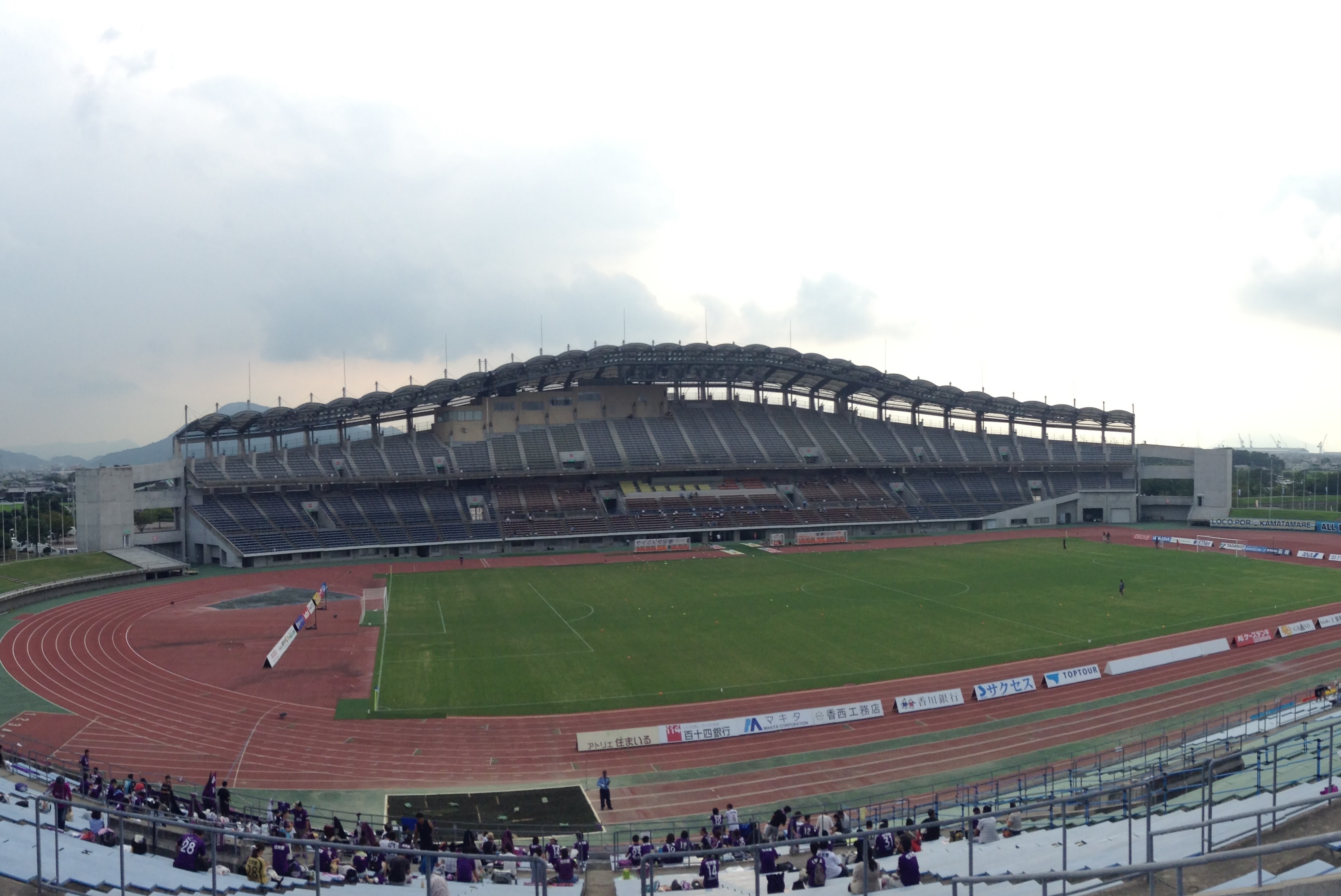
- Kamatamare Sanuki (Takamatsu)
Volleyball
- Shikoku Eighty 8 Queen
Ice Hockey
- Kagawa Ice Fellows (see Japan Ice Hockey Federation)
Tourism


- Kotohira
- Kanamaruza Kabuki Theatre
- Konpira Shrine
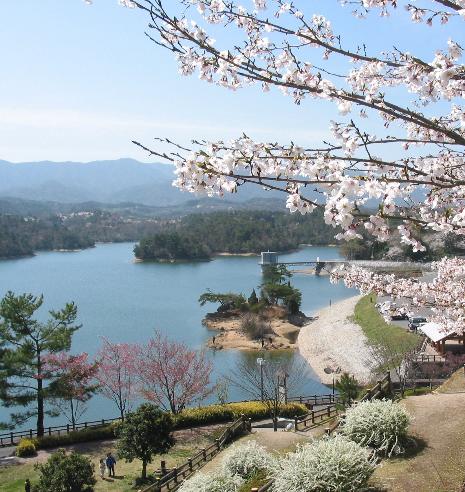
- Manno
- Manno Lake
- Sanuki Manno National Park
- Marugame
- Marugame Castle
- Marugame Genichiro-Inokuma Museum of Contemporary Art
- Sakaide
- Kagawa Prefectural Higashiyama Kaii Setouchi Art Museum (Kaii Higashiyama`s Art Museum)
- Mountain Iino (Kagawa's Mount Fuji)
- Kiyama (a castle ruins)
- Shinto shrine (misasagi) (Emperor Sutoku's Tomb)
- Fuchu Dam
- Great Seto Bridge
- Higashi Kagawa
- Hiketa Castle - A castle ruin, one of the Continued 100 Fine Castles of Japan in 2017.[14]
- Naoshima Island
- Ando Museum
- Benesse House
- Chichu Art Museum
- Lee Ufan Museum
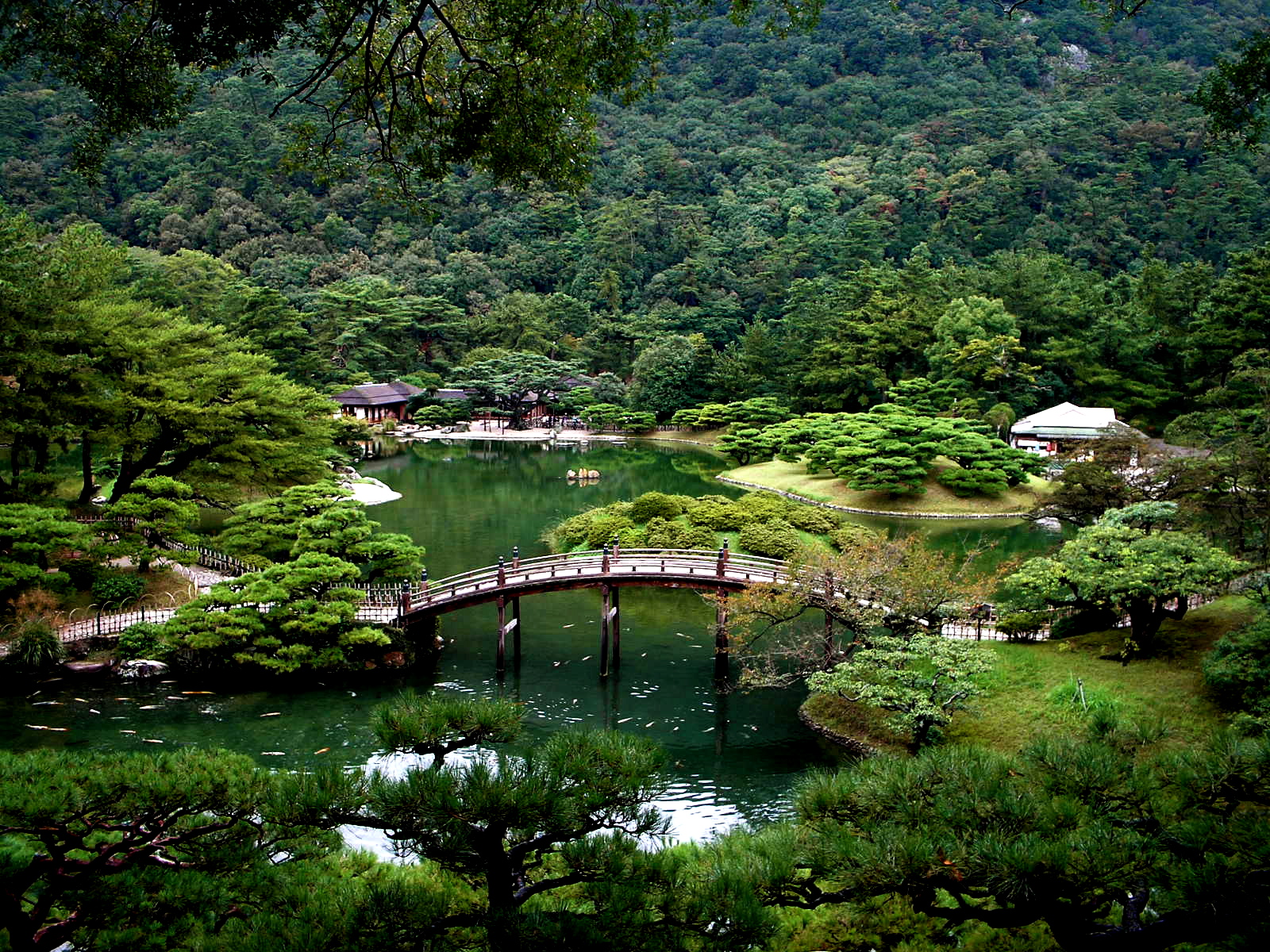
- Setonaikai National Park
- Shikoku Pilgrimage – Zentsū-ji, Motoyama-ji, Yashima-ji, etc.

- Shodoshima
- Kankakei Gorge
- Shodoshima Olive Park
- Takamatsu
- Teshima Island
- Shima Kitchen
- Teshima Art Museum
- Zentsūji
- Amagiri Castle
Based on its ancient name, Sanuki, Kagawa is famous for its Sanuki udon (wheat noodles). Recent years have seen an interest in Sanuki udon across Japan[citation needed], and many Japanese now take day-trips to taste the many Sanuki udon restaurants in Kagawa.
Transportation
Railroad
- JR Shikoku
- Seto-Ōhashi Line
- Yosan Line
- Dosan Line
- Kotoku Line
- Kotoden (Takamatsu Kotohira Electric Railroad)
- Kotohira Line
- Shido Line
- Nagao Line
Bus
Departure from Takamatsu
- Tokyo Station
- Shinjuku of Tokyo
- Tokyo Disneyland
- Hachioji
- Yokohama
- Nagoya
- Kyoto Station
- Osaka
- Umeda
- Nanba
- Kansai Int'l Airport
- Kobe
- Sannomiya
- Maiko Bus Stop
- Tokushima
- Kōchi
- Matsuyama
- Yawatahama
- Hiroshima
- Fukuoka
Road
Expressway
- Seto-Chūō Expressway
- Takamatsu Expressway
- Matsuyama Expressway
National Highway
- Route 11 (Tokushima-Takamatsu-Marugame-Niihama-Maysuyama)
- Route 30
- Route 32 (Takamatsu-Kotohira-Kochi)
- Route 193
- Route 318
- Route 319
- Route 377
- Route 436
- Route 438
Port
- Port of Takamatsu – Ferry route to Uno, Tonoshō (Shōdoshima Island), Kobe, Naoshima
- Port of Marugame
- Port of Tadotsu
- Port of Tonoshō – Ferry route to Okayama, Himeji, Kobe and Osaka.
Airport
In popular culture
- Shōdoshima is the setting of the novel Twenty-Four Eyes by Sakae Tsuboi and it's subsequent film adaptations.
- The manga Teasing Master Takagi-san is also set on Shōdoshima, in Tonoshō the native place of the creator, Sōichirō Yamamoto
- The novel Battle Royale by Koushun Takami was set in the fictional town of Shiroiwa ('Castle Rock') in Kagawa Prefecture. Okishima, the fictional island on which much of the novel takes place is placed in the Seto Inland Sea. The manga also places Shiroiwa in Kagawa, while the film moves Shiroiwa to Kanagawa Prefecture.
- The city of Takamatsu is the main setting of the book "Kafka on the Shore" by Haruki Murakami.
- Kan'onji is the setting of the early parts of the manga My Bride Is a Mermaid as well as the anime series Yuki Yuna is a Hero.[15]
- Poco's Udon World.
Notes
- Estimate. Part of boundary between Okayama and Kagawa is undefined.[1]
References
- "全国都道府県市区町村別面積調 (10月1日時点) [Areas of prefectures, cities, towns and villages (October 1)]" (PDF). Geospatial Information Authority of Japan. Ministry of Land, Infrastructure, Transport, and Tourism. October 1, 2020. p. 66. Retrieved March 18, 2021.
{{cite web}}: CS1 maint: url-status (link) - "香川県推計人口及び人口移動(令和2年9月1日現在推計)". 香川県 (Kagawa Prefecture). Kagawa Prefectural Government. September 1, 2020. Retrieved February 17, 2021.
{{cite web}}: CS1 maint: url-status (link) - Nussbaum, Louis-Frédéric. (2005). "Kagawa prefecture" in Japan Encyclopedia, p. 446, p. 446, at Google Books
- Nussbaum, "Takamatsu" at p. 934, p. 934, at Google Books.
- Nussbaum, "Provinces and prefectures" at p. 780, p. 780, at Google Books.
- Ikatachōshi Editing Committee, ed. (March 31, 1987). Ikatachōshi 伊方町誌 [Ikata Town History] (in Japanese). Town of Ikata, printed by DAI-ICHI HOKI Publishing.
- "General overview of area figures for Natural Parks by prefecture" (PDF). Ministry of the Environment. Retrieved August 19, 2012.
- "「『平成の合併』について」の公表 [Heisei era mergers]" (PDF). Ministry of Internal Affairs and Communications. March 5, 2010. Retrieved March 25, 2021.
{{cite web}}: CS1 maint: url-status (link) - "香川県の郵便番号 ("Postal Codes of Kagawa Prefecture)". Japan Post. Retrieved March 15, 2021.
{{cite web}}: CS1 maint: url-status (link) - "Kagawa Regional Information - Investing In..." Japan External Trade Organization. Retrieved September 21, 2021.
{{cite web}}: CS1 maint: url-status (link) - 日 本 貿 易 振 興 機 構 ( J E T R O ); 香 川 貿 易 情 報 セ ン タ ー (March 2020). "香川県貿易実態調査 2020 年(令和 2 年)3 月" (PDF). 香川県貿易実態調査: 155.
- "Kagawa 香川". Zipango. 2017.
- Kagawa, Prefecture Demographics. "Japan: Kagawa". www.citypopulation.de. Retrieved May 17, 2022.
- "続日本100名城" (in Japanese). 日本城郭協会. November 29, 2017. Retrieved July 25, 2019.
- "Yuki Yuna is a Hero" Fights for Local Tourism in Kan'onji City". Crunchyroll. Retrieved October 29, 2022.
External links
- Kagawa Prefecture English homepage
- (in Japanese) Official Kagawa Prefecture Japanese homepage
- National Archives of Japan ... Kagawa map (1891)[permanent dead link]
- Notes from Shikoku in English
Takamatsu (capital) | ||
| Core city | ||
| Cities | ||
| Districts | ||
| Others |
| |
List of mergers in Kagawa Prefecture | ||
Regions and administrative divisions of Japan | |||||||||||||||||
|---|---|---|---|---|---|---|---|---|---|---|---|---|---|---|---|---|---|
| |||||||||||||||||
| Regions |  | ||||||||||||||||
| 47 Prefectures |
| ||||||||||||||||
| |||||||||||||||||
Authority control | |
|---|---|
| General | |
| National libraries | |
| Other |
|
На других языках
[de] Präfektur Kagawa
Die Präfektur Kagawa (jap. 香川県, Kagawa-ken) ist eine Präfektur Japans und liegt im Nord(ost)en der westjapanischen Region Shikoku auf der Hauptinsel Shikoku und über 100 weiteren Inseln im Seto-Binnenmeer. Sitz der Präfekturverwaltung ist die Stadt Takamatsu.- [en] Kagawa Prefecture
[ru] Кагава (префектура)
Кагава (яп. 香川県 Кагава-кэн) — префектура, расположенная в регионе Сикоку на острове Сикоку, Япония. Площадь префектуры составляет 1876,55 км²[1], население — 981 577 человек (1 августа 2014)[2], плотность населения — 523,08 чел./км². Центр префектуры — город Такамацу. Кагава – самая маленькая из префектур Японии.Другой контент может иметь иную лицензию. Перед использованием материалов сайта WikiSort.org внимательно изучите правила лицензирования конкретных элементов наполнения сайта.
WikiSort.org - проект по пересортировке и дополнению контента Википедии