world.wikisort.org - Japan
Shinjuku (新宿区, Shinjuku-ku) is a special ward in Tokyo, Japan. It is a major commercial and administrative centre, housing the northern half of the busiest railway station in the world (Shinjuku Station) and the Tokyo Metropolitan Government Building, the administration centre for the government of Tokyo. As of 2018, the ward has an estimated population of 346,235, and a population density of 18,232 people per km2. The total area is 18.23 km2.[4] Since the end of the Second World War, Shinjuku has been a major secondary center of Tokyo (fukutoshin), rivaling to the original city center in Marunouchi and Ginza. It literally means "New Inn Ward".
This article needs additional citations for verification. (January 2010) |
This article may be expanded with text translated from the corresponding article in Japanese. (March 2022) Click [show] for important translation instructions.
|
Shinjuku
新宿区 | |
|---|---|
| Shinjuku City[1] | |
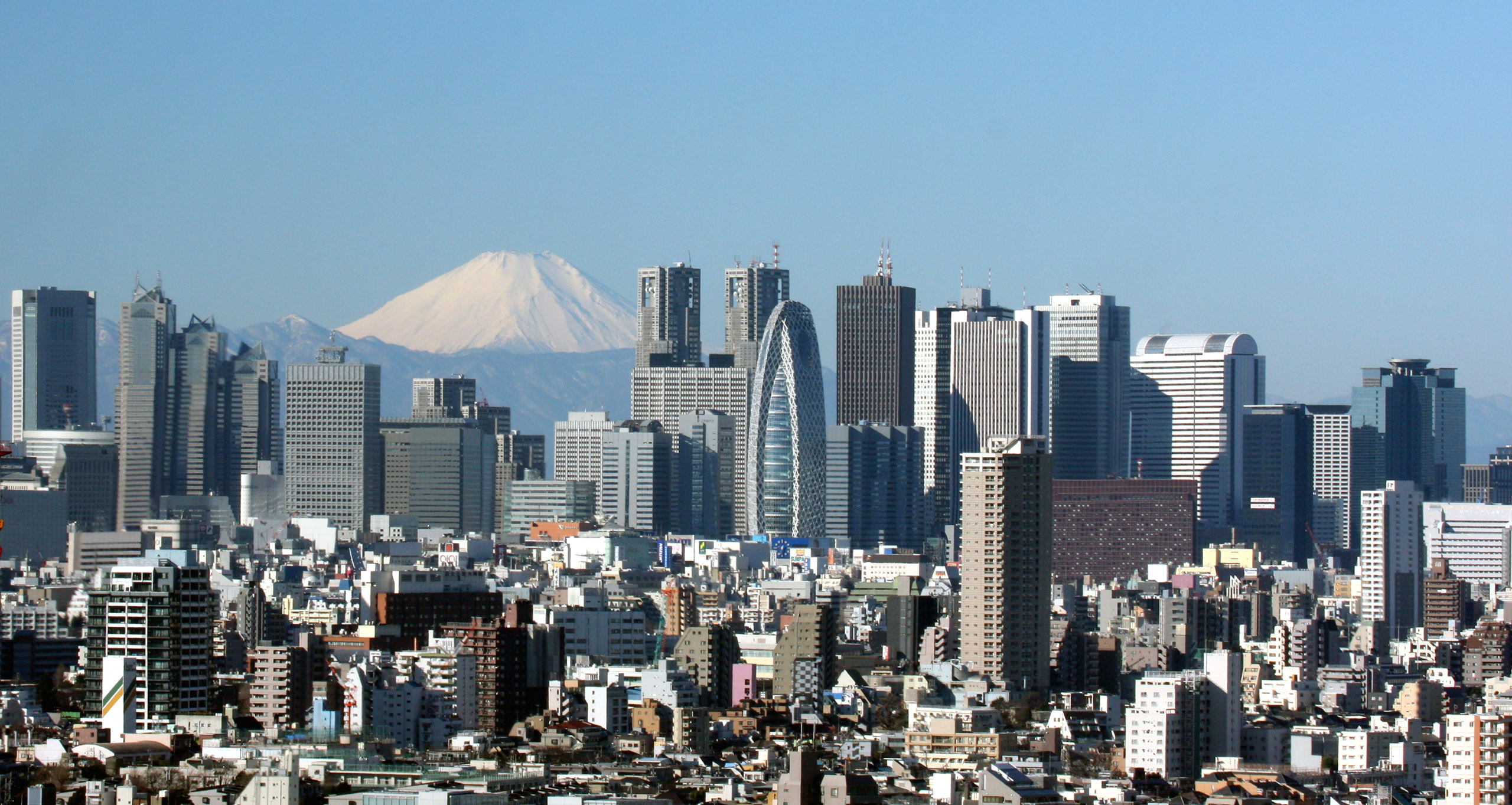 Skyscrapers of Shinjuku with Mount Fuji in the background | |
 Flag  Seal | |
 Location of Shinjuku in Tokyo | |
 Shinjuku | |
| Coordinates: 35°42′5″N 139°42′35″E | |
| Country | Japan |
| Region | Kantō |
| Prefecture | Tokyo |
| Government | |
| • Mayor | Kenichi Yoshizumi |
| • Tourism Ambassador | Godzilla[2] |
| Area | |
| • Total | 18.23 km2 (7.04 sq mi) |
| Population (1 October, 2020[3]) | |
| • Total | 349,385 |
| • Density | 19,000/km2 (50,000/sq mi) |
| Time zone | UTC+9 (Japan Standard Time) |
| - Tree | Zelkova serrata |
| - Flower | Azalea |
| Phone number | 03-3209-1111 |
| City Hall Address | Kabukichō 1-4-1, Shinjuku-ku, Tokyo 160-8484 |
| Website | www |
Shinjuku is also commonly used to refer to the entire area surrounding Shinjuku Station. The southern half of this area and of the station in fact belong to Yoyogi and Sendagaya districts of the neighboring Shibuya ward.
Geography

Shinjuku is surrounded by Chiyoda to the east; Bunkyo and Toshima to the north; Nakano to the west, and Shibuya and Minato to the south.[5]


The current city of Shinjuku grew out of several separate towns and villages, which have retained some distinctions despite growing together as part of the Tokyo metropolis.
- East Shinjuku (or administratively called Shinjuku, Shinjuku-ku): The area east of Shinjuku Station and surrounding Shinjuku-sanchome Station, historically known as Naito-Shinjuku, houses the city hall and the flagship Isetan department store, as well as several smaller areas of interest:
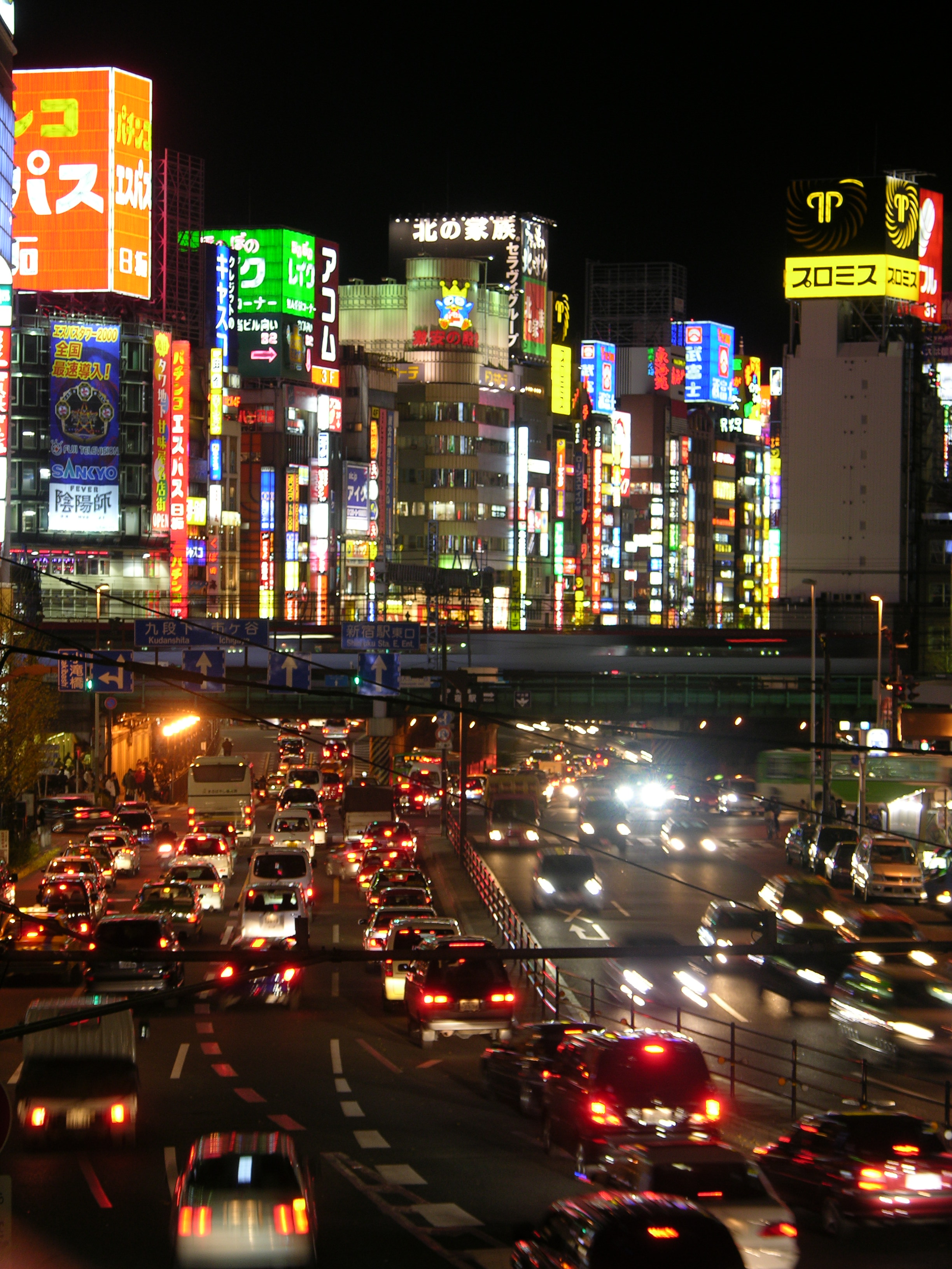
- Kabukichō: Tokyo's best-known red-light district, renowned for its variety of bars, restaurants, and sex-related establishments.
- Golden Gai: An area of tiny shanty-style bars and clubs. Musicians, artists, journalists, actors and directors gather here, and the ramshackle walls of the bars are literally plastered with film posters.
- Shinjuku Gyo-en: A large park, 58.3 hectares, 3.5 km in circumference, blending Japanese traditional, English Landscape and French Formal style gardens.
- Shinjuku Ni-chōme: Tokyo's best-known gay district.
- Nishi-Shinjuku: The area west of Shinjuku Station, historically known as Yodobashi, is home to Tokyo's largest concentration of skyscrapers. Several of the tallest buildings in Tokyo are located in this area, including the Tokyo Metropolitan Government Building, KDDI Building and Park Tower.
- Ochiai: The northwestern corner of Shinjuku, extending to the area around Ochiai-minami-nagasaki Station and the south side of Mejiro Station, is largely residential with a small business district around Nakai Station.
- Ōkubo: The area surrounding Okubo Station, Shin-Okubo Station and Higashi-Shinjuku Station is best known as Tokyo's historic ethnic Korean neighborhood after World War II.
- Totsuka: The northern portion of Shinjuku surrounding Takadanobaba Station and Waseda University, today commonly referred to as Nishi-Waseda. The Takadanobaba area is a major residential and nightlife area for students, as well as a commuter hub.
- Toyama: A largely residential and school area, in the east of Ōkubo and south of Waseda University, extending to the area around Nishi-Waseda Station, Gakushuin Women's College and Toyama Park.
- Ushigome: A largely residential area in the eastern portion of the city.
- Ichigaya: A commercial area in eastern Shinjuku, site of the Ministry of Defense.
- Kagurazaka: A hill descending to the Iidabashi Station area, once one of Tokyo's last remaining hanamachi or geisha districts, and currently known for hosting a sizable French community.[6]
- Yotsuya: An upscale residential and commercial district in the southeast corner of Shinjuku. The Arakichō area is well known for its many small restaurants, bars, and izakaya.
"Shinjuku" is often popularly understood to mean the entire area surrounding Shinjuku Station, but the Shinjuku Southern Terrace complex and the areas to the west of the station and south of Kōshū Kaidō are part of the Yoyogi and Sendagaya districts of the special ward of Shibuya.
Naturally, most of Shinjuku is occupied by the Yodobashi Plateau, the most elevated portion of which extends through most of the Shinjuku Station area. The Kanda River runs through the Ochiai and Totsuka areas near sea level, but the Toshima Plateau also builds elevation in the northern extremities of Totsuka and Ochiai. The highest point in Shinjuku is Hakone-san in Toyama Park, 44.6 m above sea level.[7]
Districts and neighborhoods
|
|
|
History

In 1634, during the Edo period, as the outer moat of the Edo Castle was built, a number of temples and shrines moved to the Yotsuya area on the western edge of Shinjuku. In 1698, Naitō-Shinjuku had developed as a new (shin) station (shuku or juku) on the Kōshū Kaidō, one of the major highways of that era. Naitō was the family name of a daimyō whose mansion stood in the area; his land is now a public park, the Shinjuku Gyoen. In 1898, the Yodobashi Water Purification Plant, the city's first modern water treatment facility, was built in the area that is now between the park and the train station.[8]
In 1920, the town of Naitō-Shinjuku, which comprised large parts of present-day Shinjuku (the neighbourhood, not the municipality), parts of Nishi-Shinjuku and Kabukichō was integrated into Tokyo City. Shinjuku began to develop into its current form after the Great Kantō Earthquake in 1923, since the seismically stable area largely escaped the devastation. Consequently, West Shinjuku is one of the few areas in Tokyo with many skyscrapers.
The Tokyo air raids from May to August 1945 destroyed almost 90% of the buildings in the area in and around Shinjuku Station.[9] The pre-war form of Shinjuku, and the rest of Tokyo, for that matter, was retained after the war because the roads and rails, damaged as they were, remained, and these formed the heart of the Shinjuku in the post-war construction. Only in Kabuki-cho was a grand reconstruction plan put into action.[10]
The present ward was established on March 15, 1947 with the merger of the former wards of Yotsuya, Ushigome, and Yodobashi. It served as part of the athletics 50 km walk and marathon course during the 1964 Summer Olympics.[11] In the 1970s, the Yodobashi Water Purification Plant closed and was replaced by skyscrapers.[12]
In 1991, the Tokyo Metropolitan Government moved from the Marunouchi district of Chiyoda to the current building in Shinjuku. (The Tokyo International Forum stands on the former site vacated by the government.)
Economy

The area surrounding Shinjuku Station is a major economic hub of Tokyo. Many companies have their headquarters or Tokyo offices in this area, including regional telephone operator NTT East, global camera and medical device manufacturer Olympus Corporation, electronics giant Seiko Epson,[13] video game developer Square Enix,[14] fast food chains McDonald's Japan and Yoshinoya,[15] travel agency H.I.S.,[16] Subaru Corporation (Subaru),[17] railway operator Odakyu Electric Railway, construction giants Taisei Corporation[18] and Kumagai Gumi,[19] medical equipment manufacturer Nihon Kohden,[20] Enoki Films,[21] navigation software company Jorudan,[22] instant noodle giant Nissin Foods,[23] automotive components manufacturer Keihin Corporation,[24] and regional airline Airtransse.[25] The station area also hosts numerous major retailers such as Isetan, Takashimaya, Marui, Bic Camera, Yodobashi Camera and Yamada Denki.
Northeastern Shinjuku has an active publishing industry and is home to the publishers Shinchosha[26] and Futabasha.[27] The main store of the Books Kinokuniya bookstore chain is also located in Shinjuku.
Demographics
As of December 2017 Shinjuku had the highest concentration of non-Japanese citizens in Japan, and by 2012 people of Chinese citizenship became the most numerous foreign citizens in Shinjuku. Previously the most common citizenship was collectively those of North and South Korea.[28]
Government and politics


Like the other special wards of Tokyo, Shinjuku has a status equivalent to that of a city. The current mayor is Kenichi Yoshizumi. The ward council (区議会, kugikai) consists of 38 elected members; the Liberal Democratic Party and New Komeitō Party together currently hold a majority. The Democratic Party of Japan, Japanese Communist Party and the Social Democratic Party are also represented together with four independents. Shinjuku's city office (区役所, kuyakusho) is located on the southeastern edge of Kabukichō.
Shinjuku is also the location of the Tokyo Metropolitan Government. The governor's office, the metropolitan assembly chamber, and all administrative head offices are located in the Tokyo Metropolitan Government Building. Technically, Shinjuku is therefore the prefectural capital of Tokyo; but according to a statement by the governor's office, Tokyo (the – as administrative unit: former – Tokyo City, the area of today's 23 special wards collectively) can usually be considered the capital of Tokyo (prefecture/"Metropolis") for geographical purposes. The Geographical Survey Institute (Kokudo Chiriin) names Tōkyō (the city) as capital of Tōkyō-to (the prefecture/"Metropolis").[29]
| Resident Nationalities[30] | |
| Nationality | Population (Percentage) (2018) |
|---|---|
| 301,163 (87.8%) | |
| 13,060 (3.8%) | |
| 10,006 (2.9%) | |
| 3,716 (1%) | |
| 3,368 (0.98%) | |
| 2,211 (0.64%) | |
| Others | 12,711 (3.88%) |
Elections
- 2004 Shinjuku local election
- 2006 Shinjuku mayoral election
- 2007 Shinjuku local election
Transportation
Shinjuku is a major urban transit hub. Shinjuku Station sees an estimated 3.64 million passengers pass through each day, making it the busiest station in the world. It houses interchanges to three subway lines and three privately owned commuter lines, as well as several JR lines.
Rail
A list of railway lines passing through and stations located within Shinjuku includes:
- JR East
- Yamanote Line: Takadanobaba, Shin-Ōkubo, Shinjuku
- Chūō Line (Rapid), Chūō-Sōbu Line: Yotsuya, Shinanomachi, Shinjuku, Ōkubo
- Saikyō Line, Shōnan-Shinjuku Line: Shinjuku
- Tokyo Metro
- Marunouchi Line: Yotsuya, Yotsuya-sanchōme, Shinjuku-gyoenmae, Shinjuku-sanchōme, Shinjuku, Nishi-Shinjuku
- Yūrakuchō Line: Ichigaya, Iidabashi
- Tōzai Line: Kagurazaka, Waseda, Takadanobaba, Ochiai
- Fukutoshin Line: Nishi-Waseda, Higashi-Shinjuku, Shinjuku-sanchōme
- Namboku Line: Iidabashi, Ichigaya, Yotsuya
- Tokyo Metropolitan Bureau of Transportation
- Toei Shinjuku Line: Akebonobashi, Shinjuku-sanchōme, Shinjuku
- Toei Ōedo Line: Ochiai-Minaminagasaki, Nakai, Nishi-Shinjuku-gochōme, Tochō-mae, Kokuritsu-Kyōgijō, Ushigome-Kagurazaka, Ushigome-Yanagichō, Wakamatsu-Kawada, Higashi-Shinjuku, Shinjuku-Nishiguchi
- Toden Arakawa Line: Omokagebashi, Waseda
- Odakyu Electric Railway Odawara Line: Shinjuku
- Keio Corporation Keio Line, Keio New Line: Shinjuku
- Seibu Railway Seibu Shinjuku Line: Seibu-Shinjuku, Takadanobaba, Shimo-Ochiai, Nakai
Roads
Shuto Expressway:
- No.4 Shinjuku Route (Miyakezaka JCT - Takaido)
- No.5 Ikebukuro Route (Takebashi JCT - Bijogi JCT)
National highways:
- National Route 20 (Shinjuku-dōri, Kōshū-kaidō)
Other major routes:
- Tokyo Metropolitan Route 8 (Mejiro-dōri, Shin-Mejiro-dōri)
- Tokyo Metropolitan Route 302 (Yasukuni-dōri, Ōme-kaidō)
- Tokyo Metropolitan Route 305 (Meiji-dōri)
Education
Colleges and universities
- Chuo University graduate school
- Gakushuin Women's College
- Keio University Medical College
- Kogakuin University
- Lakeland College Japan
- Mejiro University
- Sophia University Mejiro Seibo Campus
- Tokyo Fuji University
- Tokyo Medical University
- Tokyo University of Science
- Tokyo Women's Medical University
- Waseda University
Schools
High schools
Public high schools are operated by the Tokyo Metropolitan Government Board of Education.
- Shinjuku High School
- Shinjuku Yamabuki High School
- Toyama High School
Closed:
- Koishikawa Technical High School
Private schools:
- Gakushuin Girls Junior and Senior High School, private girls' school, affiliated with Gakushuin University and Gakushuin Women's College
- Hozen Junior and Senior High School, private boys' school
- Kaijō Junior and Senior High School, private boys' school
- Seijo Senior High School and Seijo Gakuen Junior High School, private girls' school
- Seijō Junior and Senior High School, private boys' school
- Waseda Junior and Senior High School, private boys' school, affiliated with Waseda University
- Meijiro Kenshin Junior and Senior High School
Elementary and junior high schools
Public elementary and junior high schools in Shinjuku are operated by the Shinjuku City (the Shinjuku Ward) Board of Education.
Public institutions
Libraries
Shinjuku operates several public libraries, including the Central Library (with the Children's Library), the Yotsuya Library, the Tsurumaki Library, Tsunohazu Library, the Nishi-Ochiai Library, the Toyama Library, the Kita-Shinjuku Library, the Okubo Library, and the Nakamachi Library. In addition there is a branch library, Branch Library of Central Library in the City Office, located in the city office.[31]
Hospitals
There are several major hospitals located within the city limits.
- Keio University Hospital
- Center Hospital of the National Center for Global Health and Medicine
- Tokyo Yamate Medical Center
- Tokyo Medical University Hospital
- Tokyo Women's Medical University Hospital
- Tokyo Metropolitan Health and Medical Treatment Corporation Ohkubo Hospital
Cultural centers
Museums
- National Printing Bureau Banknote and Postage Stamp Museum
- National Museum of Nature and Science, Shinjuku Branch
- Shinjuku Historical Museum
- Tokyo Fire Department Museum
- Tokyo Toy Museum
Halls
- Tokyo Opera City
- Shinjuku Bunka Center
- Meiji Yasuda Life Hall
Sister cities
Shinjuku has sister city agreements with several localities:[32]
 Lefkada, Greece
 Mitte, Berlin, Germany
 Dongcheng District, Beijing, China
 Ina, Nagano, Japan
See also
- Citizens' Plaza, an urban space in Shinjuku
- Tourism in Japan
References
- Shinjuku City Archived 2008-02-09 at the Wayback Machine
- Izadi, Elahi (9 April 2015). "Terrifying monster named Tokyo's new tourism ambassador". The Washington Post. Retrieved 15 September 2018.
- "Population by District". Tokyo Statistical Yearbook. Retrieved 2022-07-15.
- Shinjuku City
- Tokyo Special Wards Map
- japanvisitor.com
- http://www.city.shinjuku.lg.jp/content/000021207.pdf [bare URL PDF]
- "Water Supply in Tokyo". Bureau of Waterworks, Tokyo Metropolitan Government. Bureau of Waterworks, Tokyo Metropolitan Government. Retrieved 15 February 2021.
- History of Shinjuku Archived 2006-03-26 at the Wayback Machine
- Ichikawa, 2003
- 1964 Summer Olympics official report. Volume 2. Part 1. p. 74.
- "Shinjuku Then and Now". Real Estate Japan. GPlus Media Inc. 7 October 2015. Retrieved 15 February 2021.
- "Head Office & Japanese Facilities." Seiko Epson. Retrieved on January 13, 2009.
- "We tour Square Enix's awesome HQ since you probably never will". vulturebeat.com. 26 March 2015. Retrieved 20 December 2016.
- 会社概要. Yoshinoya. Retrieved February 25, 2010.
- "Company Info." H.I.S. Retrieved on March 11, 2010.
- "." Fuji Heavy Industries and Subaru.
- "Corporate Data." Taisei Corporation. Retrieved on February 20, 2012. "Head Office 1-25-1, Nishi-Shinjuku, Shinjuku-ku, Tokyo 163-0606"
- "Corporate Profile." Kumagai Gumi. Retrieved on August 30, 2017. "Headquarters 2-1, Tsukudo-cho, Shinjuku-ku, Tokyo 162-8557"
- "Key Facts." Nihon Kohden. Retrieved on August 9, 2015.
- "Home." Enoki Films. Retrieved on March 23, 2014. "Enoki Bldg., No. 2, 1-30-10 Shinjuku, Shinjuku-ku, Tokyo 160-0022 Japan"
- "Headquarter." Jorudan. Retrieved on January 7, 2011. "ZIP 160-0022 2-1-9 Shinjuku, Shinjuku-ku, Tokyo, Japan" (map)
- "Company Profile." Nissin Foods. Retrieved on August 15, 2009.
- "Company Overview." Keihin Corporation. Retrieved on May 23, 2018.
- 会社概要. Airtransse. Retrieved May 20, 2009.
- 会社情報. Shinchosha. Retrieved June 17, 2011.
〒162-8711 東京都新宿区矢来町71
- 会社概要. Futabasha. Retrieved January 7, 2011.
所在地 〒162-8540 東京都新宿区東五軒町3-28
(GIF map of location) (PDF of location) - Obe, Mitsuru; Sakura, Yusuke (2018-07-25). "Chinatowns and Little Indias take shape in Tokyo". Nikkei Shimbun. Retrieved 2022-11-08.
- Tokyo Metropolitan Government, governor's office: About Tokyo's prefectural capital Archived 2014-04-19 at the Wayback Machine (in Japanese)
- "Resident nationalities of Shinjuku)" (PDF). Retrieved April 13, 2018."Shinjuku Demographics". (in Japanese)
- "Information on Everyday Living for Foreign Residents of Shinjuku City". Archived from the original on 2008-05-14. Retrieved 2008-08-27.
- Friendship cities Archived 2010-04-07 at the Wayback Machine
- Shinjuku Ward Office, History of Shinjuku
- Hiroo Ichikawa "Reconstructing Tokyo: The Attempt to Transform a Metropolis" in C. Hein, J.M. Diefendorf, and I. Yorifusa (Eds.) (2003). Building Urban Japan after 1945. New York: Palgrave.
External links
 Shinjuku travel guide from Wikivoyage
- Shinjuku City Official website (in Japanese)
- Shinjuku Demographics (in Japanese)
- The Shinjuku Historical Museum: a nicely arranged museum with interesting exhibits of Tokyo's past
| Districts |
|  | ||||||
|---|---|---|---|---|---|---|---|---|
| Education |
| |||||||
| Major stations |
| |||||||
| Landmarks |
| |||||||
* - partially | ||||||||
| 2,000,000 and more | |
|---|---|
| 1,000,000–1,999,999 | |
| 500,000–999,999 | |
| 200,000–499,999 |
|
|
| 19th century |
|  |
|---|---|---|
| 20th century |
| |
| 21st century |
| |
Authority control | |
|---|---|
| General | |
| National libraries | |
| Scientific databases | |
| Other |
|
На других языках
[de] Shinjuku
Shinjuku (jap. 新宿区 -ku, „Bezirk ~“, engl. "~ City"[1]) ist ein („Sonder-“)Bezirk und Verwaltungssitz der japanischen Präfektur Tokio. Er liegt im Westen Tokios.- [en] Shinjuku
[es] Shinjuku (Tokio)
Shinjuku (新宿区 -ku, Shinjuku?) es una región especial de la Metrópolis de Tokio, en Japón.[ru] Синдзюку
Синдзюку (яп. 新宿区 Синдзюку-ку) — один из 23 специальных районов Токио, административный центр префектуры Токио. Город был основан путём объединения трёх близлежащих районов Усигомэ-ку, Ёцуя-ку и Ёдобаси-ку. Площадь города составляет 18,23 км²[1], население — 349 743 человека (1 октября 2020)[2], плотность населения — 19 185,02 чел./км². Соседние специальные районы Токио: Тиёда на востоке; Бункё и Тосима на севере; Накано на западе, Сибуя и Минато на юге.Другой контент может иметь иную лицензию. Перед использованием материалов сайта WikiSort.org внимательно изучите правила лицензирования конкретных элементов наполнения сайта.
WikiSort.org - проект по пересортировке и дополнению контента Википедии